

Landkaart Wegenkaart SC1 & SC2 Cape Town > Montagu- Tracks4Afrika
DEEL 1 Cape Town > Montagu


Korte omschrijving
Wegenkaart SC1 & SC2 Cape Town > Montagu Productomschrijving: SC1 & SC2 : Cape Peninsula, Boland, Winelands, False Bay, Walker Bay and the Overberg region. Omvat: Cape Peninsula, Boland...

Specificaties
- Uitgever: Tracks4Africa
- ISBN-13: 9781776322749
- HOOFDCATEGORIEËN: Wegenkaart - Landkaart
- Activiteiten: Street/Road maps & city plans
- Regio: Capetown Zuid Afrika, West-Kaap, Zuid Afrika
- Land: Zuid-Afrika
- Schaal: 1:200000
- Editie: 1
- Taal: Engels
- Reeks/Serie: Cape to Addo maps, Tracks4Afrika
Volledige omschrijving
Wegenkaart SC1 & SC2 Cape Town > Montagu
Productomschrijving: SC1 & SC2 : Cape Peninsula, Boland, Winelands, False Bay, Walker Bay and the Overberg region.
Omvat: Cape Peninsula, Boland, Winelands, False Bay, Walker Bay and the Overberg region.
The Cape to Addo map series covers the southern parts of the Western Cape of South Africa in a series of eight highly detailed maps, printed on four sheets of A1 durable paper. We start in Cape Town in the west and move along the southern coast through the Overberg, Winelands, Garden Route, Klein Karoo R62, Baviaanskloof to eventually arrive in the Addo National Park up to Gqeberha (Port Elizabeth) in the east.
The maps are highly detailed and well researched. Our map scale is 1:200 000 which allows us to show a lot of detail including minor gravel roads, hiking trails, farm boundaries and points of interest which are relevant to self-drive tourists. The size of the paper is kept small enough to allow this to be the perfect road tripping map. We use Duraflex paper and print two maps per sheet of A1 paper, making this a four-sheet series. Each map sheet is individually packed in a plastic protective sleeve.
The maps are perfect for day drives, overlanding or just doing road trips in your sedan, 4WD or motorbike along our beautiful southern coast, Klein Karoo and parts of the proper Karoo. Mountain passes form a prominent feature in this area, and these are indicated together with scenic route options. As with other Tracks4Africa maps, these maps include drive times over and above driving distances. Adventure bikers will be pleased to know that minor gravel roads are included together with various accommodation options.
The map has a relief background onto which farm boundaries, protected areas and other geographical features are shown.
For each town we indicate what basic services are offered, e.g. fuel, shops, camping accommodation. We also show the facilities and activities of the various nature reserves.
This Map – the SC1 & SC2 : Cape Town to Montagu is perfect for day trips in and around Cape Town or from the Winelands towns of Stellenbosch, Paarl and Franschhoek. It covers some of the most iconic tourism attractions in the Western Cape which include Cape Point and Table Mountain, Robben Island where Nelson Mandela was held prisoner during the apartheid era, the wine routes of the Cape, the whale watching along the coast of Hermanus and further east, the southernmost point of Africa at L’Agulhas and shark cage diving at Gansbaai.
Plan your trips with our driving times on each road and include scenic routes indicated on the map together with the various mountain passes of the Western Cape. The area boasts top-end destinations which include world-class restaurants and wine estates.
As the name suggests, these two maps, printed on either side of a single sheet of Duraflex paper, stretch from Cape Town in the west to Montagu in the east. The coastline forms the southern boundary and to the north towns such as Malmesbury and Worcester are included.
Prominent towns on these maps include: Cape Town, Durbanville, Somerset West, Stellenbosch, Malmesbury, Paarl, Franschhoek, Hermanus, Gansbaai, Montagu, L’Agulhas, Worcester, Caledon, Robertson and De Doorns.

Gekoppelde artikelen

Landkaart Wegenkaart SC3 & SC4 Swellendam > Mossel Bay • 9781776322756
standaard versieWegenkaart SC3 & SC4 Swellendam > Mossel Bay Productomschrijving: SC3 & SC4 : Overberg, Klein Karoo along the R62, part of the Garden Route The Cape to Addo map series covers the southern parts of the Western Cape of South Africa in a series of eight highly detailed maps, printed on four sheets of A1 durable paper. We start in Cape Town in the west and move along the southern coast th…
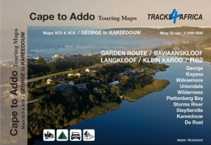
Landkaart Wegenkaart SC5 & SC6 George > Kareedouw - Tracks4Afrika • 9781776322763
standaard versieWegenkaart SC5 & SC6 George > Kareedouw Productomschrijving: SC5 & SC6 : Garden Route / Baviaanskloof Includes: George, Knysna, Willowmore, Uniondale, Wilderness, Plettenberg Bay, Storms River, Steytlerville and Kareedouw. The Cape to Addo map series covers the southern parts of the Western Cape of South Africa in a series of eight highly detailed maps, printed on four sheets of A…

Landkaart Wegenkaart SC7 & SC8 Baviaanskloof > Addo Tracks4Afrika • 9781776322770
standaard versieWegenkaart SC7 & SC8 Baviaanskloof > Addo Elephant Park Productomschrijving: SC7 & SC8 : Baviaanskloof / Addo Elephant National Park Includes: Cape St. Francis, Humansdorp, Patensie, Jansenville, Jeffrey’s Bay, Kariega (Uitenhage), Kirkwood, Paterson, Colchester, Alexandria and Gqeberha (Port Elizabeth). The Cape to Addo map series covers the southern parts of the Western Cape of …
Artikelen uit dezelfde regio
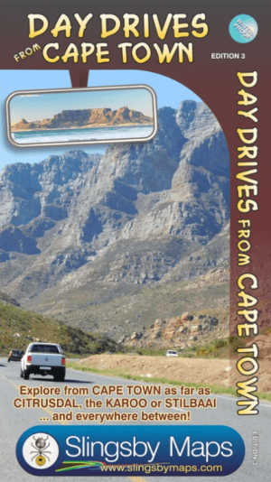
Landkaart Wegenkaart Cape Town Day Drives - Slingsby Maps • 9781920377342
Wegenkaart Cape Town Day Drives - Slingsby Productomschrijving: Day Drives from Cape Town. Our Day Drives from Cape Town map is the most comprehensive map available of the heartland of the Western Cape. The map shows all the roads, towns and relief of the area from Cape Town north to Citrusdal, north-east to Laingsburg and east to Stilbaai / Albertinia: all destinations within easy mo…

Landkaart Wegenkaart Cederberg Touring Map - Slingsby Maps • 9781776322800
Wegenkaart Cederberg Touring Map - Slingsby Productomschrijving: The CEDERBERG, so other worldly and yet so easily accessible from Cape Town, weaves a particular magic. These mountains are unlike any others in South Africa. The geography can be confusing but with this map you can explore the secret kloofs, ethereal rock art and majestic mountains, experiencing the magic for yourself. …
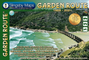
Landkaart Wegenkaart Garden Route NP Zuid Afrika - Slingsby Maps • 9781920377472
Wegenkaart Garden Route NP, West kaap Zuid Afrika - Slingsby Productomschrijving: Brand new 11th edition of the FIRST and still the BEST Garden Route map … Now thoroughly updated. From Witsand and Heidelberg in the west, this all new map has been extended eastwards through Mossel Bay, George, Knysna and Plett to include Jefferys Bay and the Gamtoos RIver Mouth – with fully updated Tou…