

Landkaart Wegenkaart Pocket map Northern Ireland - Harper Collins
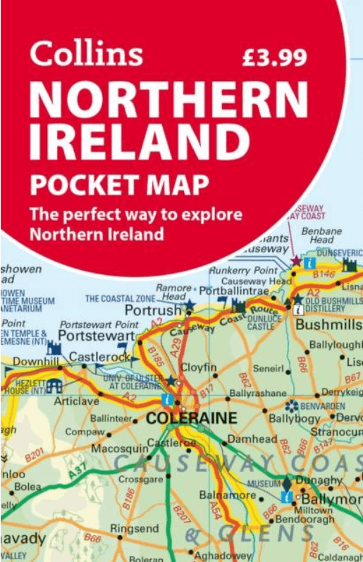
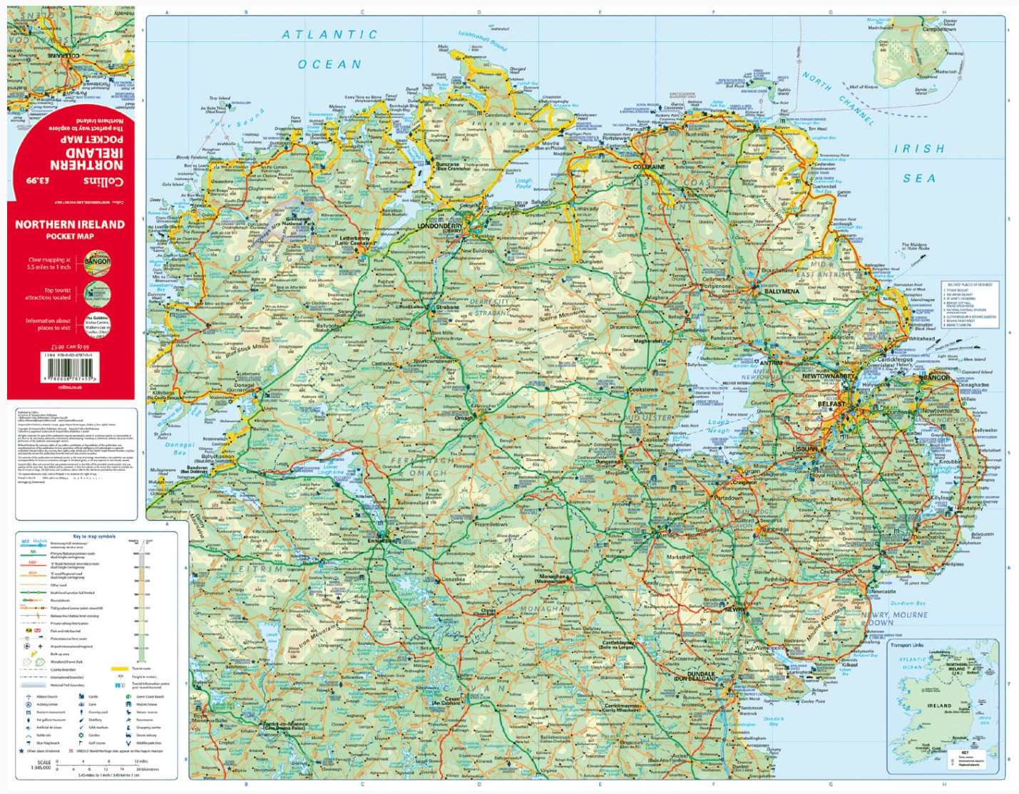
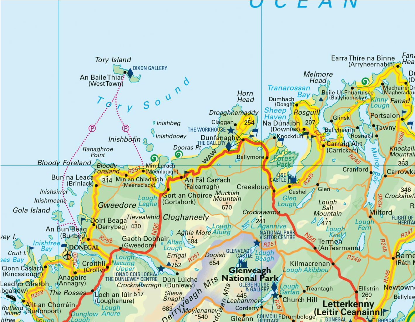
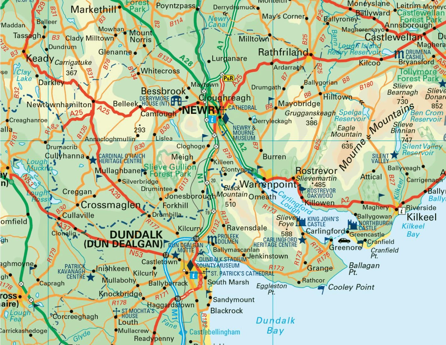
Northern Ireland Pocket Map
Korte omschrijving
Wegen- & stadskaarten Northern Ireland, UK van HarperCollins Publishers. Ideaal voor tochten in Northern Ireland en United Kingdom, Great Britain.
Wegenkaart Pocket map Northern Ireland - Harper Collins Productomschrijving: Northern Ireland Pocket Map: The perfect way to explore Northern Ireland Map Main features of this map includ...

Specificaties
- Uitgever: HarperCollins Publishers
- ISBN-13: 9780008787455
- HOOFDCATEGORIEËN: Wegenkaart - Landkaart
- Activiteiten: Street/Road maps & city plans
- Regio: Northern Ireland, UK
- Land: Northern Ireland, United Kingdom, Great Britain
- Taal: Engels
- Reeks/Serie: Pocket Maps
Volledige omschrijving
Wegenkaart Pocket map Northern Ireland - Harper Collins
Productomschrijving: Northern Ireland Pocket Map: The perfect way to explore Northern Ireland Map
Main features of this map include:
• Clear mapping
• Main tourist attractions located and described
• Ideal for touring with sights, places to stay, cafe/restaurant, golf courses, things to do all on the map
• Essential travel information
• Index to places of interest and place names
Handy little full colour map of Northern Ireland.
Artikelen uit dezelfde regio

Wandelkaart 05 Discoverer Ballycastle - Discoverer series - OSNI • 9781911643005
Wandelkaart Ballycastle N. Ireland - OSI Productomschrijving: Ballycastle is een locatie in het Noord-Ierse graafschap County Antrim. Omvat: Ballymoney, Bushmills, Cushendall & Rathlin Island.

Wandelkaart 13 The Sperrins Ulster N. Ireland - OSNI • 9781905306848
The Sperrins Ulster Northern Ireland - OSI Productomschrijving: De Sperrins of genaamd de Sperrin Mointains, zijn een gebergte in N.W. Noord-Ierland, meer bepaald in de districten Mid Ulster, Fermanagh and Omagh en Derry and Strabane. Key Features: - Each map covers an area of 40km x 30km and is based on the Irish Grid co-ordinate system - The OSNI Discoverer Series is fully compat…

Wandelkaart XT25 Mourne Mountains N. Ireland - Harvey maps • 9781851376124
Wandelkaart - Mourne Mountains N. Ireland - Harvey maps Productomschrijving: Noord Ireland behoort toe aan Engeland, maar geen enkel haar op het hoofd doet denken aan Engeland als u in Noord Ierland rond loopt in de Morne Mountains, of de mournes ook soms wel genaamd. U kunt het zo wat vergelijken met de Schotse Highlands. Eveneens geen regio die doet denken aan Engeland. De Mourne Mountai…

Reisgids Secret Belfast - Editions Jonglez • 9782361952631
Reisgids Secret Belfast - Editions Jonglez Productomschrijving: Laat Secret Belfast je rondleiden door het ongewone en onbekende. Verlaat de gebaande paden met deze fascinerende reisgids over Belfast en laat onze lokale experts u de goed verborgen schatten van deze geweldige stad laten zien. Ideaal voor lokale bewoners, nieuwsgierige bezoekers en leunstoelreizigers. Ontdek hoe de stad…

Reisgids Great Britain - DK Eyewitness • 9780241408292
Reisgids Great Britain - DK Eyewitness Productomschrijving: Visit Stonehenge's mysterious monoliths, take the sea air in buzzing Brighton or come face to face with the Vikings in York: everything you need to know is clearly laid out within colour-coded chapters. Discover the best of Great Britain with this indispensable travel guide. Inside DK Eyewitness Travel Guide Great Britain: -…