

Reisgids Great Britain - DK Eyewitness
Stonehenge- Brighton- York- Highlands and much more

Korte omschrijving
Reisgidsen Engeland, Wales, Schotland en Northern Ireland, UK van Dorling Kindersley Limited. Ideaal voor tochten in United Kingdom, Great Britain, England, Wales en Schotland.
Reisgids Great Britain - DK Eyewitness Productomschrijving: Visit Stonehenge's mysterious monoliths, take the sea air in buzzing Brighton or come face to face with the Vikings in York: every...

Specificaties
- Uitgever: Dorling Kindersley Limited
- ISBN-13: 9780241408292
- HOOFDCATEGORIEËN: Reisgids
- Activiteiten: Toerisme
- Regio: Engeland, Northern Ireland, UK, Schotland, Wales
- Land: England, Schotland, United Kingdom, Great Britain, Wales
- Taal: Engels
- Reeks/Serie: Eyewitness, Dorling Kingsley
Volledige omschrijving
Reisgids Great Britain - DK Eyewitness
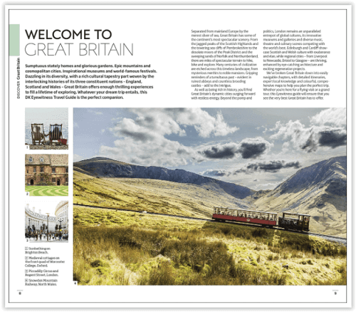
Productomschrijving: Visit Stonehenge's mysterious monoliths, take the sea air in buzzing Brighton or come face to face with the Vikings in York: everything you need to know is clearly laid out within colour-coded chapters. Discover the best of Great Britain with this indispensable travel guide.
Inside DK Eyewitness Travel Guide Great Britain:
- Over 60 colour maps help you navigate with ease
- Simple layout makes it easy to find the information you need
- Comprehensive tours and itineraries of Great Britain, designed for every interest and budget
- Illustrations and floorplans show in detail Westminster Abbey, St Paul's Cathedral, Buckingham Palace and the Tower of London, as well as Brighton's Royal Pavilion, Canterbury Cathedral, Blenheim Palace, the Eden Project, Castle Howard, the Royal Mile and much more
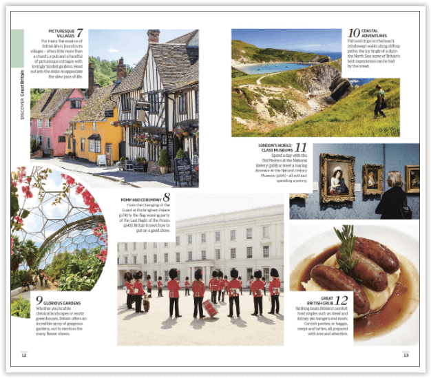
- Colour photographs of Great Britain's stunning landscape - bucolic countryside, spectacular coastline, rugged moorland and more - as well as architectural highlights, peaceful villages and vibrant cities
- Detailed chapters, with area maps, cover London - West End and Westminster; South Kensington and Hyde Park; Regent's Park and Bloomsbury; the City and Southwark; and sights beyond the city - the Downs and Channel Coast; East Anglia; Thames Valley; Wessex; Devon and Cornwall; the Midlands; Lancashire and the Lakes; Yorkshire and the Humber Region; Northumbria; Wales; and Scotland
- Historical and cultural context gives you a richer travel experience: learn about Great Britain's long history, society and politics; heraldry and aristocracy; rural architecture and stately homes; sporting highlights; and festivals and events
- Experience the culture with features on the gardens of England; John Nash's Regency London; the castles of Wales; the Industrial Revolution; and more
- Essential travel tips: our expert choices of where to stay, eat, shop and sightsee, plus transport, visa and health information.
Locatie op kaart
Artikelen uit dezelfde regio

Reisgids Dominicus Ierland en Noord-Ierland - Gottmer • 9789465250106
Reisgids Ierland en Noord-Ierland - Gottmer Productomschrijving: Ierland heeft zijn geheel eigen charme: ruige kusten, golvende groene heuvels, verstilde veengebieden, vriendelijke en humorvolle mensen, Keltische mystiek en vrolijke folkmuziek. Daarbij zijn twee fascinerende grote steden, Dublin en Belfast, elk voor zich al een lange stedentrip waard. Middelgrote plaatsen als Cork en Galw…

Fietsgids Great British Bike Rides - Vertebrate Publ. • 9781906148553
Great British Bike Rides - Vertebrate Productomschrijving: 40 classic routes for road cyclists Great British Bike Rides by Dave Barter brings together 40 of the best road rides in England, Scotland and Wales, searching out the country's most celebrated routes, toughest climbs and scenic roads. Features detailed route information, bespoke mapping and a statistical breakdown of every det…
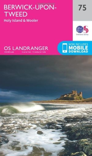
Wandelkaart 75 Berwick-upon-Tweed- England - OSI • 9780319261736
Wandelkaart Berwick-upon-Tweed - Northumebrland England Productbeschrijving: Gelegen dichtbij de Schotse grens, is Berwick-upon-Tweed de meest noordelijke stad in Engeland, en verschijnt op kaart nummer 75 in de OS Landranger kaarten reeks. Vele bezienswaardigheden te ontdekken in de omgeving. De enorme uitgestrektheid van Northumberland platteland beschikt over glooiende heuvels, stranden…

Reisgids Culture Smart Britain - Groot Brittannië - Kuperard • 9781787023574
Reisgids Culture Smart Britain - UK Productomschrijving: The essentiel guide to customs & culture. Culture smart Britain is an illuminating and practical guide to British culture and society. It will help you turn your visit - whether it's for business or for pleasure - into a memorable and enriching experience. Contents include: - local customs and traditions - the impact of histo…

Anwb Camperboek Engeland & Wales - Anwb • 9789018055066
Camperboek Engeland & Wales - Anwb Productomschrijving: Ontdek met het ANWB Camperboek Engeland & Wales de mooiste camperroutes door adembenemende natuur en karaktervolle steden. Rijd langs ruige kusten, groene heuvels, nationale parken en sfeervolle dorpen, met 17 zorgvuldig samengestelde routes vol highlights. Inclusief praktische tips, campings, GPS-coördinaten en inspirerende fotografi…