

Landkaart Wegenkaart H4 Ierland Zuid - OSI
Ireland South Road map

Korte omschrijving
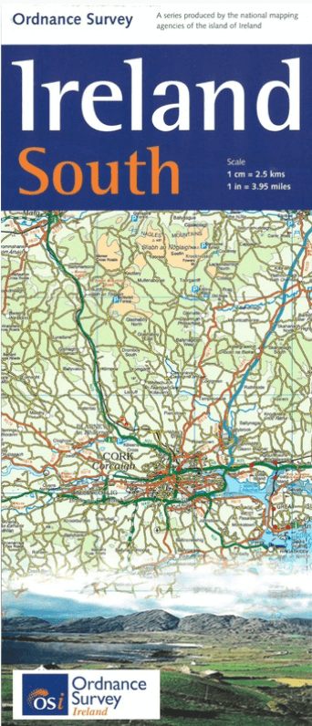
Wegenkaart Zuid Ierland Zuid - OSI Productomschrijving: Ordnance Survey Ireland South Road map at 1:250,000 approx 4 miles to the Inch. This map shows detailed road classification, alti...

Specificaties
- Uitgever: Ordnance Survey Ireland
- ISBN-13: 9781908852861
- HOOFDCATEGORIEËN: Wegenkaart - Landkaart
- Activiteiten: Street/Road maps & city plans
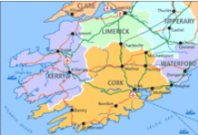
- Regio: Ierland, Zuid ierland
- Land: Ierland
- Schaal: 1:250000
- Taal: Engels
- Reeks/Serie: Discovery Series, OSI
Volledige omschrijving
Wegenkaart Zuid Ierland Zuid - OSI
Productomschrijving: Ordnance Survey Ireland South Road map at 1:250,000 approx 4 miles to the Inch.
This map shows detailed road classification, altitude colouring and tourist information, published by OSI, the Ordnance Survey of Ireland.
Topography of the island is shown by altitude colouring, with additional spot heights and names of mountain or hill ranges and other geographical features. Additional graphics show different types of woodlands etc. Road network shows six grades of roads; Railway lines are shown with stations.
A range of symbols highlights camping and caravan sites, nature reserves, National Trust and An Taisce properties or land, golf courses (indicating the number of holes), historical sites, etc.

Artikelen uit dezelfde regio
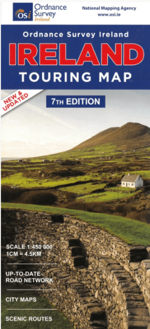
Landkaart Wegenkaart Discovery Ierland touring map - OSI • 9781908852892
Wegenkaart Discovery Ierland touring map - OSI Productomschrijving: A folded map covering the whole of the island of Ireland published by Ordnance Survey Ireland. - Clear easy to read mapping, with tourist information symbols for a variety of attractions - Up to Date Road Network and includes a placename Index. - Includes a Distance Chart in Kms. - Distances in Kms marked across…
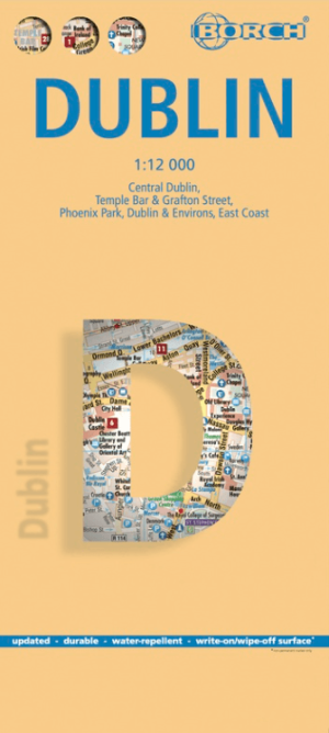
Stadskaart plattegrond Dublin Ierland - Borch • 9783866091344
Wandelkaart Dublin Ierland - Borch Productomschrijving: Our soft-laminated folded map of Dublin in the 9th edition shows: Central Dublin 1:12 000, Phoenix Park 1:25 000, Temple Bar & Grafton Street 1:10 000, Dublin & Environs 1:125 000, East Coast 1:700 000, Public Transport Dublin, Ireland administrative & time zones, Top 30 Sights. Borch Maps are easy to fold, durable and water-repellent…

Reisgids Ireland Ierland - Mini Rough Guides • 9781835291658
Reisgids Ireland - Mini Rough Guides Productopschrijving: Compact, concise and packed full of essential information about where to go and what to do, this is an ideal on-the-move guide for exploring Ireland. From top tourist attractions like The Rock of Cashel, The Dingle Peninsula and The Giant's Causeway to cultural gems, including The Book of Kells, Newgrange and Temple Bar, including a…

Klimgids Ridges of England- Wales & Ireland - Cicerone • 9781852845391
Klimgids - Ridges of England- Wales & Ireland - Cicerone Productomschrijving: Een gids voor zomerscrambles, technische rockroutes en winterbeklimmingen op ruggen in het Lake District, Snowdonia, Peak District, Exmoor, het eiland Wight, Kerry en Connemara, die betrekking hebben op populaire klassiekers en duistere edelstenen, van scherpe rand naar skelet Ridges. Deze handleiding is met grot…

Wandelkaart 31 County Mayo Central Discovery Series - OSI Ireland • 9781912140558
Wandelkaart Mayo Central Discovery Series - OSI Productomschrijving: Ontdek Ierland met de Discovery Series Wandelkaarten van Ordnance Survey Ireland De Discovery Series wandelkaarten van Ordnance Survey Ireland (OSi) zijn dé keuze voor wandelaars, fietsers en avonturiers die Ierland echt willen verkennen. Deze hoogwaardige topografische kaarten bieden een gedetailleerd en nauwkeurig o…