

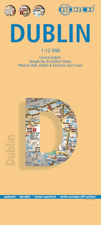
Stadskaart plattegrond Dublin Ierland - Borch
Temple bar - Grafton street - Phoenix Park
Korte omschrijving
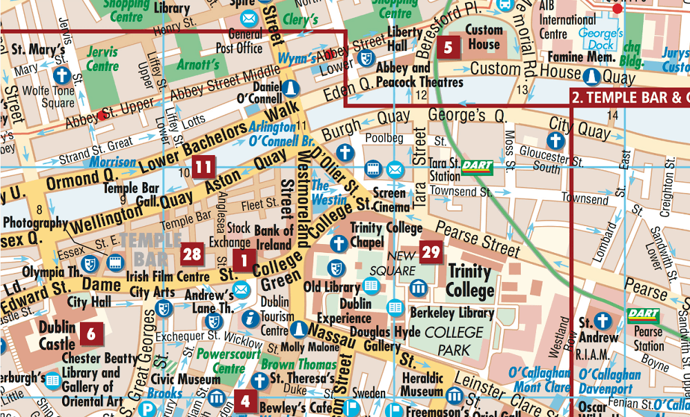
Wandelkaart Dublin Ierland - Borch Productomschrijving: Our soft-laminated folded map of Dublin in the 9th edition shows: Central Dublin 1:12 000, Phoenix Park 1:25 000, Temple Bar & Grafton...
Specificaties
- Uitgever: Borch GmbH
- ISBN-13: 9783866091344
- HOOFDCATEGORIEËN: Stadskaart plattegrond, Wandelkaart
- Activiteiten: Street/Road maps & city plans
- Regio: County Leinster, Ireland, Ierland
- Land: Ierland
- Schaal: 1:12000
- Editie: 10
- Taal: Duits, Engels, Frans, Itailaans, Spaans
- Reeks/Serie: Borch Stadskaart - City map
Volledige omschrijving
Wandelkaart Dublin Ierland - Borch
Productomschrijving: Our soft-laminated folded map of Dublin in the 9th edition shows: Central Dublin 1:12 000, Phoenix Park 1:25 000, Temple Bar & Grafton Street 1:10 000, Dublin & Environs 1:125 000, East Coast 1:700 000, Public Transport Dublin, Ireland administrative & time zones, Top 30 Sights. Borch Maps are easy to fold, durable and water-repellent with a wipeable surface. Borch Maps show hotels, museums, moanuments, markets, public transport, top sights and points of interest, useful statistics, conversion charts for temperatures, weights and measurements, climate charts showing temperatures, sunshine hours, precipitation and humidity, overview maps, time zones, and much more...
The bustling Irish capital has much to offer the visitor, especially with regard to literary history. Once home to Oscar Wilde, James Joyce, W.B. Yeats, G.B. Shaw, Samuel Beckett, Bram Stoker, Jonathan Swift, to name but a few, Dublin today bears testimony to its literary genius in countless museums, galleries, libraries and arts centres. In this city, where the spoken (slightly self-deprecating) word is at least as entertaining as the written, you'll find many sights of historical significance, as well as monuments dear to Dubliners, such as the statue of Molly Malone, a beautiful fishmonger, also known as "The Tart With The Cart", "
The Dish With The Fish" or "The Trollop With The Scallop", the statue of Anna Livia "The Floozie In The Jacuzzi", the statue of Oscar Wilde "The Quare In The Square" and "The Time (or Chime) In The Slime" (an underwater clock in the River Liffey). Not to mention Dublin's vibrant nightlife, the liveliest of which can be found in the Temple Bar district. Dublin of course has it's own microclimate, temperatures are normally mild and extremes are rare, but it's always a good idea to keep an umbrella at hand.
Artikelen uit dezelfde regio
Fietsgids Big Rides- Great Britain & Ireland - Vertebrate Publ. • 9781839810725
Big Rides- Great Britain & Ireland - Vertebrate Productomschrijving: 25 of the best long-distance road cycling, gravel and mountain biking routes Big Rides: Great Britain & Ireland features twenty-five long-distance cycling trails in England, Scotland, Wales, Northern Ireland and Ireland, and includes a general overview of the trails, specific technical information, overview mapping, …
Reisgids Culture Smart Ireland - Kuperard • 9781787023666
Reisgids Culture Smart Ireland Productomschrijving: The essentiel guide to customs & culture Culture smart Ireland an illuminating and practical guide to Irish culture and society. It will help you turn your visit - whether it's for business or for pleasure - into a memorable and enriching experience. Contents include: - local customs and traditions - the impact of history, re…

Landkaart Wegenkaart Ierland driving map - Ordnance Survey • 9781908852885
Wegenkaart Ierland driving map - OSI Productomschrijving: A folded map covering the whole of the island of Ireland published by Ordnance Survey Ireland. Clear easy to read mapping. Up to Date Road Network and includes a placename Index. Includes a Distance Chart in Kms. Distances in Km marked across the map.
Reisgids Irlande Ierland GEOguide - Gallimard • 9782742468072
Reisgids Irlande - Gallimard Productomschrijving: Des pubs chaleureux de Dublin aux cottages rustiques du Donegal, laissez-vous envoûter par la Belle Emeraude ! Un voyage slow, respectueux et responsable, avec des itinéraires en train, à vélo... Des rencontres avec les habitants pour une immersion authentique et loin des foules. Les recommandations de nos auteurs sur place, leurs adre…
Fietsgids Eurovélo 1 Atlantikküsten-Radweg - Bikeline • 9783711102171
Eurovélo-route 1 - Atlantikküsten-Radweg - Bikeline Productomschrijving: Fietstochten zijn al tientallen jaren een populaire manier om op vakantie te gaan en worden steeds populairder. Er zijn talloze langeafstandsfietsroutes en fietsregio's waar je zorgeloos kunt fietsen. De variatie is enorm, want er zijn fietsroutes langs rivieren, langs zeekusten, over voormalige spoorlijnen, in en ron…