

Fietsgids Gravel Rides Lake District - Vertebrate Publ.
15 gravel bike adventures in Cumbria - Lake District NP

Korte omschrijving
Fietsgidsen Cumbria & Lake District, England van Vertebrate Publishing. Ideaal voor tochten in England.
Gravel Rides Lake District - Vertebrate Productomschrijving: 15 gravel bike adventures in Cumbria Gravel Rides Lake District by Andrew Barlow showcases 15 of the best gravel bike rides i...

Specificaties
- Uitgever: Vertebrate Publishing
- ISBN-13: 9781839811845
- HOOFDCATEGORIEËN: Fietsgids
- Activiteiten: Fietsen / VTT / MTB
- Auteur: Andrew Barlow
- Regio: Cumbria & Lake District, England
- Land: England
- Taal: Engels
- Fietsen: Fietsen in het Buitenland
- De Nationale Parken: Lake district National Park, England
- Wandelen in de Bossen & natuurgebieden van Europa: Lake district, England
- VTT / MTB: Mountainbike
Volledige omschrijving
Gravel Rides Lake District - Vertebrate
Productomschrijving: 15 gravel bike adventures in Cumbria
Gravel Rides Lake District by Andrew Barlow showcases 15 of the best gravel bike rides in the stunning Lake District National Park. Researched, ridden and written by Lakes local Andrew Barlow, the routes feature clear and easy-to-use Ordnance Survey 1:50,000 maps; easy-to-follow directions; details of distance, timings and difficulty gradings; stunning action photography; refreshment stops and local knowledge; and a detailed Appendix.
Gravel Rides Lake District showcases 15 of the best gravel bike rides in the stunning Lake District National Park. From 17 to 270 kilometres in length and covering a variety of terrain, there is something for every gravel cyclist.
Explore the Windermere shoreline, traverse the meandering gravel of Claife Heights, and enjoy the views and feeling of isolation on the bleak open moorland of Askham Fell and while following the peaceful Borrow Beck.
Researched, ridden and written by Lakes local Andrew Barlow, each route features clear and easy-to-use Ordnance Survey 1:50,000 maps; easy-to-follow directions; details of distance, timings and difficulty gradings; stunning action photography; refreshment stops and local knowledge; and a detailed Appendix.

Artikelen uit dezelfde regio
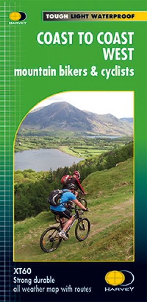
Fietskaart Coast to Coast West & St Bees to Kirkby - Harvey maps • 9781851375318
Fietskaart- Coast to Coast West & St Bees to Kirkby - Harvey maps Productomschrijving: De route van kust tot kust, is bedekt met twee kaarten. De doortocht van kust naar kust is ongeveer 200 mijl. Er is geen één definitieve route. Deze kaarten suggereren twee belangrijkste alternatieven, St Bees naar Robin Hoods Bay (bedacht door Tim Woodcock) of Bicester aan Wykeham (bedacht door pedaal N…
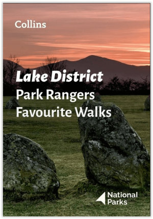
Wandelgids Park Rangers Favourite Walks Lake District - Collins • 9780008439149
Wandelgids Lake District - Collins Productomschrijving: Wandelgids over het Lake District National Park, met 20 beste routes uitgekozen door de parkwachters. Elke wandeling varieert in lengte van 2 tot 10 km en kan in minder dan 4 uur worden afgelegd. Engelse omschrijving: Walking guide to the Lake District National Park, with 20 best routes chosen by the park rangers. Each walk varies…
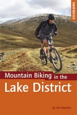
Mountainbikegids VTT in the Lake District - Cicerone • 9781852846442
Mountainbikegids - VTT in the Lake District - Cicerone Productomschrijving: Een handige gids die 24 beoordeelde mountainbike routes beschrijft in het Lake District, en biedt een aantal van de beste MTB in het Verenigd Koninkrijk. De cirkelvormige routes bieden een spectaculair uitzicht op de meren, en zijn geschikt voor alle niveau's van de renners. Geregeld door de moeilijkheid, vanuit Ke…
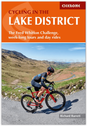
Fietsgids Lake District cycling - Cicerone • 9781786311887
Lake District cycling - Cicerone Productomschrijving: Fietsgids over een 5-daagse fietstocht door het Lake District, met 2 opties per dag tot een totaal van 299 km en bijna 5000 meter klimmen, en 15 pittige dagritten vanuit Keswick, Ambleside, Penrith en bases in het zuidwesten en zuidoosten van het nationale park. Met een overzicht van andere tochten en de Fred Whitton Challenge-rit (180 …

Wandelkaart 90 Penrith & Keswick - Lake District NP - OSI • 9780319263372
Penrith & Keswick - Lake District NP - OSI Productomschrijving: Kaart nummer 90 in de OS Landranger kaartenserie is de perfecte kaart voor het plannen van vakanties en dagtochten naar het Penrith en Keswick gebied van het Lake District. Het gebied is ideaal voor vakantiegangers die willen deelnemen aan wandelingen, tochten of watersporten, want er zijn fantastische paden, activiteiten en l…