

Fietsgids Cycling in Surrey England - Bradt Travel guides
21 hand-picked rides - totaal 529 km routes

Korte omschrijving
Fietsgidsen Surrey South England van Bradt guides. Ideaal voor tochten in England.
Cycling in Surrey - Bradt Travel guides Productomschrijving: De nieuwe fietsgids voor Surrey - is onderdeel van een groeiende serie ontworpen voor in de zadeltas - biedt 21 routes, elk inclu...

Specificaties
- Uitgever: Bradt guides
- ISBN-13: 9781804691359
- HOOFDCATEGORIEËN: Fietsgids
- Activiteiten: Fietsen / VTT / MTB
- Regio: Surrey South England
- Land: England
- Editie: 1
- Taal: Engels
- De Engelse Graafschappen: Surrey
Volledige omschrijving
Cycling in Surrey - Bradt Travel guides
Productomschrijving: De nieuwe fietsgids voor Surrey - is onderdeel van een groeiende serie ontworpen voor in de zadeltas - biedt 21 routes, elk inclusief uitgebreide routebeschrijvingen plus contextuele verkenning van geschiedenis, natuur en cultuur, geschreven door fervent fietser en historicus Ross Hamilton. Elke route is gekoppeld aan OS Explorer kaarten en, waar relevant, National Cycle Network routes, terwijl QR-codes verbinding maken met downloadbare GPX-kaarten via de komoot app, zodat navigatie met een smartphone mogelijk is. Met een speciale sectie over fietsverhuur (zodat je een alternatief hebt als je fiets niet geschikt is voor een bepaalde rit) en suggesties voor accommodatie is dit boek een onmisbare reisgenoot voor avonturen op twee wielen.
Het huidige Surrey was ooit een relatief dunbevolkt en rustiek gebied ondanks de nabijheid van Londen. Toch heeft de county zijn landelijke charme niet verloren. Naast de vele Areas of Outstanding Natural Beauty is het het meest beboste graafschap van Engeland en is het bezaaid met rivieren, waaronder de langste van Engeland, de machtige Theems.
Bovendien heeft Surrey een lange band met fietsen. Toen de fietsgekte voor het eerst toesloeg in Groot-Brittannië in de jaren 1800, werd de stad Ripley in Surrey al snel het 'Mekka van alle goede fietsers' genoemd. De wegen van Surrey vormen nu een groot deel van het jaarlijkse RideLondon-evenement, dat zelf een uitbreiding is van de Olympische route voor wielrenners in 2012. De in totaal 529 km lange, zorgvuldig uitgekozen selectie ritten varieert van 14 tot 44 km, met een gemiddelde van 25 km, waardoor ze perfect zijn voor een halve dag.
Engelse omschrijving: Bradt’s new cycling guide to Surrey – part of a growing series designed for the saddle bag – offers 21 routes, each including comprehensive directions plus contextual exploration of history, wildlife and culture, written by avid cyclist and historian Ross Hamilton. Each route links to OS Explorer maps and, where relevant, National Cycle Network routes, while QR codes connect with downloadable GPX maps via the komoot app, enabling navigation by smartphone. With a dedicated bike-hire section (so you have an alternative if your bicycle isn’t suitable for a particular ride) and accommodation suggestions, this book is an indispensable travel companion for two-wheeled adventures.
Once a relatively sparsely populated and rustic area despite its proximity to London, present-day Surrey is prime commuter-belt territory. Even so, the county has not lost its rural charm. As well as boasting many Areas of Outstanding Natural Beauty, it is England’s most wooded county and is riddled with rivers including England’s longest, the mighty Thames.
Moreover, Surrey has a long connection with cycling. When the riding craze first hit Britain in the 1800s, the Surrey town of Ripley was quickly dubbed the ‘Mecca of all good cyclists’. Surrey roads now make up much of the annual RideLondon event, itself an extension of the 2012 Olympic road-cycling route. Collectively totalling 529 km, the handpicked selection of rides range from 14 to 44 km – averaging 25 km, which makes them perfect for a half-day outing. Many are looped circuits, and most begin and end at railway stations, making travel hassle-free. Most are aimed at beginners and leisure cyclists, while some offer adventurous riders a more challenging experience.
So whether you fancy riding Surrey’s numerous tree-cloaked country lanes or off-road networks, cycling between Medieval churches or along a Roman road, visiting Guildford Castle or Newark Abbey on two wheels, doffing your helmet to a four-thousand-year-old yew tree, biking between nature reserves and country houses, or having a drink at the UK’s smallest pub, Surrey is a superb cycling destination with something for everyone – making Bradt’s Cycling in Surrey brim with inspiration for cyclists of all ages and energy levels.

Artikelen uit dezelfde regio
Reisgids Zuid-Engeland - Uitgeverij Lannoo • 9789059960978
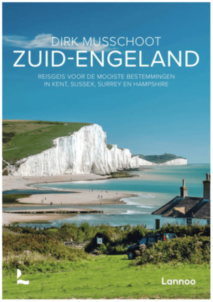
Reisgids Zuid-Engeland - Lannoo Productomschrijving: Engelandkenner Dirk Musschoot laat je op een onovertroffen wijze kennismaken met de regio's Kent, East en West Sussex, Surrey, Hampshire en het eiland Wight, en de bestemmingen die je daar absoluut niet mag missen. Enkele voorbeelden: de optrekjes van Charles Darwin, Winston Churchill en Rudyard Kipling, de imposante kliffen van Beac…

Wandelkaart OL33 Haslemere & Petersfield - OS • 9780319242728
Wandelkaart Haslemere & Petersfield - OS Productomschrijving: Haslemere, Petersfield, Midhurt & Selborne. Omvat: Haslemere, Petersfield, Midhurst and Selborne, South Downs National Park, Surrey Hills and the Sussex Border Path, Greensand Way, Hangers Way, the River Rother and New Lipchis Way Ontdek de OL-serie van Ordnance Survey: De OL-serie (Outdoor Leisure) van Ordnance Surve…

Fietsgids Cycling Days Out - South East England - Vertebrate Publ • 9781906148249
Cycling Days Out - South East England - Vertebrate Productomschrijving: Traffic-free family and leisure cycling in Kent, Sussex, Surrey & Hampshire. Cycling Days Out – South East England is a guide to traffic-free family and leisure cycling in Kent, Sussex, Surrey and Hampshire. Written by local author Deirdre Huston, it explores tourist trails, country parks, forest riding and more. …

Wandelgids North Downs Way - Trailblazer Publications • 9781912716500
Wandelgids North Downs Way - Trailblazer Productomschrijving: The North Downs Way, from Farnham to Dover is a 131-mile (211km) National Trail. (British Walking Guide) 84 trail maps 16 town plans 50 colour photos 120mm x 180mm, 5" x 7" The North Downs Way, a 131-mile (211km) National Trail runs from Farnham in Surrey to Dover in Kent via Canterbury, winding its way through…

Wandelkaart OL33 Haslemere- Petersfield & Midhurst - OSI • 9780319469514
Wandelkaart Haslemere- Petersfield & Midhurst - Surrey England Omvat ook: Midhurst & Selborne Productbeschrijving: Kaart nummer OL 33 omvat Haslemere, Petersfield, Midhurst en Selborne. Hoogtepunten zijn het Nationaal Park South Downs, de Surrey Hills en de Sussex border path. Andere hoogtepunten van het gebied zijn Greensand way, Hangers way, de rivier Rother en nieuwe Lipchis way Dez…