

Wegenatlas K'gari (Fraser Island) & the Brisbane Islands - Hema
Moreton- North & South Stradbroke- Bribie Islands- Fraser Island

Korte omschrijving
K'gari (Fraser Island) & the Brisbane Islands - Hema Productomschrijving: K'gari (Fraser Island) Atlas & Guide (incorporating Moreton, North & South Stradbroke and Bribie Islands) - your ul...

Specificaties
- Uitgever: Hema Maps
- ISBN-13: 9781922668820
- HOOFDCATEGORIEËN: Wegenatlas
- Activiteiten: Road atlases & maps, Street/Road maps & city plans
- Regio: Brisbane, Brisbane Islands, Queensland Australia, Fraser Island, Brisbane Queensland Australia, Queensland, Noord-Oost Australië
- Land: Australië
- Schaal: 1:130000
- Editie: 1
- Taal: Engels
- Reeks/Serie: Wegenatlassen
Volledige omschrijving
K'gari (Fraser Island) & the Brisbane Islands - Hema
Productomschrijving: K'gari (Fraser Island) Atlas & Guide (incorporating Moreton, North & South Stradbroke and Bribie Islands) - your ultimate companion for immersing yourself in the captivating wonders of K'gari, as well as the stunning neighboring islands of Moreton, North Stradbroke, South Stradbroke, and Bribie.
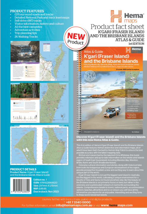
Introducing the K'gari (Fraser Island) and the Brisbane Islands Atlas & Guide, your ultimate companion for immersing yourself in the captivating wonders of K'gari (Fraser Island), as well as the stunning neighbouring islands of Moreton, North Stradbroke, South Stradbroke, and Bribie. This comprehensive atlas and guide, authored by experienced travel journalist Chris Whitelaw, offers a wealth of information to enhance your exploration of this remarkable Queensland destination.
With Hema's renowned cartographic expertise, the atlas provides clear and accurate mapping, showcasing the roads, tracks, and topographic features of Fraser Island in impressive detail. From major routes to hidden trails, you'll have the confidence to navigate every corner of Fraser Island's breathtaking landscapes. In addition, the atlas also incorporates mapping for the nearby islands, including Moreton, North Stradbroke, South Stradbroke, and Bribie, allowing you to extend your adventure and explore these coastal gems.
Beyond its exceptional mapping, the atlas and guide offers insightful guides that delve into the natural attractions, history, cultural significance, and environmental wonders of the world’s largest sand islands. Gain a deeper understanding of the unique ecosystems, wildlife, and geological formations that define these destinations. Uncover the fascinating stories behind the landmarks and learn about the Indigenous heritage that makes these islands such extraordinary places.
Practical information is also abundant within the atlas and guide. Discover camping areas, picnic spots, recreational facilities, and other essential amenities, allowing you to plan your itinerary and make the most of your time on each island. Notable points of interest, including lakes, lookouts, and iconic landmarks, are highlighted, ensuring you don't miss any of the must-see attractions across the islands.
Unleash your spirit of adventure and let the Hema Maps K'gari (Fraser Island) and the Brisbane Islands Atlas & Guide be your trusted companion as you navigate the wonders of K’gari (Fraser Island), Moreton Island, North Stradbroke Island, South Stradbroke Island and Bribie Island. Explore their pristine landscapes, uncover hidden treasures, and create lifelong memories as you delve into sandy beaches, traverse ancient rainforests, and marvel at crystal-clear lakes.
The book features 13 iconic 4WD tracks and 26 bushwalking tracks from across the islands, explored and revised by Hema's Map Patrol team. Each trip has a detailed map, plus all the information you need to plan the trip including trip grading, longest distance without fuel, permits, and contact details.
KEY FEATURES
- Advice on planning for your trip
- Highlights, History, Flora, Fauna, Places to see, Things to do for each of the islands
- Top 13 4WD tracks including trip grading, longest distance without fuel, permits, and contact details
- 26 bushwalking trips from across the islands
- 16 Page Atlas, with detailed maps showing fuel, camping areas, and rest areas
- Mapping has been field-checked by the Hema Map Patrol.
%20%26%20the%20Brisbane%20Islands%20-%20Bibliotrek.png)
Artikelen uit dezelfde regio
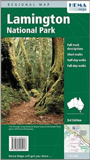
Wandelkaart Lamington National Park Autralia - Hema • 9781865005218
Wandelkaart Lamington National Park Autralia - Hema Productomschrijving: Lamington National Park, een weelderig regenwoud dat zich richt op de schilderachtige toerist, trekt natuurliefhebbers uit heel Australië en de rest van de wereld. Lamington National Park ligt in het zuidoosten van Queensland en staat bekend om zijn deel van de oude Gondwana regenwouden, waar de zeldzame Albert's lier…
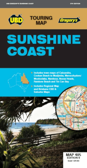
Landkaart Wegenkaart 405 Sunshine Coast Queensland- UBD Gregory's • 9780731932825
Wegenkaart Sunshine Coast Queensland- UBD Gregory's Productomschrijving: Sunshine Coast regional map at a scale of 1 : 171 950 & index covering along the coast from Inskip Peninsula in the north to Caloundra & Toorbul in the south, Wonga Lower in the west and Noosa Heads & Caloundra in the east. - Street level mapping at a scale of 1 : 25 000 with coverage for Caloundra & surrounding …

Wegenatlas Cape York Atlas & Guide - Hema Maps • 9781876413439
Wegenatlas Cape York Atlas & Guide - Hema Productomschrijving: Hema Maps’ Cape York Atlas & Guide helps you make the most of your visit to this remarkable part of Australia. With detailed coverage of The Tip, the coast from the Cairns region to Cooktown, Rinyirru (Lakefield) National Park, the Peninsula Developmental Road, Old Telegraph Track, Torres Strait and the Savannah Way, it en…

Stadsplattegrond 460 Brisbane City Pocket map - UBD Gregory's • 9780731932214
Stadskaart Brisbane City Pocket map - UBD Gregory's Productomschrijving: The latest edition of the Brisbane City Pocket map has been fully revised and updated and includes the following: City map in handy pocket size. - 1:5000 detailed coverage of the Brisbane CBD, Petrie Terrace, Spring Hill and South Brisbane including building and hotel names, theatres, shopping centres, parking …

Landkaart Wegenkaart 419 Queensland State & Cities - Gregory's • 9780731933419
Wegenkaart Queensland State & Cities - UBD Gregory's Productomschrijving: The latest edition of the Queensland State and Cities map has been fully revised and updated and includes state mapping and an index to towns and localities on one side and detailed street level mapping for Brisbane City, Cairns, Gladstone, Longreach, Mackay, Maroochydore, Mount Isa, Surfers Paradise, Toowoomba and T…