

Land
- Albanië (13)
- Andorra (9)
- België (606)
- Bulgarije (1)
- Denemarken (16)
- Duitsland (357)
- England (669)
- Europa (4)
- Finland (35)
- Frankrijk (1376)
- Georgië (3)
- Griekenland (180)
- Hongarije (3)
- Ierland (103)
- Ijsland (72)
Regio
- A Coruña (provincie) Galicië Spanje (16)
- A Coruña (stad) A Coruña, Galicië Spanje (1)
- A Pobra do Caramiñal (gemeente) A Coruna, Galicië (1)
- Aargau, Zwitserland (6)
- Ababuj (gemeente) Teruel, Aragon (1)
- Abegondo (gemeente) A Coruna Galicië Spanje (1)
- Aberdeenshire, Schotland (27)
- Abla (gemeente) Almeria, Andalusië Spanje (1)
- Abrajanejo (gemeente) Cadiz, Andalusië Spanje (1)
- Abruzzo, Italië (8)
- Abárzuza (gemeente) Navarra (1)
- Acharnes, Griekenland (1)
- Achterhoek West, Nederland (1)
- Achterhoek, Nederland (3)
- Adeje (eiland) TENERIFE, Canarische eilanden Spanje (1)
- Adra (gemeente) Almeria, Andalusië Spanje (1)
- Agost (gemeente) Alicante, Valencia Spanje (1)
- Agullana (gemeente) Girona, Catalonië (1)
- Agulló (gemeente) Lerida, Catalonië (1)
- Agulo (eiland) LA GOMERA, Canarische eilanden Spanje (1)
- Agüero (gemeente) Huesca, Aragon (1)
- Aineto (gemeente) Huesca, Aragon (1)
- Akershus, Noorwegen (5)
- Alaior (gemeente) Mallorca, Balearen Spanje (1)
- Alaró (gemeente) Mallorca, Balearen Spanje (1)
- Albanese Alpen (3)
- Albanië (1)
- Albarracín (gemeente) Teruel, Aragon (1)
- Albatera (gemeente) Alicante, Valencia Spanje (1)
- Alberite (gemeente) La Rioja, La Rioja SPanje (1)
- Alboloduy (gemeente) Almeria, Andalusië Spanje (1)
- Albox (gemeente) Almeria, Andalusië Spanje (1)
- Alburquerque (gemeente) BAdajoz, Extremadura Spanje (1)
- Albánchez (gemeente) Almeria, Andalusië Spanje (1)
- Alcalà de Xivert (gemeente) Castellon, Valencia (1)
- Alcalá de los Gazules (gemeente) Cadiz, Andalusië Spanje (1)
- Alcalá del Valle (gemeente) Cadiz, Andalusië Spanje (1)
- Alcalá la Real (gemeente) Jaén, Andalusië Spanje (1)
- Alcanar (gemeente) Tarragona, Catalonië (1)
- Alcoi (stad) Alicante, Valencia Spanje (1)
- Alcubierre (gemeente) Huesca, Aragon (1)
- Alcubilla de Avellaneda (gemeente) Soria, Castillië y léon (1)
- Alcublas (gemeente) Valencia, Velencia Spanje (1)
- Alcuéscar (gemeente) Caceres, Extremadura Spanje (1)
- Aldea del Cano (gemeente) Caceres, Extremadura Spanje (1)
- Aldeadávila de la Ribera (gemeente) Salamanca, Castillië y Léon (1)
- Aldeanueva De La Vera (gemeente) Caceres, Extremadura (1)
- Aldehuela de Periánez (gemeente) Soria, Castillië y léon (1)
- Aldeire (gemeente) Granada, Andalusië Spanje (1)
- Alentejo, Portugal (1)
- Alençon (1)
- Alforja (gemeente) Tarragona, Catalonië (1)
- Algar (gemeente) Cadiz, Andalusië Spanje (1)
- Algarve, Portugal (2)
- Algodonales (gemeente) Cadiz, Andalusië Spanje (1)
- Algorta (provincie) Baskenland (1)
- Algorta (provincie) Euskadi (1)
- Algorta (wijk) Biskaje, Baskenland Spanje (1)
- Alhama de Almería (gemeente) Almeria, Andalusië Spanje (1)
- Alhama de Granada (gemeente) Granada, Andalusië Spanje (1)
- Alhama de Murcia (gemeente) Murcia, Murcia Spanje (1)
- Alhambra (gemeente) Ciudad Real, Castilla-la Mancha Spanje (1)
- Alhaurín El Grande (gemeente) Malaga, Andalusië Spanje (1)
- Alicante (de stad) Alicante, Valencia Spanje (1)
- Alins (gemeente) Lerida, Catalonië (1)
- Alkotz (gemeente) Navarra (1)
- Aller (gemeente) Asturië (1)
- Allgauer Alpen (1)
- Allgäu, Duitsland (4)
- Almadenes (natuurgebied) Murcia, Murcia Spanje (1)
- Almedinilla (gemeente) Cordoba, Andalusië Spanje (1)
- Almenar de Soria (gemeente) Soria, Castillië y léon (1)
- Almendricos (gemeente) Almeria, Murcia Spanje (1)
- Almeria (Provincie) Andalusië Spanje (1)
- Almería (stad) Almeria, Andalusië Spanje (1)
- Almogía (gemeente) Malaga, Andalusië Spanje (1)
- Almoradí (gemeente) Alicante, Valencia Spanje (1)
- Alpes-Maritimes, Frankrijk (1)
- Alpes-de-Haute-Provence, Frankrijk (5)
- Alquézar (gemeente) Huesca, Aragon (1)
- Alsace, Frankrijk (1)
- Altea (gemeente) Alicante, Valencia Spanje (1)
- Altsasu/Altsasua (gemeente) Navarra (1)
- Alustante (gemeente) Guadalajara, Castilla la-Mancha (1)
- Alzira (gemeente) Valencia, Valencia Spanje (1)
- Amer (gemeente) Girona, Catalonië (1)
- Amurrio (gemeente) Baskenland (1)
- Andalusië, Spanje (6)
- Andoain (gemeente) Gipuzkoa Baskenland (1)
- Andorra (1)
- Andorra (gemeente) Teruel, Aragon (1)
- Anguiano (gemeente) La Rioja (1)
- Anido, A Coruña Galicië (1)
- Annecy, Frankrijk (1)
- Antequera (gemeente) Malaga, Andalusië SPanje (1)
- Antigua (eiland) FUEREVENTURA, Canarische eilanden Spanje (1)
- Antrim, N. Ierland (1)
- Antwerpen, België (30)
- Antwerpse Kempen, België (1)
- Aoste, Italië (12)
- Appenzell Innerrhoden / Appenzell Rhodes-Intérieures / Appenzello Interno /Appenzell dadens (2)
- Appenzell Innerrhoden, Zwitserland (1)
- Appenzell, Zwitserland (2)
- Apulië, Italië (1)
- Aquitaine, Frankrijk (3)
- Aracena (gemeente) Huelva, Andalusië Spanje (1)
- Aragon, Espagne (12)
- Aragón, Spanje (1)
- Arahal (gemeente) Sevilla, Andalusië Spanje (1)
- Aranda de Duero (gemeente) Burgos, Castillië y léon (1)
- Arauzo de Miel (gemeente) Burgos, Castillië y léon (1)
- Arbúcies (gemeente) Girona, Catalonië (1)
- Arcavell, Les Valls de Valira (gemeente) Lerida, Catalonië (1)
- Archidona (gemeente) Malaga, Andalusië Spanje (1)
- Arcos de la Frontera (gemeente) Cadiz, Andalusië Spanje (1)
- Arcusa (gemeente) Huesca, Aragon (1)
- Ardales (gemeente) Malaga, Andalusië Spanje (1)
- Ardennen, België (8)
- Arenas (gemeente) Ciudad Real, Castilla- La Mancha Spanje (1)
- Arenas del Rey (gemeente) Granada, Andalusië Spanje (1)
- Aretxabaleta (gemeente) Gipuzkoa, Baskenland (1)
- Argyl, Shotland (5)
- Argyll & Bute, Schotland (33)
- Arico (eiland) TENERIFE, Canariche eilanden Spanje (1)
- Arizgoiti (gemeente) Biskanje Baskenland Spanje (1)
- Arlberg, Oostenrijk (1)
- Arras, Frankrijk (1)
- Arrecife (eiland) LANZAROTE, Canarische eilanden Spanje (1)
- Arredondo (gemeente) Cantabrië (1)
- Arriate (gemeente) Malaga, Andalusië Spanje (1)
- Arroyo de Verdelecho (gemeente) Almeria, Andalusië Spanje (1)
- Arteixo (gemeente) Galicië (1)
- Arzúa (gemeente) A Coruna, Galicië (1)
- As Pontes de García Rodriguez (gemeente) A Coruna, Galicië Spanje (1)
- Aspariegos (gemeente) Zamora, Castillië y léon (1)
- Astorga (gemeente) Léon, Castillië y Léon (1)
- Asturië (provincie) Spanje (31)
- Asturië Oost, Spanje (2)
- Atapuerca (gemeente) Burgos, Castilië y Léon (1)
- Atea (gemeente) Zaragoza, Aragon (1)
- Ateca (gemeente) Zaragoza, Aragon (1)
- Athene, Griekenland (3)
- Atienza (gemeente) Guadalajara, Castilla-la Mancha (1)
- Attica, Griekenland (3)
- Attika, Griekenland (3)
- Aust-Agder, Zuid-Noorwegen (1)
- Austurland, IJsland (12)
- Auvergne, Frankrijk (5)
- Auvergne-Rhône-Alpes, Frankrijk (182)
- Avignon, Frankrijk (1)
- Avilés (stad) Asturië, Asturië Spanje (1)
- Ayamonte (gemeente) Huelva, Andalusië Spanje (1)
- Ayrshire Lanark, West Schotland (11)
- Azoren, Portugal (1)
- Azpeitia (gemeente) Gipuzkoa Baskenland (1)
- Aínsa (gemeente) Huesca, Aragon (1)
- Badajoz (gemeente) Badajoz, Extremadura (1)
- Badalona (gemeente) Barcelona, Catalonië (1)
- Baden bei Zürich, Zwitserland (1)
- Baden-Württemberg, Duitsland (48)
- Badia Gran (gemeente) Malloraca, Balearen Spanje (1)
- Baides (gemeente) Guadalajara, Castilla-la Mancha (1)
- Bailo (gemeente) Zaragoza, Aragon (1)
- Balboa (gemeente) comarca El Bierzo, Léon, Castillië y Léon (1)
- Balearen, Spanje (9)
- Balkan, Zuid-Europa (3)
- Banyeres de Mariola (gemeente) Alicante, Valencia Spanje (1)
- Banyoles (gemeente) Girona, Catalonië (1)
- Barbadillo del Pez (gemeente) Burgos, Castillië y léon (1)
- Barbate (gemeente) Cadiz, Andalusië Spanje (1)
- Barcelona (Stad) Barcelona, Catalonië (1)
- Barcia (parochie) Asturië, Asturië Spanje (1)
- Barinas (gemeente) Murcia, Murcia Spanje (1)
- Barluenga (gemeente) Huesca, Aragon (1)
- Barruera (gemeente) Lerida, Catalonië (1)
- Basel Aargau, Zwitserland (10)
- Basel, Zwitserland (4)
- Baskenland, Spanje (1)
- Basse-Normadie, Frankrijk (3)
- Batea (gemeente) Tarragona, Catalonië (1)
- Bayern of Beieren, Duitsland (4)
- Baza (gemeente) Granada, Andalusië Spanje (1)
- Baztan (gemeente) Navarra (1)
- Beceite (gemeente) Teruel, Aragon (1)
- Becerril De Campos (gemeente) Palencia, Castillië y Léon (1)
- Bedfordshire, England (7)
- Beieren, Duitsland (70)
- Belgisch Eifel gebied (1)
- Belgisch Limburg (2)
- Belgisch Lotharingen (2)
- Belluno, Italië (8)
- Belmonte de Miranda (gemeente) Asturië, Asturië Spanje (1)
- Benahavís (gemeente) Malaga, Andalusië Spanje (1)
- Benalup-Casas Viejas (gemeente) Cadiz, Andalusië Spanje (1)
- Benalúa (gemeente) Granada, Andalusië Spanje (1)
- Benasque (gemeente) Huesca, Aragon (1)
- Beneixama (gemeente) Alicante, Valencia Spanje (1)
- Benejúzar (gemeente) Alicante, Valencia Spanje (1)
- Benia (gemeente) Asturië (1)
- Benidorm (gemeente) Alicante, Valencia Spanje (1)
- Benifallet (gemeente) Tarragona, Catalonië (1)
- Benissa (gemeente) Alicante, Valencia Spanje (1)
- Benitachell (gemeente) Allicante, Valencia Spanje (1)
- Bera (gemeente) Navarra (1)
- Berga (gemeente) Barcelona, Catalonië (1)
- Bergamo Alpen, Italië (1)
- Berja (gemeente) Almeria, Andalusië Spanje (1)
- Berkshire South West England (1)
- Berlijn, Duitsland (3)
- Bermeo (gemeente) Biskaje Baskenland (1)
- Bermeo (gemeente) Biskaje, Baskenland Spanje (1)
- Bern, Zwitserland (75)
- Berner Alpen, Zwitserland (2)
- Berner Oberland, Zwitserland (13)
- Bernese Hooglanden, Zwitserland (15)
- Berrocal (gemeente) Huelva, Andalusië Spanje (1)
- Betanzos (gemeente) A Coruna, Galicië Spanje (1)
- Betanzos (provincie) A Coruna Galicië Spanje (1)
- Betlem (gemeente) Mallorca, Balearen Spanje (1)
- Bezas (gemeente) Teruel, Aragon (1)
- Biel (gemeente) Zaragosa, Aragon (1)
- Bielsa (gemeente) Huesca, Aragon (1)
- Biescas (gemeente) Huesca, Aragon (2)
- Bigastro (gemeente) Alicante, Valencia Spanje (1)
- Bilbao (stad) Biskaje Basskenland (1)
- Binnen Hybriden (Inner Hybrids), Schotland (5)
- Biskaje (provincie) Baskenland Spanje (2)
- Blanes (gemeente) Girona, Catalonië (1)
- Blekinge Iän, Zweden (3)
- Boal (gemeente) Asturië, Asturië Spanje (1)
- Boca de Huérgano (gemeente) Cantabrië Spanje (1)
- Boedapest, Hongarije (1)
- Bohemen, Tsjechië (2)
- Bohuslän, Zweden (2)
- Bolea, La Sotonera (gemeente) Huesca, Aragon (1)
- Boltaña (gemeente) Huesca, Aragon (1)
- Bolzano, Italië (19)
- Bornholm (eiland), Denemarken (2)
- Borredà (gemeente) Barcelona, Catalonië (1)
- Bouches-du-Rhône, Frankrijk (1)
- Bourgogne, Frankrijk (6)
- Bourgogne-Franche-Comté, Frankrijk (94)
- Bozen, Zuid Tirol, Oostenrijk (2)
- Brabant, België (9)
- Brabant, Nederland (2)
- Brandenburg, Duitsland (5)
- Bremen (3)
- Brens (gemeente) A Coruna, Galicië (1)
- Brescia, Noord Italië (2)
- Bretagne, Frankrijk (90)
- Brighton, England (1)
- Bristol, England (4)
- Broto (gemeente) Huesca, Aragon (2)
- Brussel, België (5)
- Buckinghamshire, England (4)
- Bucovina, Roemenië/Oekraine (1)
- Budapest, Hongarije (1)
- Buenavista del No (eiland) TENERIFE, Canarische eilanden Spanje (1)
- Buiten Hebriden (Outer Hybrids), Schotland (7)
- Buitrago (gemeente) Soria, Castillië y léon (1)
- Burganes de Valverde (gemeente) Zamora, Castillië y léon (1)
- Burgenland, Oostenrijk (4)
- Burgos (provincie) Castillië y Léon (1)
- Burjulú (gemeente) Almeria, Andalusië Spanje (1)
- Buskerud, Noorwegen (15)
- Bute, West Schotland (1)
- Bérchules (gemeente) Granada, Andalusië Spanje (1)
- Bétera (gemeente) Valencia, Valencia Spanje (1)
- Bürgenland, Oostenrijk (1)
- Cabacés (gemeente) Tarragona, Catalonië (1)
- Cabeza del Caballo (gemeente) Salamanca, Castillië y léon (1)
- Cabo de Santa Pola (gemeente) Alicante, Valencia Spanje (1)
- Cabra (gemeente) Cordoba, Andalusië Spanje (1)
- Cabrejas del Pinar (gemeente) Soria, Castillië yléon (1)
- Cabuérniga (gemeente) Cantabrië (1)
- Cala d'Or (gemeente) Mallorca, Balearen Spanje (1)
- Cala de Portinatx (gemeente) Ibiza, Balearen Spanje (1)
- Calaceite (gemeente) Teruel, Aragon (1)
- Calasparra (gemeente) Murcia, Murcia Spanje (1)
- Calella de Palafrugell (gemeente) Girona, Catalonië (1)
- Caleruega (gemeente) Burgos, Castillië y léon (1)
- Caleta de Sebo (eiland) LANZAROTE, Canarische eilanden Spanje (1)
- Calpe (gemeente) Alicante, Valencia Spanje (1)
- Calvarrasa de Arriba (gemeente) Salamanca, Castillië y léon (1)
- Camaleño (gemeente) Cantabrië (1)
- Camargo (gemeente) Spanje (1)
- Camarillas (gemeente) Teruel, Aragon (1)
- Camariñas (gemeente) A Coruna Galicië (1)
- Cambridgeshire, England (17)
- Campanië, Italië (2)
- Campillos gemeente) Malaga, Andalusië Spanje (1)
- Campohermoso (gemeente) Almeria, Andalusië Spanje (1)
- Campolara (gemeente) Burgos, Castillië y léon (1)
- Camporrells (gemeente) Huesca, Aragon (1)
- Camprodon (gemeente) Girona Catalonië (1)
- Canales de la Sierra (gemeente) La Rioja (1)
- Canarische Eilanden (17)
- Canarische Eilanden, Spanje (4)
- Candelaria (eiland) TENERIFE, Canarische eilanden Spanje (1)
- Canet D'Adri (gemeente) Girona, Cantalonië (1)
- Canet de Mar (gemeente) Barcelona, Catalonië (1)
- Cangas del Narcea (gemeente) Asturië, Asturië Spanje (1)
- Cangues de Onís & Cangas de Onís, Asturië (1)
- Canillas de Aceituno (gemeente) Malaga, Andalusië Spanje (1)
- Canjáyar (gemeente) Almeria, Andalusië Spanje (1)
- Cantabrisch gebergte, Spanje (2)
- Cantabrië (provincie) Spanje (2)
- Cantabrië, Spanje (4)
- Cantalapiedra (gemeente) Salamanca, Castillië (1)
- Cantalojas (gemeente) Guadalajara, Castillië-La Mancha (1)
- Canteras (gemeente) Murcia, Murcia Spanje (1)
- Cap Blanc (gemeente) Mallorca, Balearen Spanje (1)
- Capellen, Luxemburg (1)
- Caravaca de la Cruz (gemeente) Murcia, Murcia Spanje (1)
- Carbachu (gemeente) Asturië (1)
- Carballo (gemeente) A Coruna, Galicië Spanje (1)
- Carballo (gemeente) Galicië (1)
- Carboneras (gemeente) Almeria, Andalusië Spanje (1)
- Carcauz (canyon-Dal) Almeria, Andalusië Spanje (1)
- Cardona (gemeente) Barcelona, Catalonië (1)
- Carinthia (10)
- Cariño (gemeente) A Coruna, Galicië Spanje (1)
- Carlet (gemeente) Valencia, Valencia Spanje (1)
- Carmarthenshire, Wales (7)
- Carnota (gemeente) A Coruna Galicië (1)
- Caroch (bergketen) Valencia, Valencia Spanje (1)
- Carrión de los Condes (gemeente) Palencia, Castillië y Léon (1)
- Cartagena (gemeente) Murcia, Murcia Spanje (1)
- Cartaya (gemeente) Huelva, Andalusië Spanje (1)
- Casabermeja (gemeente) Malaga, Andalusië Spanje (1)
- Casablanca (gemeente) Almeria, Andalusië Spanje (1)
- Casablanquilla (gemeente) Malaga, Andalusië Spanje (1)
- Casares (gemeente) Malaga, Andalusië Spanje (1)
- Casas de Don Juan (gemeente) Granada, Andalusië Spanje (1)
- Casas de Don Pedro (gemeente) Badajoz, Extremadura Spanje (1)
- Caserío de Almansa (gemeente) Caceres, Castilla-la- Mancha (1)
- Casillas (gemeente) Avila, Castillië y Léon Spanje (1)
- Caso (gemeente) Asturië Spanje (1)
- Cassá de la Selva (gemeente) Girona, Catalonië (1)
- Castejón de Sos (gemeente, Ribagorza, Huesca, Aragon (1)
- Castell de Ferro (gemeente) Granada, Andalusië Spanje (1)
- Castellar de la Frontera (gemeente) Cadiz, Andalusië Spanje (1)
- Castelldefels (gemeente) Barcelona, Catalonië (1)
- Castelserás (gemeente) Teruel, Aragon (1)
- Castilblanco (gemeente) Badajoz, Extremadura Spanje (1)
- Castilië León, Spanje (2)
- Castilië y León, Spanje (4)
- Castilla La Mancha, centraal Spanje (1)
- Castillejar (gemeente) Granada, Andalusië Spanje (1)
- Castillo de Locubín (gemeente) Jéan, Andalusië Spanje (1)
- Castillo de Tajarja (gemeente) Granada, Andalusië Spanje (1)
- Castril (gemeente) Alicante, Valencia Spanje (1)
- Castrillo de la Vega (gemeente) Burgos, Castillië y Léon (1)
- Castro-Urdiales (gemeente) Cantabrië (1)
- Castro-Urdiales (gemeente) Cantabrië, Cantabrië Spanje (1)
- Castrojeriz (gemeente) Burgos, Castillië y Méon (1)
- Catalaanse Pyreneeën, Spanje (8)
- Catalonië (Regio) Spanje (18)
- Catalonië (provincie) Spanje (1)
- Catalonië, Spanje (5)
- Cazorla (gemeente) Jaén, Andalusië Spanje (1)
- Caín (bergdorp) Léon, Castillië-y-Léon Spanje (1)
- Cañada de Jara (gemeente) Cadiz, Andalusië Spanje (1)
- Cañada del Gállego (gemeente) Murcia, Murcia Spanje (1)
- Cañadas de Cañepla (gemeente) Almeria, Andalusië Spanje (1)
- Cañete la Real (gemeente) Malaga, Andalusië Spanje (1)
- Cañizal (gemeente) Zamora, Castillië y léon (1)
- Cedeira (gemeente) A Coruna, Galicië Spanje (1)
- Cehegín (gemeente) Murcia, Murcia Spanje (1)
- Celeiro (vissershaven) Lugo, Galicië Spanje (1)
- Cenicero (gemeente) La Rioja, La Rioja Spanje (1)
- Centelles (gemeente) Barcelona, Catalonië (1)
- Centraal Griekenland (6)
- Centraal Massief, Frankrijk (1)
- Centraal Portugal (2)
- Centraal Schotland (3)
- Centraal Wales (1)
- Centraal Zweden (1)
- Centraal Zwitserland (20)
- Central Wales (1)
- Centre Val de Loire, Frankrijk (68)
- Ceredigion, South Wales (2)
- Ceredigion, Wales (5)
- Cerralbo (gemeente) Salamanca, Castillië y léon (1)
- Champagne Ardennes, Frankrijk (1)
- Charches (gemeente) Granada, Andalusië Spanje (1)
- Checa (gemeente) Guadalajara, Castilla la-Mancha (1)
- Cheshire, England (8)
- Cheste (gemeente) Valencia, Spanje (1)
- Chichester, England (1)
- Chiclana de la Frontera (gemeente) Cadiz, Andalusië Spanje (1)
- Chiemsee, Duitsland (1)
- Chilluévar (gemeente) Jaén, Andalusië Spanje (1)
- Chillón (gemeente) Ciudad Real, Castilla-la Mancha Spanje (1)
- Chimeneas (gemeente) Granada, Andalusië Spanje (1)
- Chipiona (gemeente) Cadiz, Andalusië Spanje (1)
- Chulilla (gemeente) Valencia, Spanje (1)
- Cidones (gemeente) Soria, Castillië y léon (1)
- Cisneros (gemeente) Palencia, Castillië y Léon (1)
- Cistierna (gemeente) Léon, Castillië y Léon (1)
- Ciudad Rodrigo (gemeente) Salamanca, Castillië y léon (1)
- Civís, Les Valls de Valira (gemeente) Lerida, Catalonië (1)
- Cleveland, Noord Engeland (1)
- Clwyd, Wales (1)
- Codo (gemeente) Zaragoza, Aragon (1)
- Colmenar (gemeente) Malaga, Andalusië Spanje (1)
- Colomera (gemeente) Granada, Andalusië Spanje (1)
- Colonia del Romeral (gemeente) Valencia, Valencia Spanje (1)
- Colònia de Sant Pere (gemeente) Mallorca, Balearen (1)
- Comillas (gemeente) Cantabrië, Cantabrië Spanje (2)
- Condado de Treviño (gemeente) Burgos, Castillië y Léon (1)
- Conil de la Frontera (gemeente) Cadiz, Andalusië Spanje (1)
- Conquista del Guadiana (gemeente) Babdajoz, Extremadura Spanje (1)
- Coripe (gemeente) Sevilla, Andalusië Spanje (1)
- Cornellà de Terri (gemeente) Girona, Catalonië (1)
- Cornudella de Montsant (gemeente) Tarragona, Catalonië (1)
- Cornwall, England (13)
- Corralejo (eiland) FUENTEVENTURA, Canarische eilanden Spanje (1)
- Corsica Sud, Frankrijk (1)
- Corsica, Frankrijk (32)
- Cortegana (gemeente) Huelva, Andalusië Spanje (1)
- Cortelazor (gemeente) Huelva, Andalusië Spanje (1)
- Cortes de Pallas (gemeente) Valencia, Valencia Spanje (1)
- Cortes de la Frontera (gemeente) Malaga, Andalusië Spanje (1)
- Corvera (gemeente) Murcia, Murcia Spanje (1)
- Costa Calma (eiland) FUERTEVENTURA, Canarische eilanden Spanje (1)
- Costa Verde, Spanje (1)
- County Antrim, Northern Ireland (3)
- County Armagh, Northern Ireland (1)
- County Carlow, Ireland (4)
- County Cavan, Ireland (2)
- County Clare, Ierland (10)
- County Cork, Ierland (11)
- County Dingle, Ireland (1)
- County Donegal, Ireland (4)
- County Dublin, Ierland (1)
- County Fermanagh, Ireland (1)
- County Galway, Ierland (8)
- County Kerry, Ireland (7)
- County Kildare, Ireland (2)
- County Kilkenny, Ireland (3)
- County Laois, Ireland (1)
- County Leinster, Ireland (1)
- County Leitrim, Ireland (3)
- County Longford, Ireland (2)
- County Mayo, Ierland (10)
- County Meath, Ireland (1)
- County Monaghan, Ierland (1)
- County Newry, Noord Ierland (2)
- County Offaly, Ireland (1)
- County Roscommon, Ireland (1)
- County Tipperary, Ireland (1)
- County Tyrone, Ireland (1)
- County Waterford, Ireland (1)
- County Wexford, Ierland (2)
- County Wicklow, Ireland (1)
- County, Leitrim, N. Ireland (1)
- Covacha (gemeente) Badajoz, Estremadura Spanje (1)
- Covaleda (gemeente) Soria, Castillië y léon (1)
- Covarrubias (gemeente) Burgos, Castillië y léon (1)
- Coín (gemeente) Malaga, Andalusië Spanje (1)
- Crespos (gemeente) Avila, Castillië y léon (1)
- Cretas (gemeente) Teruel, Aragon (1)
- Crevillent (gemeente) Alicante, Valencia Spanje (1)
- Cruz de la Demanda (gemeente) La rioja, La Rioja Spanje (1)
- Cuenca (Provincie) Castilla-la-Mancha Spanje (1)
- Cuevas del Almanzora (gemeente) Almeria, Andalusië Spanje (1)
- Cumbria & Lake District, England (7)
- Cumbria, England (23)
- Cycladen Zuid, Griekenland (10)
- Cycladen, Griekenland (19)
- Cádiz (gemeente) Cadiz, Andalusië Spanje (1)
- Cártama (gemeente) Malaga, Andalusië Spanje (1)
- Cómpeta (gemeente) Malaga, Andalusië Spanje (1)
- Córdoba (provincie) Andalusië Spanje (1)
- Côte du Rhone, Frankrijk (1)
- Dalarna, Zweden (1)
- Dalarnas län, Zweden (22)
- Dalsland, Zweden (2)
- Dalías (gemeente) Almeria, Andalusië Spanje (1)
- Dehesa de Piedrabuena (bosgebied) Badajoz, Extremadura Spanje (1)
- Deifontes (gemeente) Granada, Andalusië Spanje (1)
- Denbighshire, England (2)
- Derbyshire & Peak District, England (2)
- Derbyshire, England (11)
- Devon, England (36)
- Dinant, Namur (1)
- Disko Island (1)
- Dodecanesos, Griekenland (2)
- Dodekanesos eilanden, Griekenland (4)
- Dolomieten, Italië (2)
- Donegal (1)
- Dorothea, Zweden (1)
- Dorset, England (11)
- Dos aguas (gemeente) Valencia, Valencia Spanje (1)
- Doubs, Frankrijk (1)
- Doña Mencía (gemeente) Cordoba, Andalusië Spanje (1)
- Drenthe, Nederland (6)
- Dublin, Ierland (3)
- Duitse Alpen gebied (1)
- Duitse Baltische kust & eilanden (1)
- Duitsland (1)
- Dumbría (gemeente) A coruna Galicië (1)
- Dumfries & Galloway, Schotland (34)
- Durango (gemeente) Biskaje Baskenland (1)
- Durham, England (5)
- Dyfed, Wales (1)
- Dénia (gemeente) Alicante, Valencia Spanje (1)
- Dúrcal (gemeente) Granada, Andalusië SPanje (1)
- East Anglia, England (2)
- East Ayrshire, Schotland (2)
- East Dunbartonshire, Schotland (1)
- East England (2)
- East Fife, Schotland (2)
- East Kilbride, South Lanarkshire, England (1)
- East Lothian, Schotland (1)
- East Midlands, England (6)
- East Riding of Yorkshire, England (7)
- East Schotland (5)
- East Staffordshire, England (1)
- East Sussex, England (10)
- Echternach, Duitse Grens Luxemburg (1)
- Edinburgh West Schotland (6)
- Edinburgh, West Schotland (6)
- Egeische eilanden, Griekenland (27)
- Eifel regio, Duitsland (3)
- Eifel, Duitsland (2)
- Eivissa (gemeente) Ibiza, Balearen Spanje (1)
- El Abalario (gemmente) Huelva, Andalusië Spanje (1)
- El Almendro (gemeente) Huelva, Andalusië Spanje (1)
- El Alquián (gemeente) Almeria, Andalusië Spanje (1)
- El Arenal (gemeente) Avila, Castillië y léon (1)
- El Barco De Ávila (gemeente) Avila, Castillië y léon (1)
- El Burgo (gemeente) Malaga, Andalusië SPanje (1)
- El Campello (gemeente) Alicante, Valencia Spanje (1)
- El Campillo (gemeente) Huelva, Andalusië Spanje (1)
- El Castillo (eiland) FUERTEVENTURA, Canarische eilanden Spanje (1)
- El Colmenar (gemeente) Malaga, Andalusië Spanje (1)
- El Corralejo (camping) Valencia, Valencia Spanje (1)
- El Cotillo (eiland) FUERTEVENTURA, Canarische eilanden Spanje (1)
- El Ejido (gemeente) Almeria, Andalusië Spanje (1)
- El Gastor (gemeente) Cadiz, Andalusië Spanje (1)
- El Granado (gemeente) Huelva, Andalusië Spanje (1)
- El Hacho (gemeente) Sevilla, Andalusië Spanje (1)
- El Hiero, Canarische eilanden Spanje (1)
- El Jautor (gemeente) Cadiz, Andalusië Spanje (1)
- El Llano de Don Antonio (gemeente) Almeria, Andalusië Spanje (1)
- El Morell (gemeente) Tarragona, Catalonië (1)
- El Médano (eiland) TENERIFE, Canarische eilanden Spanje (1)
- El Oro (gemeente) Valencia, Valancia Spanje (1)
- El Palmar (gemeente) Cadiz, Andalusië Spanje (1)
- El Parador (gemeente) Valencia, Valencia Spanje (1)
- El Perello (kustgemeente) Tarragona, Catalonië (1)
- El Pinell de Brai (gemeente) Tarragona, Catalonië (1)
- El Pino (gemeente) Caceres, Extremadura Spanje (1)
- El Planerón (gemeente) Zaragoza, Aragon (1)
- El Pont d´Armentera (gemeente) Tarragona, Catalonië (1)
- El Portal (gemeente) Cadiz, Andalusië Spanje (1)
- El Pueblo (eiland) LA PALMA, Canarische eilanden Spanje (1)
- El Puertecico (gemeente) Almeria, Andalusië Spanje (1)
- El Pueyo de Araguás (gemeente) Huesca, Aragon (1)
- El Reatillo (gemeente) Valencia, Valencia Spanje (1)
- El Risco (eiland) GRAN CANARIA, Canarische eilanden Spanje (1)
- El Rocío (gemeente) Huelva, Andalusië Spanje (1)
- El Roque (eiland) FUENTEVENTURA, Canarische eilanden Spanje (1)
- El Royo (gemeente) Soria, Castillië y léon (1)
- El Saucejo (gemeente) Sevilla, Andalusië Spanje (1)
- El Tablero (eiland) GRAN CANARIA, Canarische eilanden SPanje (1)
- El Torno (gemeente) Caceres, Extremadura (1)
- El Valle (gemeente) Granada, Andalusië Spanje (1)
- El Vendrell (gemeente) Tarragona, Catalonië (1)
- Elbasan, Albanië (1)
- Elche of Elx (gemeente) Alicante, Valencia Spanje (1)
- Elda (gemeente) Alicante, Valencia Spanje (1)
- Eljas (gemeente) Caceres, Extremadura (1)
- Elorrio (gemeente) Biskaje Baskenland (1)
- Elzas, Frankrijk (3)
- Embalse de Forata (Reservoir) Valencia, Spanje (1)
- Embalse del Celemín (stuwmeer) Cadiz, Andalusië Spanje (1)
- Empuriabrava Sur (jachthaven) Girona, Catalonië (1)
- Ena (gemeente) Huesca, Aragon (1)
- Engeland (6)
- Enguera (gemeente) Valencia, Valencia Spanje (1)
- Entrambasaguas (gemeente) Cantabrië (1)
- Entrimo (gemeente) Ourense, Galicië (1)
- Epirus, Griekenland (1)
- Eratsun (gemeente) Navarra (1)
- Ergoien (gemeente) Gipuzkoa Baskenland (1)
- Ermita Nueva (gemeente) Jaén, Andalusië Spanje (1)
- Erzgebirge, Duitsland (1)
- Es Cubells (gemeente) Ibiza, Balearen Spanje (1)
- Escalada, Valle de Sedano (gemeente) Burgos, Castillië Y Léon (1)
- Esch, Luxemburg (1)
- Escuain (gemeente) Huesca, Aragon (1)
- Escurial (gemeente) Caceres, Extremadura Spanje (1)
- Escúzar (gemeente) Granada, Andalusië Spanje (1)
- Espeja (gemeente) Salamanca, Castillië y léon (1)
- Espeja de San Marcelino (gemeente) Soria, Castillië y léon (1)
- Espot (gemeente) Lieda, Catalonië Spanje (1)
- Essex South England (10)
- Estació d´Esquí Vallter 2000 (Skigebied) Girona, Catalonië (1)
- Estación Ferrocarril (gemeente) Lugo, Galicië (1)
- Estación de Salinas (gemeente) Malaga, Andalusië Spanje (1)
- Estación de Urda Peleches (Toledo) Castilla-la Mancha (1)
- Estella-Lizarra (gemeente) Navarra (1)
- Estepa (gemeente) Sevilla, Andalusië Spanje (1)
- Esterri d'Àneu (gemeente) Lerida, Catalonië (1)
- Esterri d'Àneu (gemeente) Pallars Sobirà, Catalonië Spanje (1)
- Etxalar (gemeente) Navarra (1)
- Eulate (gemeente) Navarra, Spanje (1)
- Europa (3)
- Extramundi de Abaixo (gemeente) A Coruna Galicië (1)
- Extremadura, Spanje (1)
- Facinas (gemeente) Cadiz, Andalusië Spanje (1)
- Falset (gemeente) Tarragona, Catalonië (1)
- Far de Roses (gemeente) Girona, Catalonië (1)
- Farlete (gemeente) Zaragosa, Aragon (1)
- Fasnia (eiland) TENERIFE, Canarische eilanden Spanje (1)
- Fatran-Tatra, Slowakije (1)
- Felix (gemeente) Almeria, Andalusië Spanje (1)
- Fermanagh, N. Ierland (1)
- Fife, Schotland (7)
- Figueres (gemeente) Girona, Catalonië (1)
- Finana (gemeente) Almeria, Andalusië Spanje (1)
- Finnmark, Noorwegen (20)
- Firenze of FLorence, Italië (1)
- Fiscal (gemeente) Heusca, Aragon (1)
- Fisterra (gemeente) A Coruna Spanje (1)
- Flensburger Fjörd, Deens Duitse grens in Denemarken (1)
- Flevoland, Nederland (1)
- Flintshire, Wales (1)
- Fontanars dels Alforins (gemeente) Valencia, Valencia Spânje (1)
- Forest of Bowland, England (1)
- Formentera, Spanje (1)
- Fortuna (gemeente) Murcia, Murcia Spanje (1)
- Foz (gemeente) Lugo, Galicië Spanje (1)
- Frailes (gemeente) Jaén, Andalusië Spanje (1)
- Franche Comté, Frankrijk (5)
- Franken, Duitsland (1)
- Frankrijk (2)
- Frans Baskenland, Frankrijk (1)
- Franse Pyreneeën, Frankrijk (1)
- Freila (gemeente) Granada, Andalusië Spanje (1)
- Fribourg, Duitsland (4)
- Fribourg, Zwitserland (10)
- Friesland Noord, Nederland (2)
- Friesland, Nederland (8)
- Friuli-Venezia Giulia, Italië (1)
- Frontera (eiland) EL HIERRO, Canarische eilanden Spanje (1)
- Fuengirola (gemeente) Malaga, Andalusië Spanje (1)
- Fuente del Fresno (gemeente) Ciudad Real, Castilla-la Mancha Spanje (1)
- Fuente Álamo de Murcia (gemeente) Murcia, Murcia Spanje (1)
- Fuentearmegil (gemeente) Soria, Castillië y léon (1)
- Fuentecén (gemeente) Burgos, Castillië y Léon (1)
- Fuentes de Ebro (gemeente) Zaragoza, Aragon (1)
- Fuentes de Nava (gemeente) Palencia, Castillië y Léon (1)
- Fuentes de Oñoro (gemeente) Salamanca, Castillië y léon (1)
- Fuentespina (gemeente) Burgos, Castillië y léon (1)
- Funen, Denemarken (3)
- Galicië, Spanje (2)
- Galve de Sorbe (gemeente) Guadalajara, Castilla-la Mancha (1)
- Gamvik, Finland (1)
- Gandia (gemeente) Valencia, Valencia Spanje (1)
- Gandul-Marchenilla (gemeente) Sevilla, Andalusië Spanje (1)
- Garlitos (gemeente) Badajoz, Extremadura Spanje (1)
- Garriguella (gemeente) Girona, Catalonië (1)
- Garrucha (gemeente) Almeria, Andalusië Spanje (1)
- Gata (gemeente) Caceres, Extremadura (1)
- Gatova (gemeente) Valencia, Valencia SPanje (1)
- Gaucín (gemeente) Malaga, Andalusië Spanje (1)
- Gaume, Ardennen provincie Luxemburg (2)
- Gauna (gemeente) Alava, Baskenland (1)
- Gea de Albarracín (gemeente) Teruel, Aragon (1)
- Gelderland, Nederland (18)
- Gent, Oost-Vlaanderen (1)
- Genève, Zwitserland (1)
- Georgië, Azië (2)
- Gernika-Lumo (gemeente) Biskaje Baskenland (1)
- Gers, Frankrijk (2)
- Gigonza (gemeente) Cadiz, Andalusië Spanje (1)
- Gijón (stad) Asturië, Asturië Spanje (1)
- Gipuzkoa (provincie) Baskenland (4)
- Girona (gemeente) Girona, Catalonië (1)
- Girona (provincie) Catalonië, Spanje (1)
- Gironella (gemeente) Barcelona, Catalonië (1)
- Girvan South Ayrshire, Schotland (1)
- Glamorgan, Wales (2)
- Glarner Alpen, Zwitserland (1)
- Glarus, Zwitserland (3)
- Glasgow, Schotland (9)
- Gloucester, England (1)
- Gloucestershire, Egland (12)
- Golf van Napels (1)
- Gombrèn (gemeente) Girona, Catalonië (1)
- Gorenjska, Slovenië (2)
- Gorizia, Italië (1)
- Gotland, Zweden (6)
- Gower Peninsula, Wales (1)
- Grado (gemeente) Asturië, Asturië Spanje (1)
- Gramos (1)
- Grampian East Schotland (5)
- Gran Bachimala (bergtop) Huesca, Aragon (1)
- Gran Tarajal (eiland) FUERTEVENTURA, Canarische eilanden Spanje (1)
- Granada Norte (gemeente) Granada, Andalusië Spanje (1)
- Granada Sur (Zuid Granada) Granada, Andalusië Spanje (1)
- Granadilla de Abona (eiland) TENERIFE, Canarische eilanden Spanje (1)
- Grand Est, France (123)
- Grandas (gemeente) Asturië, Asturië Spanje (1)
- Graubünden, Zwitserland (49)
- Grazalema (gemeente) Cadiz, Alndalusië Spanje (1)
- Greater London, England (8)
- Greater Manchester, England (5)
- Grensgebied Slovenië/Italië (1)
- Griegos (gemeente) Teruel, Aragon (1)
- Griekenland vasteland (5)
- Grieks Macedonië (3)
- Griekse eilanden (2)
- Groene hart Nederland (1)
- Groenland (2)
- Groningen, Nederland (5)
- Groot Hertogdom Luxemburg (1)
- Grosseto, Toscane Italië (1)
- Gruyère, Fribourg, Zwitserland (1)
- Guadalajara Cuenca (Provincie) Castilla-la-Mancha Spanje (1)
- Guadiaro (gemeente) Cadiz, Andalusië Spanje (1)
- Guadix (gemeente) Granada, Andalusië Spanje (1)
- Guardamar de Segura (gemeente) Alicante, Valencia Spanje (1)
- Guipuzcoa (proincie) Baskenland (2)
- Guitiriz (gemeente) Lugo, Galicië Spanje (1)
- Guntín (gemeente) Lugo Galicië (1)
- Guía de Isora (eiland) TENERIFE, Canarische eilanden Spanje (1)
- Gwynedd, Wales (13)
- Gádor (gemeente) Almeria, Andalusië Spanje (1)
- Gáldar (eiland) GRAN CANARIA, Canarische eilanden Spanje (1)
- Gästrikland, Zweden (3)
- Gävleborgs län, Zweden (1)
- Gérgal (gemeente) Almeria, Andalusië Spanje (1)
- Götaland, Zweden (4)
- Güéjar-Sierra (gemeente) Granada, Andalusië Spanje (1)
- Güímar (eiland) TENERIFE,; Canarsche eilanden Spanje (1)
- Hageland, Oost-Vlaamse Brabant, Brussel België (1)
- Hainaut / Henegouwen, België (47)
- Halland, Zweden (8)
- Hamburg, Duitsland (2)
- Hamont-Achel, (Bel) Limburg (2)
- Hampshire, England (15)
- Harz mountains, Duitsland (2)
- Haría (eiland) LANZAROTE, Canarische eilanden Spanje (1)
- Hasselt, België (1)
- Haute-Normandie, Frankrijk (4)
- Haute-S'avoie, Frankrijk (15)
- Hauts-de-France, Frankrijk (55)
- Hedmark, Noorwegen (20)
- Heiden (1)
- Helechosa de los Montes (gemeente) Badajoz, Extremadura Spanje (1)
- Helmsdale Highlands (1)
- Helsinki, FInland (1)
- Henares (gemeente) Murcia, Murcia SPanje (1)
- Hereford, England (1)
- Herefordshire, England (7)
- Hermigua (eiland) LA GOMERA, Canarische eilanden Spanje (1)
- Herrera del Duque (gemeente) Badajoz, Extremadura Spanje (1)
- Hertfordshire East England (3)
- Hessen, Duitsland (20)
- Highlands Noord, Schotland (19)
- Highlands, Schotland (141)
- Hoge Tatra, Polen & Slowakije (1)
- Hoge Venen NP, België (1)
- Hondón de los Frailes (gemeente) Alicante, Valencia Spanje (1)
- Hongarije (1)
- Hontoria del Pinar (gemeente) Burgos, Castillië y léon (1)
- Hordaland, Noorwegen (14)
- Horna (gemeente) Guadalajara, Castilla-la Mancha (1)
- Hornachos (gemeente) Badajoz, Extremadura Spanje (1)
- Horta de Sant Joan (gemeente) Tarragona, Catalonië (1)
- Hortunas (gemeente) Valencia, Spanje (1)
- Hospital de Benasque (gemeente) Huesca, Aragon Spanje (1)
- Hospitalet de l'infant (gemeente) Tarragona, Catalonië (1)
- Hovedstaden, Denemarken (1)
- Huelma (gemeente) Jaén, Andalusië Spanje (1)
- Huelva (gemeente) Huelva, Andalusië Spanje (1)
- Huerta del Rey (gemeente) Burgos, Castillië y léon (1)
- Huertas del Río (gemeente) Malaga, Andalusië Spanje (1)
- Huesca (Provincie) Spanje (2)
- Humilladero (gemeente) Malaga, Andalusië Spanje (1)
- Hunedoara, Roemenië (1)
- Huélamo (gemeente) Cuenca, Castilla La-Mancha (1)
- Huéneja (gemeente) Granada, Andalusië Spanje (1)
- Huércal-Overa (gemeente) Almeria, Andalusië Spanje (1)
- Huéscar (gemeente) Granada, Andalusië Spanje (1)
- Huétor de Santillán (gemeente) Granada, Andalusië Spanje (1)
- Hälsingland, Zweden (8)
- Härjedalen, Zweden (3)
- Höfuðborgarsvæðið, IJsland (1)
- IJsland (4)
- Ibahernando (gemeente) Caceres, Extremadura Spanje (1)
- Ibdes (gemeente) Zaragoza, Aragon (1)
- Icod de los Vinos (eiland) TENERIFE, Canarische eilanden Spanje (1)
- Idagebergte, Kreta Griekenland (1)
- Ierland (2)
- Ierse Zee (1)
- Igualeja (gemeente) Malaga, Andalusië Spanje (1)
- Illa del Toro y Cap de Cala Figuera (gemeente) Mallorca Spanje (1)
- Ilulissat (1)
- Inca (gemeente) Mallorca Balearen (1)
- Incles (gemeente) Canillo, Andorra (1)
- Ingenio (eiland) GRAN CANARIA, Canarische eilanden Spanje (1)
- Inner hybrids (Binnen-Hebriden), Schotland (20)
- Innlandet, Noorwegen (11)
- Inverness, Schotland (1)
- Ionische Eilanden, Griekenland (6)
- Irati in Sangüesa (gemeente) Navarra (1)
- Ireland (3)
- Irun (gemeente) Giouzkoa, Baskenland Spanje (1)
- Isar (gemeente) Burgos, Castillië y Léon (1)
- Isil in Alt Aneu (gemeente) Lerida Catalonië (1)
- Isla Cristina (gemeente) Huelva, Andalusië Spanje (1)
- Isla de Alborán (eiland) Almeria, Andalusië Spanje (1)
- Isla de Alegranza (eiland) LANZAROTE anarische eilanden, Spanje (1)
- Isla de Montaña (eiland) LANZAROTE, Canarische eilanden Spanje (1)
- Isle of Arran, Schotland (1)
- Isle of Man (2)
- Isle of sky, Schotland (12)
- Isona (gemeente) Lerida, Catalonië (1)
- Istanboel, Turkije (1)
- Istán (gemeente) Malaga, Andalusië Spanje (1)
- Isère, Frankrijk (2)
- Italië (1)
- Izaña (eiland) TENERIFE, Canarische eilanden Spanje (1)
- Jabaloyas (gemeente) Teruel, Aragon (1)
- Jaca (gemeente) Huesca, Aragon (1)
- Jalance (gemeente) Valencia, Valencia Spanje (1)
- Jarafuel (gemeente) Valencia, Valencia Spanje (1)
- Jarandilla de la Vera (gemeente) Caceres, Extremadura (1)
- Javierrelatre (gemeente) Huesca, Aragon (1)
- Jayena (gemeente) Granada, Andalusië Spanje (1)
- Jerez de la Frontera (gemeente) Cadiz, Andalusië Spanje (1)
- Jimena de la Frontera (gemeente) Cadiz, Andalusië Spanje (1)
- Julische Alpen, Slovenië (5)
- Jura Alpen, Frankrijk/Zwitserland (35)
- Jura, Frankrijk (4)
- Jura, Schotland (1)
- Jura, Zwitserland (8)
- Jutland, Denemarken (4)
- Jämtland, Noorwegen (1)
- Jämtland, Zweden (1)
- Jämtlands län, Zweden (28)
- Kainuu, Finland (1)
- Kanta-Häma, Finland (1)
- Karinthië, Oostenrijk (23)
- Kefalonia, Greece (1)
- Kempen, België (5)
- Kent South East England (14)
- Kolari, Finland (1)
- Kopenhagen Seeland, Denemarken (1)
- Korfoe, Griekenland (1)
- Korça, Albanië (1)
- Kreta Griekenland (6)
- Kreta, Balearen Spanje (6)
- Kurtzea (gemeente) Biskaje Baskenland (1)
- Kyle of Lochalsh, Schotland (2)
- Kymenlaakso, Finland (1)
- L'Aquila, Abruzzen (1)
- L'Arboç (gemeente) Tarragona, Catalonië (1)
- L'Escala (gemeente) Girona, Catalonië (1)
- La Alcaidía (gemeente) Sevilla, Andalusië Spanje (1)
- La Aldea de San Nicolás (eiland) GRAN CANARIA, Canarische eilanden Spanje (1)
- La Azohía (gemeente) Murcia, Murcia Spanje (1)
- La Barca de la Florida (gemeente) Cadiz, Andalusië Spanje (1)
- La Bisbal d'Emordà (gemeente) Girona, Catalonië (1)
- La Cabezuela (gemeente) Valencia Spanje (1)
- La Carolina (gemeente) Jaén, Andalusië Spanje (1)
- La Codosera (gemeente) Badajoz, Extremadura Spanje (1)
- La Coronela (gemeente) Sevilla, Andalusië Spanje (1)
- La Encina (gemeente) Salamanca, Castillië y léon (1)
- La Fatarella (gemeente) Tarragona, Catalonië (1)
- La Fresneda (gemeente) Teruel, Aragon (1)
- La Gomera, Spanje (1)
- La Harinosa (gemeente) Cadiz, Andalusië Spanje (1)
- La Heredad (gemeente) Granada, Andalusië Spanje (1)
- La Horcajada (gemeente) Avila, Castillië y léon (1)
- La Iglesia (gemeente) Cantabrië (1)
- La Iruela (gemeente) Jaén, Andalusië Spanje (1)
- La Jonquera (gemeente) Girona, Catalonië (1)
- La Lajita (eiland) FUERTEVENTURA, Canarische eilanden Spanje (1)
- La Línea de la Concepción-Norte (gemeente) Cadiz, Andalusië Spanje (1)
- La Majada (gemeente) Murcia, Murcia Spanje (1)
- La Oliva (eiland) FEURTEVENTURA, Canarische eilanden Spanje (1)
- La Palma d'Ebre (gemeente) Tarragona, Catalonië (1)
- La Pola de Gordón (gemeente) Léon, Castillië y Léon (1)
- La Puebla de Cazalla (gemeente) Sevilla, Andalusië Spanje (1)
- La Restinga (eiland) EL HIERRO, Canarische eilanden Spanje (1)
- La Rioja (provincie) La Rioja (1)
- La Robla (gemeente) Léon, Castillië y Léon (1)
- La Sauceda (gemeente) Malaga, Andalusië Spanje (1)
- La Selva del Camp (gemeente) Tarragona, Catalonië (1)
- La Sénia (gemeente) Tarragona, Catalonië (1)
- Labastida (gemeente) Alava, Baskenland (1)
- Labata (gemeente) Huesca, Aragon (1)
- Lac de Genève, Zwitserland (17)
- Laconische vlaktes, Griekenland (1)
- Lagran (gemeente) Alava, Baskenland (1)
- Laguardia (gemeente) Alava, Baskenland (1)
- Laguarta (gemeente) Huesca, Aragon (1)
- Laguna de Cameros (gemeente) La Rioja (1)
- Laguna de los Tollos (meer) Sevilla, Andalusië Spanje (1)
- Laguna del Barco (gemeente) Avila, Castillië y léon (1)
- Lagunas de Neila (Natuurpark) Burgos, Castillië y l&on (1)
- Lake district NP, England (1)
- Lakuntza (gemeente) Navarra (1)
- Lanacshire, England (6)
- Land van Aarlen (Arelerland), Prov. Luxemburg (1)
- Landes, Frankrijk (1)
- Langreo (gemeente) Asturië, Asturië Spanje (1)
- Languedoc-Roussillon, Frankrijk (5)
- Lanjarón (gemeente) Granada, Andalusië Spanje (1)
- Lanzarote, Canarische eilanden, Spanje (2)
- Lapland (18)
- Lapland, Finland (11)
- Lapland, Zweden (17)
- Laredo (gemeente) Cantabrië (1)
- Laroles (gemeente) Granada, Andalusië Spanje (1)
- Larrabetzu (gemeente) Biskaje Baskenland Spanje (1)
- Las Algámitas (gemeente) Sevilla, Andalusië Spanje (1)
- Las Berlanas (gemeente) Avila, Castillië y léon (1)
- Las Cabezuelas (gemeente) Sevilla, Andalusië Spanje (1)
- Las Encarnaciones (gemeente) Sevilla, Andalusië Spanje (1)
- Las Labores (gemeente) Ciudad Real, Castilla-la Mancha Spanje (1)
- Las Marinas (gemeente) Almeria, Andalusië Spanje (1)
- Las Molineras (gemeente) Granada, Andalusië Spanje (1)
- Las Monjas (gemeente) Sevilla, Andalusië Spanje (1)
- Las Negras (gemeente) Almeria, Andalusië Spanje (1)
- Las Nieves (eiland) TENERIFE, Canarische eilanden Spanje (1)
- Las Palmas de Gran Canaria (eiland) GRAN CANARIA, Canarische eilanden Spanje (1)
- Las Salinas (gemeente) Alicante, Valencia Spanje (1)
- Las Tablas (gemeente) Cadiz, Andalusië Spanje (1)
- Lasithi, Kreta (1)
- Lastres (gemeente) Asturië, Asturië Spanje (1)
- Latium, Italië (1)
- Laxe (gemeente) A Coruna Galicië (1)
- Laxe (gemeente) A Coruna, Galicië Spanje (1)
- Lazio, Rome (9)
- Lazzio, Rome Italië (2)
- Ledrada (gemeente) Salamanca, Castillië y léon (1)
- Legutiano (gemeente) Alava, Baskenland Spanje (1)
- Leicestershire, England (3)
- Leipzig, Duitsalnd (1)
- Lekeitio (gemeente) Biskaje, Basenland Spanje (1)
- Leon (provincie) Castillië y Léon (5)
- Lepe (gemeente) Huelva, Andalusië Spanje (1)
- Lerida (provincie) Catalonië (1)
- Leros, Griekenland (1)
- Les Deux Alpes, Isère Frankrijk (1)
- Lesaka (gemeente) Navarra (1)
- Letland, Baltische staten (1)
- Lezáun (gemeente) Navarra (1)
- Libische Zee, Griekenland (1)
- Ligurië, Italië (8)
- Limburg (ned) (21)
- Limousin, Frankrijk (1)
- Lincolnshire East Midlands, England (7)
- Liparische & Eolische Eilanden, Italië (1)
- Lissabon, Portugal (3)
- Liège / Luik (province / provincie) (3)
- Liège / Luik, België (21)
- Lladorre (gemeente) Lerida, Catalonië (1)
- Llagostera (gemeente) Girona, Catalonië (1)
- Llanes (gemeente) Asturië Spanje (1)
- Llanes (gemeente) Asturië, Asturië Spanje (1)
- Llano del Beal (gemeente) Murcia, Murcia Spanje (1)
- Llançá (gemeente) Girona, Catalonië (1)
- Lleida (provincie) Catalonië (1)
- Llombai (gemeente) Valencia, Valencia Spanje (1)
- Lloret de Mar (gemeente) Girona, Catalonië (1)
- Llorts (gemeente) Ardino, Andorra (1)
- Llíria (gemeente) Valencia, Valencia Spanje (1)
- Loch Ness, Schotland (1)
- Lochaber, Schotland (1)
- Lofoten, Noorwegen (4)
- Logano (1)
- Logroño (gemeente) La Rioja, La Rioja (1)
- Loire centre, Frankrijk (1)
- Loire, Frankrijk (1)
- Loja (gemeente) Granada, Andalusië Spanje (1)
- Lombardije, Italië (28)
- Lomos de Orio (gemeente) Soria, Castillië y léon (1)
- Longás (gemeente) Zaragosa, Aragon (1)
- Lorca (gemeente) Murcia, Murcia Spanje (1)
- Los Alcazáres (gemeente) Murcia, Murcia Spanje (1)
- Los Canarios (eiland) LA PALMA, Canarische eilanden Spanje (1)
- Los Corrales (gemeente) Sevilla, Andalusië Spanje (1)
- Los Cristianos (eiland) TENERIFE, Canarische eilanden Spanje (1)
- Los Frailes (gemeente) Granada, Andalusië panje (1)
- Los Gamez (gemeente) Malaga, Andalusië Spanje (1)
- Los Guindos (gemeente) Jaén, Andalusië, Spanje (1)
- Los Guájares (gemeente) Granada, Andalusië Spanje (1)
- Los Hermanos (stad) Zaragosa, Aragon (1)
- Los Laneros (gemeente) Granada, Andalusië Spanje (1)
- Los Llanos de Aridane (eiland) LA PALMA, Canarische eilanden Spanje (1)
- Los Naveros (gemeente) Cadiz, Andalusië Spanje (1)
- Los Palacios y Villafranca (gemeente) Sevilla, Andalusië Spanje (1)
- Los Romeranos (gemeente) Huelva, Andalusië Spanje (1)
- Los Rábanos (gemeente) Soria, Castillië y léon (1)
- Los Valientes (gemeente) Murcia, Murcia Spanje (1)
- Los Verodes (eiland) FUERTEVENTURA, Canarische eilanden Spanje (1)
- Lovenska, Slovenië (1)
- Lowland Scotland & Borders (7)
- Lozère, Frankrijk (1)
- Luarca (gemeente) Asturië, Asturië Spanje (1)
- Lubrín (gemeente) Almeria, Andalusië Spanje (1)
- Lugo (Provincie) Galicië Spanje (12)
- Lugueros (gemeente) Léon, Castillië y Léon (1)
- Lumbier (gemeente) Navarra Spanje (1)
- Luque (gemeente) Cordoba, Andalusië Spanje (1)
- Luxemburg (4)
- Luxemburg (Provincie) (146)
- Luxemburg (Stad) (1)
- Luzern, Zwitserland (15)
- Lyon, Frankrijk (1)
- Láujar de Andarax (gemeente) Almeria, Andalusië Spanje (1)
- Léon, provincie Léon, Regio Castillië y Léon Spanje (1)
- Macael (gemeente) Almeria, Andalusië Spanje (1)
- Macedonië, Balkan (1)
- Macizo de Viñamala (gemeente) Heusca, Aragon (1)
- Madeira, Portugal (2)
- Madrid Nordoeste (omgeving) Madrid Spanje (1)
- Madrid Noreste (omgeving) Madrid, Spanje (1)
- Madrid Sureste (omgeving) Madrid, Spanje (1)
- Madrid Suroeste (omgeving) Madrid, Spanje (1)
- Madrid, Spanje (3)
- Madridejos (toledo) Castilla-la Mancha (1)
- Madrigalejo (gemeente) Caceres, Extremadura Spanje (1)
- Maeztu/Maestu (gemeente) Alava, Baskenland (1)
- Mairena (gemeente) Granada, Andalusië Spanje (1)
- Malaga (Provincie) Andalusië Spanje (2)
- Mallorca (1)
- Mallorca, Balearen Spanje (2)
- Malmö, Zweden (1)
- Malpartida de Plasencia (gemeente) Caseres, Extremadura (1)
- Manchester, England (1)
- Manilva (gemeente) Malaga, Andalusië Spanje (1)
- Mansilla de la Sierra (gemeente) La Rioja (1)
- Maraña (gemeente) Castillië y Leon (1)
- Marbella (KUST gemeente) Malaga, Andalusië Spanje (1)
- Marche, Italië (2)
- Marchena (gemeente) Sevilla, Andalusië Spanje (1)
- Marchenilla (gemeente) Vadiz, Andalusië Spanje (1)
- Marines (gemeente) Valencia, Spanje (1)
- Markinez (gemeente) Alava, Baskenland (1)
- Marne, Frankrijk (1)
- Martorell (gemeente) Barcelona, Catalonië (1)
- María de Huerva (gemeente) Zaragoza, Aragon (1)
- Mas Pils (gemeente) Girona, Catalonië (1)
- Mas de Ponc (gemeente) Tarragona, Catalonië (1)
- Mayorga (gemeente) Valladolid, Castillië y léon Spanje (1)
- Mazagón (gemeente) Huelva, Andalusië Spanje (1)
- Mazaleón (gemeente) Teruel, Aragon (1)
- Mazaricos (gemeente) A Coruna Galicië (1)
- Mazarrón (gemeente) Murcia, Murcia Spanje (1)
- Maçanet de Cabrenys (gemeente) Girona, Catalonië (1)
- Mecklenburg-Voor-Pommeren, Duitsland (12)
- Medelpad, Zweden (4)
- Medina Sidonia (gemeente) Cadiz, Andalusië Spanje (1)
- Medway London, England (2)
- Meetjesland, België (1)
- Mejorada del Campo (gemeente) Madrid, Spanje (1)
- Melgar de Fernamental (gemeente) Burgos, Castillië (1)
- Melide (gemeente) A Coruna, Galicië (1)
- Melilla (eiland) Cabo Tres Forcas (Melilla) Spanje (1)
- Meranges (gemeente) Girona, Catalonië (1)
- Mersch, Luxemburg (1)
- Merseyside, England (7)
- Miajadas (gemeente) Caceres, Extremadura Spanje (1)
- Midden Bohemen, Tsjechië (1)
- Midden Sporaden (2)
- Midden-Wales (2)
- Middenlandse zee (1)
- Midi-Pyrénées, Frankrijk (6)
- Milagros (gemeente) Burgos, Castillië y léon (1)
- Millares (gemeente) Valencia, Valencia Spanje (1)
- Milton Keynes, England (1)
- Mimetiz (gemeente) Biskaje Baskenland (1)
- Mogente/Moixent (gemeente) Valencia, Valencia Spanje (1)
- Mogán (eiland) GRAN CANARIA, Canarische eilanden Spanje (1)
- Molise, Italië (1)
- Molledo (gemeente) Cantabrië (1)
- Mollina (gemeente) Malaga, Andalusië Spanje (1)
- Mondoñedo (gemeente) Lugo, Galicië Spanje (1)
- Monserrat (gemeente) Valencia, Spanje (1)
- Montanejos (gemeente) Castellon, Valencia (1)
- Monte Perdido (bergtop) Huesca, Aragon (1)
- Montecorto (gemeente) Malaga, Andalusië Spanje (1)
- Montejicar (gemeente) Granada, Andalusië Spanje (1)
- Montejo de la Vega de la Serrezuela (gemeente) Segovia, Castillië (1)
- Montellano (gemeente) Sevilla, Andalusië Spanje (1)
- Montenegro de Cameros (gemeente) Soria, Castillië y léon (1)
- Montenegro, Balkan (2)
- Montseny (bergketen) Barcelona, Catalonië (1)
- Montánches (gemeente) Caceres, Extremadura Spanje (1)
- Mora de Rubielos (gemeente) Teruel, Aragon (1)
- Moratalla (gemeente) Murcia, Murcia Spanje (1)
- Moray, North Schotland (4)
- Morro Jable (eiland) FUERTEVENTURA, Canarische eilanden Spanje (1)
- Morón de la Frontera (gemeente) Sevilla, Andalusië Spanje (1)
- Moscardón (gemeente) Teruel, Aragon (1)
- Moscow, Rusland (1)
- Munchen, Duitsland (1)
- Murcia, Spanje (2)
- Muriel de la Fuente (gemeente) Soria, Castillië yléon (1)
- Muro (gemeente) Mallorca Balearen (1)
- Muro de Alcoy (gemeente) Alicante, Valencia Spanje (1)
- Muros (gemeente) A Coruna Galicië (1)
- Murtas (gemeente) Granada, Andalusië Spanje (1)
- Málaga (Stad) Malaga, Andalusië Spanje (1)
- Móra La Nova (gemeente) Tarragona, Catalonië (1)
- Móra d'Ebre (gemeente) Tarragona, Catalonië (1)
- Møre og Romsdal, West-Noorwegen (20)
- Namur, België (21)
- Nanclares de la Oca/Langraiz Oka (gemeente) Alava, Baskenland (1)
- Narvik, Noorwegen (1)
- Natuurpark Somiedon Asturië (1)
- Nava del Rey (gemeente) Valladolid, Castillië y léon (1)
- Navalagamella (gemeente) Madrid, Spanje (1)
- Navaleno (gemeente) Soria, Castillië y léon (1)
- Navarra (provincie) Spanje (1)
- Navarra, Espagne (4)
- Navas del Rey (gemeente) Madrid (1)
- Navata (gemeente) Girona, Catalonië (1)
- Naxos, Griekenalnd (1)
- Neder-Oostenrijk (1)
- Neila (gemeente) Burgos, Castillië y léon (1)
- Nerva (gemeente) Huelva, Andalusië Spanje (1)
- Neuchatel, Zwitserland (6)
- Neuchâtel, Zwitserland (2)
- Neuenburg / Neuchâtel, Zwitserland (3)
- Nice, Frankrijk (1)
- Nidwalden, Zwitserland (3)
- Niederbayern, Duitsland (1)
- Niederrhein Süd, Duitsland (1)
- Niedersachen, Duitsland (7)
- Niedersächen, Duitsland (18)
- NiederÖstenreich (18)
- NiederÖsterreich, Oostenrijk (3)
- Nièvre, Frankrijk (1)
- Noarre (gemeente) Lerida Catalonië (1)
- Nocito (gemeente) Huesca, Aragon (1)
- Noia (gemeente) A Coruna Galicië (1)
- Noja (gemeente) Cantabrië, Cantabrië Spanje (1)
- Noord Albanië (1)
- Noord Brabant, Nederland (3)
- Noord Friesland, Nederland (1)
- Noord Holland, Nederland (10)
- Noord Ijsland (1)
- Noord Jutland, Denemarken (1)
- Noord Limburg (1)
- Noord Noorwegen (7)
- Noord Oost Egeische eilanden, Griekenland (5)
- Noord Oost Zwitserland (22)
- Noord Oost Zwitsers grensgebied (1)
- Noord Zwitserland (4)
- Noord-Egeische eilanden, Griekenland (1)
- Noord-Friese Wadden-eilanden, Duitsland (1)
- Noord-Karelië, Finland (1)
- Noord-Rijnland-Westfalen, Duitsland (1)
- Noordelijke Kalkalpen, Oostenrijk (1)
- Noordelijke Sporaden, Griekenland (6)
- Noordland Oost (10)
- Noordland West (6)
- Noordrhein Westfalen, Duitsland (6)
- Noordrhein-Westfalen, Duitsland (33)
- Norbotten, Zweden (1)
- Nord, Frankrijk (2)
- Nord-Pas-de-Calais, Frankrijk (3)
- Nord-Trøndelag, Noorwegen (6)
- Nordland, Noorwegen (25)
- Nordland, Zweden (1)
- Nordmøre, Noorwegen (1)
- Nordrhein-Westfalen (2)
- Nordsjælland, Noord Zeeland, Denemarken (1)
- Norfolk East England (22)
- Normandië, Frankrijk (60)
- Norrbottens län, Zweden (31)
- Norte, Portugal (1)
- North & North East England (2)
- North Downs, England (1)
- North East England (6)
- North East Lincolnshire, England (3)
- North Lincolnshire, Engeland (3)
- North Wales (16)
- North West England (7)
- North Yorkshire, Engeland (28)
- Northampshire, Engeland (5)
- Northampton, Engeland (1)
- Northamptonshire, Engeland (2)
- Northern Highland's, Schotland (3)
- Northern Ireland, UK (5)
- Northern Schotland, Highlands & Islands (17)
- Northhamshire, Engeland (1)
- Northhumberland, Engeland (9)
- Northhumberland, North England (11)
- Northumberland, Engeland (9)
- Norðurland eystra, IJsland (11)
- Norðurland vestra, IJsland (6)
- Nottinghamshire, Engeland (10)
- Nouvelle-Aquitaine - Bassin Aquitain, Frankrijk (1)
- Nouvelle-Aquitaine, Frankrijk (168)
- Novelda (gemeente) Alicante, Valencia Spanje (1)
- Nueno (gemeente) Huesca, Aragon (1)
- Nueva Espahna, Asturië Spanje (1)
- Närke, Zweden (4)
- Níjar (gemeente) Almeria, Andalusië Spanje (1)
- O Grove (gemeente) Pontevedra, Galicië (1)
- Oakham, Engeland (2)
- Oberbayern, Duitsland (19)
- Oberfranken, Duitsland (1)
- Oberstdorf, Duitsland (1)
- Oberwald, Zwitserland (1)
- Oberöstenreich, Oostenrijk (13)
- Obwalden, Zwitserland (3)
- Occitanië, Frankrijk (171)
- Oekraïne (1)
- Olazti / Olazagutía (gemeente) Navarra (1)
- Oliva (gemeente) Valencia, Valencia Spanje (1)
- Ollo (gemeente) Navarra (1)
- Olost (gemeente) Barcelona, Catalonië (1)
- Olula del Río (gemeente) Almeria, Andalusië Spanje (1)
- Olvera (gemeente) Cadiz, Andalusië Spanje (1)
- Ontinyent (gemeente) Valencia, Valencia Spanje (1)
- Oost Sporaden, Griekenland (2)
- Oost Steiermark, Oostenrijk (2)
- Oost-Friesland, Duitsland (1)
- Oost-Vlaanderen, België (14)
- Oostelijke Pyreneeën (2)
- Oostende, W-VL België (1)
- Oostland, IJsland (12)
- Oostseekust, Duitsland (1)
- Oostzeekust- Denemarken (1)
- Oppland, Noorwegen (21)
- Orba (gemeente) Alicante, Valencia Spanje (1)
- Orce (gemeente) Granada, Andalusië Spanje (1)
- Ordizia (gemeente) Gipuzkoa BAskenland (1)
- Orea (gemeente) Guadalajara, Castilla la-Mancha (1)
- Orellana La Vieja (gemeente) Badajoz, Extremadura Spanje (1)
- Orellana de la Sierra (gemeente) Badajoz, Extremadura Spanje (1)
- Oria (gemeente) Almeria, Andalusië Spanje (1)
- Orihuela (gemeente) Alicante, Valencia Spanje (1)
- Orihuela del Tremedal (gemeente) Teruel, Aragon (1)
- Orkney Islands (10)
- Orkney Islands, Schotland (2)
- Os de Balaguer (gemeente) Lerida, Catalonië (1)
- Oseja de Sajambre (gemeente) Castillië y Leon (1)
- Oslo (4)
- Oslo, Noorwegen (8)
- Oslofjorden (2)
- Osorno (gemeente) Pelencia, Castillië y Léon (1)
- Osrednjes (1)
- Ostfold > nu Viken, Noorwegen (2)
- Ostrobothnia, FInland (1)
- Osuna (gemeente) Sevilla, Andalusië Spanje (1)
- Oulu, Finland (1)
- Ourense (provincie) Galicië Spanje (2)
- Outer Hibrids, Schotland (11)
- Outer Hybrids, (Buiten Hybriden) Schotland (7)
- Outes (gemeente) A Coruna Galicië (1)
- Overijssel, Nederland (7)
- Oxfordshire west England (11)
- Oña (gemeente) Burgos, Castillië y Léon (1)
- Padrones de Bureba (gemeente) Burgos, Castillië y Léon (1)
- Padrón (gemeente) A Coruna Galicië (1)
- Padul (gemeente) Granada, Andalusië Spanje (1)
- Padules (gemeente) Almeria, Andalusië Spanje (1)
- Pajares de Lampreana (gemeente) Zamora, Castillië y léon (1)
- Palafrugell (gemeente) Girona, Catalonië (1)
- Palamós (gemeente) Girona, Catalonië Spanje (1)
- Palazuelo (gemeente) Badajoz, Extremadura Spanje (1)
- Palencia (Provincie) Spanje (1)
- Palencia (stad) Palencia, Castillië Spanje (1)
- Palieterland, Antwerpen (1)
- Pamplona/Iruña (gemeente) Navarra, Navarra Spanje (1)
- Pantano de Cíjara (stuwmeer) Caceres, Extremadura (1)
- Pantano del Chorro (meer stuwdam) Malaga, Andalusië Spanje (1)
- Pantano del Zújar (gemeente) Badajoz, Extremadura Spanje (1)
- Papatrigo (gemeente) Avila, Castillië yléon (1)
- Parcent (gemeente) Alicante, Valencia Spanje (1)
- Paredes De Nava (gemeente) Palencia, Castillië y Léon (1)
- Paredes de Sigüenza (gemeente) Guadalajara, Castilla-la Mancha (1)
- Paretón (gemeente) Murcia, Murcia Spanje (1)
- Parres (gemeente) Les Arriodes AsturiË Spanje (1)
- Pas de la Casa (gemeente) Encamp, Andorra (1)
- Paterna de la Rivera (gemeente) Cadiz, Andalusië Spanje (1)
- Patrite (gemeente) Vadiz, Andalusië Spanje (1)
- Pays-de-la-Loire, Frankrijk (68)
- Pedralba (gemeente) Valencia, Valencia Spanje (1)
- Pedreguer (gemeente) Alicante, Valencia Spanje (1)
- Pedrera (gemeente) Sevilla, Andalusië Spanje (1)
- Pelayo (gemeente) Cadiz, Andalusië Spanje (1)
- Peloche (gemeente) Badajoz, Extremadura Spanje (1)
- Peloponnesos, Griekenland (2)
- Peloponnessos (5)
- Peloponnessos, Griekenland (4)
- Pembrokeshire, Wales (7)
- Pentland Hills, Schotland (1)
- Peníscola (stad) Castellon, Valancia (1)
- Perales del Alfambra (gemeente) Teruel, Aragon (1)
- Perales del Puerto (gemeente) Caceres, Extremadura (1)
- Peramola (gemeente) Girona, Catalonië (1)
- Periana (gemeente) Malaga, Andalusië Spanje (1)
- Perth and Kinross, Schotland (20)
- Perthshire, Schotland (7)
- Peñalobar (gemeente) Badajoz, Extremadura Spanje (1)
- Peñalsordo (gemeente) Badajoz, Extremadura Spanje (1)
- Peñaparda (gemeente) Salamanca, Castillië y léon (1)
- Peñaranda del Duero (gemeente) Burgos, Castillië y léon (1)
- Phocis (1)
- Picardië, Frankrijk (1)
- Pico de Aneto (bergtop) Huesca, Aragon (1)
- Pico de Navachica (gemeente) Malaga, Andalusië Spanje (1)
- Pico del Teide (vulkaan) TENERIFE, Canarische eilanden Spanje (1)
- Pico del Veleta (bergtop) Sierra Nevada, Granada Andalusië Spanje (1)
- Picón de Jéres (gemeente) Granada, Andalusië Spanje (1)
- Piemonte, Italië (48)
- Pilas Dedil (gemeente) Granada, Andalusië Spanje (1)
- Piloña (gemeente) Asturië (1)
- Pinares (Provincie) Castillië y Léon Spanje (1)
- Pino de la Virgen (eiland) LA PALMA, Canarische eilanden Spanje (1)
- Pinos Puente (gemeente) Granada, Andalusië Spanje (1)
- Pirkanmaa, Finland (2)
- Piëmonte (1)
- Planes (gemeente) Alicante, Valencia Spanje (1)
- Planoles (gemeente) Girona, Cataonië (1)
- Playa Blanca (eiland) LANZAROTE, Canarische eilanden Spanje (1)
- Playa del Inglés (eiland) GRAN CANARIA, Canarische eilanden Spanje (1)
- Pobladura De La Sierra, Lucillo (gemeente) Léon, Castillië y Léon (1)
- Poitiers (1)
- Poitou-Charentes (1)
- Pola de Somiedo (gemeente) Somiedo Asturië (1)
- Polen (1)
- Pollença (gemeente) Mallorca, Balearen Spanje (1)
- Polopos (gemeente) Granada, Andalusië Spanje (1)
- Pontedeume (gemeente) A Coruna, Galicië Spanje (1)
- Pontevedra (Provincie) Galicië Spanje (3)
- Pordenone (3)
- Porto do Son (gemeente) A Coruna Galicië (1)
- Portomarín (gemeente) Lugo, Galicië (1)
- Portugese Rivièra, Portugal (1)
- Posada de Valdéon (gemeente) Castillië y Leon (1)
- Potes (gemeente) Cantabrië (1)
- Powys, Wales (19)
- Pozo Amargo (gemeente) Sevilla, Andalusië Spanje (1)
- Pozondón (gemeente) Teruel, Aragon (1)
- Praag, Tsjechië (2)
- Prades (gemeente) Tarragona, Catalonië (1)
- Prado del Rey gemeente) Cadiz, Andalsuië Spanje (1)
- Prats de Lluçanès (gemeente) Barcelona, Catalonië (1)
- Premià de Mar (gemeente) Barcelona, Catalonië (1)
- Prešov, Slowakije (1)
- Priego de Córdoba (gemeente) Cordoba, Andalusië Spanje (1)
- Proaza (gemeente) Asturië, Asturië Spanje (1)
- Provence, Alpes-Côte D'azur, Frankrijk (78)
- Provence-Alpes-Côte d’Azur (23)
- Provincie Luxemburg (1)
- Puebla de Alcocer (gemeente) Badajoz, Extremadura Spanje (1)
- Puebla de Arenoso (gemeente) Castellon, Valencia (1)
- Puebla de Guzmán (gemeente) Huelva, Andalusië Spanje (1)
- Puebla de Lillo (gemeente) Castillië y Leon (1)
- Puente de Montañana (gemeente) Huesca, Aragon (1)
- Puerto Lumbreras (gemeente) Murcia, Murcia Spanje (1)
- Puerto Real (gemeente) Cadiz, Andalusië Spanje (1)
- Puerto Rico (eiland) GRAN CANARIA, Canarische eilanden Spanje (1)
- Puerto de la Cruz (eiland) TENERIFE, Canarische eilanden Spanje (1)
- Puerto de la Encina (gemeente) Sevilla, Andalusië Spanje (1)
- Puerto del Rosario (eiland) FUERTEVENTURA, Canarische eilanden Spanje (1)
- Puig-Reig (gemeente) Barcelona, Catalonië (1)
- Puigcerdà (gemeente) Girona, Catalonië (1)
- Puigmal (hoogste berg) Girona, Catalonië (1)
- Punta de Anaga (eiland) TENERIFE, Canarische eilanden Spanje (1)
- Punta de Jandía (eiland) FUERTEVENTURA, Canarische eilanden Spanje (1)
- Purullena (gemeente) Granada, Andalsuië Spanje (1)
- Puértolas (gemeente) Huesca, Aragon (1)
- Pwllheli, North Wales (2)
- Pyreneeën, Frankrijk (3)
- Pyrénées Aragonaises, Frankrijk (2)
- Pájara (eiland) FUERTEVENTURA, Canarische eilanden Spanje (1)
- Päijät-Häme, Finland (1)
- Qeqertarsuaq (1)
- Quarten (1)
- Quesada (gemeente) Alicante, Valencia Spanje (1)
- Quintanar de la Sierra (gemeente) Burgos, Castillië y léon (1)
- Quirós (gemeente) Asturië Spanje (1)
- Ramales de la Victoria (gemeente) Cantrabrië (1)
- Real de Gandía (gemeente) Valencia, Valencia Spanje (1)
- Reinosa (gemeente) Cantabrië (1)
- Relleu (gemeente) Alicante, Valencia Spanje (1)
- Remich, Luxemburg (1)
- Renfrewshire (1)
- Rennes (1)
- Requena (gemeente) Valencia, Spanje (1)
- Residencial Cerro Mulera (gemeente) Cadiz, Andalusië Spanje (1)
- Reyero (gemeente) Léon, Castillië y Léon (1)
- Rhodos, Grieks eiland (1)
- Rhone Vallei, Frankrijk (1)
- Rhône-Alpes (1)
- Rhône-Alpes, Frankrijk (6)
- Riaza (gemeente) Segovia, Castillië y léon (1)
- Riba-Roja de Túria (gemeente) Valencia, Valencia Spanje (1)
- Riba-roja d´Ebre (gemeente) Tarragona, Catalonië (1)
- Ribadedeva (provincie) Asturië Spanje (1)
- Ribadeo (gemeente) Lugo, Galicië Spanje (1)
- Ribadesella (gemeente) Asturië, Asturië Spanje (1)
- Ribeira (gemeente) A Coruna, Galicië (1)
- Ribes de Freser (gemeente) Girona, Catalonië (1)
- Ricote (gemeente) Murcia, Murcia SPanje (1)
- Rijnland-Palts, Duitsland (1)
- Rijnland-Pfaltz, Duitsland (1)
- Rincón de la Victoria (gemeente) Malaga, Andalusië Spanje (1)
- Riofrío del Llano (gemeente) Guadalajara, Castilla-la Mancha (1)
- Rionansa (gemeente) Cantabrië (1)
- Ripoll (gemeente) Girona, Catamonië (1)
- Roa (gemeente) Burgos, Castillië y léon (1)
- Roda de Berà (gemeente) Tarragona, Catalonië (1)
- Rodellar (gemeente) Huesca, Aragon (1)
- Rogaland, Noorwegen (9)
- Roldán (gemeente) Murcia, Murcia Spanje (1)
- Ronda (stad) Malaga, Andalusië Spanje (1)
- Roquetas de Mar (gemeente) Almeria, Andalusië Spanje (1)
- Roses (gemeente) GIrona, Catalonië (1)
- Royal Deeside, Schotland (1)
- Rubí (gemeente) Barcelona, Catalonië (1)
- Ruhr gebied (1)
- Rusecu-Rioseco (gemeente) Valladilid, Castillië-y-Léon Spanje (1)
- Rías Bajas, Pontevedra Galicië Spanje (1)
- Río Guadalemar (gemeente) Badajoz, Extremadura Spanje (1)
- Ródenas (gemeente) Teruel, Aragon (1)
- Sa Pobla (gemeente) Mallorca, Spanje (1)
- Saarland (2)
- Sabinosa (eiland) EL HIERRO, Canarische eilanden Spanje (1)
- Sabiñánigo (gemeente) Huesca, Aragon (1)
- Sacedón (gemeente) Guadalajara, Castilla la-Mancha (1)
- Saksen (13)
- Saksen, Duitsland (1)
- Saksen-Anhalt (5)
- Salamanca (provincie) Castillië y léon, Spanje (1)
- Salardú, Naut Aran (gemeente) Lerida Catalonië (1)
- Salas de los Infantes (gemeente) Burgos, Castillië y l&on (1)
- Saliente Alto (gemeente) Almeria, Andalusië Spanje (1)
- Salorino (gemeente) Caceres, Extremadura Spanje (1)
- Salou (kust gemeente) Tarragona, Catalonië (1)
- Salt (gemeente) Girona, Catalonië (1)
- Salzburg (5)
- Salzburg, Duitsland (1)
- Salzburg, Oostenrijk (35)
- Salzburgerland (2)
- Samos (gemeente) Lugo Galicië (1)
- San Agustín (gemeente) Almeria, Andalusië Spanje (1)
- San Bartolomé de Tirajana (eiland) GRAN CANARIA, Canarische eilanden Spanje (1)
- San Cebrián De Campos (gemeente) Palencia, Castillië y Léon (1)
- San Climenç, Pinell de Solsonès (gemeente) Lerida, Catalonië (1)
- San Felices de los Gallegos gemeente) Salamanca, Castillië y léon (1)
- San Fernando (gemeente) Cadiz, Andalusië Spanje (1)
- San Ildefonso (gemeente) Segovia, Castillië y léon (1)
- San Isidro de Níjar (gemeente) Almeria, Andalusië Spanje (1)
- San Javier (gemeente) Murcia, Murcia Spanje (1)
- San Jorge de Algarvejo (gemeente) Sevilla, Andalusië Spanje (1)
- San José del Valle (gemeente) Cadiz, Andalusië Spanje (1)
- San Juan de Plan (gemeente) Huesca, Aragon (1)
- San Juan de Puntallana (eiland) LA PALMA, Canarische eilanden Spanje (1)
- San Leonardo de Yagüe (gemeente) Soria, Castillië y léon (1)
- San Miguel de Luena (gemeente) Cantabrië (1)
- San Pedro de Alcántara (gemeente) Malaga, Andalusië Spanje (1)
- San Pedro del Arroyo (gemeente) Avila, Castillië y léon (1)
- San Pedro del Pinatar (gemeente) Murcia, Murcia Spanje (1)
- San Roque (gemeente) Cadiz, Andalusië Spanje (1)
- San Salvador de Serantes (gemeente) A Coruna, Galicië SPanje (1)
- San Vicente de Alcántara (gemeente) Badajoz, Extremadura Spanje (1)
- San Vicente de la Barquera (gemeente) Cantabrië, Canatabrië Spanje (1)
- San Vicente del Raspeig (gemeente) Alicante, Valencia Spanje (1)
- SanSebastian de La Gomera (eiland) LA GOMERA, Canarische eilanden Spanje (1)
- Sancti Petri-La Barrosa (gemeente) Cadiz, Andalusië Spanje (1)
- Sangüesa / Zangoza (gemeente) Navarra Spanje (1)
- Sankt-Gallen, Zwitserland (14)
- Sanlúcar de Barrameda (gemeente) Cadiz, Andalusië Spanje (1)
- Sanlúcar de Guadiana (gemeente) Huelva, Andlusië Spanje (1)
- Sant Antoni de Portmany (gemeente) Ibiza, Balearen Spanje (1)
- Sant Feliu de Guíxols (gemeente) Girona, Catalonië (1)
- Sant Hilari Sacalm (gemeente) Girona, Catalonië (1)
- Sant Joan de Labritja (gemeente) Ibiza, Balearen Spanje (1)
- Sant Jordi of San Jorge (gemeente) Castellon, Valencia (1)
- Sant Llorenç de la Muga (gemeente) Girona, Catalonië (1)
- Sant Martí Sarroca (gemeente) Barcelona, Catalonië (1)
- Sant Mateu (gemeente) Castellon, Valencia (1)
- Sant Miquel de Balansat (gemeente) Ibiza, Balearen Spanje (1)
- Sant Pere de Ribes (gemeente) Barcelona, Catalonië (1)
- Sant Rafel (gemeente) Ibiza, Balearen Spanje (1)
- Santa Brígida (eiland) GRAN CANARIA, Canarische eilanden Spanje (1)
- Santa Clara (gemeente) Huelva, Andalusië Spanje (1)
- Santa Coloma de Farners (gemeente) Girona, Catalonië (1)
- Santa Coloma de Queralt (gemeente) Tarragona, Catalonië (1)
- Santa Colomba De Somoza (gemeente) Léon, Vastillië y Léon (1)
- Santa Cruz De Tenerife (eiland) TENERIFE, Canarische eilanden, Spanje (1)
- Santa Cruz de Campezo (gemeente) Alava, Baskenland (1)
- Santa Cruz de Montes (gemeente) Léon, Castillië y Léon (1)
- Santa Cruz de la Palma (eiland) LA PALMA, Canarische eilanden Spanje (1)
- Santa Eulalia (gemeente) Teruel, Aragon (1)
- Santa Fé (gemeente) Granada, Andalusië Spanje (1)
- Santa Inés (gemeente) Burgos, Castillië y léon (1)
- Santa Maria de Palautordera (gemeente) Barcelona, Catalonië (1)
- Santa María de Cayón (gemeente) Cantabrië (1)
- Santa Pau (gemeente) Girona, Catalonië (1)
- Santander (gemeente) Cantabrië (1)
- Santander (stad) Cantabrië, Cantabrië Spanje (1)
- Santandria (gemeente) Menorca, Balearen Spanje (1)
- Santiago de Compostela (gemeente) A Coruna Glaicië (1)
- Santiago del Teide (eiland) TENERIFE, Canarische eilanden Spanje (1)
- Santo Domingo (eiland) LA PALMA, Canarische eilanden Spanje (1)
- Santo Domingo de Silos (gemeente) Burgos, Castillië y léon (1)
- Santomera (gemeente) Murcia, Murcia Spanje (1)
- Santoña (gemeente) Cantabrië (1)
- Santurtzi (gemeente) Biskaje (1)
- Sardinië (4)
- Sardinië, Italië (5)
- Saronische Golf (3)
- Saronische eilanden, Griekenland (1)
- Sarria (Gemeente) Lugo Galicië (1)
- Sarrià de Ter (germeente) Girona, Catalonië (1)
- Saucelle (gemeente) Salamanca, Castilllië y léon (1)
- Sauerland, Duitsland (2)
- Schaffhausen, Zwitserland (5)
- Schetland Islands (8)
- Schleswick-Holstein (1)
- Schleswig-Holstein (14)
- Schotland (1)
- Schotse grenzen (17)
- Schwarzwald, Baden-Württemberg, Duitsland (1)
- Schwyz, Zwitserland (7)
- Seeland/Sjælland, Denemarken (1)
- Selaya (gemeente) Cantabrië (1)
- Senegüé (gemeente) Huesca, Aragon (1)
- Serra de Tramuntana (1)
- Serrato (gemeente) Malaga, Andalusië Spanje (1)
- Setcases (gemeente) Girona, Catalonië (1)
- Severn (1)
- Sevilla (provincie) Andalusië Spanje (1)
- Shetland eilanden (8)
- Shkodra, Albanië (1)
- Shropshire West Midlands (16)
- Sicilië (1)
- Sicilië, Italië (1)
- Sierra de Azorejo (gemeente) Badajura, Extremadura Spanje (1)
- Sierra de Espuña (natuurpark) Murcia, Murcia Spanje (1)
- Sierra de la Calderina (gemeente) Badajoz, Extremadura Spanje (1)
- Sierra del Reventón (Bergpas) Avila, Castillië-y-Léon (1)
- Sierra del Saltillo (gemeente) Caceres, Extremadura Spanje (1)
- Sierro (gemeente) Almeria, Andalusië Spanje (1)
- Siete Agua (gemeente) Valencia, Spanje (1)
- Sigüenza (gemeente) Guadalajara, Castilla-la Mancha (1)
- Sigüés (gemeente) Zaragoza, Aragon (1)
- Silveretta Alpen (1)
- Siruela (gemeente) Badajoz, Extremadura Spanje (1)
- Skopelos (1)
- Skåne län, Zweden (11)
- Slovenië (1)
- Småland, Zweden (21)
- Soba (gemeente) Cantabrië (1)
- Sogn og Fjordane, Noorwegen (22)
- Solothurn, Zwitserland (8)
- Somerset South West England (12)
- Soncillo (gemeente) Navarra (1)
- Sondrio, Italië (2)
- Soo (eiland) LANZAROTE, Canarische eilanden Spanje (1)
- Sorbas (gemeente) Almeria, Andalusië Spanje (1)
- Soria (stad) Soria, Castillië y léon (1)
- Sos del Rey Católico (gemeente) Zaragosa, Aragon (1)
- Sotiel Coronada (gemeente) Huelva, Andalusië Spanje (1)
- South & South East England (5)
- South Ayrshire, Schotland (3)
- South Devon, England (1)
- South East England (8)
- South Lanarkshire, Schotland (8)
- South Wales (30)
- South West England (16)
- South Yorkshire, England (8)
- Southern Highlands, Schotland (2)
- Southwest Germany (1)
- Spaanse Pyreneeën, Spanje (11)
- Spanje (3)
- St Kilda and Flannan Isles (1)
- St-Gallen (1)
- Staffordshire, England (9)
- Steiermark (2)
- Steiermark, Oostenrijk (31)
- Sterea Ellada, Griekenland (1)
- Stockholm, Zweden (8)
- Styria (2)
- Sub-Apennijns gebergte, Italië (1)
- Suffolk East Anglia (17)
- Sunbilla (gemeente) Navarra (1)
- Surrey South England (4)
- Sussex, England (5)
- Sutherland, Schotland (1)
- Sutton (1)
- Suðurland (1)
- Suðurnes (3)
- Södermanland Iän, Zweden (15)
- Södermanland, Zweden (1)
- Sør Trøndelag, Noorwegen (1)
- Sør-Trøndelag, Noorwegen (12)
- Tabernas (gemeente) Almeria, Andalusië Spanje (1)
- Taberno (gemeente) Almeria, Andalusië Spanje (1)
- Tabuenca (gemeente) Zaragosa, Aragon (1)
- Tacoronte (eiland) TENERIFE, Canarische eilanden Spanje (1)
- Tahivilla (gemeente) Cadiz, Andalusië Spanje (1)
- Talarrubias (gemeente) Badajoz, Extremadura Spanje (1)
- Talveila (gemeente) Soria, Castillië y léon (1)
- Tarifa (gemeente) Cadiz, Andalusië Spanje (1)
- Tarragona (provincie) Catalonië Spanje (1)
- Tarrogona (stad) Tarragons, Catalonië (1)
- Tayside, Schotland (5)
- Teba (gemeente) Malaga, Andalusië Spanje (1)
- Tegueste (eiland) TENERIFE, Canarische eilanden Spanje (1)
- Teguise (eiland) LANZAROTE, Canarische eilanden Spanje (1)
- Telde (eiland) GRAN CANARIA, Canarische eilanden Spanje (1)
- Telemark, Noorwegen (10)
- Tenerife (2)
- Teror (eiland) GRAN CANARIA, Canarische eilanden Spanje (1)
- Terriente (gemeente) Teruel, Aragon (1)
- Terrines (gemeente) Badajoz, Extremadura Spanje (1)
- Tessin / Ticino (16)
- Tessin / Ticino, Zwitserland (1)
- Tetir (eiland) FUERTEVENTURA, Canarische eilanden Spanje (1)
- Teutoburger Wald (1)
- Teverga (gemeente) Asturië Spanje (1)
- The Golden Circle, Iceland (1)
- Thessalië, Griekenland (4)
- Thessaloniki, Griekenland (2)
- Thessaly (2)
- Thingvellir (1)
- Thurgau, Zwitserland (8)
- Thuringen (9)
- Thuringen, Duitsland (1)
- Tias (eiland) LANZAROTE, Canarische eilanden Spanje (1)
- Ticino, Zwitserland (27)
- Tierrantona, La Fueva (gemeente) Huesca, Aragon (1)
- Timanfaya (eiland) LANZAROTE, Canarische eilanden Spanje (1)
- Tinajo (eiland) LANZAROTE, Canarische eilanden Spanje (1)
- Tindaya (eiland) FUERTEVENTURA, Canarische eilanden Spanje (1)
- Tineo (gemeente) Asturië, Asturië Spanje (1)
- Tirana, Albanië (1)
- Tirol (11)
- Tirol Zuid (1)
- Tirol, Oostenrijk (90)
- Torre de les Maçanes (gemeente) Alicante, Valancia Spanje (1)
- Torre-Pacheco (gemeente) Murcia, Murcia Spanje (1)
- Torrecilla en Cameros (gemeente) La Rioja (1)
- Torredembarra (gemeente) Tarragona, Catalonië (1)
- Torrelacárcel (gemeente) Teruel, Aragon (1)
- Torrelavega (gemeente) Cantabrië, Cantabrië Spanje (1)
- Torremolinos (KUST gemeente) Malaga, Andalusië Spanje (1)
- Torres de Albarracín (gemeente) Teruel, Aragon (1)
- Torrevieja (gemeente) Alicante, Valencia Spanje (1)
- Torroella de Montgrí (gemeente) Girona, Catalonië (1)
- Torvizcón (gemeente) Granada, Andalusië Spanje (1)
- Toscaanse archipel (1)
- Toscane (7)
- Toscane, Italië (9)
- Totana (gemeente) Murcia, Murcia Spanje (1)
- Toulon (1)
- Tours (1)
- Tragacete (gemeente) Cuenca, Castilla la-Mancha (1)
- Traiguera (gemeente) Vastellon, Valancia (1)
- Trajano (gemeente) Sevilla, Andalusië Spanje (1)
- Transylvanië, Roemenië (1)
- Trentino (35)
- Trentino Alto Adige (28)
- Trentino Dolomieten (40)
- Trentino-Zuid-Tirol, Italië (30)
- Trento (11)
- Trevélez (bergdorp) Granada, Andalusië Spanje (1)
- Trier (1)
- Trieste (1)
- Troms (7)
- Troms county, Noorwegen (13)
- Troms og Finnmark, Noorwegen (13)
- Trøndelag (14)
- Trøndelag, Noorwegen (14)
- Tsjechisch Oostenrijkse grens gebied (1)
- Tuineje (eiland) FUERTEVENTURA, Canarische eilanden Spanje (1)
- Turis (gemeente) Valencia, SPanje (1)
- Turnhout, Antwerpen (1)
- Turre (gemeente) Almeria, Andalusië Spanje (1)
- Twente, Nederland (1)
- Tyinkrysset, Noorwegen (1)
- Tíjola (gemeente) Almeria, Andalusië Spanje (1)
- Ubrique (gemeente) Cadiz, Andalusië Spanje (1)
- Udine, Italië (7)
- Ugíjar (gemeente) Granada, Andalusië Spanje (1)
- Uharte-Arakil (gemeente) Navarra (1)
- Uiterste Noorden van Noorwegen (1)
- Uleila del Campo (gemeente) Almeria, Andalusië Spanje (1)
- Ulster, Ireland (2)
- Umbrië, Italië (2)
- Uncastillo (gemeente) Zaragosa, Aragon (1)
- United Kindom Great Britain (1)
- Upper Austria (5)
- Upper Bavaria (1)
- Uppland, Zweden (9)
- Uppsala län, Zweden (1)
- Urda (gemeente) Toledo, Castilla-la Mancha (1)
- Uri (4)
- Uri, Zwitserland (5)
- Utrecht, Nederland (4)
- Utrera (gemeente) Sevilla, Andalusië Spanje (1)
- Uusimaa, Finland (2)
- Uña (gemeente) Cuenca, Castilla La-Mancha (1)
- Val d'Aoste, Italië (4)
- Valais (11)
- Valdebótoa (gemeente) Badajoz, Extremadura Spanje (1)
- Valdefuentes (gemeente) Caceres, Extremadura Spanje (1)
- Valdeíñigos (gemeente) Caceres, Extemadura (1)
- Valencia de Alcántara (gemeente) Caceres, Extremadura Spanje (1)
- Vall de Sedano (gemeente) Burgos, Castillië y Léon (1)
- Valladolid (provincie) Cantabrië (1)
- Valladolid (provincie) Castillië y Léon (1)
- Valle Gran Rey (eiland) LA GOMERA Canarisch eilanden Spanje (1)
- Valle Susa (1)
- Valle de Abdalajís (gemeente) Malaga, Andalusië Spanje (1)
- Valle de Bujaruelo (vallei gemeente) Huesca, Aragan (1)
- Valle de Hecho (gemeente) Huesca, Aragaon (1)
- Valle de Lago (gemeente) Asturië (1)
- Valle de Santa Inés (eiland) FUERTEVENTURA, Canarische eilanden Spanje (1)
- Valle d’Aosta, Italië (15)
- Vallehermoso (eiland) LA GORMERA, Canarische eilanden Spanje (1)
- Vallirana (gemeente) Barcelona, Catalonië (1)
- Valls (kust gemeente) Tarragona, Catalonië (1)
- Valverde del Camino (gemeente) Huelva, Andalusië Spanje (1)
- Vandellòs (gemeente) Tarragona, Catalonië (1)
- Varsinais-Suomi, Finland (2)
- Vaud, Zwitserland (27)
- Vecindario (eiland) GRAN CANARIA, Canarische eilanden Spanje (1)
- Vega de San Mateo (eiland) GRAN CANARIA, Canarische eilanden Spanje (1)
- Vega de Valcarce (gemeente) Léon, Castillië y Léon (1)
- Vegacerneja (gemeente) Castillië y Leon (1)
- Vegadeo (gemeente) Asturië, Asturië Spanje (1)
- Vejer de la Frontera (gemeente) Cadiz, Andalusië Spanje (1)
- Velefique (gemeente) Almeria, Andalusië Spanje (1)
- Veneto, Italië (18)
- Vera (gemeente) Almeria, Andalusië Spanje (1)
- Verona, Italië (3)
- Vest-Agder, Noorwegen (4)
- Vestfold, Noorwegen (8)
- Vestland, Noorwegen (3)
- Vestlandet, Noorwegen (4)
- Vesturland (7)
- Vicenza, Veneto Italië (1)
- Vigo (gemeente) Pontevedra, Galicië (1)
- Vila-Rodona (gemeente) Tarragona, Catalonië (1)
- Viladrau (gemeente) Girona, Catalonië (1)
- Vilafranca del Penedès (gemeente) Barcelona, Catalonië (1)
- Vilalba (gemeente) Lugo, Galicië Spanje (1)
- Vilanova I La Geltrú (gemeente) Barcelona, Catalonië (1)
- Vilanova de Meià (gemeente) Lerida, Catalonië (1)
- Villabona (gemeente) Gipuzkoa Baskenland (1)
- Villafranco de Guadalhorce (gemeente) Malaga, Andalusië Spanje (1)
- Villajoyosa (gemeente) Alicante, Valencia Spanje (1)
- Villalonga (gemeente) Valencia, Valencia Spanje (1)
- Villaneuva de la vera (gemeente) Caceres, Extremadura (1)
- Villanueva de Algaidas (gemeente) Malaga, Andalusië Spanje (1)
- Villanueva de Gumiel (gemeente) Burgos, Castillië y léon (1)
- Villanueva de los Castillejos (gemeente) Huelva, Andalusië Spanje (1)
- Villanueva del Rosario (gemeente) Malaga, Andalusië Spanje (1)
- Villanueva del Trabuco (gemeente) Malaga, Andalusië Spanje (1)
- Villar Del Cobo (gemeente) Teruel, Aragon (1)
- Villar de Ciervo (gemeente) Léon, Castillië y léon (1)
- Villar de Rena (gemeente) Badajoz, Extremadura Spanje (1)
- Villar del Arzobispo (gemeente) Valencia, Spanje (1)
- Villarroya de los Pinares (gemeente) Teruel, Aragon (1)
- Villarrubia de los Ojos (gemeente) Ciudad Real, Castilla-la Mancha Spanje (1)
- Villasandino (gemeente) Burgos, Castillië (1)
- Villaviciosa (gemeente) Asturië, Asturië Spanje (1)
- Villel (gemeente) Teruel, Aragon (1)
- Villoslada de Cameros (gemeente) La Rioja (1)
- Vilvestre (gemeente) Salamanca, Castillië y léon (1)
- Vimianzo (gemeente) A Coruna Galicië (1)
- Vinuesa (gemeente) Soria, Castillië y léon (1)
- Viveiro (gemeente) Lugo, Galicië Spanje (1)
- Vlaams Brabant, België (7)
- Vlaamse Ardennen (1)
- Vlaanderen (1)
- Vorarlberg, Oostenrijk (37)
- Vrije Hanzestad Bremen, Duitsland (1)
- Värmland, Zweden (18)
- Västerbotten (17)
- Västerbotten, Lapland Zweden (1)
- Västergotland, Zweden (21)
- Västmanland, Zweden (11)
- Vélez de Benaudalla (gemeente) Granada, Andalusië Spanje (1)
- Vélez-Blanco (gemeente) Almeria, Andalusië Spanje (1)
- Vélez-Rubio (gemeente) Almeria, Andalusië Spanje (1)
- Waals Brabant, België (5)
- Waasland (2)
- Waddeneilanden, Nederland (3)
- Wales (3)
- Wallis (42)
- Wallis, Zwitserland (26)
- Wallonië, België (6)
- Warwickshire, West Midlands (2)
- West Ionische Eilanden (1)
- Westfjorden (8)
- Westland (4)
- Yorkshire, England (1)
- Zeeland, Nederland (6)
- Zug, Zwitserland (2)
- Zuid Holland, Nederland (6)
- Zuid Oost Dodecanesos eilanden (9)
- Zuid Oost Peloponnesos (1)
- Zuidelijk schiereiland (3)
- Zuiderland (9)
- Zwarte woud regio (3)
- Zwitserse grens (6)
- Zürich (5)
- Zürich, Zwitserland (7)
- castrillo de la reina (gemeente) Burgos, Castillië y léon (1)
- county Fermanagh, Northern Ireland (1)
- la garriga (gemeente) Barcelona, Catalonië (1)
- lincolnshire (14)
- santa magdalena de pulpis (gemeente) Castellon, Valencia (1)
- vallei van de Sava, Slovenië (1)
- Àreu (gemeente) Lerida, Catalonië (1)
- Álava (provincie) Baskenland (5)
- Álora (gemeente) Malaga, Andalusië Spanje (1)
- Ávila, Léon, Castillië y Léon, Spanje (1)
- Ångermanland (8)
- Île-de-France (22)
- Órgiva (gemeente) Granada, Andalusië Spanje (1)
- Öland Eiland, Zweden (2)
- Östergötlands län, Zweden (15)
- Østfold, Noorwegen (1)
- Østlandet (1)
- Úrcal (gemeente) Almeria, Andalusië Spanje (1)
Taal
Reeks/Serie:
- ANWB Fiets en wandelknooppuntenkaart (21)
- Adventure Series, OSI (10)
- Albanië hiking & Biking - Huber (1)
- Alpenvereinskarte, Deutches Alpen Verrein DAV (45)
- Alpina 10 (1)
- Alpina 15 (2)
- Alpina 20 (2)
- Alpina 25 (25)
- Alpina 30 (5)
- Alpina 40 (1)
- Alpina 50 (6)
- Anavasi Griekelnad Regionale kaarten (1)
- Bergkaart/Fjällkarta 1:100.000 Calazo (9)
- Bergwandelkaarten 1.25.000, Calazo (2)
- Bergwandelkaarten 1:50.000 Calazo (22)
- Borch Stadskaart - City map (24)
- CNIG - Camino Santiago wandelkaarten (14)
- CNIG - Parques Nacionales / Nationale Parken Spanje (16)
- CT reeks - TD Luxemburg (16)
- Calazo Outdoormaps Serie (12)
- Calazo Pad/Routekaarten (1)
- Calazo, Turkart (44)
- Denemarken Calazo (1)
- Discovery Series, OSI (73)
- Découvrir des lieux d'exception en France - Cartes PLEIN Air (1)
- Edizione Il Lupo, Topokaarten (14)
- Excursion Wandelkaarten 3301 T - 3328 T - Swisstopo (21)
- Explorer ACTIVE Series OSI (383)
- Explorer Series OS (395)
- FFR (1)
- Fahrradkarte, Kompass (1)
- Falk Natuurmonumenten (2)
- Falk REGIO-fietskaarten (1)
- Falk Wandelkaarten (9)
- Friluftsatlas, Calazo (6)
- Fysieke wandelkaarten (1)
- GIZI Geografische kaarten (1)
- Gardasee wandelroutes (4)
- Grande Randonnée, FFR (1)
- Great Treks Topographic Map Guides (1)
- Greenland Hiking Maps (2)
- Hallwag Wanderkarten Schweiz 1:50.000 (14)
- Hike & Rail, Alta Via (1)
- HoogAlpenkaarten, Calazo 1:25.000 (4)
- HoogAlpinekaart / Hoyfjellskart Calazo (33)
- IGN France - TOP Cartes en Reliëf (89)
- IGN France > Découverte des villes (21)
- IGN France > TOP Itinérance - Découverte des Chemins (3)
- IGN France > TOP25 Randoo (98)
- IGN France > TOP25 Randoo / Série Bleue (621)
- IGN France > TOP25 Randoo > TOP25 MINI (1)
- IGN France > TOP75 Randoo (41)
- Imray Iolaire, Passage kaarten (Nautische zeekaarten) (2)
- Knife Edge, The Great treks of the Alps (2)
- Kompass Wanderführer (2)
- Kompass, Fahrrad-Tourenkarte (1)
- Kümmerly & Fry Outdoorkarte (1)
- L'essentiel de l'itinérance rando (14)
- Landranger ACTIVE series OSI (199)
- Landranger Series OSI (193)
- Lonely Planet City maps (10)
- MTN25 (1129)
- MTN50 (14)
- Map Booklet, Cicerone (1)
- Michelin Route planning kaarten (1)
- National Geographic (1)
- National Geographic Trails Illustrated (4)
- National Trails, UK (30)
- Nationale Landkaarten 2502 > 2527 Swisstopo (4)
- Nationale Summitkaarten 25101 > 25115 Swisstopo (13)
- Nationale topografische kaarten 205 - 297 - Swisstopo (77)
- Nationale wandelkaarten 207t - 297t -- 5001t - 5027t Swisstopo (46)
- Norge Serien (168)
- OSNI, Northern Ireland (11)
- Orama Landkaarten/Wegenkaarten (1)
- Orama Wandelkaarten 1:40.000 (8)
- Outdoorkarten Deutschland, K&F (46)
- PhoneMaps Freytag & Berndt (7)
- Pocket Maps (1)
- Popout maps, Heartwoord Publ. (12)
- Regiokaarten, Anwb (36)
- Road Editions > Regionale Wegenkaarten Griekenland (10)
- Road editions > Regionale Wandelkaarten Griekenland (9)
- Scala 1:25.000 (15)
- Scala 1:50.000 (22)
- Sentiero Italia, 4Land (4)
- Serie Fjällkarta, Lantmateriet (4)
- Sjö- & Kustkartor, Calazo (10)
- Special Maps, Tabacco (3)
- Sterkste Fietskaart, Buijten & Schipperheijn (1)
- Stikart, Calazo (6)
- Superwalker XT25, Harvey Maps (13)
- Superwalker XT30, Harvey Maps (1)
- Superwalker XT40, Harvey Maps (14)
- Sverigeserien, Norstedts (116)
- TCI, Overzicht Wandelkaarten, Carta-guida (7)
- TOPO cartes FFR (5)
- Tabacco 1:25.000 wandelkaarten (85)
- Tabacco Coastal maps (1)
- Tabacco Naturpark / Parco Naturale PA (4)
- Toeristische kaarten, NGI (165)
- Topo 3000, Nordeca (9)
- Touren karten, Hallwag (15)
- Turkart Serien, Calazo (75)
- Wandel- Zee & Kustkaart, Calazo (1)
Editie
Schaal
- 1:100.000 (2)
- 1:10000 (17)
- 1:100000 (207)
- 1:1000000 (3)
- 1:10500 (1)
- 1:11000 (9)
- 1:110000 (1)
- 1:1100000 (1)
- 1:11500 (1)
- 1:115000 (1)
- 1:12000 (8)
- 1:120000 (1)
- 1:12500 (2)
- 1:125000 (1)
- 1:1250000 (1)
- 1:13000 (2)
- 1:130000 (1)
- 1:14000 (2)
- 1:15000 (37)
- 1:150000 (2)
- 1:16000 (2)
- 1:16200 (1)
- 1:16500 (1)
- 1:170000 (1)
- 1:17500 (2)
- 1:18000 (3)
- 1:19000 (3)
- 1:190000 (1)
- 1:20000 (108)
- 1:200000 (7)
- 1:21000 (1)
- 1:210000 (1)
- 1:22000 (1)
- 1:220000 (1)
- 1:25 (1)
- 1:25000 (4376)
- 1:250000 (4)
- 1:26000 (2)
- 1:27000 (3)
- 1:28000 (1)
- 1:30000 (56)
- 1:300000 (2)
- 1:31000 (2)
- 1:32000 (2)
- 1:33000 (2)
- 1:33333 (85)
- 1:35000 (128)
- 1:36000 (1)
- 1:40000 (138)
- 1:400000 (4)
- 1:4000000 (2)
- 1:43000 (1)
- 1:45000 (6)
- 1:5000 (2)
- 1:50000 (1932)
- 1:500000 (4)
- 1:55000 (5)
- 1:60000 (26)
- 1:615000 (1)
- 1:6500 (1)
- 1:65000 (7)
- 1:7000 (3)
- 1:70000 (2)
- 1:700000 (1)
- 1:7000000 (1)
- 1:7500 (1)
- 1:75000 (62)
- 1:8000 (2)
- 1:80000 (49)
- 1:800000 (5)
- 1:85000 (7)
- 1:875000 (2)
- 1:9000 (1)
- 1:90000 (1)
- 1:900000 (1)
Auteur:
Waterafstotende kaart
- Adventure Maps Portugal (5)
- Calazo Tyvek© Water- en scheurvast (191)
- Gizimaps Waterdicht (1)
- IGN France (71)
- Karttakeskus, Finland (8)
- Kompass, Wetterfest (82)
TOPO's & Stafkaarten
Korte afstand wandelroutes
Lange afstand wandelroutes
- ALTA VIA 1 (120 km) (2)
- ALTA VIA 2 (150km) (1)
- Arran Coastal Way (100km) (1)
- Bergslagsleden, Zweden (45 km) (2)
- Berninapass, Zwitserland (56km) (1)
- Bohusleden, Göteborg > Strömstad (350 km) 27 Etappes (4)
- Bruksleden/Molenpad, Dalarna Zweden, 27 etappes (250 km) (1)
- Cammino Dei Briganti, Abruzzen Italië (180 km) (1)
- Cateran Trail, centraal Schotland (103 KM) (2)
- Chemin de St-Guilhem-le-Désert (242 km) (1)
- Cleveland Way (177km) (3)
- Cotswold Way, England (164km) (2)
- Cumbria Way, England (112km) (2)
- Deel 1 Abisko naar Kebnekaise, Kunsleden Zweden (1)
- Deel 2, Kebnekaise > Saltoluokta, Kungsleden Nordtedts (1)
- Deel 3 - Saltoluokta > Kvikkjokk Kungsleden Zweden (1)
- Deel 4 - Kvikkjokk tot Adolfström, Kungsleden Zweden (1)
- Deel 5 - Adolfström tot Hemavan, Kungsleden Zweden (1)
- Dingle Way, county Kerry Ireland (176 km) (1)
- E4 Trail Europe (10.000 km) (1)
- E5 Bodensee bis Verone (600 km) (1)
- Eifelsteig (313 km) (1)
- El Cami dels Bons Homes / Trail of the Cathars GR107 (225 Km) (1)
- England Coast Path (4500 km) (1)
- Escapardenne Eisleck Trail, (104 km) (1)
- Fjordruto, Noorwegen (154 km) (1)
- Fjärilsleden-fietroute, Zweden (275 km) (1)
- GR70 - Robert Louis Stevenson trail (140 km) (1)
- Gendarmstien/Gendarmepad, Denemarken (84 km) (1)
- Glyndwr's Way, Wales (217 km) (1)
- Great Glen Way, Schotland (127 km) (2)
- Gästrikeleden, Zweden 32 etappes (270 km) (1)
- Hadrian's Wall path (135 km) (3)
- Hallandsleden, Zweden 26 etappes (453 km) (2)
- Haukkajoki-kanoroute, FInland (1)
- Herajärvi-circuit, Koli NP Finland (62 km) (1)
- Hetta-Pallas Trail, West Lapland Finland (50 km) (1)
- Högakustenleden trail (129 km) (1)
- John Bauerleden, Zweden (47 km) (1)
- John o'Groats Trail (232 km) (1)
- Jämtlandstriangeln, Jämtland Zweden (47 km) (1)
- Karhunkierros Trail, Finland (82 km) (1)
- Karnischer Högeweg, Karinthië Oostenrijk (150 km) (1)
- Kattegattleden-fietsroute, Zweden (395 km) (1)
- Kungsleden, Lapland Zweden (425 km) (2)
- Kungsledentrail, Zweden (400 km) (4)
- La Route Napoléon, Castellane à Sisteron (108 Km) (1)
- Lapplandsleden, Lapland Zweden (190 km) (1)
- Menalon trail, Peloponesos Griekenland (75 km) (1)
- NIdderdale Way, north Yorkshire (84,3 Km) (1)
- Nordkalottleden, Zweden (800 km) (1)
- Norge på tvers, Noorwegen (120 km) (1)
- North Downs Way (246 km) (1)
- Northumberland Coastal Path (42 km) (1)
- Offa's Dyke Path (285 km) (4)
- Panoramaweg Südalpen, Karinthiê Oostenrijk (286 km) (1)
- Peaks of the Balkans Trail (192 km) (1)
- Peddars Way & Norfolk Coast Path (135 km) (3)
- Pembrokeshire Coast Path National Trail (299 km) (4)
- Pennine Bridleway, England (330 km) (4)
- Pennine Way (420 km) (4)
- Peukaloinen Trail, Liesjärvi NP Finland (3,8 km) (1)
- Peuran Polku Hertenpad, FInland (77 km) (1)
- Rankåsleden – Västra Vätterleden, Zweden (38.5 km) (1)
- Rennsteig, Thüringer Woud Duitsland (169 km) (1)
- Rheinsteig, Noordrhein-Westfalen, Duitsland (320 km) (1)
- Ridgeway National Trail (139 km) (1)
- Rob Roy Way, Schotland (128 km) (5)
- Rota Vicentina Z.W. Portugal (226.5 km) (1)
- Sahajärvi trail (8.8 km) (1)
- Siljansleden, Zweden (340 km) (1)
- Sjuhäradsleden, Zweden 6 etappes (100 km) (1)
- Skey Trail, Schotland (40 km) (1)
- Skåneleden Zweden, (1400 km) 6 delen, 134 etappes (3)
- South Down's Way, (160 km) (11)
- South West Coast Path - SWCP (1014 km) (12)
- Speyside Way & Dava Way (100km) (5)
- Stockholm Archipelago Trail (270 Km) (1)
- Sörmlandsleden Zweden (1000 km) 62 etappes (1)
- Sörmlandsleden wandelnetwerk (1000 km routes) (6)
- Tavelsjöleden-route, Zweden (42 km) (1)
- Thames Path Way (296 km) (1)
- The Dales Way (130 km) (1)
- The Great Trossachs Path (48 km) (1)
- The Isle of Anglesey Coastal Path (200 km) (1)
- The Southern Upland Way, Schotland (338 km) (1)
- The West Highland Way (151 km) (1)
- Tour de Loisans (Ecrin NP) (254 km) (1)
- Tour de Mont Blanc, Frankrijk (168 km) (1)
- Tour des combins, Wallis Zwitserland (100 Km) (1)
- Tour le L'Obou, Haut-Alpes, Provence-Alpes,Côte-d'Azur (64 Km, alle delen samen) (1)
- Transardennaise (153 km) (1)
- Trekanten-route, Noorwegen (58.4 km) (1)
- UKK Trail, Lapland Finland (57.8 km) (2)
- Uilenspiegel streek GR 8 (160 km) (1)
- Upplandsleden Zweden (500 km) 31 Etappes (5)
- Vänerleden Fietsroute, Zweden (640 km) (2)
- Wales Coast Path (part2 - 300 km) (3)
- Wales Coastel Path (1400 km) (1)
Historische wandelroutes
Bedevaart routes
Nationale parken
- Abisko NP, Zweden (10)
- Aiguestortes i estany de Sant Maurici NP, Spanje (1)
- Alde Feanen NP, Friesland Nederland (1)
- Alpe Veglia NP Italië (1)
- Anderdalen Nasjonalpark-vest, Troms og Finnmark, Noorwegen (1)
- Arcipelago Toscano NP, Livorno Toscane (1)
- Asinara National Park Marine Reserve, Sardinië Italië (1)
- Baltrum in het Nationaal Park Waddenzee, Nedersaksen Duitsland (1)
- Bayerischer Wald NP, Duitsland (8)
- Berchtesgadener Alpen NP (3)
- Blåfjella-Skjækerfjella NP, Trondelag Noorwegen (1)
- Brecon Beacons NP (Western Area) (5)
- Brecon Beacons NP, Wales (7)
- Brecon Beacons NP, Wales (Eastern Area) (3)
- Breheimen NP, Vestland Noorwegen (1)
- Breheimen National Park, Vestland Noorwegen (1)
- Broads National Park, England (4)
- Böhmerwald & Tsjechïsche Sumava NP, Duitsland (2)
- Börgefjell NP, Noorwegen (1)
- Børgefjell NP, Noorwegen (1)
- Cabañeros NP, Castilla-la-Mancha Spanje (1)
- Cabo de Gata NP, Andalusië Spanje (1)
- Cadi-Moixero NP, Catalonië Spanje (3)
- Cairngorms NP, Schotland (36)
- Calanques PN, Marseille Frankrijk (4)
- Caldera Taburiente NP, La Palma, Caarische eilanden Spanje (1)
- Cap de Creus NP, Spanje (1)
- Cevennes NP, Frankrijk (4)
- Cilento NP, Salerno Campanië Italië (1)
- Cinque Terre NP, Italië (4)
- Colline di Brescia NP, Lombardije Italië (1)
- Collserola Park Naturel, Catalonië Spanje (1)
- Connemara NP, Ireland (1)
- Dartmoor NP, Devon England (14)
- De Groote Peel NP, Nederland (1)
- De Hoge Veluwe NP, Nederland (1)
- De Maasduinen NP, Nederland (1)
- Delta de l'Èbre PN, Spanje (1)
- Djurö nationalpark, Västergotland Zweden (1)
- Dolomiti Bellunesi NP, Italië (1)
- Donau-Auen NP (1)
- Dovrefjell Sunndalsfjella NP, Noorwegen (2)
- Dovrefjell-Sunndalsfjella NP, Noorwegen (1)
- Dovrefjell-Sunndalsfjella Nationaal Park, Oppland Noorwegen (1)
- Doñana Nationaal Park, Andalusië Spanje (2)
- Drei Zinnen NP, Italië (2)
- Durmitor NP, Momntenegro (1)
- Dwingelderveld Nationaal park, Drenthe Nederland (1)
- Ecrin NP, Frankrijk (9)
- Eifel NP, Duitsland (8)
- Exmoor NP, Devon England (5)
- Femundsmarka NP, Innlandet Trondelag Noorwegen (2)
- Foreste Casentinesi & Monte Falterona NP, Toscane Italië (1)
- Fulufjället NP, Dalarna Zweden (1)
- Färnebofjärden NP, Zweden (1)
- Garajonay NP, La Gomera Canarische eilanden Spanje (1)
- Gargano NP, Apulië Italië (1)
- Gennargentu NP, Sardinië Italië (1)
- Gesäuse NP, Oostenrijk (4)
- Gotska Sandön Nationalpark, Zweden (1)
- Gran Paradiso NP, Aoste vallei Italië (9)
- Grand Sasso NP, Abruzzen Italië (2)
- Hainich NP, Thüringen Duitsland (1)
- Hallingskarvet NP, Noorwegen (1)
- Hammastunturi wildernis, Lapland Finland (1)
- Hamra Nationalpark, Gävleborgs län Zweden (1)
- Haparanda Archipel Nationaal Park, Norrbottens län Zweden (1)
- Hardangervidda NP (1)
- Hardangervidda NP, Noorwegen (5)
- Hardangervidda National Park, Noorwegen (5)
- Harz National Park, Duitsland (6)
- Hette NP, Finland (1)
- Hoge Venen NP, België (5)
- Hohe Taurn NP, Oostenrijk (7)
- Hossa NP, Kainuu Finland (1)
- Jn-unkerdal Nasjonalpark, Zweeds Lapaland (1)
- Jostedalbreen NP, Noorwegen (1)
- Jotunheimen NP, Noorwegen (10)
- Jotunheimen NP, Vestland Noorwegen (1)
- Kaldoaivin Erämaa Wilderness Nationaal Park, Finland (1)
- Kellerwald NP, Duitsland (2)
- Killarney National Park, County Kerry Ireland (1)
- Kongernes NP, Noord Zeeland Denemarken (1)
- La Alpujarra NP, Andalusië Spanje (1)
- La Garajonay, La Gomera Canarische eilanden (1)
- La Maddalena Nazional park, Sardinië (1)
- La serralada de Marina Parque Nationale, Catalonië Espanga (1)
- Lago de Sanabria y Alrededores NP, Zamora, Castillië y Léon Spanje (1)
- Lake District NP, Cumbria England (11)
- Langsua nasjonalpark, Noorwegen (2)
- Lemmenjoki NP, Lapland Noord Finland (1)
- Liesjärvi NP, Kanta-Häma Finland (1)
- Loch Lomond & the Trossachs NP, Highland's Schotland (5)
- Lomsdal-Visten NP, Noorwegen (1)
- Maas-Schwalm-Nette NP, Limburg Nederland (1)
- Mercantour NP, Frankrijk (10)
- Mols Bjerge NP, Jutland Denemarken (1)
- Monfrague NP, Cáceres Extremadura Spanje (1)
- Monte Corno Parco Naturale, Trentino-Alto Adige (1)
- Monti Aurunci Parco Naturale, Lazzio Italië (1)
- Monti Sibillini NP, Italië (2)
- Montnegre i el Corredor PN, Spanje (1)
- Morne Mountains NP, N. Ireland (1)
- Mount Oeta National Park, Griekenland (1)
- Muttos NP, Lapland Zweden (1)
- Müritz NP, Mecklenburg-Voor-Pommeren, Duitsland (2)
- Nationaal park Aigüestortes i Estany de Sant Maurici, Catalonië Spanje (1)
- New Forest National Park, England (3)
- Niedersächsisches Wattenmeer NP, Duitsland (4)
- Nockberge National Park, Karinthië Oostenrijk (1)
- North York Moors NP, England (5)
- Northumberland NP, England (10)
- Northumbria National Park (1)
- Nuuksio NP, Finland (1)
- Nuuksio National Park, FInland (1)
- Ordesa y Monte Perdido NP, Spanje (6)
- Oulanga NP, Juuma Finland (1)
- Ovre Pasvik Nationaal Park, Noorwegen (1)
- PN des Vallees de la Burdinale et de la Mehaigne (1)
- Padjelanta NP, Lapland Zweden (1)
- Padjelanta NP, Zweden (1)
- Parc del Garraf NP, Catalonië Spanje (1)
- Parc national de Forêts, Grand-est Frankrijk (1)
- Parco Nazionale D'abruzzo, Abruzzo Italië (1)
- Parco Nazionale delle Foreste Casentinesi, Monte Falterona, Campigna (1)
- Parnitha NP, Acharnai, Griekenland (1)
- Parnitha NP, Centraal Griekenland (1)
- Patvinsuo NP, Noord-Karelië Finland (1)
- Peak District NP, Derbyshire UK (12)
- Pembrokeshire Coast NP, Wales (5)
- Peneda - Gerês Parque nacional, Portugal (1)
- Pfälzerwald NP, Duitsland (1)
- Picos de Europa NP, Spanje (3)
- Pindos Valia Kalnta NP, Griekenland (1)
- Podyji NP, Tsjechië (1)
- Port Cros NP, Frankrijk (1)
- Posets-Maladeta Natural Park, Huesca, Spanje (3)
- Prokletije NP, Montenegro (1)
- Puez-Odle Parco Naturale, Trentino Alto-Adige Italië (1)
- Pyhätunturin NP, Lapland FInland (1)
- Pyrénées NP, Frankrijk (26)
- Päijänne NP, Päijät-Häme Finland. (1)
- Rago Nasjonalpark, Nordland Noorwegen (1)
- Reinheimen NP, Noorwegen (1)
- Reisa NP, Noorwegen (1)
- Repovesi NP, Finland (1)
- Retezat NP, Zuidelijke Karpaten Roemenië (1)
- Riisitunturi NP, Lapland Finland (1)
- Rila NP, Bulgarije (1)
- Rondane NP, Noorwegen (6)
- Schiermonnikoog NP, Friesland Nederland (1)
- Schleswig-Holsteinisches Wattenmeer NP, Duitsland (1)
- Seewinkel NP (1)
- Seitseminen NP, Pirkanmaa Finland (1)
- Sibillini NP, Marche Italië (1)
- Sierra Nevada NP, Spanje (4)
- Sierra de Guaderrama NP, Castilië y León Spanje (2)
- Sierra de las Nieves, Malaga (Provincie) Andalusië (1)
- Sipoonkorvi NP, Helsinki Finland (1)
- Skaftafell NP, IJsland (2)
- Skjoldungernes Land NP, Seeland Denemarken (1)
- Skuleskogen NP, Västernorrlands län Zweden (1)
- Skäckerfjällen NP, Åre Zweden (1)
- Snowdonia NP, Wales UK (16)
- South Downs NP, Sussex Egland (19)
- Stabbursdalen NP, Noorwegen (1)
- Stelvio NP, Trentino Zuid-Tirol Italië (6)
- Stenshuvud NP, Skane Ian Zweden (1)
- Stilfserjoch NP Dolomieten (1)
- Syöte NP, Lapland Finland (1)
- Sächsische Schweiz NP, Duitsland (1)
- Sånfjället NP, Härjedalen Zweden (1)
- Söderåsenn NP, Skane Ian Zweden (1)
- Teijo NP, Varsinais-Suomi Finland (1)
- Texel Nationaal Park, Texel Waddeneilanden Noord Friesland Nederland (1)
- Texelgruppe, NP Italië (1)
- Thayatal NP, Nieder Östenreich (1)
- The Trossarchs National Park, Schotland (6)
- Theti NP, Noord Albanië (1)
- Thy NP, Noord-Jutland Denemarken (1)
- Thüringer Wald NP, Duitsland (2)
- Timanfaya NP, Lanzarote Canarische eilanden Spanje (1)
- Tiveden NP, Västra Götaland Zweden (1)
- Triglav NP, Slovenië (6)
- Trillemarka-Rollagsfjell NP, Noorwegen (1)
- Trollheimen NP, Noorwegen (1)
- Trossachs NP, Schotland (9)
- Tyresta NP, Stockholm Zweden (2)
- Unterengadin NP, Graubunden Zwitserland (1)
- Urho Kekkonen NP, Finland (1)
- Urho Kekkosen NP, Lanland Finland (1)
- Utrechtse Huevelrug Nationaal Park, Ned. (1)
- Vaerdya Lofotoddens NP, Lofoten Nordland, Noorwegen (1)
- Val Grande NP, Italië (1)
- Val S-Charl NP, Zwitserland (1)
- Valles Occidentales PN (1)
- Vanoise NP, Frankrijk (6)
- Veluwezoom Nationaal Park, Gelderland Nederland (1)
Regionale parken
- Aiguamolls de l'Empordà, Catalnië Spanje (1)
- Altmühltal Natuurgebied, Beieren Duitsland (1)
- Argyll Forest park, in Loch Lomond & The Trossachs NP (2)
- Ashdown Forest, East Sussex (2)
- Bayerischer Wald, Duitsland (1)
- Blackwater Estuary, National Nature Reserve (2)
- Bort-les-Orgues PNR, Frankrijk (1)
- Bracciano Parco Naturale Regionale, Lazio Italië (1)
- Brattforsheden natuurgebied, Zweden (1)
- Brechfa Forest (1)
- Brechfa Forest, West Wales (1)
- Cabo de Gata-Níjar NP, Almeira Adalusië (1)
- Cairngorms Mountains, Schotland (4)
- Clyde Muirshiel Régonal park, Schotland (1)
- Deeside & Lochnagar, Schotland (1)
- Delamere Forest (2)
- Dolomiti friulane, Parco naturale (1)
- Drevfjällen natuurreservaat, Zweden (1)
- Epping Forest, London (1)
- Fegens Naturreservat, Zweden (1)
- Finnskogen bosgebied, Noors Zweedse grens (1)
- Fluvial Llobregat NP, Spanje (1)
- Forest of Alyth (2)
- Forest of Bowland, England (5)
- Forest of Mercia (1)
- Forêt Domaniale de la Hardt, Frankrijk (1)
- Forêt d'Arques, Normandië Frankrijk (1)
- Forêt de Chantilly d'Halatte et d'Ermenonville, Picardie Frankrijk (1)
- Forêt de Haye, Meurthe-et-Moselle, Frankrijk (1)
- Forêt de Hez-Froidmont, Oise (1)
- Forêt de la Coubre, Nouvelle-Aquitaine (1)
- Galloway Forest park, Schotland (6)
- Glenmlore Forest Park National Scenic Area, Schotland (1)
- Gruppo di Tessa Parco Naturale, Italië (1)
- Hesten Natuurserservat, Rogaland, Noorwegen (1)
- Kershope Forest (1)
- Kielder Forest, Northumerland (1)
- Kintail Forest, Highland's Schotland (2)
- Kylmäluoma régionaal park, Kainuu Finland (1)
- Lagunas Glaciares de Neila, Natuurpark, Burgos, Castillië y léon (1)
- Le Caroux PNR (1)
- Les Troufferies, Libin België (1)
- Lincolnshire Wolds North, RP (1)
- Lincolnshire Wolds South, RP (1)
- Lüneburger Heide natuurpark, Niedersächen Duitsland (1)
- Lüneburger Heide, Duitsland (1)
- Mersey Community Forest (1)
- Mont Avic NP, Aoste vallei, Italië (1)
- Montseny PN, Catalonië Spanje (1)
- Naturpark Adamello-Brenta, Trentino Italië (2)
- Naturpark Dübener Heide, Duitsland (1)
- Natuur Park Maas-schwalm-Nette, Ned. Dui. (1)
- PNR, Forêt de Bord-Louviers, Normandië Frankrijk (1)
- Parc Castell de Montesquiu, Catalonië Spanje (1)
- Parc Natural Dels Ports, Catalonië Spanje (1)
- Parc Natural de la Muntanya de Montserrat, Catalonië Spanje (1)
- Parc Natural de la Zona Volcànica de la Garrotxa (1)
- Parc Naturel Régional d'Armorique, Frankrijk (7)
- Parc Naturel Régional de Lorraine, Frankrijk (2)
- Parc Naturel Régional de Millevaches en Limousin, Frankrijk (2)
- Parc Naturel Régional de Normandie-Maine (1)
- Parc Naturel Régional de St-Naziare de Brière, Pays de la Loire, Frankrijk (1)
- Parc Naturel Régional de l'Avesnois, Maroilles, Frankrijk (1)
- Parc Naturel Régional de la Sainte-Baume (2)
- Parc Naturel Régional des Alpilles, Saint-Étienne-du-Grès, Frankrijk (2)
- Parc Naturel Régional des Ballons des Vosges (7)
- Parc Naturel Régional des Baronnies Provecale (2)
- Parc Naturel Régional des Caps et Marais d'Opale (1)
- Parc Naturel Régional des Landes de Gascogne (9)
- Parc Naturel Régional des Préalpes d'Azur (1)
- Parc Naturel Régional des Pyrénées (7)
- Parc Naturel Régional des Pyrénées Ariégeoises (6)
- Parc Naturel Régional des Pyrénées Catalanes (9)
- Parc Naturel Régional des Volcans d'Auvergne (9)
- Parc Naturel Régional du Ballon d'Alsace (1)
- Parc Naturel Régional du Camargue, Frankrijk (3)
- Parc Naturel Régional du Corse (16)
- Parc Naturel Régional du Golf de Morbihan (1)
- Parc Naturel Régional du Haut-Languedoc (6)
- Parc Naturel Régional du Massif des Bauges, Frankrijk (5)
- Parc Naturel Régional du Morvan, Frankrijk (12)
- Parc Naturel Régional du Périgord Limousin (1)
- Parc Naturel régional de Chasseral, Jura Zwitserland (1)
- Parc Naturel régional des Boucles de la Seine Normandie (4)
- Parc Naturel régional du Gâtinais Français, Milly-la-Forêt, Frankrijk (1)
- Parc Naturel régional du Luberon (2)
- Parc Naturel régional du Mont-Ventoux (1)
- Parc Naturel régional du Vexin français, Frankrijk (1)
- Parc Naturèl Régionales du Forêts de Brotonne et du Trait-Maulévrier, Frankrijk (1)
- Parc de la Serralada de marina, Spanje (1)
- Parc naturel Régional de Brière (1)
- Parc naturel Régional des Vosges du Nord (7)
- Parc naturel Régional du Loire-Anjou-Touraine, Frankrijk (4)
- Parc naturel Régional du verdon (4)
- Parc naturel regional du Grands Causses (1)
- Parc naturel régional Causse Méjean (2)
- Parc naturel régional Gruyère Pays-d'Enhaut (1)
- Parc naturel régional Médoc (1)
- Parc naturel régional de Brière, Loire-Atlantique, Frankrijk (4)
- Parc naturel régional de Chartreuse, Frankrijk (3)
- Parc naturel régional de Labruguière, Midi Pyrénées Frankrijk (1)
- Parc naturel régional de Scarpe-Escaut (2)
- Parc naturel régional de la Brenne, Rosnay, Frankrijk (1)
- Parc naturel régional de la Forêt d'Orient (3)
- Parc naturel régional de la Haute Vallée de Chevreuse (2)
- Parc naturel régional des Causses du Quercy (3)
- Parc naturel régional des Cévennes (2)
- Parc naturel régional des Grands Causses (2)
- Parc naturel régional des Monts d'Ardèche, Fabrias, Jaujac, Frankrijk (4)
- Parc naturel régional des Monts d'Ardèche, Frankrijk (2)
- Parc naturel régional du Haut-Jura, Frankrijk (6)
- Parc naturel régional du Haut-Jura, Lajoux, Frankrijk (1)
- Parc naturel régional du Livradois-Forez (1)
- Parc naturel régional du Luberon, Frankrijk (7)
- Parc naturel régional du Marais poitevin (4)
- Parc naturel régional du Médoc, Frankrijk (1)
- Parc naturel régional du Perche (2)
- Parc naturel régional du Pilat, Le Rhône, Pélussin, Frankrijk (3)
- Parc naturel régional du Queyras, Frankrijk (8)
- Parc naturel régional du Vercors, Frankrijk (12)
- Parc naturel régional du Verdon (3)
- Parc naturèl régional de baie de somme (2)
- Parce Naturel Régional de Forêt de Fontainbleau (1)
- Parco Naturale Fennes-Sennes-Braies, Trentino Zuid-Tirol Italië (1)
- Parco Naturale Regionale della Lessinia, Veneto Italië (1)
- Parco dell'Alto Garda Bresciano, Lombardije Italië (1)
- Parco regionale dei Colli Euganei, Veneto Italië (1)
- Park Natural Régional du Doubs, Zwitserland (1)
- Parque Natural Regional de Gâtinais Francés, îll-de-France (1)
- Parque Natural de Arrabida, Westkust Portugal (1)
- Parque Naturale Posets - Maladeta (1)
- Parque Regional de la Sierra de Gredos, Spanje (1)
- Parque natural de la Laguna Negra y los Circos Glaciares de Urbión, Pinares Castillië y Léon Spanje (1)
- Parque naturel Montes de Málaga, Andalusië (1)
- ParqueNatural Posets-Maladeta, Aragon, Espagne (1)
- Pentland Hills Régionalo park, Edinburgh (2)
- Pfälzerwald, Duitsland (1)
- Queen Elizabeth, Forest Park Schotland (3)
- Regional Park Gruyère Pays-d'Enhaut, Zwitserland (1)
- Rieserferner-Ahrn NP, Vedrette die Ries Parco Naturale, Trentino Zuid-Tirol Italië (1)
- Régionaal Naturpark THAL, Zwitserland (1)
- Régional naturpark Thal, Zwitserland (1)
- Réserve Naturelle Nationale du Néouvielle, Frankrijk (1)
- Sandsjöbackaleden natuurreservaat, Zweden (1)
- Sant Llorenç del Munt i l'Obac PN, Espagne (1)
- Savernake Forest, Wiltshire (1)
- Schlern-Rosengarten Natuurpark, Trentino Zuid-Tirol, italië (1)
- Schlern-Rosengarten natuurpark, Italië (1)
- Sciliar natuurpark, Dolomieten Italië (2)
- Serra da Estrela, Parque Natural, Portugal (1)
- Serranía de Cuenca PN, Guadalajara Cuenca (Provincie) Castilla-la-Mancha (1)
- Sherwood Forest, Nottinghamshire England (4)
- Sintra Cascais Parque Natural, Portugal (1)
- Sjávnja naturreservat, Lapland Zweden (1)
- Skäckerfjällen naturseservat, Jämtland Zweden (1)
- Skäckerfjällen, Zweden (1)
- Stora Röå naturreservat, Zweden (1)
- Sudoeste Alentejano e Costa Vicentina Parque Natural, Portugal (1)
- Sylarna Natuurreservaat, Jämtland Zweden (1)
- Sölktaler Naturpark, Steiermark Oostenrijk (1)
- Sölktäler Natuurpark, Steiermark Oostenrijk (1)
- Tay Forest Park, Perthshire Schotland (2)
- Teutoburger Woud regionaal park, Duitsland (1)
- Thetford Forest in the Brecks (2)
- Tre Cime Parco Naturale, Zuid-Tirol Italië (1)
- Viroin-Hermeton Natuurpark, Namur België (1)
- parc naturel des préalpes de Giulie, Italië (1)
AONB - Area of Outstanding Beauty/National Landscape
- Ashford, Kent England (1)
- Cannock Chase AONB (3)
- Chichester Harbour, AONB (1)
- Chiltern Hills AONB (8)
- Cornwall, AONB (12)
- Cotswolds AONB (6)
- Cranborne Chase AONB (4)
- Dedham Vale AONB (2)
- Dorset AONB (3)
- East Devon AONB (3)
- Forest of Bowland AONB (7)
- Gower AONB (1)
- Gower peninsula, Wales AONB (1)
- High Weald AONB (4)
- Howardian Hills, Helmsley AONB (3)
- Isle of Anglesey AONB (2)
- Isle of Wight AONB, Newport, Verenigd Koninkrijk (1)
- Isles of Scilly AONB (2)
- Kent Downs AONB (5)
- Lincolnshire Wolds AONB (5)
- Lincolnshire Wolds North (1)
- Lincolnshire Wolds South AONB (1)
- Lleyn Peninsular AONB (2)
- Malvern Hills AONB (3)
- Mendip Hills AONB (1)
- Mourne Mountains AONB (1)
- Nidderdale AONB (6)
- Norfolk Coast AONB (2)
- North Devon and Cornwall AONB (2)
- North Wessex Downs AONB (5)
- Northern Pennines AONB (9)
- Northumberland coast AONB (2)
- Quantock Hills AONB (2)
- Shropshire Hills AONB (8)
- Solway coast AONB (2)
- South Devon, AONB (1)
- Suffolk Coast and Heaths AONB (6)
- Surrey Hills AONB (1)
- Sussex Downs AONB (1)
- Tamar Valley AONB (1)
- The Chilterns AONB (1)
- The Cotswolds AONB (1)
- The Isle of Anglesey Coastal Path - AONB (1)
- The Mournesn, Northern Ireland AONB (1)
UNESCO werelderfgoed
- Albi, France 2010 (1)
- Baai van de Somme, Normandië Frankrijk (1)
- Canal du Midi, Frankrijk (1)
- Cantebury Kathedral (2)
- Cevennes, Frankrijk (1)
- Chaîne des Puys, Auvergne France (1)
- Cornwall & West Devon Mining Landscape, England (6)
- Dolomieten, Italië (1)
- Dorset & East Devon Coast, England UK (7)
- Global Geopark Harz, Duitsland (1)
- Hadrian's Wall Path (135 km) (2)
- Jurassic Coast (6)
- Liverpool - Maritime Mercantie City, England UK (1)
- Meteora Rotsformaties Kalampaka centraal Griekenland (1)
- Meteora, Thessalië Griekenland (1)
- Mount Athos, Grieks Macedonië (1)
- Oberes Mittelrheintal, 65 km tussen Bingen/Rüdesheim en Koblenz (1)
- Padjelanta NP, Lapland Zweden (1)
- Pala groep, Dolomieten Italië (1)
- Pays de Bitche, Moselle, Noordelijke Vogezen (1)
- Peak District (1)
- Saltaire, England (2)
- Schwäbische Alb, Hohen zollern, Baden-Würtemberg Duitsland (1)
- Schwäbische Alb- Münsinger Alb, Baden-Würtemberg Duitsland (1)
- Sognefjord, Aurland Noorwegen (1)
- Speyer (1)
- Tectonic Arena Sardona, Zwitserland (1)
Toepasselijke bergketen
- Adamellogroep, Sondrio Trento Italië (2)
- Allgäuer Alpen, Duitsland/Oostenrijk (3)
- Alpe di Siusi, Trentino Alto Adige Italië (1)
- Anti-Apennijnen of voor-Apennijnen, Lazio Rome (1)
- Apennijnen, Italië (10)
- Appenzell-Alpen, Zwitserland (2)
- Aragonese Pyreneeën, Spanje (1)
- Arrochar Alps, Argyl & Bute Schotland (1)
- Bayerishe Alpen, Beieren Duitsland (1)
- Berner Jura, Zwitserland (2)
- Beskiden Karpaten, Slowakije (1)
- Catinaccio/Rosengarten, Dolomieten Italië (1)
- Centraal Massief Frankrijk (4)
- Chaine des Puys, Frankrijk centraal massief (1)
- Chiemgauer Alpen, Duitsland (3)
- Dachsteingebirge, Steiermark Oostenrijk (2)
- De Franse Alpen (1)
- Dolomieten Italië (14)
- Dom, Wallis Zwitserland (1)
- Eiger, Berner Oberland Zwitserland (1)
- Elbsandsteingebirge, Tsjechië (Duitse grens) (2)
- Emmentaler Alpen, Zwitserland (1)
- Ennstaer Alpen, Oostenrijk (1)
- Ertsgebergte, Duitsland, Tsjechië (2)
- Fichtelgebergte, Beieren Duitsland (1)
- Fischbacher Alpen, Steiermark Oostenrijk (2)
- Glocknergruppe, Oostenrijk (1)
- Goldberggruppe, Karinthië Oostenrijk (1)
- Grajische Alpen, Italië (3)
- Gruppo di Brenta, Brenta Dolomieten, Trentino Italië (1)
- Gruppo di Tessa/Texelgroep, Italië (1)
- Gurktaler Alpen, Oostenrijk (1)
- Gurlktaler Alpen, centraal Karinthië Oostenrijk (1)
- Hotagsfjällen, Krokom Jämtland Zweden (1)
- Höge Taurn, Karinthië Oostenrijk (1)
- Idagebergte, Kreta (1)
- Jotunheimen gebergte, Innlandet Noorwegen (8)
- Julische Alpen, Italië, Slovenië (6)
- Jura, Frankrijk (2)
- Juragebergte, Zwitserland (1)
- Kaisergebirge, Oostenrijk (2)
- Karawanken, Karinthië Oostenrijk (1)
- Karnische Alpen, Oostenrijk (2)
- Karwendelgebirge, Duitsland/Oostenrijk (1)
- Kilsbergen gebergte, Zweden (1)
- Kitzbüheler Alpen, Oostenrijk (1)
- Lechtaler Alpen, Oosterijk (1)
- Lienzer Dolomieten, Tirol Oostenrijk (2)
- Lousa and Acor Mountains, Portugal (1)
- Maladeta-massief, grens Frankrijk/Spanje (1)
- Massief Central France (1)
- Massif des Bauges (2)
- Massif des Ecrin, Frankrijk (2)
- Massif des Maures, Var Frankrijk (1)
- Massif du Mont Blanc (3)
- Massif du Vercors, Frankrijk (1)
- Miemingergebergte (Kette), Tirol Oostenrijk (2)
- Mont Ventoux, Vaucluse Frankrijk (1)
- Mont-Blanc massief, Frankrijk (2)
- Monte Perdido, Ordesa y Monte perdido Huesca, Aragon Spanje (1)
- Monte Rosa, Wallis Zwitserland - Grens Italië (3)
- Monte Tamaro, Ticino Zwitserland (1)
- Napf, Bern Zwitserland (1)
- Noordelijke KalkAlpen (3)
- Ortler Alpen, Zuid-Tirol Italië (1)
- Pala groep, Dolomieten Italië (1)
- Penninische Alpen, Wallis, Zwitserland - Italië (2)
- Pyreneeën, Frankrijk (8)
- Pyreneeën, Spanje (3)
- Retezatgebergte, Zuidelijke Karpaten Roemenië (1)
- Reuzengebergte, Polen Tsjechië (1)
- Riesengebirge KrKonose, Polen (1)
- Rätische Alpen (1)
- Schnebelhorn, Zürich Zwitserland (1)
- Schotse Highlands, Schotland (2)
- Seckauer Alpen, Steiermark Oostenrijk (1)
- Serra da Arrábida, Portugese Westkust (1)
- Serra da Estrela, Parque Natural, Portugal (1)
- Serra de Tramuntana, Mallorca Espagna (2)
- Sesto Dolomieten, Italië (1)
- Sextener Dolomieten, Italië (2)
- Sierra Nevada, Spanje (1)
- Skäckerfjällen, Åre Zweden (1)
- Stubaier Alpen, Tirol Oostenrijk (2)
- Sub-Apennijnen, Lazio Italië (2)
- Sylan Noordzijde (1)
- Sylan-bergmassief, Noors Zweedse Grens, Noorwegen (1)
- Tatra Gebergte, Slowakije (1)
- Texelgruppe, Meran Bozen Italië (2)
- The Mournesn, Northern Ireland AONB (1)
- Titlis, Bern Zwitserland (1)
- Totes Gebergte, Oostenrijk (2)
- Tramuntana, Spanje (1)
- Trollheimen, More og Romsdalen West Noorwegen (1)
- Tuxer Alpen, Oostenrijk (1)
- Venabygdsfjellet, Oppland Noorwegen (1)
- Verwallgruppe, Tirol Oostenrijk (1)
- Vogezen (Vosges), Frankrijk (1)
Uitgever
- 4Land Cartografia Italia (48)
- AA Publishing (14)
- ALTA VIA (7)
- Adventure Maps (6)
- Anavasi Editions (74)
- Borch GmbH (34)
- Buijten & Schipperheijn (3)
- CICERONE Press (1)
- Calazo Förlag (219)
- Centro Nacional de Informacion Geografica (1211)
- Cordee Books, Maps and Guides (2)
- Deutscher Alpenverein (45)
- Didier Richard (18)
- Editorial Alpina S.L. (97)
- Editorial Piolet (4)
- Edizione Il Lupo (17)
- Falkplan (14)
- Fraternali Editore (45)
- Freytag-Berndt und Artaria KG (116)
- Fédération Française de la Randonnée Pédestre (20)
- Gizimap (1)
- Goldeneye (1)
- HARVEY MAPS (148)
- Hallwag Kümmerly+Frey (77)
- HarperCollins Publishers (1)
- Heartwood Publishing Ltd. (12)
- Huber Kartographie GmbH (14)
- Idnu Bokautgafa (Ferdakort) (61)
- Institut Géographique National (1272)
- Istituto Geografico centrale - IGC (37)
- Jana Seta Map Publishers (1)
- KOMPASS-Karten (475)
- Kaarten en atlassen (5)
- Kartförlaget - Lantmäteriet - Norstedts (140)
- Kartografija (7)
- Karttakeskus (9)
- Knife Edge Outdoor Limited (2)
- Les Sentier de Grande Randonnée (1)
- Lonely Planet Publications (10)
- Mini-Planète / Ardenne (49)
- Nationaal Geografisch Instituut (510)
- National Geographic (8)
- Nordeca AS (Nordic Maps) (309)
- Nordisk Korthandel (1)
- Orama Editions (9)
- Ordnance Survey (1203)
- Ordnance Survey Ireland (85)
- Ountravela Editions (2)
- Publicpress Publikationsgesellschaft mbH (70)
- Rando Editions (17)
- Road Editions (38)
- Shocart (10)
- Suzac Editions (1)
- Swisstopo (485)
- Sögur Publishing House (5)
- TERRAQUEST (11)
- Tabacco Casa Editrice (102)
- Terrain Editions (55)
- Toerisme Antwerpen (12)
- Toerisme Oost-Vlaanderen (12)
- Toerisme Vlaams-Brabant (6)
- Toerisme Voerstreek (2)
- Toersime West-Vlaanderen - Westtoer (2)
- Topografische Dienst Luxemburg (25)
- Touring Editore (7)
- Turinta (2)
- Unique Iceland - Uwe Grunewald (1)
- Vektor Editions (1)
- Vertebrate Publishing (3)
- Vtopo (1)
- Wandelnet LAW (1)
- Xploreit (1)
- anwb (72)

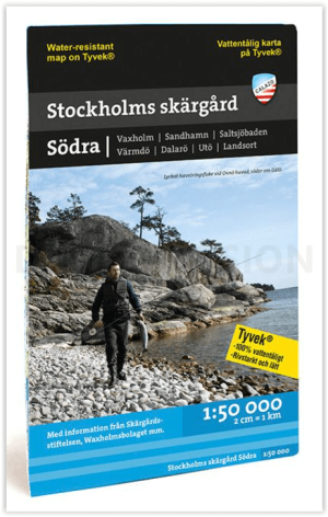

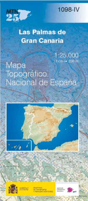
 De Wandelkaart van Europa - BIBLIOTREK
Wandelkaarten Europa van Bibliotrek die gaan over landen van de Europese Unie. Geen land waar geen kaarten over te vinden zijn. Voor Europa biedt Bibliotrek kaarten van zo’n 40-tal grote uitgevers. Van Noorwegen tot het uiterste van Albanië en Bulgarije, alsook de gekende Prachtige Duitse Regio's, Nederlandse en Franse Regio's. Als voormalige wandelorganisatie met 25 jaar ervaring spitsten wij ons vroeger toe op begeleide wandelingen in de Franse & Oostenrijkse Alpen.
Dankzij onze jarenlange ervaring kunnen wij u alle info geven die u zoekt. Heeft u een vraag? Dan lossen wij die voor u op. Het is niet altijd gemakkelijk om uw weg te vinden doorheen de grote hoeveelheid Wandelkaarten en uitgevers. Misschien vindt u wat u zoekt bij de Wandelgidsen Europa - Fietskaarten Europa - Fietsgidsen Europa


Landkaart Europa - Borch • 9783866093379
Wandelkaart Landkaart Europa - Borch Productomschrijving: Our soft-laminated folded map of Europe in the 14th edition shows: Europe 1:4 000 000, Europe North 1:5 000 000, the cities of London and Paris 1:15 000, Rome 1:13 000 and their Regions each in 1:700 000. In addition you find the Top 15 sights and airports of this three cities and a map of the European Union with time zones. Borch M…
Landkaart Duitsland - Borch • 9783866093171
Landkaart Duitsland - Borch Productomschrijving: Our soft-laminated folded map of Germany in the 15th edition shows: Germany North 1:800 000, Germany South 1:800 000, Germany administrative, Europe time zones. Borch Maps are easy to fold, durable and water-repellent with a wipeable surface. Borch Maps show hotels, museums, monuments, markets, public transport, top sights and points of inte…
Landkaart Groot-Brittannië - Borch • 9783866093157
Wandelkaart Landkaart Groot-Brittannië - Borch Productomschrijving: Our soft-laminated folded map of Great Britain in the 13th edition shows: Scotland and Northern Ireland 1:800 000, England and Wales 1:800 000, Channel Crossings 1:800 000, Great Britain and Ireland administrative, Europe time zones. Borch Maps are easy to fold, durable and water-repellent with a wipeable surface. Borch Ma…
Landkaart Ierland - Borch • 9783866093232
Wandelkaart Landkaart Ierland - Borch Productomschrijving: Our soft-laminated folded map of Ireland in the 18th edition shows: Ireland 1:700 000, Dublin 1:15 000, Cork 1:8 000, Killarney National Park 1:100 000, Wicklow Mountains 1:350 000 and Ireland administrative. Borch maps are easy to fold, durable and water-repellent with a wipeable surface. Borch Maps show hotels, museums, monuments…

Landkaart Italië - Borch • 9783866093164
Wandelkaart Landkaart Italië - Borch Productomschrijving: Our soft-laminated folded map of Italy in the 13th edition shows: Italy North, Italy South, Sardinia and Sicily 1:800 000, Italy administrative, Europe time zones. Borch Maps are easy to fold, durable and water-repellent with a wipeable surface. Borch Maps show hotels, museums, monuments, markets, public transport, top sights and po…
Landkaart Spanje - Borch • 9783866093362
Landkaart Spanje - Borch Productomschrijving: Our soft-laminated folded map of Spain in the 9th edition shows: Spain East 1:875 000, Spain West 1: 875 000, Canary Islands 1:1 875 000, Spain administrative and Europe time zones. Borch Maps are easy to fold, durable and water-repellent with a wipeable surface. Borch Maps show hotels, museums, monuments, markets, public transport, top sights …
Landkaart Zwitserland - Borch • 9783866093386
Wandelkaart Landkaart Zwitserland - Borch Productomschrijving: Our soft-laminated folded map of Switzerland in the 7th edition shows: Switzerland West 1:400 000, Switzerland East 1:400 000, Switzerland administrative with its alpine passes, Europe time zones. Borch Maps are easy to fold, durable and water-repellent with a wipeable surface. Borch Maps show hotels, museums, monuments, market…

Stadskaart plattegrond Amsterdam - Borch • 9783866093393
Stadkaart Amsterdam - Borch Productomschrijving: Our soft-laminated folded map of Amsterdam in the 14th edition shows: Amsterdam 1:11 000, Central Amsterdam 1:6 000, Greater Amsterdam 1:100 000, Public Transport Amsterdam, Top 30 Sights and The Netherlands administrative. Borch Maps are easy to fold, durable and water-repellent with a wipeable surface. Borch Maps show hotels, museums, monu…
Stadskaart plattegrond Athene Griekenland - Borch • 9783866093416
Wandelkaart Athene Griekenland - Borch Productomschrijving: Our soft-laminated folded map of Athens in the 14th edition shows: Athens 1: 7500, Athens & Region 1:100 000, Attica 1: 750 000, Acropolis 1:2 400, Epidavros 1:7 000, Mycenae 1:3 500, Public Transport Athens, Greece administrative & time zones, Top 30 Sights. Borch Maps are easy to fold, durable and water-repellent with a wipeable…

Stadskaart plattegrond Boedapest & Margaret Eiland - Borch • 9783866093287
Wandelkaart Boedapest & Margaret Eiland - Borch Productomschrijving: Our soft-laminated folded map of Budapest in the 9th edition shows: Budapest 1:11 000, Budapest & Region 1:400 000, Margaret Island 1:11 000, Public Transportation Budapest, Top 30 Sights, Hungary administrative and time zones. Borch Maps are easy to fold, durable and water-repellent with a wipeable surface. Borch Maps sh…
Landkaart Kreta - Borch • 9783866093935
Landkaart Kreta - Borch Productomschrijving: Our soft-laminated folded map of Crete in the 11th edition shows: Crete (West) 1:200 000, Crete (East) 1:200 000, Iraklio 1:7 000, Agios Nikolaos 1:6 000, Chania 1:10 000, Ierapetra 1:10 000, Rethimno 1:9 000, Samaria Gorge 1:90 000, Sitia 1:7 000 and Gavdos 1:200 000. Borch maps are easy to fold, durable and water-repellent with a wipeable surf…

Landkaart Frankrijk - Borch • 9783866093485
Wandelkaart Landkaart Frankrijk - Borch Productomschrijving: Our soft-laminated folded map of France in the 9th edition shows: France North 1:875 000, France South 1:875 000, Corsica 1: 875 000, France administrative, Europe time zones. Borch Maps are easy to fold, durable and water-repellent with a wipeable surface. Borch Maps show hotels, museums, monuments, markets, public transport, to…
Stadskaart plattegrond Berlijn Germany - Borch • 9783866093041
Wandelkaart Berlijn Duitsland - Borch Productomschrijving: Our soft-laminated folded map of Berlin in the 19th edition shows: Berlin 1:18 000, Berlin Mitte 1:11 500, Greater Berlin 1:130 000, Public Transport Berlin, Berlin Wall, Germany administrative and Top 30 sights. Borch Maps are easy to fold, durable and water-repellent with a wipeable surface. Borch Maps show hotels, museums, monum…

Stadskaart plattegrond Madrid Spain - Borch • 9783866093577
Wandelkaart Madrid Spain - Borch Productomschrijving: Our soft-laminated folded map of Madrid in the 11th edition shows: Central Madrid 1:10 000, Madrid & Region 1:200 000, Province of Madrid 1:700 000, Toledo 1:9 000, Segovia 1:8 500, Public Transport Madrid, Spain administrative. Borch maps are easy to fold, durable and water-repellent with a wipeable surface. Borch Maps show hotels, mus…

Stadskaart plattegrond Praag Tsjechië - Borch • 9783866093614
Wandelkaart Praag Tsjechië - Borch Productomschrijving: Our soft-laminated folded map of Prague in the 17th edition shows: Old Town & Lesser Quarter 1:10 000, Prague 1:15 000, Prague Castle 1:5 000, Prague & Region 1:100 000, Czech Republic (West) 1:1 200 000, Public Transport Prague, Czech Republic administrative. Borch Maps are easy to fold, durable and water-repellent with a wipeable su…
Stadskaart plattegrond Venise Venetië Italy - Borch • 9783866093683
Wandelkaart Venise - Borch Omvat: PIazza San Marco - Dogepalace - Murano - Gondole - Ponte Rialto Productomschrijving: Our soft-laminated folded map of Venice in the 18th edition shows: Venice 1:6 500, Venice Lagoon 1:95 000, Murano 1:8 000, Torcello 1:8 000, Burano 1:8 000, Lido 1:13 500, Veneto 1:900 000, Italy administrative, Top 30 Sights and Public Transport Venice (Vaporetti). Bo…
Stadskaart plattegrond Barcelona - Borch • 9783866093737
Wandelkaart Barcelona - Borch Productomschrijving: Our soft-laminated folded map of Barcelona in the 14th edition shows: Barcelona Centre 1:11 000, Royal Palace 1: 11 000, Parc Güell 1:11 000, Old Town 1:5 500, Barcelona and Region 1:150 000, Public Transport Barcelona, Top 30 Sights and Spain administrative. Borch maps are easy to fold, durable and water-repellent with a wipeable surface.…

Stadskaart plattegrond Brussel - Borch • 9783866093553
Wandelkaart Brussel - Borch Productomschrijving: Our soft-laminated folded map of Brussels in the 8th edition shows: Brussels 1:12 000, Brussels Center 1: 10 900, Grand Place, Brussels Region 1:100 000, Public Transport Brussels and Belgium administrative. Borch maps are easy to fold, durable and water-repellent with a wipeable surface. Borch Maps show hotels, museums, monuments, markets, …
Stadskaart plattegrond Firenze Tosane - Borch • 9783866093607
Wandelkaart Firenze Tosane - Borch Productomschrijving: Our soft-laminated folded map of Florence in the 16th edition shows: Florence Centre 1:7 000, Fiésole 1:12 000, Pisa 1:7 000, Florence & Environs 1:80 000, Florence & Region 1: 450 000 Cathedral of Santa Maria del Fiore 1: 1 900, Italy administrative, Top 24 Sights of Florence and 12 of Pisa. Borch maps are easy to fold, durable and w…

Stadskaart plattegrond München - Borch • 9783866093096
Wandelkaart München - Borch Productomschrijving: Our soft-laminated map of Munich in the 7th edition shows: Munich City Centre 1:11 000, Munich 1:22 000, Greater Munich 1:130 000, Munich Exhibition Centre 1:22 000, Allianz Arena 1:22 000, Alpine Foreland 1: 850 000, Public Transport Munich, 30 top sights, Germany administrative & time zones, interesting statistics, conversion chart for tem…
Landkaart Toscane Italy - Borch • 9783866093775
Wandelkaart Toscane - Borch Productomschrijving: Our soft-laminated folded map of Tuscany in the 11th edition shows: Tuscany 1:400 000, Florence 1:9000, Siena 1:8 000, Pisa 1:7 000, Lucca 1: 12 000, Italy administrative and time zones. Borch Maps are easy to fold, durable and water-repellent with a wipeable surface. Borch Maps show hotels, museums, monuments, markets, public transport, top…

Stadskaart plattegrond Hamburg Duitsland - Borch • 9783866093065
Wandelkaart Hamburg Duitsland - Borch Productomschrijving: Our soft-laminated folded map of Hamburg in the 9th edition shows: Hamburg 1:22 000, Hamburg Centre 1:10 500, Blankenese 1:22 000, Hamburg Airport 1:22 000, Hamburg Harbour 1:25 000, Greater Hamburg 1:130 000, public transport, Top 30 sights, Germany administrative & time zone. Borch Maps are easy to fold, durable and water-repelle…

Stadskaart plattegrond Lissabon Portugal - Borch • 9783866093966
Wandelkaart Lissabon Portugal - Borch Productomschrijving: Our soft-laminated folded map of Lissabon in the 7th edition shows: Lisbon 1:14 000, Baixa, Alfama, Mouraria 1:8 250, Cascais & Estoril 1:12 500, Lisbon & Region 1:135 000, Lisbon District 1:700 000, Portugal administrative & time zones, Public Transport Lisbon and Top 30 sights. Borch Maps show hotels, museums, monuments, markets,…
Stadskaart plattegrond Oslo Noorwegen - Borch • 9783866093102
Wandelkaart Oslo Noorwegen - Borch Productomschrijving: Our soft-laminated folded map of Oslo in the 6th edition shows: Oslo Centre 1:11 000, Holmenkollen & Tryvannshogda 1:25 000, Oslo & Region 1:200 000, Western Norway 1:800 000, Public Transport Oslo, Norway administrative & time zones, Top 30 Sights. Borch Maps show hotels, museums, monuments, markets, public transport, top sights and …
Stadskaart plattegrond Stockholm Sweden - Borch • 9783866093942
Wandelkaart Stockholm Sweden - Borch Productomschrijving: Our soft-laminated folded map of Stockholm in the 2nd edition shows: Stockholm 1:15 000, Gamla Stan 1:7 500, Greater Stockholm 1:100 000, Public Transport Stockholm, Sweden administrative & time zones, Top 30 Sights. Borch Maps show hotels, museums, monuments, markets, public transport, top sights and points of interest, useful stat…
Alle landen van Europa
In Alle landen van Europa, is Wandelen is op zich een sport geworden. Of u nu simpelweg op zondagmiddag een wandeling maakt, of u gaat op ware bedevaarttocht langs een 1500 km lange historische wandelroute, bij Bibliotrek kunnen wij u begeleiden naar de juiste uitgever die de meest relevante kaart voor u heeft met de meeste info, voor die specifieke route die u wenst af te leggen. Met de Reisgidsen van Europa geraakt u door gans dit continent, met alle informatie op zak.
De Europese Wandelkaarten van Bibliotrek zijn allemaal zorgvuldig geselecteerd aan de hand van de kennis en ervaring van de verbonden cartograaf organisaties. De meest bekende zijn de nationale cartografen zoals bijvoorbeeld NGI(B) en IGN voor Frankrijk. Daarnaast zijn er nog honderden andere cartografen en diensten die kaarten uitbrengen. De ene uitgever is echter de andere niet. Er komt heel wat bij kijken om een overzichtelijke wandelkaart te ontwikkelen met de nodige informatie en relevante lokalisering.
Vaak zijn uitgevers ook niet 100% toegewijd aan enkel wandelen. Ze brengen in sommige gevallen dan een kluwen aan gidsen en kaarten uit die van alles omvatten, van skiën tot rolschaatsen. De echte cartografen zijn er echter makkelijk uit te halen. De Wandelgidsen Europa die gaan over het Europese continent, en dan meerbepaald het West-Europese continent, zijn een pak gedetailleerder dan bijvoorbeeld de kaarten van de meeste Zuid-Amerikaanse cartografen. In het Westen neemt de wandelaar niet zomaar de eerste de beste kaart uit de rekken, maar wordt er tijd gestopt in het kiezen van de beste kaart.
Wandelen met de kaart in Europa
Wandelen met de kaart in Europa is een essentieel onderdeel van het avontuur en biedt zowel praktische voordelen als een diepere band met de landschappen die je verkent. Het uitgebreide netwerk van paden in Europa, variërend van bergpaden in de Alpen tot kustroutes langs de Middellandse Zee, kan complex en gevarieerd zijn. Een gedetailleerde wandelkaart zorgt ervoor dat je met vertrouwen over deze paden kunt navigeren, zodat je op koers blijft en niet verdwaalt. Zelf de volledige reeks van Historische fiets- en wandelroutes kunnen met de kaarten worden gevolgd.
Met behulp van een Topografische kaart kunnen wandelaars het terrein beter begrijpen, anticiperen op hoogteverschillen en belangrijke herkenningspunten onderweg identificeren. Het biedt ook meer flexibiliteit bij het plannen van je route, of je nu een mooie omweg wilt maken, een kortere weg wilt vinden of je plannen wilt aanpassen vanwege het weer of de beperkte tijd. Veel Europese wandelkaarten zijn topografisch en tonen niet alleen paden, maar ook de contouren van het land, rivieren, bossen en andere natuurlijke kenmerken.
Wandelen met een kaart verrijkt ook de ervaring, omdat je de omgeving beter leert kennen. Je kunt je voortgang bijhouden, interessante geografische kenmerken zien en zelfs verborgen juweeltjes ontdekken zoals afgelegen meertjes of oude ruïnes die misschien niet op een digitale app staan. In regio's met een beperkte mobiele service is een fysieke kaart van onschatbare waarde, zodat je veilig en met plezier door de diverse en prachtige landschappen van Europa kunt wandelen. Wandelkaarten zijn al vele jaren van groot belang, zelfs in de meest bekende regio's die u door en door kent, dan nog staan er op de wandelkaarten details waarvan u niet op de hoogte was. Laat staan dat diezelfde Wandelkaarten dan de meest afgelegen routes ingetekend in kaart brengen, en u er veilig door brengen.