

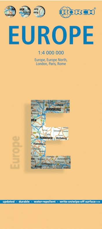
Landkaart Europa - Borch
Belgium- France- Germany- Netherlands- Spain- Italy- Portugal
Korte omschrijving
Wandelkaart Landkaart Europa - Borch Productomschrijving: Our soft-laminated folded map of Europe in the 14th edition shows: Europe 1:4 000 000, Europe North 1:5 000 000, the cities of Londo...
Specificaties
- Uitgever: Borch GmbH
- ISBN-13: 9783866093379
- HOOFDCATEGORIEËN: Wandelkaart, Wegenkaart - Landkaart
- Activiteiten: Street/Road maps & city plans, Wandelen, Hiking & Trekking
- Regio: Europa
- Land: Europa
- Schaal: 1:4000000
- Editie: 19, 20
- Taal: Duits, Engels, Frans, Itailaans, Spaans
Volledige omschrijving
Wandelkaart Landkaart Europa - Borch
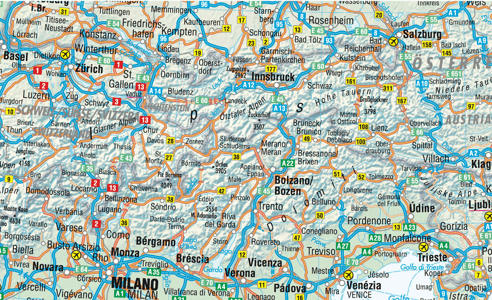
Productomschrijving: Our soft-laminated folded map of Europe in the 14th edition shows: Europe 1:4 000 000, Europe North 1:5 000 000, the cities of London and Paris 1:15 000, Rome 1:13 000 and their Regions each in 1:700 000. In addition you find the Top 15 sights and airports of this three cities and a map of the European Union with time zones. Borch Maps are easy to fold, durable and water-repellent with a wipeable surface. Borch Maps show hotels, museums, monuments, markets, public transport, top sights and points of interest, overview maps, time zones, and much more...
Covering only 2% of the earth’s surface, Europe is home to just over 742 million people spread out over 10.18 million square kilometres and currently represents the world’s largest economy and second-smallest continent. About 508 million Europeans reside in the 28 EU member states. Europe is one of the seven continents, even though it is actually just a peninsula of Eurasia.
The Ural Mountains and River and the Caspian Sea separate Europe from Asia to the east. Europe is bordered by the Arctic Ocean to the north, the Atlantic Ocean to the west, the Mediterranean to the south and the Caucasus Mountains and Black Sea on its southeastern perimeter. Europe boasts a diverse array of climatic and geographic regions, languages and cultures, world cities, beautiful countryside and breathtaking sea and mountainscapes.
Artikelen uit dezelfde regio
Reisgids Perron Europa Deel 2 - Mo'Media • 9789083263977
Reisgids Perron Europa - Mo'Media Productomschrijving: Perron Europa 2 "Kriskras door Europa, in alle windrichtingen, liggen tienduizenden kilometers aan spoorlijnen. Reizen over het spoor is slow travel, het landschap zien veranderen, onderweg uitstappen wanneer je wilt en mensen ontmoeten." Aldus Bart Giepmans, auteur van het boek en verkozen tot reisjournalist van het jaar 2023. Het ver…

Landkaart Wegenkaart Planning map Europe - Lonely Planet • 9781786579102
Wegenkaart & Planning map Europe - Lonely Planet Productomschrijving: With an easy-fold, easy-to-use format, Lonely Planet Europe Planning Map is your conveniently-sized passport to traveling with ease. Get more from your map and your trip with images and information about top country attractions, itinerary suggestions and themed lists. With this easy-to-use, full colour navigation tool i…

Plano Wandkaart Europa Gelamineerd - 124 x 88 cm - F&B • 5425013060271
Plano Wandkaart Europa - F&B Productomschrijving: Politiek overzicht,elk land in een verschillende kleur. Met inzet: Scandinavië, Ijsland - Plaatsnamenregister op rugzijde van de kaart - Internationaal vliegveld, vliegveld - Vaarroutes
La Bible du Trek - Du trek à l'expédition - Editions Glénat • 9782365451932
La Bible du Trek - Editions Glénat Productomschrijving: Du trek à l'expédition en haute altitude Ce guide de référence traite tous les aspects concernant la préparation d'un trek ou d'une expédition en haute altitude (plus de 2 500 m). Organisation avant le départ, équipement, entraînement, nutrition, problèmes médicaux liés à l'altitude, premiers soins, préparation mentale, les femmes et …
Mooiste treinreizen - Kosmos UJitgeverijen • 9789043942256
Mooiste treinreizen - Kosmos Productomschrijving: Volledig herziene editie met 60 van de beste treinreizen ter wereld, van klassieke langeafstandsreizen tot onbekende pareltjes. Met 10 ongelofelijke nieuwe avonturen per trein waaronder Mr Henderson's Railway (Spanje), De Flamsbana (Noorwegen) en De Kusttram (België) Elke reis gaat vergezeld van praktische informatie, ticketopties, dien…