
Wandelkaart Southwest Alberta & Southeast British Columbia - GT
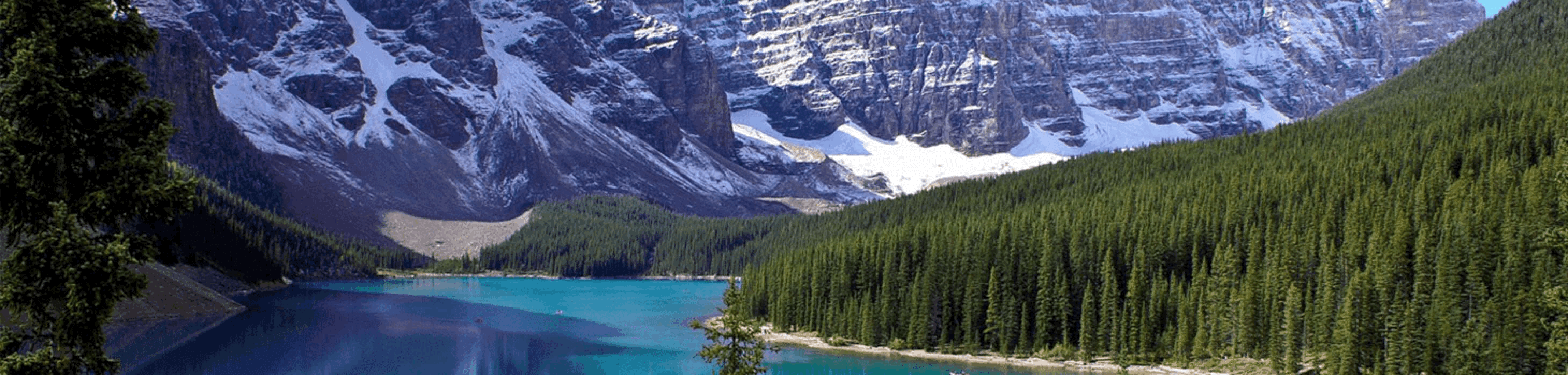
Canadian Rockies - Kootenays - Alberta foothills (Kananaskis)

Korte omschrijving
Wandelkaarten British Colombia, Canada en Alberta, Canada van Gem Trek Publishing. Ideaal voor tochten in Canada.
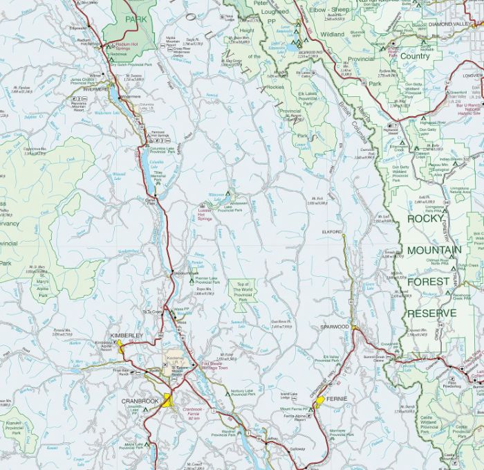
Southwest Alberta & Southeast British Columbia - Gem trek Productomschrijving: Gem Trek’s Southwest Alberta and Southeast British Columbia Map is designed for visitors looking to explore th...

Specificaties
- Uitgever: Gem Trek Publishing
- ISBN-13: 9781990161216
- HOOFDCATEGORIEËN: Wandelkaart
- Activiteiten: Wandelen, Hiking & Trekking
- Regio: Alberta, Canada, British Colombia, Canada
- Land: Canada
- Schaal: 1:500000
- Editie: 8
- Taal: Engels
Volledige omschrijving
Southwest Alberta & Southeast British Columbia - Gem trek
Productomschrijving: Gem Trek’s Southwest Alberta and Southeast British Columbia Map is designed for visitors looking to explore the regions east and west of the Canadian Rockies, including the Kootenays of British Columbia, the Alberta foothills (Kananaskis), and west-central Alberta. All the major highways are shown, as well as national and provincial parks and wilderness areas.
The map also shows lesser-known back roads, and pinpoints the location of lodges, campgrounds and hot springs. Mileage charts on the front and back provide distances between major towns and cities.
Artikelen uit dezelfde regio

Reisgids Banff- Jasper & Glacier NP - Lonely Planet • 9781786575920
Banff- Jasper & Glacier NP - Lonely Planet Covers: Banff National Park, Jasper National Park, Glacier National Park, Lake Louise, Lake Minnewanka, Bow Valley, Backcountry, Kananaskis Country, Lake O’Hara, Jasper Town, Blackfeet Indian Reservation and more. Product description: Lonely Planet Banff, Jasper & Glacier National Parks is your passport to the most relevant, up-to-date advice …

Wandelkaart 215 Glacier & Waterton Lakes NP - Montana - Nat Geo • 9781566953184
TOPO Wandelkaart 215 - Glacier & Waterton Lakes NP Productomschrijving: Glacier National Park is een nationaal park in de Amerikaanse staat Montana. Het park sluit nadeloos aan op het Canadese Waterten Lakes NP net over de grens in Alberta Canada. Het park ligt in de Rocky Mountains op de grens met Canada. Zes bergtoppen bereiken er een hoogte van meer dan 3000 meter. Engelse omschrijv…
Reisgids Banff - Jasper & Glacier national parks - Lonely Planet • 9781838696757
Banff - Jasper & Glacier national parks - Lonely Planet Productomschrijving: Jasper & Glacier National Parks is jou paspoort voor het meest relevante, actuele advies over wat je moet zien en overslaan, en welke verborgen ontdekkingen er op je wachten. Ga wandelen en kamperen in de Backcountry in Banff, (hou rekening met de wilde dieren, kom er niet dicht bij), mountainbiken en paardrijden …

Reisgids Canada NED - insight guide • 9789066554849
Reisgids - Canada - insight guide Productomschrijving: Canada is het op één na grootste land ter wereld en strekt zich uit over een afstand van 5500 km tussen de Atlantische Oceaan en de Grote Oceaan. De variatie van landschappen is dan ook ongekend groot en ondanks deze enorme afmetingen zijn de auteurs en fotografen op de bekende, onovertroffen en veelvuldig bekroonde Insight Guide-wijze…
Landkaart Wegenkaart Canada West - Reise Know-How Verlag • 9783831775194
Wegenkaart Canada West - Reise Know-How Verlag Productomschrijving: De Reise Know-How wegenkaart van Canada West is een betrouwbare, gedetailleerde en duurzame landkaart voor wie Canada West zelfstandig wil verkennen. Deze hoogwaardige reiskaart is ideaal voor gebruik tijdens een rondreis met de auto, camper, motor of fiets en biedt alle informatie die je nodig hebt voor een zorgeloze rei…