
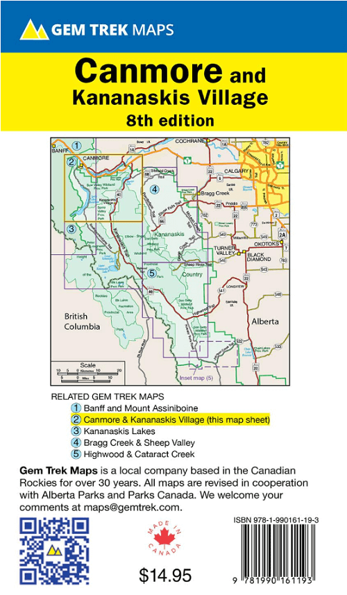
Wandelkaart Canmore & Kananaskis village Alberta - Gem Trek Publ.
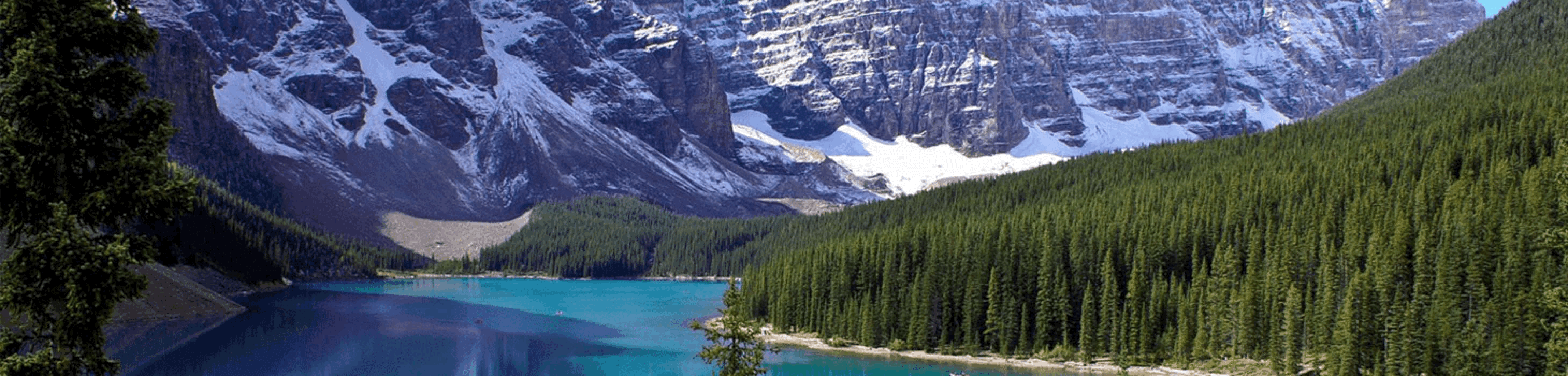
Canmore west to the Stoney Reserve and south to Kananaskis Vilage


Korte omschrijving
Wandelkaarten Alberta, Canada van Gem Trek Publishing. Ideaal voor tochten in Canada.
Wandelkaart Canmore & Kananaskis village - Gem Trek Productomschrijving: Gem Trek’s CANMORE & KANANASKIS VILLAGE MAP is designed for outdoor enthusiasts looking to explore the northern porti...

Specificaties
- Uitgever: Gem Trek Publishing
- ISBN-13: 9781990161193
- HOOFDCATEGORIEËN: Wandelkaart
- Activiteiten: Wandelen, Hiking & Trekking
- Regio: Alberta, Canada
- Land: Canada
- Schaal: 1:50000
- Editie: 8
- Taal: Engels
Volledige omschrijving
Wandelkaart Canmore & Kananaskis village - Gem Trek
Productomschrijving: Gem Trek’s CANMORE & KANANASKIS VILLAGE MAP is designed for outdoor enthusiasts looking to explore the northern portion of Kananaskis Country. Whether you are touring along the roads or heading into the backcountry, you’ll find the waterproof and tear-resistant Canmore & Kananaskis Village Map to be an invaluable tool. (Kananaskis = beginnende heuvels van de Rockies)
This map features detailed cartography, accurate hiking trails with distances, and details such as logging roads, campgrounds, equestrian routes, picnic areas, and fire lookouts. On the back are descriptions of the most popular hiking trails, as well as details of services such as campgrounds and visitor centres.
The Canmore & Kananaskis Village Map covers the town of Canmore west to the Stoney Reserve and south to Kananaskis Village along Highway 40. It includes all of Spray Valley Provincial Park, Bow Valley Provincial Park, Bow Valley Wildland Provincial Park, and the northern section of the Elbow-Sheep Wildland Provincial Park.
Popular hiking trails on the Canmore & Kananaskis Village Map include Grassi Lakes, Yamnuska, Ha Ling, Lady Macdonald, Barrier Lake Lookout, Mt. Allen via Centennial Ridge (the highest maintained trail in the Canadian Rockies), Ribbon Falls and Ribbon Lake, Lillian and Galatea lakes, Buller Pass, and trails originating from the Mount Shark Day Use Area.
A 1:25,000-scale inset map on the back increases coverage in the vicinity of Kananaskis Village and as far south as Wedge Pond. If you are staying at Kananaskis Village or Mount Kidd RV park, you will find this inset map invaluable.

Artikelen uit dezelfde regio
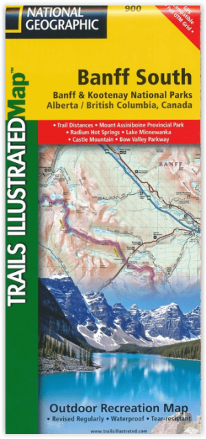
Wandelkaart 900 Banff South & Banff and Kootenay NP - Nat Geo • 9781566956581
Wandelkaart 900 - Banff South & Banff and Kootenay NP - Natgeo Productomschrijving: Deze omvat een overzicht van alle recreatieve wandelpaden, wegen en vele andere informatie die u zou kunnen nodig hebben in deze 2 schitterende nationale parken, die letterlijk aan elkaar werden genaaid. De wildernis van Banff en Kootenay, zijn geen zondag wandelplaatsje, je bereidt uw tocht altijd goed voo…
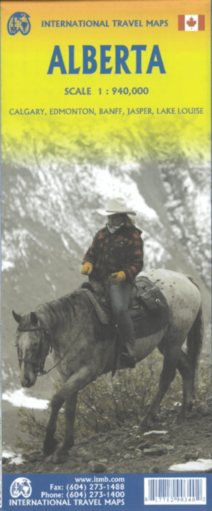
Landkaart Wegenkaart Alberta Canada - ITMB • 9781771290340
Wegenkaart Alberta Canada - ITMB Productomschrijving: Alberta is many different things - a dynamic powerhouse of the Canadian economy, the source of oil in vast quantities, cow country, the Calgary Stampede, the Rockies. Alberta is a real gem in the crown of Canada, and is one of the most popular touristic destinations in North America. With Calgary, Edmonton, Banff NP, Jasper & Lake Louis…

Wandelkaart 902 Jasper NP South - Nat Geo • 9781566956604
TOPO Wandelkaart 902 - Jasper NP South - Alberta - Natgeo Productomschrijving: Het Jasper National Park is een nationaal park in Canada, gelegen in het westen van Alberta, en onderdeel van de Rocky Mountains. Het omvat onder meer het plaatsje Jasper en Maligne Lake. Het Banff National Park ligt ten zuiden van dit park. Jasper staat bekend om het vele wild. Dikhoornschapen, edelherten, beve…

Wandelkaart Banff National Park - Gem Trek • 9781990161117
Wandelkaart Banff NP - Gem Trek Productomschrijving: Waterproof and tear-resistant map for Banff National Park in the Canadian Rockies. Whether you are a first-time visitor or a long-time local, you’ll find Gem Trek’s Banff National Park Map to be an invaluable tool. Researched and designed by locals, and printed in Canada, this map features accurate cartography and subtly colored reli…
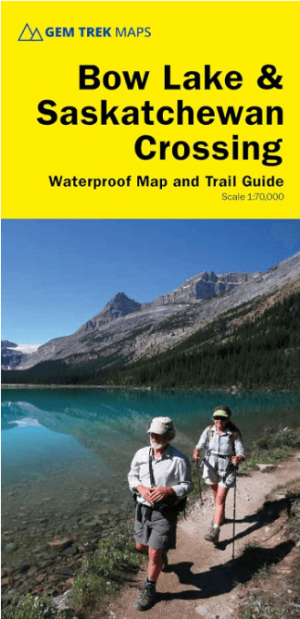
Wandelkaart 15 Bow Lake & Saskatchewan river Crossing - Gem Trek • 9781990161087
Wandelkaart Bow Lake & Saskatchewan river Crossing - Gem Trek Productomschrijving: Deze Gem Trek kaart voldoet aan de behoeften van bezoekers die de Bow Lake en Saskatchewan Crossing regio van Banff National Park willen verkennen. Of je nu over de wegen toert of het binnenland intrekt, de waterdichte en scheurbestendige kaart van Bow Lake & Saskatchewan Crossing is van onschatbare waarde. …