

Wandelkaart North York Moors Oost XT40 - Harvey Maps
Robin Hood's Bay- Flyingdales Moor & het populaire Rosedale Abbey
Korte omschrijving
Wandelkaarten Yorkshire, England van HARVEY MAPS. Ideaal voor tochten in England.
Wandelkaart North York Moors Oost - Harvey Maps Productomschrijving: Omvat een groot gebied maar is praktisch en compact, zakformaat. Gedetailleerde kaart voor lopers en wandelaars van het o...

Specificaties
- Uitgever: HARVEY MAPS
- ISBN-13: 9781851376230
- HOOFDCATEGORIEËN: Wandelkaart
- Activiteiten: Wandelen, Hiking & Trekking
- Regio: Yorkshire, England
- Land: England
- Nationale parken: North York Moors NP, England
- Schaal: 1:40000
- Taal: Engels
- Reeks/Serie: National Trails, UK, Superwalker XT40, Harvey Maps
- De Nationale Parken: North Yorkshire Moors National Park, England
- De Engelse Graafschappen: North Yorkshire
Volledige omschrijving
Wandelkaart North York Moors Oost - Harvey Maps
Productomschrijving: Omvat een groot gebied maar is praktisch en compact, zakformaat. Gedetailleerde kaart voor lopers en wandelaars van het oostelijk gedeelte van het Nationaal Park North York Moors.
Omvat: Robin Hood's Bay, Flyingdales Moor en het populaire Rosedale Abbey.
- De North Yorkshire Steam spoorweg en de Lyke Wake Walk zijn aangeduid.
- Heeft de voordelen van zijn grotere broers:
- Gebruik zonder plastic hoesje: stevig en 100% waterbestendig
- Opent direct aan beide zijden van het blad
Locatie op kaart
Artikelen uit dezelfde regio
Wandelkaart Cleveland Way - Across North York NP - Harvey maps • 9781851374892
Wandelkaart Cleveland Way - Across North York NP - Harvey maps Productomschrijving: 174km (109 mijl) van Helmsley over het North York Moors National Park naar Saltburn en langs de kust via Scarborough eindigend met Filey. Informatie over het vinden van accommodatie, camping, voedsel. Routebeschrijving naar het begin. Ook Ranger Service contacten met nummers en uitbreidingen van steden/dorp…
Wandelkaart OL21 South Pennines - OS • 9780319242605
Wandelkaart South Pennines - Ordnance Survey Productomschrijving: Parts of the Peak District National Park, South Pennines, Brontë Way, Burnley Way, Calder / Aire Link, Calderdale Way, Colne Valley Circular Walk, Dales High Way, E2 European long distance Path, Irwell Sculpture trail, Kirklees Way, Meltham Way, Millenium Way, Oldhan Way & Crompton Circuit, Pendle Way, Pennine Bridleway, Pen…
Wandelkaart OL30 Yorkshire Dales - Yorkshire England - OSI • 9780319475379
Wandelkaart Yorkshire Dales - Yorkshire England Omvat ook: Wensleydale & Swaledale Productbeschrijving: Kaart nummer OL30 in de OS Explorer kaarten reeks is de ideale kaart voor mensen die een bezoek willen brengen aan de noordelijke en centrale gebieden van de Yorkshire Dales, met inbegrip van Wensleydale & Swaledale. Er is een schat van landschappen in dit deel van het Yorkshire Dale…
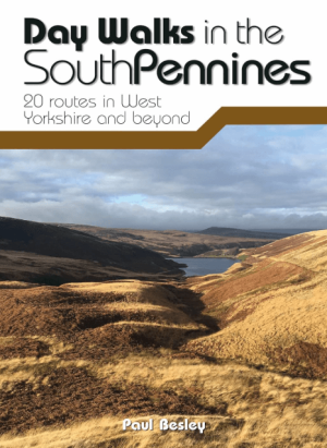
Wandelgids Day Walks in the Southern Pennines - Vertebrate Publ. • 9781912560653
Day Walks in the Southern Pennines - Vertebrate Productomschrijving: 20 routes in West Yorkshire and beyond Day Walks in the South Pennines features 20 circular walks between 5 and 18 miles (8km and 29 km) in length, spread across West Yorkshire, Lancashire and Greater Manchester. Researched and written by knowledgeable and experienced author Paul Besley, the walks range from gentle r…

Wandelkaart 291 Goole & Gilberdyke- Yorkshire - OSI • 9780319244883
Wandelkaart Goole & Gilberdyke - Yorkshire England Productbeschrijving: Holme-on-Spalding-Moor, Hemingbrough & Howden. 291 / Goole & Gilberdyke, Yorkshire, England - Aan het begin van de Humber toont OS Explorer kaart 291 de rivieren de Ouse en de Trent, de stad van Goole en het omliggende gebied. Hoogtepunten zijn de Bubwith Rail Trail, Hoden 20 recreatieve paden en de Trans Pennine …