

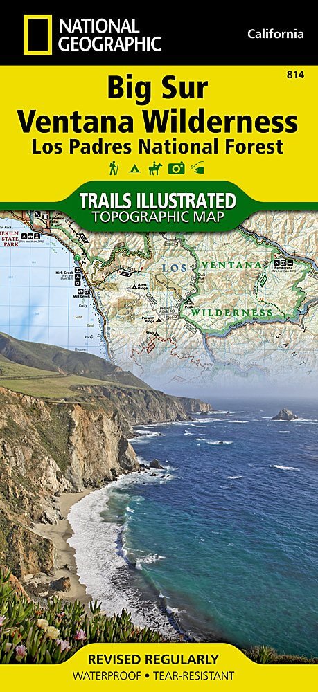
Wandelkaart 814 Big Sur & Ventana Wilderness - Natgeo
Het Los Padres National Forest in New York State
Korte omschrijving
Wandelkaarten Californië, USA van National Geographic. Ideaal voor tochten in Verenigde Staten van Amerika (USA).
TOPO Wandelkaart 814 - Big Sur & Ventana Wilderness - Natgeo Productomschrijving: Big Sur & Ventana Wilderness California- Natgeo zijn in andere woorden, het Los Padres National Forest in he...

Specificaties
- Uitgever: National Geographic
- ISBN-13: 9781566955782
- HOOFDCATEGORIEËN: Wandelkaart
- Auteur: National Geographic
- Regio: Californië, USA
- Land: Verenigde Staten van Amerika (USA)
- Regionale parken: Los Padres National Forest, California USA
- TOPO's & Stafkaarten: Topografisch wandelen
- Schaal: 1:80000
- Taal: Engels
Volledige omschrijving
TOPO Wandelkaart 814 - Big Sur & Ventana Wilderness - Natgeo
Productomschrijving: Big Sur & Ventana Wilderness California- Natgeo zijn in andere woorden, het Los Padres National Forest in het United States national forest in southern en central California.
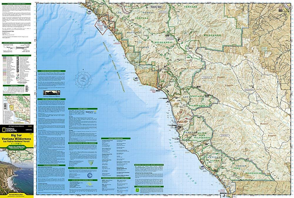
National Geographic's Trails Illustrated map of Big Sur, Ventana Wilderness combines unmatched detail with helpful information to offer an invaluable tool for making the most of your visit to this remarkable section of California coastline. Expertly researched and created in partnership with local land management agencies, this map features key points of interest including Los Padres National Forest, Silver Peak Wilderness, Pinnacles National Park, Fort Ord National Monument, Big Sur National Wild and Scenic River, and Julia Pfeiffer Burns State Park.
With miles of mapped trails, this map can guide you off the beaten path and back again in some of the most breathtaking scenery in the region. The trails are clearly marked according to use and include mileages between intersections. The Big Sur Coast Highway is noted for those wishing to take in the scenery by car. The map base includes contour lines and elevations for summits and coastal waters. Some of the many recreation features include surfing and scuba diving areas, interpretive trails, fishing areas, trailheads, and campgrounds. A variety of information about California state parks, Monterrey Bay National Marine Sanctuary, California Coastal National Monument, and Los Padres National Forest is included as well. Every Trails Illustrated map is printed on "Backcountry Tough" waterproof, tear-resistant paper. A full UTM grid is printed on the map to aid with GPS navigation.
Other features found on this map include: Cape San Martin, Carmel Point, Carmel River, Gabilan Range, Greenfield, Junipero Serra Peak, Lopez Point, Los Padres National Forest, Monterey, Pacific Grove, Pinnacles National Park, Point Lobos, Point Pinos, Point Sur, Santa Lucia Range, Seaside, Sierra de Salinas, Silver Peak Wilderness, Soledad, Ventana Wilderness.
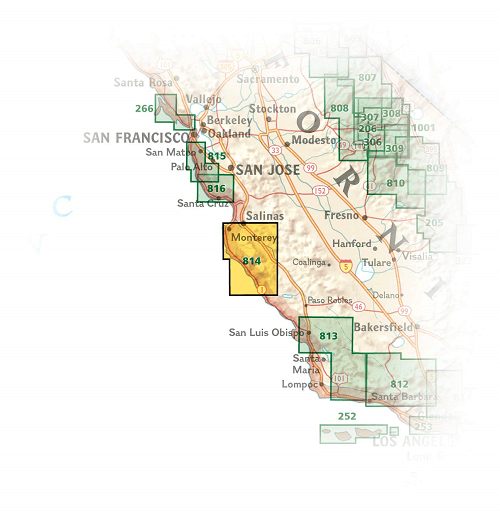
Locatie op kaart
Artikelen uit dezelfde regio

Wandelkaart 812 Los Padres Nat. Forest East - Natgeo • 9781566955805
TOPO Wandelkaart 812 - Los Padres Nat. Forest East - Natgeo Productomschrijving: Los Padres National Forest is een bosgebied in Amerika, meerbepaald in oost- en centraal California. Het bos is uitermate gekend voor mountainbikers en hikers. Engelse omschrijving: One of the most diverse National Forests in the United States, Los Padres National Forest provides recreation opportunities f…
Reisgids USA Southwest & National Parks - DK Eyewitness • 9780241365519
USA Southwest & National Parks Omvat: Arizona, Las Vegas, Southern Utah, the Four Corners & New Mexico. Productomschrijving: Staar naar de diepten van de Grand Canyon, ervaar de glitter en glamour van de Las Vegas strip, beklim de rotsachtige overspanningen van Arches National Park of wandel door het historische Santa Fe: alles wat u moet weten is overzichtelijk weergegeven in kleurgec…

Wandelkaart 803 Lake Tahoe Basin - California - Nat Geo • 9781566953344
TOPO Wandelkaart 803 - Lake Tahoe Basin - California - Nat Geo Productomschrijving: Lake Tahoe Basin is een bosgebied in het Sierra Nevada-gebergte in de Verenigde Staten, dat als National Forest. Het bosgebied ligt verspreid over Placer, El Dorado en Alpine County in Californië en Washoe en Douglas County en Carson City in Nevada. Engelse omschrijving: The largest alpine lake in North…

Wandelkaart 807 Carson-Iceberg- Nat.Geo • 9781566952651
TOPO Wandelkaart 807 - Carson-Iceberg- Nat.Geo Productomschrijving: Een verzameling aan nationale bosgebieden op één kaart en gelegen in Calofornia. Engelse omschrijving: Expertly researched and created in partnership with the U.S. Forest Service and others, National Geographic's Trails Illustrated map of Yuba and American Rivers region of Tahoe National Forest provides an unparalleled…
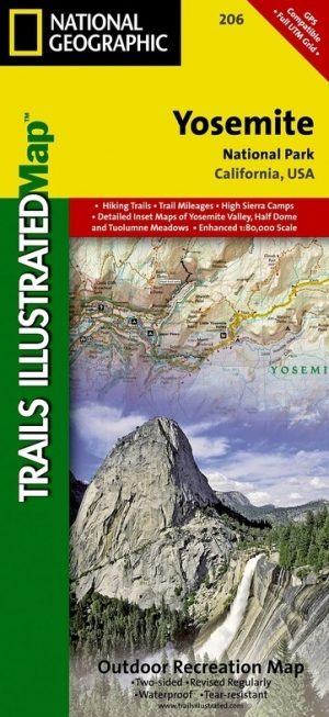
Wandelkaart 206 Yosemite NP - California - Nat Geo • 9781566952996
TOPO Wandelkaart 206 - Yosemite NP- California - Nat geo Productomschrijving: Yosemite National Park, wat een parel van schoonheid en tegelijk wereld bekend, is een nationaal park in het oosten van de Amerikaanse staat Californië. Hij ligt op de westelijke flanken van de centrale Sierra Nevada, in het oosten van Tuolumne, Mariposa en Madera County. Engelse omschrijving: Explore the maj…