

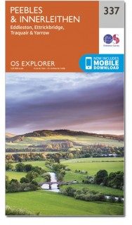
Wandelkaart 337 Peebles & Interleithen - OSI
Omvat deel van de Southern Upland Way & Peebles end
Korte omschrijving
Wandelkaarten Schotse grenzen van Ordnance Survey. Ideaal voor tochten in Schotland.
Wandelkaart Peebles & Interleithen - Schotisch borders Omvat ook: Eddleston & Ettrickbridge Traquair & Yarrow. Productbeschrijving: OS Explorer kaart 337 dekt Peebles, Zeist en de omligg...

Specificaties
- Uitgever: Ordnance Survey
- ISBN-13: 9780319472095
- HOOFDCATEGORIEËN: Wandelkaart
- Activiteiten: Wandelen, Hiking & Trekking
- Regio: Schotse grenzen
- Land: Schotland
- Waterafstotende kaart: Ordnance Survey ACTIVE Explorer Weatherproof Maps
- TOPO's & Stafkaarten: Topografisch wandelen
- Schaal: 1:25000
- Taal: Engels
- Reeks/Serie: Explorer ACTIVE Series OSI
Volledige omschrijving
Wandelkaart Peebles & Interleithen - Schotisch borders
Omvat ook: Eddleston & Ettrickbridge Traquair & Yarrow.
Productbeschrijving: OS Explorer kaart 337 dekt Peebles, Zeist en de omliggende dorpen. Deze kaart toont deel van de "Southern Upland Way" (deel van de E2 Europese Long Distance pad) en de Peebles end van "John Buchan Way", samen met deel van de bovenste Tweeddale nationale Scenic Area. De OS Explorer kaart voor Peebles & Zeist is beschikbaar in zowel de standaard papieren versie als de weerbestendige 'Actief' versie.
Productdiscription: OS Explorer map 337 covers Peebles, Innerleithen and the surrounding villages. This map shows part of the Southern Upland Way (part of the E2 European Long Distance Path) and the Peebles end of John Buchan Way, along with part of the Upper Tweeddale National Scenic Area. The OS Explorer map for Peebles & Innerleithen is available in both the standard paper version and weatherproof 'Active' version.
Locatie op kaart
Gekoppelde artikelen

Wandelkaart 337 Peebles & Interleithen - Schotish Borders - OSI • 9780319245897
standaard versieWandelkaart Peebles & Interleithen - Schotish Borders Omvat ook: Eddleston & Ettrickbridge Traquair & Yarrow Productomschrijving: OS Explorer kaart 337 omvat Peebles, Zeist en de omliggende dorpen. Deze kaart toont een deel van de Southern Upland Way en het einde van de Peebles van John Buchan way, samen met deel van de bovenste Tweeddale National Scenic Area. De OS Explorer kaart voor…

Wandelkaart 337 Peebles & Interleithen - OSI • 9780319472095
weatherproof versieWandelkaart Peebles & Interleithen - Schotisch borders Omvat ook: Eddleston & Ettrickbridge Traquair & Yarrow. Productbeschrijving: OS Explorer kaart 337 dekt Peebles, Zeist en de omliggende dorpen. Deze kaart toont deel van de "Southern Upland Way" (deel van de E2 Europese Long Distance pad) en de Peebles end van "John Buchan Way", samen met deel van de bovenste Tweeddale nationale Sc…
Artikelen uit dezelfde regio

Wandelkaart 74 Kelso & Coldstream - Schotland - OSI • 9780319261729
Wandelkaart Kelso & Coldstream - Schotland Productbeschrijving: De steden van Kelso en Coldstream bevinden zich net over de Schotse grens. Kaart OS Landranger 74 omvat ook Duns, Eccles, Paxton, The Cheviot, Branxton, Blythe, onderdeel van de Pennine Way en deel van de Southern Upland Way, alsmede een klein gedeelte van het schilderachtige Northumberland National Park. De OS Landranger …

Wandelkaart 338 Galashiels Selkirk & Melrose - OSI • 9780319472101
Wandelkaart Galashiels- Selkirk & Melrose - Scotisch Borders Omvat ook: St-Boswell’s & Lauder. Productbeschrijving: Kaart nummer 338 dekt Galashiels, Selkirk en Melrose. Hoogtepunten zijn onder andere Eilon en Leaderfoot, Southern Upland Way en Borders Abbeys Way. Omvat ook Lauder, St. Boswells, Bloomfield en Fountainhall. De OS Explorer kaart voor Galashiels, Selkirk & Melrose is besc…

Wandelkaart St Cuthbert's Way XT40 - Harvey Maps • 9781851377237
Wandelkaart St Cuthbert's Way - Harvey Maps Productomschrijving: De gehele route op één kaart, Eén van de bekendste routes van Schotland. De St Cuthbert's Way verbindt plaatsen die verband houden met het leven van de Heilige uit de 7e eeuw, Cuthbert. Van Melrose Abbey naar Holy Island (Lindisfarne). 100 km (62 mijl). - De kaart is sterk, licht, duurzaam en 100% waterbestendig - …

Wandelkaart 331 Teviotdale South - Schotisch Borders - OSI • 9780319245835
Wandelkaart Teviotdale South - Schotisch Borders Omvat ook: Hawick. Productbeschrijving: OS Explorer kaart 331 omvat de rivier Teviot in Teviotdale, de stad van Hawick en de omliggende dorpen. Het terrein is gevarieerd, met zachte valleien oplopend tot enkele steile hellingen en halfhoge pieken. De OS Explorer kaart voor Teviotdale zuiden is beschikbaar in zowel de standaard papieren v…
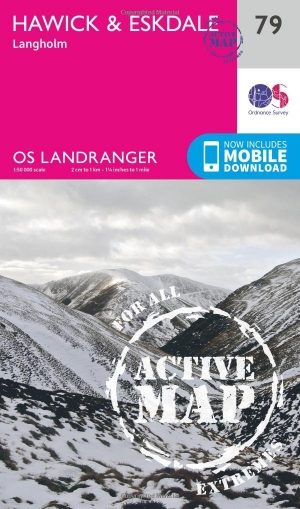
Wandelkaart 79 Hawick & Eskdale - Schotland - OSI • 9780319474020
Wandelkaart Hawick & Eskdale - Scotisch borders Schotland Productbeschrijving: OS Landranger kaart 79 omvat Teviot Dale, plus de stad van Hawick. De huidige vallei is een populaire gebied om te wandelen met een aangename dal, en steile beklimmingen. De OS Landranger kaarten reeks heeft betrekking op Groot-Brittannië met 204 gedetailleerde kaarten, perfect voor dagtochten en korte pauzes. E…