

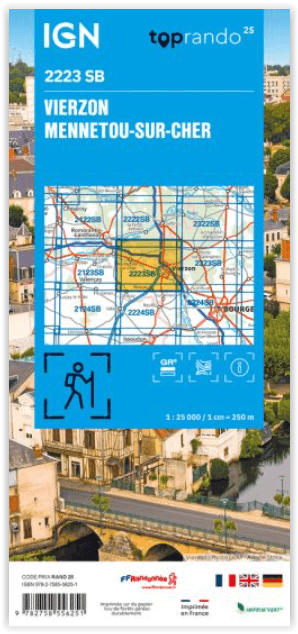
Wandelkaart 2223 SB Vierzon & Mennetou-sur-Cher - IGN
Foëcy- Vierzon- Thénioux- Maray- Méreau- Saint-Loup- Genouilly...

Korte omschrijving
Wandelkaarten Centre Val de Loire, Frankrijk van Institut Géographique National. Ideaal voor tochten in Frankrijk.
Wandelkaart Vierzon & Mennetou-sur-Cher - IGN Productomschrijving: L'indispensable carte de randonnée ! Ces cartes topographiques d'une très grande précision contiennent tous les détails ex...

Specificaties
- Uitgever: Institut Géographique National
- ISBN-13: 9782758556251
- HOOFDCATEGORIEËN: Wandelkaart
- Activiteiten: Wandelen, Hiking & Trekking
- Regio: Centre Val de Loire, Frankrijk
- Land: Frankrijk
- Departement: Cher (18)
- Schaal: 1:25000
- Editie: 2
- Taal: Frans
- Reeks/Serie: IGN France > TOP25 Randoo / Série Bleue
- De Franse Regio's: Centre-val-de-Loire
Volledige omschrijving
Wandelkaart Vierzon & Mennetou-sur-Cher - IGN
Productomschrijving: L'indispensable carte de randonnée ! Ces cartes topographiques d'une très grande précision contiennent tous les détails existant sur le terrain, les sentiers balisés et des informations touristiques. Sans oublier la représentation du relief par des courbes de niveau.
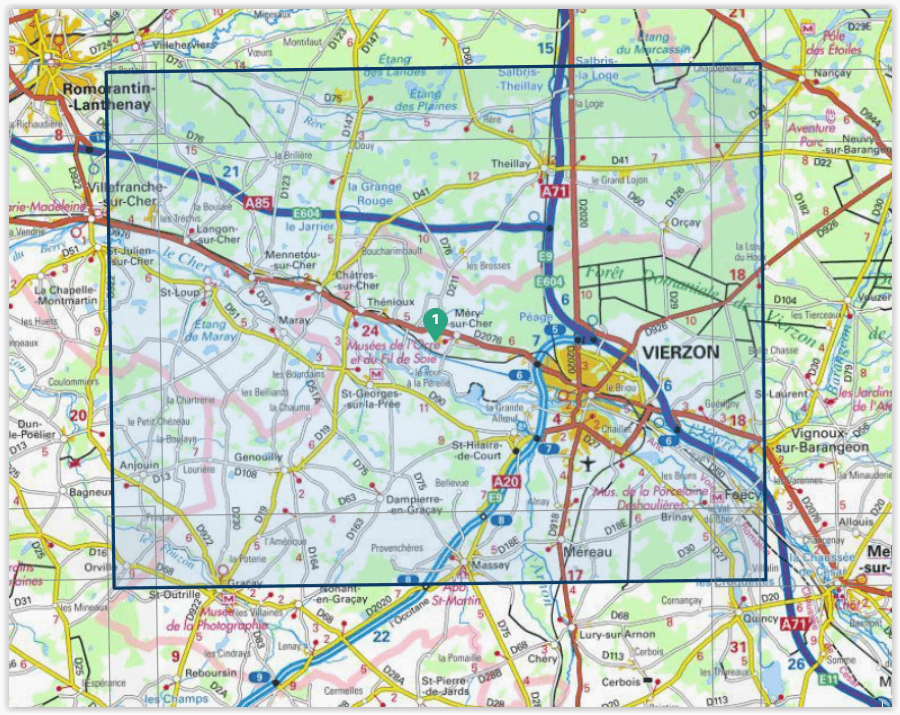
Omvat: Vierzon, Mennetou-sur-Cher, Foëcy, Vierzon, Thénioux, Maray, Méreau, Saint-Loup, Genouilly, Anjouin, Saint-Georges-sur-la-Prée, Saint-Hilaire-de-Court, Méry-sur-Cher, Brinay, Mennetou-sur-Cher, Massay, Langon-sur-Cher, Châtres-sur-Cher, Theillay.
Te ontdekken: Étang de Maray, Étang des Plaines, Étang des Landes,Forêt Domaniale de Vierzon,,Abbaye St-Martin.
Afmetingen: 96 cm x 121 cm
Overzichtskaarten
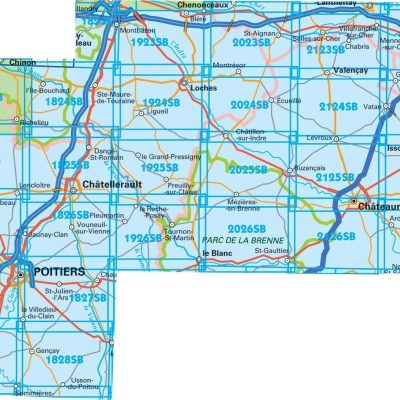
IGN TOP25 Wandelkaarten Loire Centre - Zuidelijk DEEL - Bourges - Poitiers
IGN TOP25 Wandelkaarten Loire Centre - Zuidelijk DEEL - Bourges - Poitiers
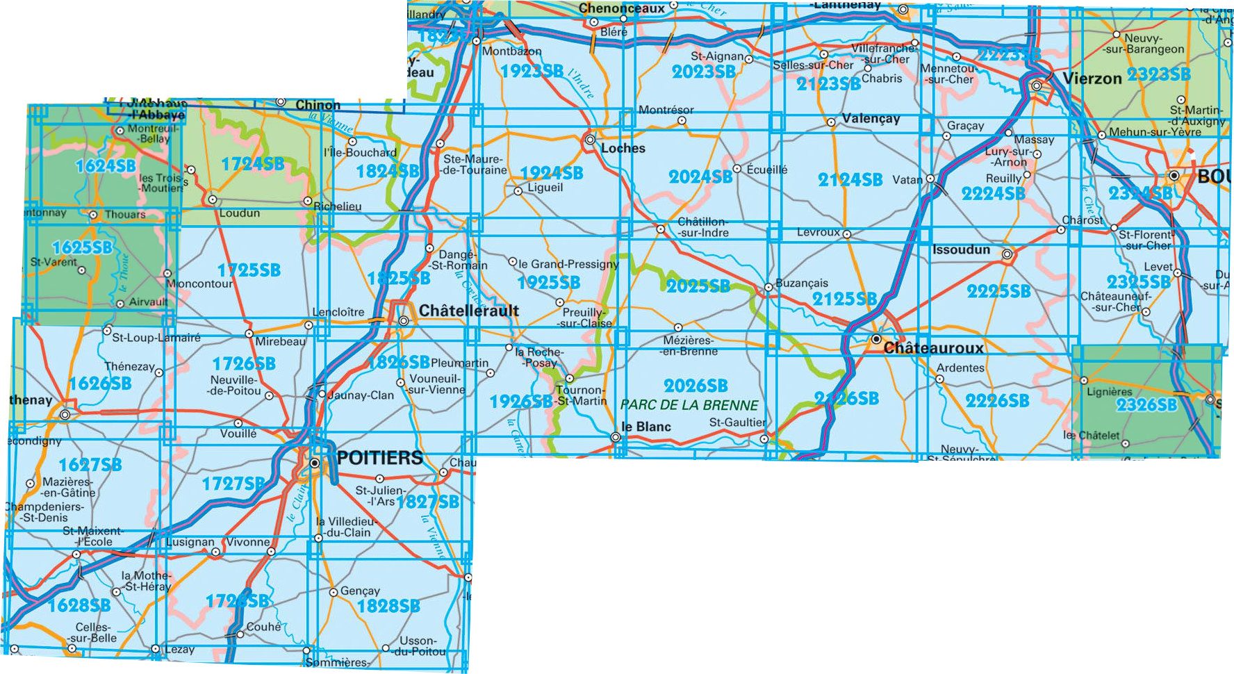
Producten op de overzichtskaart
Klik op een product om naar de detailpagina te gaan.
- Wandelkaart 1627 SB Mazières-en-Gâtine & Vasles - IGN
- Wandelkaart 1724 SB Loudun & Richelieu - IGN
- Wandelkaart 1725 SB Lencloître & St-Jean-de-Sauves - IGN
- Wandelkaart 1727 SB Poitiers & Coulombiers - IGN
- Wandelkaart 1728 SB Vivonne & Lusignan - IGN
- Wandelkaart 1824 SB Ste-Maure-de-Touraine & L'Ile-Bouchard IGN
- Wandelkaart 1825 SB Châtellerault & Descartes - IGN
- Wandelkaart 1827 SB Poitiers & Chauvigny - IGN
- Wandelkaart 1923 SB Bléré- Chenonceaux & Veigné - IGN
- Wandelkaart 1924 SB Loches & Ligueil - IGN
- Wandelkaart 1925 SB Preuilly-sur-Claise & le Grand-Pressigny
- Wandelkaart 1926 SB Le Blanc- Pleumartin & La Roche-Posay - IGN
- Wandelkaart 2024 SB Châtillon-sur-Indre - Ecueillé - IGN
- Wandelkaart 2025 SB Buzançais & Mézières-en-Brenne - IGN
- Wandelkaart 2026 SB Saint-Gaultier & Rosney - IGN
- Wandelkaart 2123 SB Selles-sur-Cher & Chabris - IGN
- Wandelkaart 2124 SB Luçay-le-Mâle & Poulaines - IGN
- Wandelkaart 2125 SB Châteauroux & Levroux - IGN
- Wandelkaart 2126 SB Le Poinçonnet- Velles & Luant - IGN
- Wandelkaart 2223 SB Vierzon & Mennetou-sur-Cher - IGN
- Wandelkaart 2224 SB Vatan & Chârost - IGN
- Wandelkaart 2225 SB Issoudun & Neuvy-Paillouxt - IGN
- Wandelkaart 2226 SB Ardentes & La Berthenoux - IGN
- Wandelkaart 2323 SB St-Martin-D'Auxigny & Foëcy - IGN
- Wandelkaart 2324 SB Bourges & Mehun-sur-Yèvre - IGN
Artikelen uit dezelfde regio

Wandelkaart 1917 SB Nogent-le-Rotrou & Thiron-Gardais - IGN • 9782758533160
Wandelkaart 1917 SB - Nogent-le-Rotrou & Thiron-Gardais Productomschrijving: Deze topografische kaarten hebben een zeer nauwkeurige gronddetail, niet te vergeten de topografische hoogteprofielen, die het wandelen een stuk gemakkelijker maken. Nogent-le-Rotrou is een gemeente in het Franse departement Eure-et-Loir (regio Centre) en telt 11.524 inwoners. De plaats maakt deel uit van het arr…
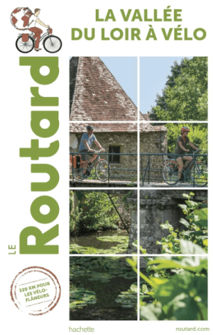
Fietsgids La Vallée du Loir à vélo - Le Routard • 9782017171966
Vallée du Loir à vélo - Le Routard Productomschrijving: Nouveauté du Routard, le guide de voyage n°1 en France ! La vallée du Loir à vélo, qui serpente sur 320 km des confins de la Beauce au Val de Loire, est l'une des plus charmantes véloroutes de France. Découvrir d'étonnants paysages d'étangs et de prairies, de sous-bois et de forêts qui caractérisent la vallée, des villages pit…

Wandelkaart TOP75 038 Ile-de-Ré & Ile d'Oléron - IGN • 9782758532729
Wandelkaart Ile-de-Ré - Ile d'Oléron & Marais Poitevin Productomschrijving: IGN TOP75 kaarten zijn op maat gemaakt voor liefhebbers van outdoor activiteiten en liefhebbers van het culturele en historische erfgoed van onze regio's. Île de Ré ligt in de regio Poitou-Charentes in het departement Charente-Maritime. Île de Ré is een vakantie-eiland dat sinds 1988 vanaf het vasteland van Frankri…

Wandelkaart 2018 SB Châteaudun & Brou - IGN • 9782758537137
Wandelkaart 2018 SB - Châteaudun & Brou Productbeschrijving: Châteaudun & Brou zijn gemeentes in het Franse departement Eure-et-Loir, regio Centre. De plaats maakt deel uit van het arrondissement Châteaudun. Op korte afstand van het PNR du Perche, is dit de perfecte uitvalsbasis voor wandelaars die van bossen kunnen genieten. Tussen 2014 en 2018, worden alle SERIE BLUE kaarten in de collec…

Wandelkaart 1916 SB La Loupe & Rémalard-en-Perche - IGN • 9782758554592
Wandelkaart La Loupe & Rémalard-en-Perche - IGN Productomschrijving: La Loupe & Rémalard-en-Perche zijn gemeentes in het Franse departement Eure-et-Loir in de regio Centre-Val de Loire. De plaats maakt deel uit van het arrondissement Nogent-le-Rotrou. Omvat: La Loupe, Rémalard,La Framboisière, Moutiers-au-Parc naturel régional du Perche, L'Hôme-Chamondot, La Ferté-Vidame, Bretoncelles,…