

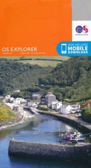
Wandelkaart 177 Carmarthen & Kidwelly South Wales - OSI
Pembrokeshire Coast National Park & Carmarthen Bay

Korte omschrijving
Wandelkaarten South Wales van Ordnance Survey. Ideaal voor tochten in Wales.
Wandelkaart 177 - Carmarthen & Kidwelly- South Wales - OSI Omvat ook: Pendine & Laugharne. Productbeschrijving: Kaart nummer 177 omvat Carmarthen en Kidwelly. Hoogtepunten zijn onder and...

Specificaties
- Uitgever: Ordnance Survey
- ISBN-13: 9780319470497
- HOOFDCATEGORIEËN: Wandelkaart
- Activiteiten: Wandelen, Hiking & Trekking
- Regio: South Wales
- Land: Wales
- Waterafstotende kaart: Ordnance Survey ACTIVE Explorer Weatherproof Maps
- TOPO's & Stafkaarten: Topografisch wandelen
- Schaal: 1:25000
- Taal: Engels
- Reeks/Serie: Explorer ACTIVE Series OSI
Volledige omschrijving
Wandelkaart 177 - Carmarthen & Kidwelly- South Wales - OSI
Omvat ook: Pendine & Laugharne.
Productbeschrijving: Kaart nummer 177 omvat Carmarthen en Kidwelly. Hoogtepunten zijn onder andere het Pembrokeshire Coast National Park, Carmarthen Bay, de rivieren Taf- en Tywi. Omvat ook Laugharne en Pendine. De OS Explorer kaart voor Carmarthen & Kidwelly is beschikbaar in zowel de standaard papieren versie als de weerbestendige 'Actief' versie.
Productdiscription: Map sheet number 177 covers Carmarthen and Kidwelly. Highlights include the Pembrokeshire Coast National Park, Carmarthen Bay, the rivers Taf and Towy. Also includes Laugharne and Pendine. The OS Explorer map for Carmarthen & Kidwelly is available in both the standard paper version and weatherproof 'Active' version.
Locatie op kaart
Gekoppelde artikelen

Wandelkaart 177 Carmarthen & Kidwelly- Wales - OSI • 9780319243701
standaard versieWandelkaart Carmarthen & Kidwelly - Wales Productbeschrijving: Pendine & Laugharne. 177 / Carmarthen & Kidwelly, Wales - Kaart nummer 177 omvat Carmarthen en Kidwelly. Hoogtepunten zijn onder andere het Pembrokeshire Coast National Park, Carmarthen Bay, de rivieren Taf- en Tywi. Omvat ook Laugharne en Pendine. De OS Explorer kaart voor Carmarthen & Kidwelly is beschikbaar in zowel de …

Wandelkaart 177 Carmarthen & Kidwelly South Wales - OSI • 9780319470497
weatherproof versieWandelkaart 177 - Carmarthen & Kidwelly- South Wales - OSI Omvat ook: Pendine & Laugharne. Productbeschrijving: Kaart nummer 177 omvat Carmarthen en Kidwelly. Hoogtepunten zijn onder andere het Pembrokeshire Coast National Park, Carmarthen Bay, de rivieren Taf- en Tywi. Omvat ook Laugharne en Pendine. De OS Explorer kaart voor Carmarthen & Kidwelly is beschikbaar in zowel de standaard …
Artikelen uit dezelfde regio
Wandelkaart 213 Aberystwyth & Cwm Rheidol - Wales - OSI • 9780319244067
Wandelkaart Aberystwyth & Cwm Rheidol - Wales 213 - Aberystwyth / Cwm Rheidol - Wales - Kaart blad nummer 213 in de OS Explorer reeks beslaat een gebied aan de westkust van Wales rond Aberystwyth op Cardigan Bay. Hoogtepunten van het gebied zijn onder andere: Plynlimon, het hoogste punt van het Cambrian Mountains and Devil's Bridge. De OS Explorer kaart voor Aberystwyth & Cwm Rheidol is be…
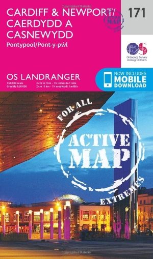
Wandelkaart 171 Cardiff & Newport - Pontypool South Wales - OSI • 9780319474945
Wandelkaart Cardiff- Newport & Pontypool - South Wales Productbeschrijving: Als een compacte en levendige stad is Cardiff een spannende plek om te troeben. OS Landranger kaart 171 dekt Cardiff (Caerdydd), Newport (Casnewydd) en Pontypool (Pont-y-pwl) en de monding van de Severn. Het heeft een schat aan sport. De OS Landranger kaarten reeks heeft betrekking op Groot-Brittannië met 204 gedet…
Wandelkaart XT40 Brecon Beacons Oost Wales - Harvey Maps • 9781851376001
Wandelkaart -XT40 Brecon Beacons Oost Wales - Harvey Maps Productomschrijving: Omvat een grote oppervlakte, maar is heel handig & compact. Gedetailleerde kaart voor hardlopers en wandelaars van het oostelijke deel van het Brecon Beacons National Park en de Black Mountains op de magische schaal van 1:40, 000. Omvat: Pen y Fan en de Black Mountains. Welsh-Engelse tekst.
Wandelgids Day Walks in the Brecon Beacons - Vertebrate Publ. • 9781906148621
Day Walks in the Brecon Beacons - Vertebrate Productomschrijving: Day Walks in the Brecon Beacons features 20 circular routes between 6.8 and 16.5 miles (11km and 16.6km) in length. Author Harri Roberts shares his favourite walks in the region, including Llangors Lake, the Taf Fechan Skyline and the Llanbedr Horseshoe. Each route features Ordnance Survey maps, easy-to-follow directions an…
Wandelkaart OL012 Brecon Beacons Nat. Parc West & Central areas • 9780319242513
Wandelkaart Brecon Beacons National Parc West & Centre Productomschrijving: Brecon Beacons National Parc Western & Central area. Parc Cenedlaethol Bannau Brycheiniog. Ontdek de OL-serie van Ordnance Survey: De OL-serie (Outdoor Leisure) van Ordnance Survey is dé referentie voor wie gaat wandelen op de Britse eilanden. Deze topografische kaarten maken deel uit van de Explorer-reeks en…