

Wandelgids Wye Valley 15 Short Walks - Cicerone Press
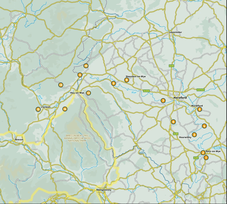
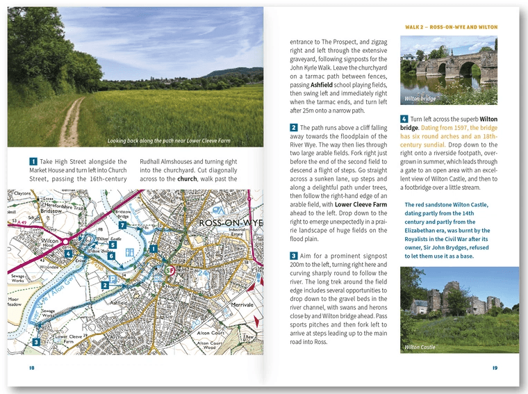
Ross-on-Wye, Chase Wood, Sellack Boat, Capler Camp and Mordiford
Korte omschrijving
Wandelgidsen Gloucestershire, Egland en Herefordshire, England van CICERONE Press. Ideaal voor tochten in England.
Wandelgids 15 Short Walks in Wye Valley - Cicerone Press Productomschrijving: Discover 15 of the best short walks in the Wye Valley, carefully chosen to showcase the area’s peaceful riversi...

Specificaties
- Uitgever: CICERONE Press
- ISBN-13: 9781786312891
- HOOFDCATEGORIEËN: Wandelgids
- Activiteiten: Wandelen, Hiking & Trekking
- Auteur: Mike Dunn
- Regio: Gloucestershire, Egland, Herefordshire, England
- Land: England
- Nationale parken: Brecon Beacons NP, Wales
- Editie: 1
- Taal: Engels
- De Engelse Graafschappen: Gloucestershire, Herefordshire
Volledige omschrijving
Wandelgids 15 Short Walks in Wye Valley - Cicerone Press
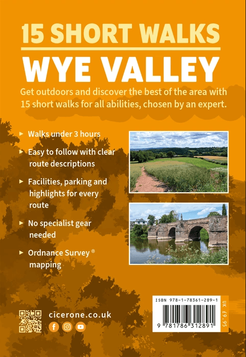
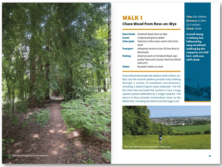
Productomschrijving: Discover 15 of the best short walks in the Wye Valley, carefully chosen to showcase the area’s peaceful riversides, ancient woodland, historic churches and Iron Age hillforts, all in under three hours. With no technical terrain and only short climbs, these routes are ideal for families, casual walkers and anyone looking for easy access to outstanding scenery.
This guidebook focuses on easy to moderate routes between 4 and 9km that are generally short and straightforward, with gentle ascents and no challenging ground, making them suitable for children, older walkers and mixed-ability groups. Each of the 15 short walks includes clear, easy-to-read Ordnance Survey maps tied to numbered route descriptions, helping you follow each walk with confidence.
From gentle strolls above the River Wye to exploring landmarks near Ross-on-Wye, Chase Wood, Sellack Boat, Capler Camp and Mordiford, these routes offer a relaxed and rewarding way to experience one of Britain’s most beautiful landscapes on foot. All details of your day out are covered, including parking, facilities and highlights along the route, plus a handy route summary table to help you choose the right walk. The walks can be enjoyed throughout the year, with each season bringing different colours and views, though you should be prepared for some mud after wet weather.
Part of Cicerone’s Short Walks series, this Wye Valley guidebook brings together everything you need for relaxed and enjoyable days outdoors: short, accessible routes, straightforward navigation, and plenty to discover along the way. Whether you are visiting for a weekend break or exploring close to home, it is an ideal companion for discovering the valley’s tranquil landscapes and historic charm on foot.
- 15 Short Walks in the Wye Valley – Quick Facts
- Trail name: 15 Short Walks in the Wye Valley
- Location: Wye Valley, Herefordshire / Gloucestershire, England, UK
- Walk type: Short day walks (each under ~3 hours)
- Total walks: 15 routes
- Difficulty: Easy to moderate; gentle ascents, no challenging terrain
- Typical duration: Walks generally under three hours each
- Terrain: Riverside paths, woodlands, hills, historic villages and hillforts
- Navigation: Clear Ordnance Survey maps and numbered route descriptions included
- Best season: Walks viable all year round, with seasonal colours and views; sturdy footwear recommended after wet weather
- Highlights: River Wye, Ross-on-Wye, Chase Wood, Capler Camp, Mordiford, Sellack Boat, historic churches, Iron Age hillforts
Artikelen uit dezelfde regio
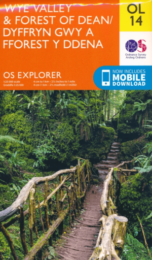
Wandelkaartv OL14 Wye Valley, Forest of Dean & Dyfryn Gwy - OS • 9780319263839
Wandelkaartv Wye Valley, Forest of Dean & Dyfryn Gwy - OS Productomschrijving: Parts of Offa's Dyke Path, on the border of England & Wales. Omvat: Wye Valley, Forest of Dean & Dyfryn Gwy, Wye Valley AONB, Daffodil Way, Gloucestershire Way, Herefordshire Way, Jubilee Way, Offa's Dyke Path, Severn Way, Thames & Severn Way, Three Coastal Walk, Wales Coast Path, Wye Valley Walk & Wysis Way…

Wandelkaart XT Malvern Hills AONB England - Harvey map • 9781851376056
Wandelkaart - Malvern Hills AONB England - Harvey map Productomschrijving: Deze Mavern Hills zijn een samenstelling van heuvels in de Engelse counties, Worcestershire, Herefordshire, en een klein deel van Gloucestershire, en domineren de volledige regio rond deze counties van het district van Alvern Hills. Het hoogst gelegen punt van deze regio biedt een panorama van de Severn vallei met d…
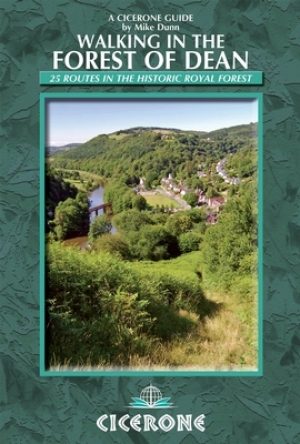
Wandelgids Walking in the Forest of Dean - Cicerone • 9781852846893
Wandelgids - Walking in the Forest of Dean - Cicerone Productomschrijving: Een gids over 25 wandelingen in de Forest of Dean, met alle informatie die nodig is om te genieten van een scala aan wandelingen in de dallen en de open ruimtes van dit oude gebied. Van korte 4-mijl lange wandelingen tot volle dagsecties van interlokale paden zoals de Offa's Dyke Path en Gloucestershire Way, is deze…

Wandelkaart 167 Thornbury- Dursley & Yate - England- OSI • 9780319243602
Wandelkaart Thornbury- Dursley & Yate - Gloucestershire Omvat ook: Berkeley & Wotton-under-Edge Productomschrijving: Kaart nummer 167 in de OS Explorer kaarten reeks omvat het gebied ten noorden van Bristol langs de rivier de Severn tussen Engeland en Wales. Hoogtepunten van het gebied: forest of Avon, de Cotswolds en de Wye Valley, met inbegrip van de Cotswold way, Offa's Dyke Path en…

Wandelgids 029 Pathfinder guides Wye Valley AONB & Forrest of Dean • 9780319090442
Wandelgids Wye Valley AONB & Forrest of Dean -OS Productomschrijving: The Wye Valley and Forest of Dean Pathfinder guidebook contains 28 circular walks for all abilities. Walks are from 4km to 17km long, and each route includes a difficulty rating, route directions, an extract of the Ordnance Survey map and notes and photos of key features to look for. All of them have been created and te…