

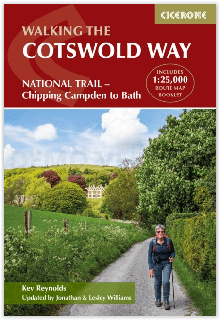
Wandelgids The Cotswold Way - Cicerone
Chipping Campden to Bath - National Trail
Korte omschrijving
Wandelgidsen Gloucestershire, Egland en Somerset South West England van CICERONE Press. Ideaal voor tochten in England.
The Cotswold Way - Cicerone Productomschrijving: Wandelgids over de Cotswold Way Nationale route. Tussen Chipping Campden en Bath verkent de 164 km lange route door de Cotswolds AONB (Area o...

Specificaties
- Uitgever: CICERONE Press
- ISBN-13: 9781786312105
- HOOFDCATEGORIEËN: Wandelgids
- Activiteiten: Wandelen, Hiking & Trekking
- Auteur: Kevin Renolds
- Regio: Gloucestershire, Egland, Somerset South West England
- Land: England
- Lange afstand wandelroutes: Cotswold Way, England (164km)
- AONB - Area of Outstanding Beauty/National Landscape: Cotswolds AONB
- Schaal: 1:25000
- Editie: 5
- Taal: Engels
- Reeks/Serie: National Trails, UK
- National Trails UK, England & Wales: Cotswolds Way, England
Volledige omschrijving
The Cotswold Way - Cicerone
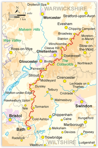
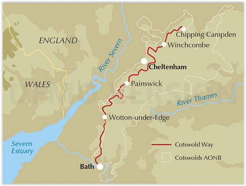
Productomschrijving: Wandelgids over de Cotswold Way Nationale route. Tussen Chipping Campden en Bath verkent de 164 km lange route door de Cotswolds AONB (Area of Outstanding Natural Beauty). Beschreven in beide richtingen over 13 etappes. De Cotswold Way kan het hele jaar door belopen worden, en is geschikt voor beginnende wandelaars. Inclusief apart OS 1:25.000 kaartboekje van de route.
Engelse omschrijving: Guidebook to walking the Cotswold Way National Trail. Between Chipping Campden and Bath, the 102 mile route explores the Cotswolds AONB. Described in both directions over 13 stages, the Cotswold Way can be walked year round and is suitable for beginner trekkers. Includes separate OS 1:25,000 map booklet of the route.
Seasons:
Can be walked all year round: accommodation is scarce during Cheltenham Festival (March) and Badminton Horse Trials (late April/May).
Centres:
Chipping Campden, Cheltenham, Gloucester, Stroud, Bath.
Difficulty:
The Cotswold Way is a waymarked lowland walk suitable for all abilities: suggested day sections are in the region of 6-10 miles (10-16km).
Must See:
Hailes Abbey, Belas Knap, Crickley Hill, Haresfield Beacon, Sudley Castle, Broadway, views of Kelston Round Hill, roman baths (Bath).
Artikelen uit dezelfde regio
Wandelkaart OL09 Exmoor NP Devon England - OS • 9780319242483
Wandelkaart Exmoor NP Devon England - OS Productomschrijving: Exmoor National Park, Devon England Omvat: Exmoor National Park, Devon England, Barnstaple, Lynton, Minehead & Dulverton. Ontdek de OL-serie van Ordnance Survey: De OL-serie (Outdoor Leisure) van Ordnance Survey is dé referentie voor wie gaat wandelen op de Britse eilanden. Deze topografische kaarten maken deel uit va…
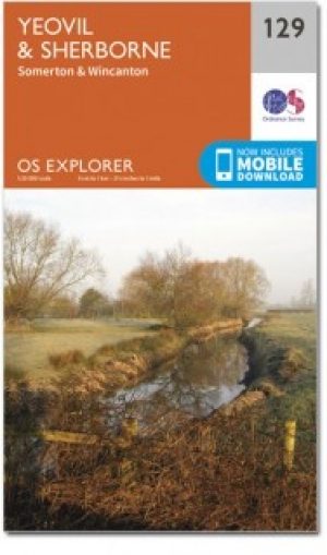
Wandelkaart 129 Yeovil & Sherborne- Somerset - OSI • 9780319470046
Wandelkaart Yeovil & Sherborne - Somerset England - OSI Productbeschrijving: Kaart nummer 129 in de OS Explorer kaarten reeks beslaat een gebied van Somerton en Wincanton in het noorden bij Yeovil en Sherborne rond North Dorset en Somerset. Hoogtepunten van het gebied van de Monach Way, Stour Valley Way en Macmillan Way West. De OS Explorer kaart voor Yeovil & Sherborne is beschikbaar in z…

Wandelkaart 141 Shepton Mallet & Mendip Hills East - OSI • 9780319470138
Wandelkaart Shepton Mallet & Mendip Hills East - England Productbeschrijving: Kaart nummer 141 in de OS Explorer kaarten reeks heeft betrekking op de westelijke Mendip Hills, Cheddar, Wells Street en Glastonbury. Hoogtepunten van het gebied zijn onder andere: Cheddar Gorge, Wookey Hole, Glastonbury Tor, Blagdon, de Chew Valley Lakes en de rivieren bijl, Brue en Cary. De OS Explorer kaart …

Wandelgids 006 Pathfinder guides Cotswolds AONB - OS • 9780319090282
Wandelgids Cotswolds AONB - OS Productomschrijving: 28 carefully selected and tested country walks around The Cotswolds, graded by length and ranging from just over four to 10 miles. All of the walks in this book include written directions, an extract of the OS map for the area and some background on the history and natural environment you may see. Most of the walks avoid busy roads, a…

Wandelgids & Fietsgids - The Cotswold AONB - Cicerone • 9781852847067
Wandelgids & Fietsgids - The Cotswold AONB - Cicerone Productomschrijving: De Cotswolds is de thuisbasis van mooie honing-hued stenen dorpen in een glooiende landschap. De dramatische 100-mijl lange kalkstenen helling biedt een adembenemend uitzicht, terwijl het netwerk van rustige wegen, fietsvriendelijke kanaalwegen, sporen en ruiterpaden perfect is voor verkenning op een fiets. De Cotwo…