

Wandelgids Walking the Dartmoor way - Cicerone
10 Etappes - 175 km - Incl. The High Moor Link


Korte omschrijving
Wandelgidsen Devon, England van CICERONE Press. Ideaal voor tochten in England.
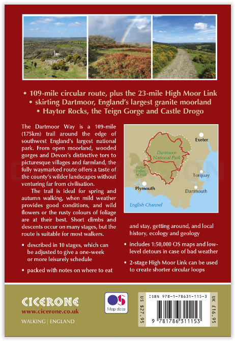
Walking the Dartmoor way - Cicerone Productomschrijving: Een gloednieuwe wandelgids van Cicerone over het wandelen van de befaamde Dartmoor Way, een bewegwijzerde wandelroute van 175 km (109...

Specificaties
- Uitgever: CICERONE Press
- ISBN-13: 9781786311153
- HOOFDCATEGORIEËN: Wandelgids
- Activiteiten: Wandelen, Hiking & Trekking
- Auteur: Sue Viccars
- Regio: Devon, England
- Land: England
- Lange afstand wandelroutes: Dartmoor way, Devon England (175 km)
- Nationale parken: Dartmoor NP, Devon England
- Editie: 1
- Taal: Engels
Volledige omschrijving
Walking the Dartmoor way - Cicerone
Productomschrijving: Een gloednieuwe wandelgids van Cicerone over het wandelen van de befaamde Dartmoor Way, een bewegwijzerde wandelroute van 175 km (109 mijl) langs de rand van het prachtige Dartmoor NP in Devon. De route bestaat uit 10 etappes (plus de High Moor Link die kan worden gebruikt om twee kortere lussen te maken) en voert langs beboste valleien, sprankelende beekjes, heide, landbouwgrond en aantrekkelijke steden en dorpen.
Engelse omschrijving: Guide to the Dartmoor Way, a waymarked 175km (109 mile) circular walking route around the edge of Devon's beautiful Dartmoor. Presented in 10 stages (plus the High Moor Link which can be used to create two shorter loops), the route takes in wooded valleys, sparkling streams, moorland, farmland and attractive towns and villages.
Seasons
Ideal in the 'shoulder' months: wild flowers, lambs and foals in spring; rusty bracken moorland, colourful oak woods and diverse fungi in autumn. Expect cooler and wetter weather in autumn and winter.
Centres
Ivybridge, South Brent, Buckfastleigh, Ashburton, Bovey Tracey, Manaton, Moretonhampstead, Chagford, South Zeal, Sticklepath, Belstone, Okehampton, Sourton, Lydford, Mary Tavy, Peter Tavy, Tavistock, Yelverton, Cornwood, Holne, Hexworthy, Princetown
Difficulty
Includes short but steep ascents and descents, but the route is well signed and split into easily manageable day walks. Alternative low-level routes listed for days when visibility is poor, and navigation may be a challenge.
Must See
Dartmoor National Park; Redlake Tramway; Buckfast Abbey; Haytor Rocks and the Haytor Granite Tramway, built in 1820; the Teign Gorge; Cranbrook Iron Age hillfort; Castle Drogo; Belstone Cleave and the Taw River; Okehampton castle; Meldon Viaduct and bluebell woodland; Dartmoor's highest point, High Willhays; Lydford Castle; The Dewerstone; Lee Moor china clay workings; Princetown's Napoleonic prison.

Locatie op kaart
Artikelen uit dezelfde regio

Wandelkaart 115 Exmouth & Sidmouth- Devon - OSI • 9780319469958
Wandelkaart Exmouth & Sidmouth - Devon England - OSI Productbeschrijving: Kaart nummer 115 in de OS Explorer reeks heeft betrekking op de east Devon kust met inbegrip van Exmouth, Sidmouth, Honiton, Budleigh Salterton en Ottery St Mary. Highlights van het gebied omvatten: Blackdown Hills, Oost-Devon AONB, East Devon Way en de South West Coast Path. De OS Explorer kaart voor Exmouth & Sidmo…
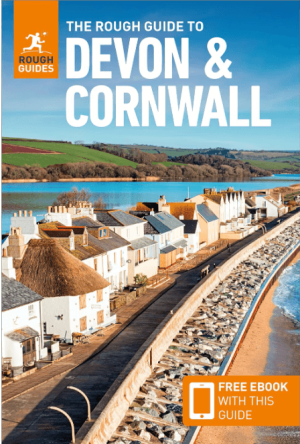
Reisgids Devon & Cornwall - Rough Guides • 9781839059940
Reisgids Devon & Cornwall - Rough Guides Productomschrijving: The Rough Guide to Devon and Cornwall is the perfect companion to your trip to this captivating peninsula, introducing you to the charms of gentle, pastoral Devon and wild, craggy Cornwall. Both counties will tempt you outside to enjoy their mild climate, with everything from hikes over Dartmoor NP and surfing off Newquay to puf…
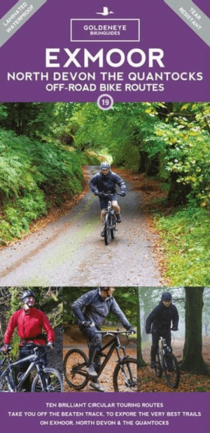
Mountainbike kaart Exmoor NP & Quantocks Hills AONB - Goldeneye • 9781859652855
MTB map Exmoor NP & Quantocks Hills AONB - Goldeneye Productomschrijving: Herewith, 10 of the best off-road touring routes to Exmoor, North Devon and The Quantock Hills AONB which include Public Rights of Way; bridlepaths & quiet lanes. These routes have also been checked out and approved by the Exmoor National Park Authority. The routes are graded: easy, moderate and more strenuous al…

Wandelkaart OL28 Dartmoor National Park - OS • 9780319264034
Wandelkaart Dartmoor National Park - OS Productomschrijving: Dartmoor National Park, Devon England. Ontdek de OL-serie van Ordnance Survey: De OL-serie (Outdoor Leisure) van Ordnance Survey is dé referentie voor wie gaat wandelen op de Britse eilanden. Deze topografische kaarten maken deel uit van de Explorer-reeks en bieden ongeëvenaarde nauwkeurigheid en detail op een schaal van 1:…

Wandelgids Cornwall Devon - 50 wandelingen - ELMAR • 9789038924045
Wandelgids Cornwall & Devon - ELMAR Productomschrijving: Cornwall – Devon is een fantastisch wandelparadijs voor natuurliefhebbers; uitzicht op zee en kust, groene heuvels en kronkelende landweggetjes. De mystieke sfeer komt tot leven bij het zien van de brede baaien met ruige kliffen, woeste kloven met subtropische vegetatie en afgelegen stranden met smaragdgroene wateren. Een wandeling n…