
Mountainbike kaart Exmoor NP & Quantocks Hills AONB - Goldeneye
10 of the best off-road touring routes to Exmoor & Quantocks Hill

Korte omschrijving
Fietskaarten Devon, England en Somerset, Bristol van Goldeneye. Ideaal voor tochten in United Kingdom, Great Britain en England.
MTB map Exmoor NP & Quantocks Hills AONB - Goldeneye Productomschrijving: Herewith, 10 of the best off-road touring routes to Exmoor, North Devon and The Quantock Hills AONB which include Pu...

Specificaties
- Uitgever: Goldeneye
- ISBN-13: 9781859652855
- HOOFDCATEGORIEËN: Fietskaart
- Activiteiten: Fietsen / VTT / MTB
- Regio: Devon, England, Somerset, Bristol
- Land: England, United Kingdom, Great Britain
- Nationale parken: Exmoor NP, Devon England
- TOPO's & Stafkaarten: Topografisch - fietsen
- AONB - Area of Outstanding Beauty/National Landscape: Quantock Hills AONB
- Schaal: 1:47700
- Editie: 3
- Taal: Engels
- De Nationale Parken: Exmoor Nationaal Park, Devon England
- VTT / MTB: Mountainbike
Volledige omschrijving
MTB map Exmoor NP & Quantocks Hills AONB - Goldeneye
Productomschrijving: Herewith, 10 of the best off-road touring routes to Exmoor, North Devon and The Quantock Hills AONB which include Public Rights of Way; bridlepaths & quiet lanes. These routes have also been checked out and approved by the Exmoor National Park Authority.
The routes are graded: easy, moderate and more strenuous although none are what could be called hard core mountain bike routes. Exmoor provides a wide variety of landscapes from sand-dunes, beaches and rocky cliffs, through wooded hills and green pastures, to the heather and grass-clad high moors.
The routes included are:
1. Woolacombe - Croyde - Georgeham - West Down.
2. Braunton and The Burrows.
3. Challacombe Circuit.
4. Horner to Dunkery Beacon.
5. Dunster Circuit.
6. Timberscombe Circuit
7. Luxborough to The Brendon Hills.
8. Dulverton to Tarr Steps.
9. Holford to Crowcombe Park Gate.
10. Holford to Bicknoller.
Artikelen uit dezelfde regio

Reisgids Devon & Cornwall - Lonely Planet • 9781837583430
Travelguide Devon & Cornwall - Lonely Planet Productomschrijving: Welcome to the wild, wild west – a land of gorse-clad cliffs, booming surf, white sand and epic, widescreen skies. Lonely Planet will get you to the heart of Devon & Cornwall, with amazing travel experiences and the best planning advice. Covers: Exeter, Torquay, Plymouth, Dartmoor National Park, Exmoor National Park, Sou…
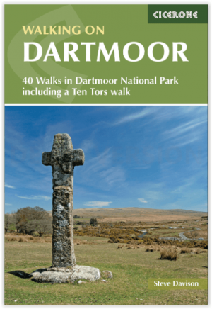
Wandelgids Dartmoor National Park - Cicerone • 9781786311085
Dartmoor National Park - Cicerone Productomschrijving: Deze wandelgids bevat routebeschrijvingen voor 42 dagwandelingen in het Dartmoor National Park en omgeving. De wandelingen variëren allemaal in lengte van 3.5 tot 17 Km en elke route is ingedeeld naar moeilijkheidsgraad van gemakkelijk tot matig of zwaar. De meeste wandelingen zijn rondwandelingen met enkele langere routes die lineair …

Reisgids Time Out Devon & Cornwall - Crimson Pub. • 9781846702433
Reisgids - Time Out Devon & Cornwall - Crimson Pub. Productomschrijving: Devon en Cornwall zijn uniek, glorieus mooi en rijk aan geschiedenis en dieren in het wild. Ze bieden alles van traditionele vissersdorpen en zandstranden tot wandelingen in de wildernis en kastelen. Accommodaties variëren van campings en huisjes tot boerderijen en boetiekhotels. Of het nu gaat om gezinsvriendelijke o…

Reisgids Cornwall & Devon - Marco Polo • 9783829734783
Reisgids Cornwall & Devon - Marco Polo Productomschrijving: Marco Polo reisgids voor Cornwall & Devon! Handig pocket formaat, boordevol informatie, met uitneembare kaart. Met ‘insider tips’ om deze regio's écht te ontdekken, de TOP 15 van bezienswaardigheden in één oogopslag, up-to-date informatie in overzichtelijke hoofdstukken: sightseeing, eten & drinken, winkelen, uitgaan, verblijf, r…

Wandelgids Part 2 SWCP Map Booklet St Ives to Plymouth - Cicerone • 9781786312785
Map Booklet Part 2 SWCP - St Ives to Plymouth - Cicerone Productomschrijving: Map of part of the southern section of the 630 mile (1014km) South West Coast Path National Trail. Covers: the trail from St Ives to Plymouth along the west Cornwall and Devon coastline. This convenient and compact booklet of Ordnance Survey 1:25,000 maps shows the route, providing all of the mapping you ne…