

Wandelgids Wales - 50 wandelingen met GPS - Elmar
De mooiste kust- en bergwandelingen in het gehele Wales

Korte omschrijving
Wandelgidsen Wales van Elmar Uitgeverij. Ideaal voor tochten in Wales.
Wandelgids Wales - 50 wandelingen Productomschrijving: Wales, een soort stukje Engeland, maar dan weer niet. Eenn stukje met zijn eigen cultuur, zijn eigen wandelcultuur en zijn eigen nation...

Specificaties
- Uitgever: Elmar Uitgeverij
- ISBN-13: 9789038926933
- HOOFDCATEGORIEËN: Wandelgids
- Activiteiten: Wandelen, Hiking & Trekking
- Regio: Wales
- Land: Wales
- Editie: 1, 2, 3
- Taal: Nederlands

Volledige omschrijving
Wandelgids Wales - 50 wandelingen
Productomschrijving: Wales, een soort stukje Engeland, maar dan weer niet. Eenn stukje met zijn eigen cultuur, zijn eigen wandelcultuur en zijn eigen nationale parken. Deze Rother wandelgids Wales beschrijft de 50 mooiste kust- en bergwandelingen in het westen van het Verenigd Koninkrijk - van Pembrokeshire tot Anglesey, van de Ierse Zee tot de grens met Engeland, in de bergachtige regio's, het binnenland en langs de kust.
* Betrouwbare routebeschrijvingen
* Gedetailleerde wandelkaarten
* Informatieve hoogteprofielen
* Downloadbare GPS Tracks
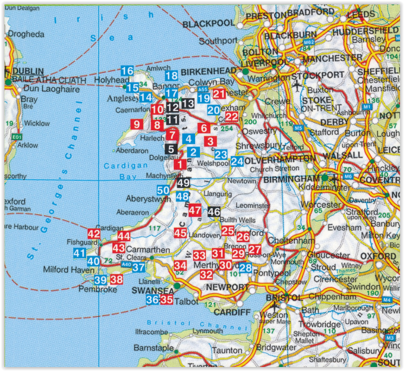
Locatie op kaart
Artikelen uit dezelfde regio

Landkaart Wegenkaart Planning maps Wales - Lonely Planet • 9781788688987
Wegenkaart Planning maps Wales - Lonely Planet Productomschrijving: From Lonely Planet, the world's leading travel guide publisher Durable and waterproof, with a handy slipcase and an easy-fold format, Lonely Planet's Wales Planning Map helps you get around with ease. Get more from your map and your trip with images and information about top attractions, itinerary suggestions, a transport …

Wandelgids Big Trails DEEL 2 Great Britain & Ireland - Vertebrate • 9781839810459
Big Trails DEEL 2 Great Britain & Ireland - Vertebrate Publ. Productomschrijving: More of the best long-distance trails Big Trails: Great Britain & Ireland Volume 2 features twenty-five long-distance trails in England, Scotland, Wales, Northern Ireland and Ireland, and includes a general overview of the trails, specific technical information, overview mapping, key information and stun…
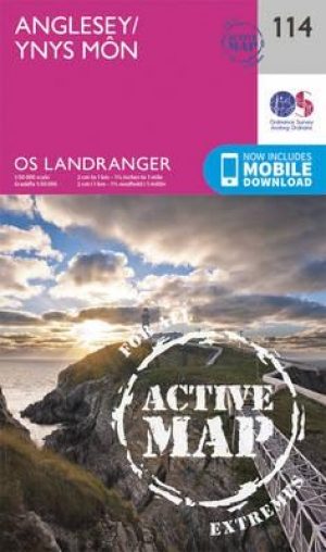
Wandelkaart 114 Anglesey- North West Wales - OSI • 9780319474372
Wandelkaart Anglesey - North West Wales - OSI Productbeschrijving: Kaart nummer 114 in de reeks van de OS Landranger kaarten bestrijkt het platteland Welsh eiland Anglesey. Het is omringd door zandstranden en rotsachtige grotten, met het binnenland dat deel is van het eiland wordt meestal landbouw geteelt. Anglesey is briljant geschikt voor toeristen met een ruime keuze aan accommodatie en…
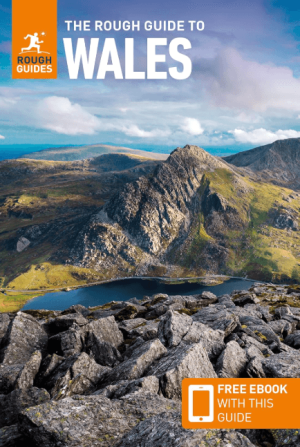
Reisgids Wales - Rough Guides • 9781839059971
Reisgids Wales - Rough Guides Productomschrijving: Discover this beautiful country with the most incisive and entertaining guidebook on the market. Whether you plan to hike through the wilds of Snowdonia, follow in Wordsworth’s footsteps at Tintern Abbey or explore Welsh music and theatre in Swansea, The Rough Guide to Wales will show you the ideal places to sleep, eat, drink and shop alon…
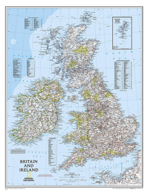
Plano Wandkaart Groot-Brittannië & Ierland 60 x 76 cm - Nat Geo • 9780792250234
Wandkaart Groot-Brittannië & Ierland 60 x 76 cm - Nat Geo Productomschrijving: National Geographic's Classic political map of Britain and Ireland is both an attractive addition to any study or classroom and an informative tool for exploring these fascinating countries. The map features thousands of place names, major highways and roads, airports, ferry routes, bodies of water, and more. Ha…