

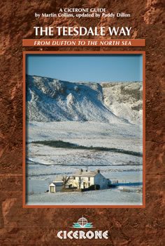
Wandelgids Teesdale Way - Cicerone
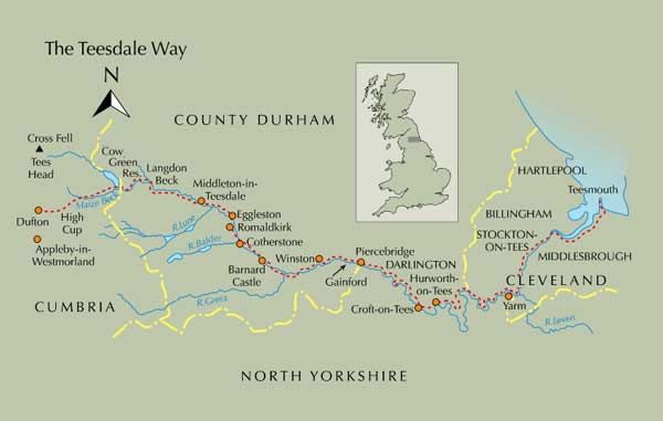
8 Stages & loopt135 km van Dufton naar Teesmouth
Korte omschrijving
Wandelgidsen County Durham, Ierland, North & North East England en North Yorkshire, Engeland van CICERONE Press. Ideaal voor tochten in England.
Wandelgids - Teesdale Way - Cicerone Productomschrijving: Deze handige gids is ideaal voor degenen die van plan zijn om de 135 km lange Teesdale Way te doorlopen. De route wordt beschreven ...

Specificaties
- Uitgever: CICERONE Press
- ISBN-13: 9781852844615
- HOOFDCATEGORIEËN: Wandelgids
- Activiteiten: Wandelen, Hiking & Trekking
- Regio: County Durham, Ierland, North & North East England, North Yorkshire, Engeland
- Land: England
- Lange afstand wandelroutes: Teesdale Way, England (135 km)
- Editie: 2
- Taal: Engels
Volledige omschrijving
Wandelgids - Teesdale Way - Cicerone
Productomschrijving: Deze handige gids is ideaal voor degenen die van plan zijn om de 135 km lange Teesdale Way te doorlopen. De route wordt beschreven in acht stappen en heeft betrekking op de gehele 100 mijl van Dufton naar Teesmouth. Elke fase biedt gematigde dagwandelingen en gemakkelijk 2 weken. Het omvat ook routebeschrijvingen voor een selectie van 10 circulaire wandelingen gebaseerd op en rond de rivier de Tees. Deze uitstekende trail volgt de rivier de Tees van zijn bron in de buurt van Dufton in de Cumbrian Pennines door het noordoostelijk platteland tot de Noordzee in de buurt van Teesside.
Product description: Guidebook to the Teesdale Way. The 100 mile walk follows the Tees from its source near Dufton to the North Sea near Teesmouth. Described in eight stages, which takes up to 2 weeks to complete. It also includes route descriptions for a selection of 10 circular walks based on and around the River Tees.
Seasons:
Suitable all year, but only limited facilities in winter.
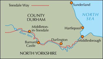
Centres:
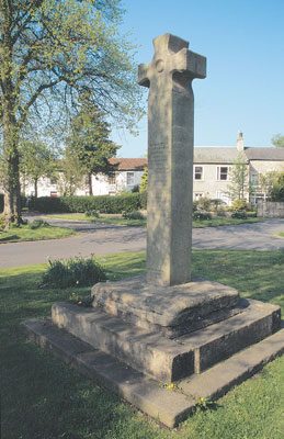
Dufton, Langdon Beck, Middleton-in-Teesdale, Barnard Castle, Darlington, Yarm, Stockton-on-Tees, Middlesborough.
Difficulty:
Fairly easy terrain. Waymarked route. Some exposed moorland. Navigation skills required in fog or snow.
Must See:
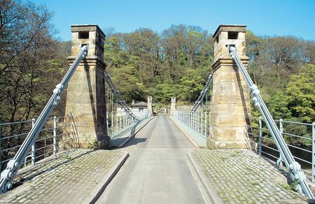
High Force (England’s largest waterfall), Fairy Cupboard caves, Piercebridge Roman remains, historic towns.

Locatie op kaart
Artikelen uit dezelfde regio

Wandelgids 093 Pathfinde North Yorkshire Accessible walks - OS • 9780319092859
Wandelgids North Yorkshire Accessible walks - OS Productomschrijving: This guide comprises 33 beautiful walks, ranging in distance from 0.5 to 8 miles, across North Yorkshire, with ten routes in the Yorkshire Dales National Park, eleven in the North York Moors National Park, North Sea coast routes at Whitby, Robin Hood’s Bay and Bempton, and routes handily placed near the Richmond, Ripon, …

Wandelkaart OL26 North York Moors NP England - OSI • 9780319468302
Wandelkaart North York Moors NP - England Productomschrijving: OL26 - North York Moors, Western area - kaart nummer OL26 in de OS Explorer reeks heeft betrekking op de Cleveland Hills, het westelijke deel van de North York Moors en een klein deel van de Howardian Hills. Hoogtepunten van het gebied zijn onder andere: Saltburn-by-the-Sea, Guisborough, Helmsley en Hunt Topping. OL26 -…

Wandelkaart Coast to Coast - Harvey maps • 9781851376186
Wandelkaart Coast to Coast - Keld to Robin Hood's Bay - Harvey maps Productomschrijving: Toont de gehele oostelijke helft van de route op één vel. Heeft betrekking op het gedeelte van Keld naar Robin Hood's Bay. Omvat alle alternatieve routes. Gedetailleerde kaart met aanvullende informatie en handige telefoonnummers. Nieuwe generatie HARVEY Superwalker, XT25 waterproof, werden ontworp…
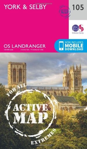
Wandelkaart 105 York & Selby- North Yorkshire - OSI • 9780319474280
Wandelkaart York & Selby - North Yorkshire - OSI Productbeschrijving: OS Landranger kaart 105 toont York, een bruisende en levendige stad boordevol culturele attracties om te bezoeken. Hoogtepunten zijn de York Minster, York Museum en het nemen van een boottocht van York langs de prachtige rivier de Ouse. De markt stad van Selby ligt ten zuiden van York samen met de andere omliggende dorpe…

Wandelgids 15 short walks in the Yorkshire Dales NP - Cicerone • 9781786312488
15 short walks in the Yorkshire Dales - Cicerone Productomschrijving: Would you like to explore the best of the Sedbergh, Kirkby Lonsdale and Ingleton? This guidebook covers 15 of the best short walks in the area (all under three hours), including Cautley Spout, Pendragon Castle, Wild Boar Fell, the Lune Valley and Ingleton Waterfalls Trail. Why choose this guidebook? - Easy to mo…