

Wandelgids Offa's Dyke path - Prestatyn to Chepstow - Trailblazer
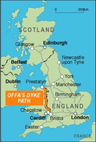
From the North Wales coast to the Severn Estuary

Korte omschrijving
Wandelgidsen Gloucestershire, Egland, North Wales, Shropshire West Midlands en West Midlands van Trailblazer Publications. Ideaal voor tochten in England.
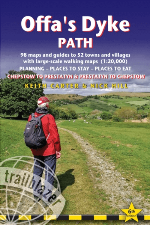
Wandelgids Offa's Dyke path, Prestatyn to Chepstow - Trailblazer Productomschrijving: (British Walking Guide) The Offa's Dyke Path is a superb National Trail that runs from the North Wales ...

Specificaties
- Uitgever: Trailblazer Publications
- ISBN-13: 9781912716425
- HOOFDCATEGORIEËN: Wandelgids
- Activiteiten: Wandelen, Hiking & Trekking
- Auteur: Keith Carter, Nick Hill
- Regio: Gloucestershire, Egland, North Wales, Shropshire West Midlands, West Midlands
- Land: England
- Historische wandelroutes: Offa's Dyke Path (283 km)
- Lange afstand wandelroutes: Offa's Dyke Path (285 km)
- AONB - Area of Outstanding Beauty/National Landscape: Shropshire Hills AONB, Wye Valley walk AONB
- Editie: 6
- Taal: Engels
- Reeks/Serie: National Trails, UK
- De Engelse Graafschappen: Gloucestershire, Shropshire
Volledige omschrijving
Wandelgids Offa's Dyke path, Prestatyn to Chepstow - Trailblazer
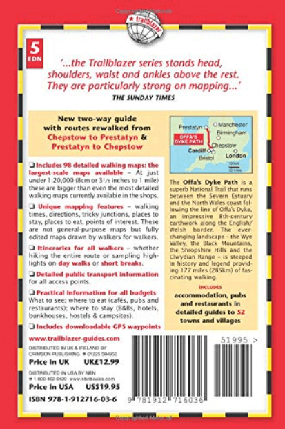
Productomschrijving: (British Walking Guide) The Offa's Dyke Path is a superb National Trail that runs from the North Wales coast to the Severn Estuary following the line of Offa's Dyke (283 km), an impressive 8th-century earthwork along the English/Welsh border. The ever-changing landscape – the Clwydian Range, the Shropshire Hills AONB, the Black Mountains and the Wye Valley – is steeped in history and legend providing 177 miles (285km) of fascinating walking.
- 98 maps- 32 colour pages including 3pp colour flower guide
- 120mm x 180mm, 5" x7" - Includes 98 detailed walking maps - Unique mapping features
- Itineraries for all walkers
- Detailed public transport information for all access points.
- Practical information for all budgets.
Artikelen uit dezelfde regio

Wandelkaartv OL14 Wye Valley, Forest of Dean & Dyfryn Gwy - OS • 9780319263839
Wandelkaartv Wye Valley, Forest of Dean & Dyfryn Gwy - OS Productomschrijving: Parts of Offa's Dyke Path, on the border of England & Wales. Omvat: Wye Valley, Forest of Dean & Dyfryn Gwy, Wye Valley AONB, Daffodil Way, Gloucestershire Way, Herefordshire Way, Jubilee Way, Offa's Dyke Path, Severn Way, Thames & Severn Way, Three Coastal Walk, Wales Coast Path, Wye Valley Walk & Wysis Way…

Wandelkaart 241 Shrewsbury- shropshire England - OSI • 9780319244340
Wandelkaart Shrewsbury - shropshire England Omvat ook: Wem, Shawbury & Baschurch. Productbeschrijving: De Shropshire en Severn Way kruis in Shrewsbury. Neem de tijd om met deze OS Explorer kaart 241 de middeleeuwse stad en de historische gebouwen te ontdekken. Buiten de stad zijn er kleine bossen en heidevelden om te verkennen. De OS Explorer kaart voor Shrewsbury is beschikbaar in zow…

Wandelkaart 125 Bala & Lake Vyrnwy- Gwynedd - OSI • 9780319262238
Wandelkaart Bala & Lake Vyrnwy- Gwynedd Wales - OSI Productbeschrijving: Kaart nummer 125 is een all purpose kaart vol gepakt met informatie om u het gebied te helpen leren kennen. De 204 Landranger-kaarten bestrijken het land. Elke kaart heeft een oppervlakte van 40 km door 40 km (25 mijl door 25 mijl) en zoals andere kaarten van Ordnance Survey, National Grid-vierkanten worden verstrekt…

Wandelkaart 220 Birmingham Walsall & Solihull - OSI • 9780319470923
Wandelkaart Birmingham- Walsall- Solihull & Redditch - England Omvat ook: Walsall, Solihull & Redditch. Productbeschrijving: Kaart nummer 220 in de OS Explorer reeks beslaat het gebied in de Midlands rond Birmingham en Solihull. Hij omvat de omgeving van Walsall en het bos van Mercia in het noorden van de kaart, naar Redditch in het zuiden. Hier lopen de paden van de Beacon Way, de Gra…
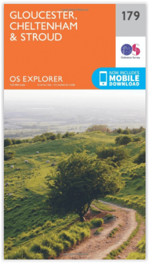
Wandelkaart 179 Gloucester- Cheltenham & Stroud - OSI • 9780319243725
Wandelkaart Gloucester- Cheltenham & Stroud - Gloucestershire Productbeschrijving: Gloucester & Cheltenham 179 / Gloucester, Cheltenham & Stroud, Gloucestershire, England - Kaart nummer 179 in de OS Explorer reeks heeft betrekking op de omgeving van Gloucester, Cheltenham, Stroud. Hoogtepunten van het gebied zijn onder meer: The Cotswolds AONB gebied van uitzonderlijke natuurlijke scho…