

Wandelgids Loch Lomond & the Trossachs walking - Cicerone
70 graded low-level, mid-level and mountain walks


Korte omschrijving
Wandelgidsen Argyll & Bute, Schotland, Stirling, Schotland, Dunbartonshire, Schotland en Loch Lomond, Schotland van CICERONE Press. Ideaal voor tochten in Schotland.
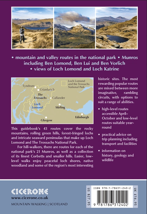
Loch Lomond & the Trossachs walking - Cicerone Productomschrijving: A guide to walking and scrambling routes in the beautiful Loch Lomond and the Trossachs National Park. Over 70 graded low-...

Specificaties
- Uitgever: CICERONE Press
- ISBN-13: 9781786312402
- HOOFDCATEGORIEËN: Wandelgids
- Activiteiten: Wandelen, Hiking & Trekking
- Regio: Argyll & Bute, Schotland, Dunbartonshire, Schotland, Loch Lomond, Schotland, Stirling, Schotland
- Land: Schotland
- Nationale parken: Trossachs NP, Schotland
- Editie: 3
- Taal: Engels
Volledige omschrijving
Loch Lomond & the Trossachs walking - Cicerone
Productomschrijving: A guide to walking and scrambling routes in the beautiful Loch Lomond and the Trossachs National Park. Over 70 graded low-level, mid-level and mountain walks taking in hills, glens and picturesque woodland, as well as all of the region's Munro summits. Highlights include Ben Lui, Ben Lomond, the Cobbler and the Arrochar Alps.
Seasons:
Year round. Spring and early summer are the very best time for high and low level routes. Mountain routes under snow require winter hillwalking experience, clothing and equipment.
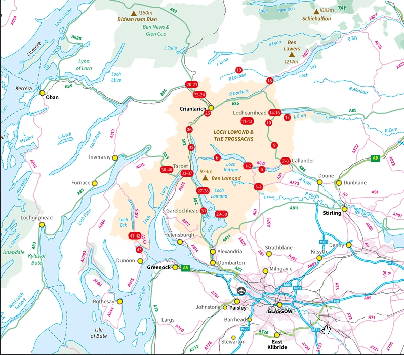
Centres:
Aberfoyle, Callander, Lochearnhead, Killin, Tyndrum, Crianlarich, Loch Lomond side, Arrochar, Lochgoilhead. Daywalks can be reached by car from Glasgow, Stirling and Edinburgh.
Difficulty:
Routes (which are graded 1-5 for difficulty) for all abilities, from woodland and lochside routes, to long mountain days, some of which are on rocky ground. The summit of the Cobbler is an exposed scramble.
Must See:
Ben Lomond. Arrochar Alps and The Cobbler. Oakwoods of the Trossachs. Ben Lui. The Cowal peninsular, and the Fairy Knowe at Aberfoyle.
Artikelen uit dezelfde regio

Wandelkaart 47 Tobermory & North Mull- Argyl & Bute - OSI • 9780319473702
Wandelkaart Tobermory & North Mull - Argyl & Bute Schotland Productbeschrijving: OS Landranger kaart 47 heeft betrekking op het eiland Mull, onderdeel van Coll, en omvat Tobermory en Ardnamurchan. De OS Landranger kaarten reeks heeft betrekking op Groot-Brittannië met 204 gedetailleerde kaarten, perfect voor dagtochten en korte pauzes. Elke kaart bevat alle informatie die u nodig heeft om …

Wandelkaart 359 Oban- Kerrera & Loch Melfort- Schotland • 9780319472309
Wandelkaart Oban- Kerrera & Loch Melfort - Argyl & Bute Schotland Omvat ook: The Garvellachs. Productbeschrijving: Kaart nummer 359 omvat Oban, Kerrera en Loch Melfort. Hoogtepunten zijn de nationale Scenic Area van Scarba, de Lunga en de Garvellachs. Ook Luing, Seil, Loch Scammadale en Loch Tralaig. De OS Landranger kaarten reeks heeft betrekking op Groot-Brittannië met 204 gedeta…
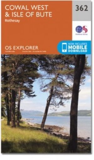
Wandelkaart 362 Cowal West & Isle of Bute- Argyl & Bure • 9780319472330
Wandelkaart Cowal West & Isle of Bute - Argyl & Bute Schotland Omvat ook: Rothesay. Productbeschrijving: Kaart nummer 362 omvat Cowal West, Rothesay en the Isle of Bute. Hoogtepunten zijn Kyles of Bute, Loch Riddon en Loch Lomond en de Trossarchs National Park. Omvat ook Loch Fyne, Garbhallt en Kingarth. De OS Explorer kaart voor Cowal West & Isle of Bute is beschikbaar in zowel de sta…

Wandelkaart OL37 Cowal East- Dunoon & Iverary - OSI • 9780319469552
Wandelkaart Cowal East- Dunoon & Iverary - Argyl & Bute Omvat ook: Dunoon & Inveraray Productbeschrijving: Kaart nummer OL 37 omvat Cowal East, Dunoon & Inveraray. Hoogtepunten Loch Lomond en de Trossachs National Park, Argyll Forest Park en Kyles of Bute. Ook Loch Fyne, Holy Loch en West Island way. Deze kaart vervangt de vorige OS Explorer kaart 363 voor dit gebied. De OS Explorer ka…

Wandelkaart XT25 Arrochar Alps - Harvey maps • 9781851376063
Wandelkaart - XT25 Arrochar Alps - Harvey maps Productomschrijving: De Arrochar Alps zijn een bergketen gelokalliseerd rond de "Loch Long", "Loch Fine" & "Loch Goil" in de Argyl & Bute regio in de schotse Highlands, in het Trossachs nationale park. Gelegen dicht bij de dorpen van Arrochar en Lochgoilhead, op de Cowal Peninsula in de Argyll and Bute regio in Schotland. Deze bergketen is een…