

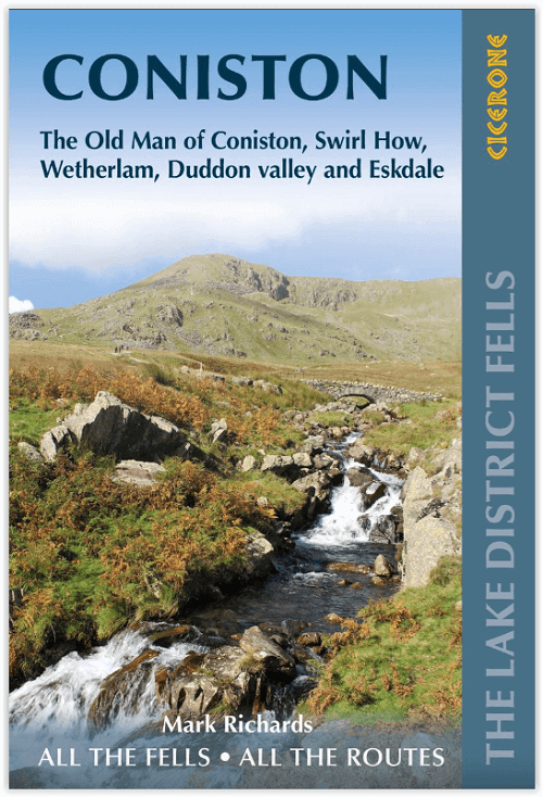
Wandelgids Coniston walking guide - Cicerone Press
23 toppen in de Southern Fells of the Lake District
Korte omschrijving
Wandelgidsen Cumbria, England van CICERONE Press. Ideaal voor tochten in England.
Wandelgids - Coniston walking guide - Cicerone Press Productomschrijving: Lakeland Fellranger-gids met 23 toppen in de Southern Fells of the Lake District, met een breed scala aan beklimming...

Specificaties
- Uitgever: CICERONE Press
- ISBN-13: 9781786310392
- HOOFDCATEGORIEËN: Wandelgids
- Activiteiten: Wandelen, Hiking & Trekking
- Auteur: Mark Richards
- Regio: Cumbria, England
- Land: England
- Nationale parken: Lake District NP, Cumbria England
- Editie: 2
- Taal: Engels
Volledige omschrijving
Wandelgids - Coniston walking guide - Cicerone Press
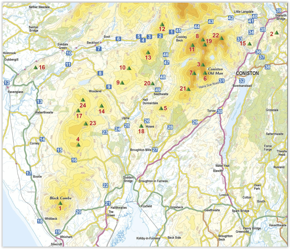
Productomschrijving: Lakeland Fellranger-gids met 23 toppen in de Southern Fells of the Lake District, met een breed scala aan beklimmingen. Er zullen hier grote valdagen zijn, tussen de passen van Wrynose en Hardknott, Black Combe in het zuiden en Muncaster in het westen, met heuvels waaronder Coniston Old Man, Wetherlam en Stickle Pike.
Engelse omschrijving: Lakeland Fellranger guidebook covering 23 summits in the Southern Fells of the Lake District, with a wide range of ascents. Great fell days are to be had here, between Wrynose and Hardknott passes, Black Combe in the south and Muncaster in the west, with fells including Coniston Old Man, Wetherlam and Stickle Pike.
Seasons:
Suitable all-year round walks. Winter walking, even on the lower fells of the Lakes, is not for the inexperienced or under-equipped.
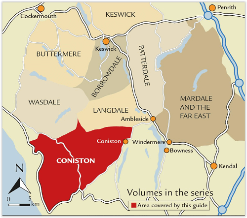
Centres:
Great Langdale, Ambleside, Borrowdale, Keswick, Wasdale Head.
Difficulty:
Straightforward, short ascents, often not on clear paths, to be used as a basis for readers' own walks. Navigational skills needed but no specialist equipment. Any scrambling is easy and non-scrambling options are always provided.
Must See:
A fresh perspective on classic Lakeland summits like Scafell Pike, Bowfell and the Crinkles, and inspiring introduction to lesser-known fells such as Hard Knott, Rossett Pike and Whin Rigg, with crystal-clear Harvey mapping and the author's detailed elevation diagrams and panoramas.
Artikelen uit dezelfde regio

Wandelgids Hadrian's wall Path - Knife Edge • 9781912933075
Wandelgids - Hadrian's wall Path - Knife Edge Productomschrijving: De definitieve tweerichtingsgids voor het Hadrian's Wall Path: zowel oostwaartse als westelijke routes worden volledig beschreven. 14 verschillende routes: schema's van 3, 4, 5, 6, 7, 8 en 9 dagen voor wandelaars en hardlopers. Omvat reisroutes naar het noorden en het zuiden. De moeilijkere berekeningen van tijd, afstand en…

Wandelkaart OL05 English Lakes - North Eastern area - OS • 9780319264003
Wandelkaart English Lakes - North Eastern area - OS Productomschrijving: Een topografische wandelkaart van het noordoostelijke deel van de Lake District National park. Omvat: English Lakes - North Eastern area, Penrith, Patterdale & Caldbeck, Parts of the Lake District, and The Cumbria Way. Ontdek de OL-serie van Ordnance Survey: De OL-serie (Outdoor Leisure) van Ordnance Survey …

Wandelgids 015 Pathfinder guides Yorkshire Dales NP - OS • 9780319090404
Wandelgids Yorkshire Dales NP - OS Productomschrijving: Pathfinder Yorkshire Dales covering parts of the National Park, Ribblesdale and Swaledale. This selection offers interest, regional variety and balance of routes in the Yorkshire Dales providing the best walks in the area. From an easy stroll through Ingleton Waterfalls to the much more challenging walks in Gunnerside, this volume co…
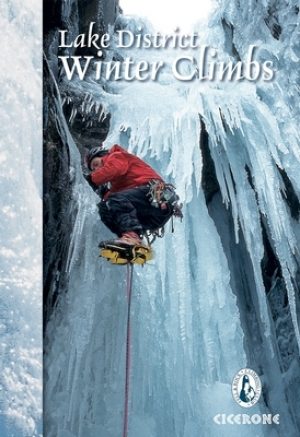
Klimgids Lake District winter climbs - Cicerone • 9781852847166
Klimgids - Lake District winter climbs - Cicerone Productomschrijving: Een onmisbare gids voor de beste winter klimroutes in het Lake District. Alle bekende routes in elk deel van de Meren zijn beschreven. Van klassieke hoge-berg afvoerputten en steunberen op de rotsen zoals Scafell, Pilar en Great Gable tot bevroren waterlopen en ijs(water)vallen met inbegrip van Great Gully op de Wasdale…
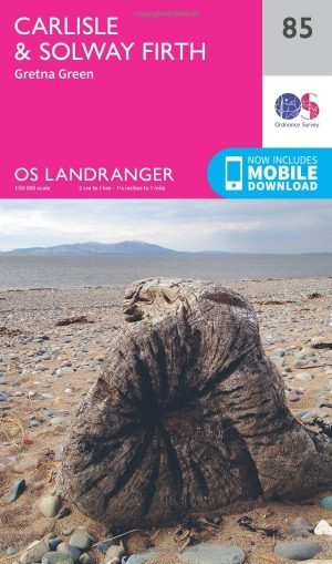
Wandelkaart 85 Carlisle & Solway Firth- Cumbria England - OSI • 9780319261835
Wandelkaart Carlisle & Solway Firth - Cumbria England Productbeschrijving: Deze kaart van Carlisle & Solway Firth omvat ook Gretna Green, Annan, Canonbie, Brydekirk, Dalton, Kirkbride, Silloth, Wigton, Thursby evenals deel van het Lake District National Park en deel van Hadrianus Wall path. De OS Landranger kaarten reeks heeft betrekking op Groot-Brittannië met 204 gedetailleerde kaart…