

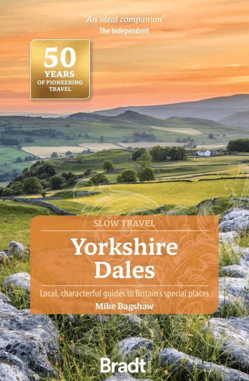
Reisgids Go Slow Yorkshire Dales NP - Bradt Travel guides
Met Nidderdale AONB (Area of Outstanding Natural Beauty)
Korte omschrijving
Reisgidsen Yorkshire, England en Yorkshire Dales van Bradt guides. Ideaal voor tochten in England.
Reisgids Yorkshire Dales NP - Bradt Productomschrijving: Deze nieuwe, grondig bijgewerkte derde editie van Yorkshire Dales (Slow Travel), onderdeel van Bradt's serie kenmerkende 'Slow' reisg...

Specificaties
- Uitgever: Bradt guides
- ISBN-13: 9781804692165
- HOOFDCATEGORIEËN: Reisgids
- Activiteiten: Toerisme
- Auteur: Mike Bagshaw
- Regio: Yorkshire Dales, Yorkshire, England
- Land: England
- Nationale parken: Yorkshire Dales NP, England
- AONB - Area of Outstanding Beauty/National Landscape: Nidderdale AONB
- Editie: 3
- Taal: Engels
- Reeks/Serie: Go slow, Bradt guides
- De Engelse Graafschappen: Yorkshire
Volledige omschrijving
Reisgids Yorkshire Dales NP - Bradt
Productomschrijving: Deze nieuwe, grondig bijgewerkte derde editie van Yorkshire Dales (Slow Travel), onderdeel van Bradt's serie kenmerkende 'Slow' reisgidsen voor lokale regio's in het Verenigd Koninkrijk, blijft de meest uitgebreide gids voor het gebied en beslaat het hele Yorkshire Dales National Park en Nidderdale Area of Outstanding Natural Beauty plus nabijgelegen 'slow' en historische steden en dorpen.
Het Yorkshire Dales National Park had uitgevonden kunnen zijn voor moderne reizen. De grotten, valleien, watervallen en kalksteengeologie van de regio zijn wereldberoemd. Op korte loopafstand vind je traditionele pubs en cafés die perfect geschikt zijn voor de filmset en waar de kans groot is dat je een praatje maakt met herders en beroemdheden.
Engelse omschrijving: This new, thoroughly updated third edition of Yorkshire Dales (Slow Travel), part of Bradt’s series of distinctive ‘Slow’ travel guides to local UK regions, remains the most comprehensive guide to the area and covers the whole of the Yorkshire Dales National Park and Nidderdale Area of Outstanding Natural Beauty plus nearby ‘slow’ and historic towns and villages.
The Yorkshire Dales national park could have been invented for modern travel. The region’s cinematic caves, valleys, waterfalls and limestone geology are famous round the world. Within a short walk are filmset-perfect traditional pubs and cafes where you are as likely to chat to shepherds as celebrities.
The Dales have never been places to hurry. In the new travel world where ‘slow’, ‘sustainable’ and ‘local’ are many people’s watchwords, this remarkable English region offers much to savour at leisure – like one of its renowned artisan cheeses or beers. Written and updated by two Yorkshire residents and outdoors enthusiasts, Bradt’s Yorkshire Dales complements well-known honeypots (Aysgarth Falls, Malham, Grassington) with off-piste gems that you’ll have to yourself, whether wild swimming spots, hidden caves, Dark Skies sites or traditional stone villages.
With hundreds of square kilometres of open-access land to explore, the Dales are one of the UK’s premier hillwalking destinations, hosting much-loved routes such as the Pennine Way, Three Peaks, Dales Way and the recently upgraded Coast to Coast. The Dales have also become known as one of England’s finest places for cycling, whether for family trips, e-bikers or hardcore road racers, prompting hopes that the Tour de Yorkshire will return.
Drop in to the Tan Hill Inn, Britain’s highest pub, where sheep regularly warm themselves by the roaring fire; journey into the depths of Gaping Gill, one of Britain’s largest underground chambers; visit book-loving Sedbergh, where even the bus stops have bookshelves; or take a scenic rail trip on the famous Settle-Carlisle line, crossing the country’s longest railway viaduct. History buffs will love medieval castles including Skipton and Richmond, while wildlife-watchers will enjoy the birds of sparkling rivers and limestone-pavement flora. Bradt’s Yorkshire Dales (Slow Travel) is the perfect companion for a successful trip.
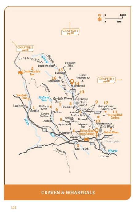
Locatie op kaart
Artikelen uit dezelfde regio

Reisgids Walking the Wharfe - Bradt travel Guides • 9781804691106
Walking the Wharfe - Bradt travel Guides Productomschrijving: In een wereld van globetrottende ontdekkingsreizigers en recordbrekende reizen - waar hij zelf ook deel van uitmaakte - besloot Johno Ellison terug te keren naar zijn roots en de hele lengte van de rivier Wharfe te lopen, de waterweg in Yorkshire waar hij opgroeide. In zijn nieuwe boek voor Bradt, Walking the Wharfe, volgt Ellis…

Wandelkaart 289 Leeds- Harrogate- Wetherby & Pontefract - OSI • 9780319244869
Wandelkaart Leeds- Harrogate- Wetherby & Pontefract England Productbeschrijving: OS Explorer kaart 289 dekt Harrogate tot Pontefract, met inbegrip van Leeds en de rivieren Nidd, rivier, Aire en Calder. Hoogtepunten omvatten de Dales Way en de Trans Pennine Trail. De OS Explorer kaart voor Leeds is beschikbaar in zowel de standaard papieren versie en weerbestendige 'Actief' versie. Prod…

Mountainbikegids Yorkshire Dales mountain biking - Cicerone • 9781852846763
Mountainbikegids - Yorkshire Dale mountain biking - Cicerone Productomschrijving: Een handige gids over 30 korte, middellange, lange en volledig-dag MTB routes over het Yorkshire Dales National Park, de speeltuin van de bergfietser van Noord-Engeland. Circulaire ritten bezoeken de grote valleien en nemen lussen rond twee van de drie pieken, Whernside en Pen-y-Gent. Kies een route door midd…

Wandelgids Northern England Coast to Coast walk - Cicerone • 9781852847593
Wandelgids - Northern England Coast to Coast walk - Cicerone Productomschrijving: Een wandelgids, uitgebreid in zijn genre, die u van kust naar kust brengt in de noordelijke regio's van Engeland. Deze streek is gekenmerkt door zijn geschiedenis met resten van zelf nog de Romeinse tijd. De regio is ook bekend om zijn Hadrian's Wall path. Product description: First devised by Alfred Wain…

Wandelkaart 291 Goole & Gilberdyke- Yorkshire - OSI • 9780319244883
Wandelkaart Goole & Gilberdyke - Yorkshire England Productbeschrijving: Holme-on-Spalding-Moor, Hemingbrough & Howden. 291 / Goole & Gilberdyke, Yorkshire, England - Aan het begin van de Humber toont OS Explorer kaart 291 de rivieren de Ouse en de Trent, de stad van Goole en het omliggende gebied. Hoogtepunten zijn de Bubwith Rail Trail, Hoden 20 recreatieve paden en de Trans Pennine …