

Wandelgids The Cleveland Way & Yorkshire Wolds Way - CIcerone
Cleveland Way - Yorkshire Wolds Way - Tabular Hills Walk
Korte omschrijving
Wandelgidsen Yorkshire, England van CICERONE Press. Ideaal voor tochten in England.
Wandelgids The Cleveland Way & Yorkshire Wolds Way - CIcerone Productomschrijving: De vernieuwede wandelgids over de Cleveland Way en Yorkshire Wolds Way National Trails, plus de Tabular Hil...

Specificaties
- Uitgever: CICERONE Press
- ISBN-13: 9781786312211
- HOOFDCATEGORIEËN: Wandelgids
- Activiteiten: Wandelen, Hiking & Trekking
- Auteur: Paddy Dylan
- Regio: Yorkshire, England
- Land: England
- Nationale parken: North York Moors NP, England
- Editie: 3
- Taal: Engels
- Reeks/Serie: National Trails, UK
- De Engelse Graafschappen: Yorkshire
- National Trails UK, England & Wales: Cleveland Way, England
Volledige omschrijving
Wandelgids The Cleveland Way & Yorkshire Wolds Way - CIcerone
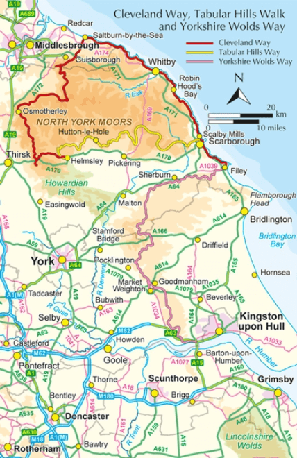
Productomschrijving: De vernieuwede wandelgids over de Cleveland Way en Yorkshire Wolds Way National Trails, plus de Tabular Hills Walk. De drie routes lopen door het North York Moors National Park, langs de kust en op het rustige platteland en kunnen worden samengevoegd tot een gemakkelijke rondwandeling van meer dan 400 km. Inclusief een 1:25.000 schaal OS kaartboekje van de Cleveland Way.
Aparte Map booklet beschikbaar hieronder!
Engelse omschrijving: A walking guidebook to the Cleveland Way and Yorkshire Wolds Way National Trails, plus the Tabular Hills Walk. Crossing the North York Moors National Park, coastal scenery and quiet countryside, the three routes can be joined to create an easy circular route of over 250 miles (400km). Includes a 1:25,000 scale OS map booklet of the Cleveland Way.
Seasons:
All year round, though winter can be bleak and wet on the moors.
Centres:
Scarborough, Whitby, Filey, Helmsley, Osmotherley.
Difficulty:
Suitable for all: the trails are divided into sections ranging from 2½-12 miles. There are some isolated stretches.
Must See:
Yorkshire's Heritage Coast; Ryedale Folk Museum; Rievaulx Abbey; Whitby; historic villages; moorland scenery.
Dorpen & Steden:
Scarborough, Whitby, Filey, Helmsley, Osmotherley
Inhoudsopgave:
The Yorkshire Wolds Way National Trail
Stage 1 Hessle to South Cave
Stage 2 South Cave to Goodmanham or Market Weighton
Stage 3 Goodmanham or Market Weighton to Millington
Stage 4 Millington to Thixendale
Stage 5 Thixendale to Sherburn
Stage 6 Sherburn to Filey
Stage 7 Filey to Scalby Mills (via the Cleveland Way)
The Tabular Hills Walk:
Stage 1 Scalby Mills to Levisham
Stage 2 Levisham to Hutton-le-Hole
Stage 3 Hutton-le-Hole to Helmsley
The Cleveland Way National Trail:
Stage 1 Helmsley to Sutton Bank
Stage 2 Sutton Bank to Osmotherley
Stage 3 Osmotherley to Clay Bank
Stage 4 Clay Bank to Kildale
Stage 5 Kildale to Saltburn-by-the-Sea
Stage 6 Saltburn-by-the-Sea to Sandsend
Stage 7 Sandsend to Robin Hood’s Bay
Stage 8 Robin Hood’s Bay to Scarborough
Stage 9 Scarborough to Filey

Gekoppelde artikelen
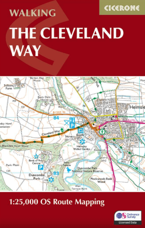
Wandelgids The Cleveland Way Map Booklet - Cicerone • 9781786312228
standaard versieThe Cleveland Way Map Booklet - Cicerone Productomschrijving: Kaartboekje van de Cleveland Way National Trail, een 177 km lange wandeling rond het North York Moors National Park. Dit boekje is inbegrepen bij de Cicerone gids voor de Cleveland Way en de Yorkshire Wolds Way en toont de volledige route van de Cleveland Way op OS 1:25.000 kaarten. Dit kaart Boekje zit reeds gratis bijgevoe…
Artikelen uit dezelfde regio
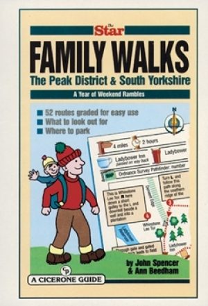
Wandelgids Peak District & South Yorkshire - Cicerone • 9781852842574
Wandelgids - Peak District & South Yorkshire - Cicerone Productomschrijving: Een gids naar 52 korte circulaire wandelingen in het Peak District en Zuid-Yorkshire, in Noord-Engeland, aangepast door plaatselijke Sheffield krant "The Star Weekend walking kolom". Routes zijn 2 tot 3 uur lang, dus ideaal voor gezinnen. Winnaar van de beste gids van COLA/OWG 1998. Allemaal binnen een uur van She…
Wandelgids Walking South Yorkshire 30 circular walks - Vertebrate • 9781906148218
Walking South Yorkshire 30 circular walks - Vertebrate Productomschrijving: 30 circular walks exploring the ancient woodland around Sheffield, Rotherham and Barnsley. Walking South Yorkshire by Rob Haslam is a collection of 30 circular walks of South Yorkshire, between 2 and 8 miles (3 and 13 km) in length, that explore the ancient woodland and rural visitor attractions around Sheffiel…

Wandelgids The Cleveland Way - Rucksack Readers • 9781898481973
Wandelgids Cleveland Way - Rucksack Readers Productomschrijving: De Cleveland Way is één van de oudste en meest geliefde National Trails van Engeland. De route loopt over een afstand van 174 km rond het North York Moors National Park en begint in het binnenland bij Helmsley, met een panoramisch uitzicht over de valleien van York en Mowbray en vanaf de Cleveland Hills. Na de kust bij Saltb…
Wandelkaart North York Moors Oost XT40 - Harvey Maps • 9781851376230
Wandelkaart North York Moors Oost - Harvey Maps Productomschrijving: Omvat een groot gebied maar is praktisch en compact, zakformaat. Gedetailleerde kaart voor lopers en wandelaars van het oostelijk gedeelte van het Nationaal Park North York Moors. Omvat: Robin Hood's Bay, Flyingdales Moor en het populaire Rosedale Abbey. - De North Yorkshire Steam spoorweg en de Lyke Wake Walk zij…
Wandelkaart 295 Bridlington- Driffield & Hornsea - OSI • 9780319245477
Wandelkaart Bridlington- Driffield & Hornsea - Yorkshire Productbeschrijving: 295 / Bridlington, Driffield & Hornsea, East Riding of Yorkshire, England - Van Hornsea langs de kust naar Bridlington en de binnenvaart tot Driffield. OS Explorer kaart 295 is de perfecte partner voor al uw outdoor avonturen. Het omvat ook delen van vier recreatieve paden: landtong way, Hornsea Rail Trail,…