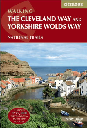
Wandelgids The Cleveland Way Map Booklet - Cicerone
Kaartboekje van de Cleveland Way National Trail - 177 Km
Korte omschrijving
The Cleveland Way Map Booklet - Cicerone Productomschrijving: Kaartboekje van de Cleveland Way National Trail, een 177 km lange wandeling rond het North York Moors National Park. Dit boekje ...

Specificaties
- Uitgever: CICERONE Press
- ISBN-13: 9781786312228
- HOOFDCATEGORIEËN: Wandelkaart
- Activiteiten: Wandelen, Hiking & Trekking
- Auteur:: Paddy Dylan
- Regio: Yorkshire, England
- Land: England
- Lange afstand wandelroutes: Cleveland Way (177km)
- Nationale parken: North York Moors NP, England
- TOPO's & Stafkaarten: Topografisch wandelen
- Schaal: 1:25000
- Editie: 2, 3
- Taal: Engels
- Reeks/Serie:: Map Booklet, Cicerone, National Trails, UK
Volledige omschrijving
The Cleveland Way Map Booklet - Cicerone
Productomschrijving: Kaartboekje van de Cleveland Way National Trail, een 177 km lange wandeling rond het North York Moors National Park. Dit boekje is inbegrepen bij de Cicerone gids voor de Cleveland Way en de Yorkshire Wolds Way en toont de volledige route van de Cleveland Way op OS 1:25.000 kaarten.
Dit kaart Boekje zit reeds gratis bijgevoegd bij de gids van de Cleveland Way zelf!, hieronder te vinden.
Engelse omschrijving: Map booklet of the Cleveland Way National Trail, a 177km (110 mile) walk around the North York Moors National Park. This booklet is included with the Cicerone guidebook to the Cleveland Way and the Yorkshire Wolds Way, and shows the full route of the Cleveland Way on OS 1:25,000 maps.
Seasons:
All year round, though winter can be bleak and wet on the moors.
Centres:
Scarborough, Whitby, Filey, Helmsley, Osmotherley.
Difficulty:
Suitable for all: In the related guidebook the trail is divided into sections ranging from 2½-12 miles. There are some isolated stretches.
Must See:
Yorkshire's Heritage Coast; Ryedale Folk Museum; Rievaulx Abbey; Whitby; historic villages; moorland scenery.
The Yorkshire Wolds Way National Trail:
Stage 1 Hessle to South Cave Stage 2 South Cave to Goodmanham or Market Weighton Stage 3 Goodmanham or Market Weighton to Millington Stage 4 Millington to Thixendale Stage 5 Thixendale to Sherburn Stage 6 Sherburn to Filey Stage 7 Filey to Scalby Mills (via the Cleveland Way)The Tabular Hills Walk:
Stage 1 Scalby Mills to Levisham Stage 2 Levisham to Hutton-le-Hole Stage 3 Hutton-le-Hole to Helmsley The Cleveland Way National Trail Stage 1 Helmsley to Sutton Bank Stage 2 Sutton Bank to Osmotherley Stage 3 Osmotherley to Clay Bank Stage 4 Clay Bank to Kildale Stage 5 Kildale to Saltburn-by-the-Sea Stage 6 Saltburn-by-the-Sea to Sandsend Stage 7 Sandsend to Robin Hood’s Bay Stage 8 Robin Hood’s Bay to ScarboroughStage 9 Scarborough to Filey
.png)
Gekoppelde artikelen

Wandelgids The Cleveland Way & Yorkshire Wolds Way - CIcerone • 9781786312211
standaard versieWandelgids The Cleveland Way & Yorkshire Wolds Way - CIcerone Productomschrijving: De vernieuwede wandelgids over de Cleveland Way en Yorkshire Wolds Way National Trails, plus de Tabular Hills Walk. De drie routes lopen door het North York Moors National Park, langs de kust en op het rustige platteland en kunnen worden samengevoegd tot een gemakkelijke rondwandeling van meer dan 400 km. In…
Artikelen uit dezelfde regio

Reisgids Yorkshire - Rough Guides • 9781835290583
Reisgids Yorkshire - Rough Guides Productomschrijving: The Rough Guide to Yorkshire was the first comprehensive guidebook to England’s largest county. Detailed coverage of the ruggedly beautiful Dales and Moors, the magnificent North Sea coast and historic York rubs shoulders with penetrating insights into the multi-cultural cities of Leeds and Sheffield, the resurgent port of Hull, and th…

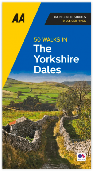
Wandelgids Yorkshire Dales - 50 walks guide - AA Publishing • 9780749583309
Yorkshire Dales - 50 walks guide - AA Publishing Productomschrijving: Wandelen is een van de favoriete vrijetijdsbestedingen van Groot-Brittannië, en deze AA gids - 50 wandelingen in de Yorkshire Dales NP bevat een verscheidenheid aan uitgestippelde wandelingen van 3 tot 12 km, voor alle niveaus. Het boek bevat alle praktische details die u nodig hebt, vergezeld van boeiende achtergrondinf…

Fietsgids West Yorkshire Mountain Biking - Vertebrate Publ. • 9781906148157
West Yorkshire Mountain Biking - Vertebrate Productomschrijving: West Yorkshire Mountain Biking - South Pennine Trails features 23 of the best mountain bike rides in West Yorkshire, between 10.5km and 32km in length, suitable for all levels of mountain bikers. Written by local expert and MTB journalist Benjamin Haworth, each route features clear and easy to use Ordnance Survey 1:50,000 map…

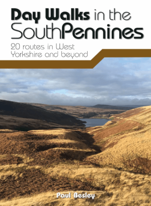
Wandelgids Day Walks in the Southern Pennines - Vertebrate Publ. • 9781912560653
Day Walks in the Southern Pennines - Vertebrate Productomschrijving: 20 routes in West Yorkshire and beyond Day Walks in the South Pennines features 20 circular walks between 5 and 18 miles (8km and 29 km) in length, spread across West Yorkshire, Lancashire and Greater Manchester. Researched and written by knowledgeable and experienced author Paul Besley, the walks range from gentle r…

Wandelgids Day Walks in the Yorkshire Dales NP - Vertebrateg Publ • 9781906148225
Day Walks in the Yorkshire Dales NP - Vertebrateg Productomschrijving: 20 circular routes in the Central Pennines Day Walks in the Yorkshire Dales NP is the fourth title in Vertebrate Publishing’s series of compact and portable hillwalking guidebooks. This book showcases 20 circular walks in the Yorkshire Dales National Park, between 6 and 11 miles (10 and 17 kilometres) in length, su…


