

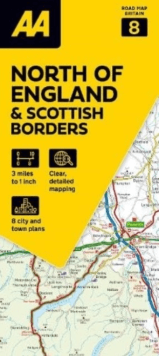
Landkaart Wegenkaart 8 Noord Engeland & Scottish Borders - AA
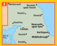
Berwick-upon-Tweed- Motherwell- Harwick- Dumfries- Carlilsle
Korte omschrijving
Wegenkaart Noord Engeland & Scottish Borders - AA Productomschrijving: AA Road Map North of England & Scottish Borders is a practical and slimline, foldable map from the experts at the AA. ...

Specificaties
- Uitgever: AA Road maps
- ISBN-13: 9780749584139
- HOOFDCATEGORIEËN: Wegenkaart - Landkaart
- Activiteiten: Street/Road maps & city plans
- Regio: Lowland Scotland & Borders, Noord Engeland, Schotse grenzen
- Land: England
- Schaal: 1:200000
- Taal: Engels
- Reeks/Serie:: AA Road maps Britain
Volledige omschrijving
Wegenkaart Noord Engeland & Scottish Borders - AA
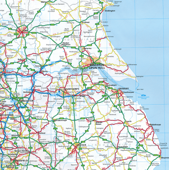
Productomschrijving: AA Road Map North of England & Scottish Borders is a practical and slimline, foldable map from the experts at the AA. Encased in a durable, weatherproof cover, the mapping is produced at a scale of 3 miles to 1 inch (1:200,000 / 2km to 1cm) combining clear design, an easy-to-read scale and more road detail to ensure that you never lose your way.
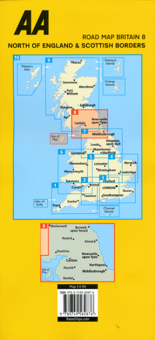
Omvat: Berwick-upon-Tweed, Motherwell, Harwick, Dumfries, Carlilsle, Newcastle-upon-Tyne, Hartepool, Kendal & Middlesborough.
Also included are toll points, service areas, road numbers, motorways, dual carriageways and wide narrow local roads, National Parks:
• Fully updated speed camera locations, plus speed cameras with speed limits shown
• Clear place name index
• 7 city and town plans
• Caravan & camping sites are pinpointed on the mapping
• National Parks and places of interest are also highlighted
• National Trust, English Heritage, Scottish and Welsh Heritage sites shown
Road Map North of England & Scottish Borders is one in a series of expertly produced road maps of Britain from the AA.
Overzichtskaarten

Wegenkaarten Landkaarten Road Maps Britain 1 > 10
Wegenkaarten Landkaarten Road Maps Britain 1 > 10
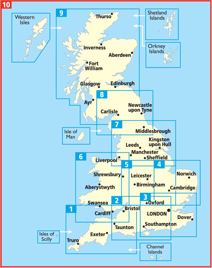
Producten op de overzichtskaart
Klik op een product om naar de detailpagina te gaan.
- Landkaart Wegenkaart 1 West Country & Wales Zuid - AA
- Landkaart Wegenkaart 2 Engeland Centr. Zuid - AA
- Landkaart Wegenkaart 3 Zuid Oost Engeland - AA
- Landkaart Wegenkaart 4 East Anglia - AA
- Landkaart Wegenkaart 5 Midlands & Central Engeland - AA
- Landkaart Wegenkaart 6 Wales - AA
- Landkaart Wegenkaart 7 Noord Engeland - AA
- Landkaart Wegenkaart 8 Noord Engeland & Scottish Borders - AA
- Landkaart Wegenkaart 9 Schotland - AA
- Landkaart Wegenkaart 10 Groot Brittannië - AA Publishing
Artikelen uit dezelfde regio
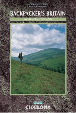
Wandelgids Northern England Backpacker's - Cicerone • 9781852843205
Wandelgids - Northern England Backpacker's - Cicerone Productomschrijving: Een gids van 25 wandelroutes voor grote backpacker overal in Noord-Engeland van de Yorkshire Dales en het Forest of Bowland, het Lake District, de Pennines, en tot de Cheviots op de Schotse grens. Taaie routes te doen in een dag, maar wel goede tweedaagse uitstapjes op externe plaatsen. Een full-color gids voor 25 g…
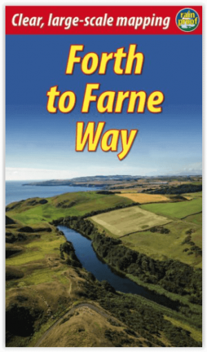
Wandelgids Forth to Farne Way - Schotland - Rucksack Readers • 9781898481966
Wandelgids Forth to Farne Way - Schotland Productomschrijving: Deze inspirerende pelgrimsroute van 110 mijl begint vanuit North Berwick aan de Firth of Forth bij Edinburgh en gaat verder via de 12e-eeuwse kerk van Whitekirk naar Dunbar. Het volgt de Noordzeekust naar het adembenemende landschap van St-Abb's Head en bezoekt Coldingham Priory, misschien wel het belangrijkste benedictijnenklo…

Wandelkaart OL37 Cowal East- Dunoon & Iverary - OS • 9780319242766
Wandelkaart Cowal East- Dunoon & Iverary - OS Productomschrijving: Cowal East- Dunoon & Iverary, & Part of Loch Lomond & The Trossachs National Part. Omvat: Cowal East- Dunoon & Iverary, & Part of Loch Lomond & The Trossachs National Part, Argyll Forest Park, Kyles of Bute National Scenic Area, Cowal Way & the West Island Way. Ontdek de OL-serie van Ordnance Survey: De OL-serie (…

Wandelkaart 338 Galashiels Selkirk & Melrose - OSI • 9780319472101
Wandelkaart Galashiels- Selkirk & Melrose - Scotisch Borders Omvat ook: St-Boswell’s & Lauder. Productbeschrijving: Kaart nummer 338 dekt Galashiels, Selkirk en Melrose. Hoogtepunten zijn onder andere Eilon en Leaderfoot, Southern Upland Way en Borders Abbeys Way. Omvat ook Lauder, St. Boswells, Bloomfield en Fountainhall. De OS Explorer kaart voor Galashiels, Selkirk & Melrose is besc…

Wandelkaart 337 Peebles & Interleithen - OSI • 9780319472095
Wandelkaart Peebles & Interleithen - Schotisch borders Omvat ook: Eddleston & Ettrickbridge Traquair & Yarrow. Productbeschrijving: OS Explorer kaart 337 dekt Peebles, Zeist en de omliggende dorpen. Deze kaart toont deel van de "Southern Upland Way" (deel van de E2 Europese Long Distance pad) en de Peebles end van "John Buchan Way", samen met deel van de bovenste Tweeddale nationale Sc…