

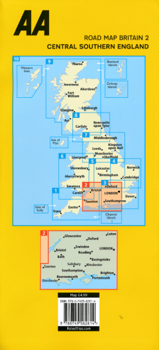
Landkaart Wegenkaart 2 Engeland Centr. Zuid - AA
Gloucester- Luton- Oxford- Bristol- Swindon- LONDON- Reading


Korte omschrijving
Wegenkaart Centraal Zuid Engeland - AA Productomschrijving: AA Road Map Central Southern England is a practical and slimline, foldable map from the experts at the AA. Encased in a durable,...

Specificaties
- Uitgever: AA Road maps
- ISBN-13: 9780749584078
- HOOFDCATEGORIEËN: Wegenkaart - Landkaart
- Activiteiten: Street/Road maps & city plans
- Regio: South West England
- Land: England
- Schaal: 1:200000
- Taal: Engels
- Reeks/Serie:: AA Road maps Britain
Volledige omschrijving
Wegenkaart Centraal Zuid Engeland - AA
Productomschrijving: AA Road Map Central Southern England is a practical and slimline, foldable map from the experts at the AA. Encased in a durable, weatherproof cover, the mapping is produced at a scale of 3 miles to 1 inch (1:200,000 / 2km to 1cm) combining clear design, an easy-to-read scale and more road detail to ensure that you never lose your way.
Omvat: Gloucester, Luton, Oxford, Bristol, Swindon, LONDON, Reading, Basingstoke, Bath, Salisbury, Windchester, Brighton, Portsmouth, Southampton, Bournsemouth & Dorchester.
Also included are toll points, service areas, road numbers, motorways, dual carriageways and wide narrow local roads, National Parks:
• Fully updated speed camera locations, plus speed cameras with speed limits shown
• Clear place name index
• 8 city and town plans
• Caravan & camping sites are pinpointed on the mapping
• National Parks and places of interest are also highlighted
• National Trust, English Heritage, Scottish and Welsh Heritage sites shown
Road Map Central Southern England is one in a series of expertly produced road maps of Britain from the AA.

Overzichtskaarten

Wegenkaarten Landkaarten Road Maps Britain 1 > 10
Wegenkaarten Landkaarten Road Maps Britain 1 > 10
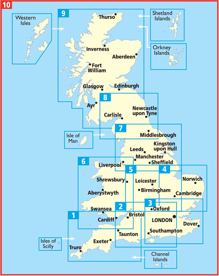
Producten op de overzichtskaart
Klik op een product om naar de detailpagina te gaan.
- Landkaart Wegenkaart 1 West Country & Wales Zuid - AA
- Landkaart Wegenkaart 2 Engeland Centr. Zuid - AA
- Landkaart Wegenkaart 3 Zuid Oost Engeland - AA
- Landkaart Wegenkaart 4 East Anglia - AA
- Landkaart Wegenkaart 5 Midlands & Central Engeland - AA
- Landkaart Wegenkaart 6 Wales - AA
- Landkaart Wegenkaart 7 Noord Engeland - AA
- Landkaart Wegenkaart 8 Noord Engeland & Scottish Borders - AA
- Landkaart Wegenkaart 9 Schotland - AA
- Landkaart Wegenkaart 10 Groot Brittannië - AA Publishing
Artikelen uit dezelfde regio

Fietsgids South West England Gravel Rides - Vertebrate Publ. • 9781839812545
South West England Gravel Rides - Vertebrate Publ. Productomschrijving: 24 gravel bike adventures in the West Country Gravel Rides South West England features 24 cycling routes, ranging from 16 to 180 kilometres, showcasing the extensive gravel trails of the West Country. Gravel enthusiast and experienced route creator Katherine Moore has taken her love of the South West and extensive …

Landkaart Wegenkaart 7 Zuidwest Engeland & Zuid Wales - OSI • 9780319263792
Wegenkaart Zuidwest Engeland & Zuid Wales - OSI Productomschrijving: Plan your journey with this series of road maps from OS. Showing all major road, rail and ferry links as well as settlements and selected features in 1: 250 000 scale, this is the ideal map for planning trips and holidays by car or cycle. OS Road 7 covers: the south-west England plus south Wales, Devon & Cornwall. …

Reisgids Go Slow Dorset - Bradt guides • 9781804691687
Reisgids Dorset - Bradt Productomschrijving: This new, thoroughly updated fourth edition of Dorset (Slow Travel), Bradt’s popular and distinctive guide, offers in-depth exploration of one of England’s most popular counties. Author Alexandra Richards, Dorset born and bred, shares local insights to offer a wider, more personal selection of places to explore than any other guide, including at…

Wandelkaart South West Coast Path 6 - Harvey maps • 9781851374472
Wandelkaart - South West Coast Path 6 - Harvey maps Productomschrijving: Waterdichte XT40 kaart van Harvey. Een ideale kaart voor wandelaars op de langste en op één van haar meest populairste nationale routes. Het loopt langs de kust van Somerset, Cornwall en Devon, Dorset van Minehead round via Land's end naar Poole. Het omvat alle 95 mijls van het World Heritage site bekend als de Jurass…

Reisgids Go Slow Cotswolds (AONB) - Bradt travel guides • 9781804691717
Reisgids Cotswolds - Bradt Productomschrijving: In deze nieuwe, grondig bijgewerkte 3e editie van Bradt's The Cotswolds, onderdeel van Bradt's kenmerkende 'Slow travel' serie van gidsen over Britse regio's, deelt lokale inwoner en ervaren reisschrijfster Caroline Mills haar favoriete plekken in een regio die onverminderd populair is. Op basis van meer dan 50 jaar wonen in de Cotswolds, en …