

Landkaart Wegenkaart 4 East Anglia - AA
Lincoln- King's Lymn- Norwich- Great Yarnmouth- Peterborough


Korte omschrijving
Wegenkaart East Anglia England - AA Productomschrijving: AA Road Map East Anglia is a practical and slimline, foldable map from the experts at the AA. Encased in a durable, weatherproof cov...

Specificaties
- Uitgever: AA Road maps
- ISBN-13: 9780749584092
- HOOFDCATEGORIEËN: Wegenkaart - Landkaart
- Activiteiten: Street/Road maps & city plans
- Regio: East Anglia, England
- Land: England
- Schaal: 1:200000
- Taal: Engels
- Reeks/Serie:: AA Road maps Britain
Volledige omschrijving
Wegenkaart East Anglia England - AA
Productomschrijving: AA Road Map East Anglia is a practical and slimline, foldable map from the experts at the AA. Encased in a durable, weatherproof cover, the mapping is produced at a scale of 3 miles to 1 inch (1:200,000 / 2km to 1cm) combining clear design, an easy-to-read scale and more road detail to ensure that you never lose your way.
Omvat: Lincoln, King's Lymn, Norwich, Great Yarnmouth, Peterborough, Northampton, Cambridge, Ipswich, Luton & Chelmsford.
Also included are toll points, service areas, road numbers, motorways, dual carriageways and wide narrow local roads, National Parks:
• Fully updated speed camera locations, plus speed cameras with speed limits shown
• Clear place name index
• 8 city and town plans
• Caravan & camping sites are pinpointed on the mapping
• National Parks and places of interest are also highlighted
• National Trust, English Heritage, Scottish and Welsh Heritage sites shown
Road Map Central Southern England is one in a series of expertly produced road maps of Britain from the AA.

Overzichtskaarten

Wegenkaarten Landkaarten Road Maps Britain 1 > 10
Wegenkaarten Landkaarten Road Maps Britain 1 > 10
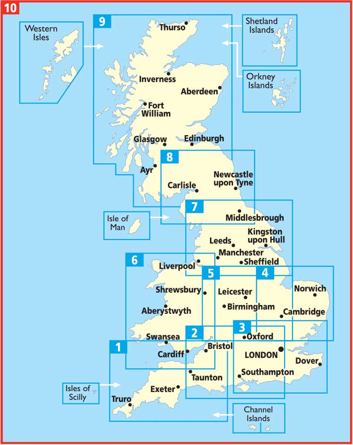
Producten op de overzichtskaart
Klik op een product om naar de detailpagina te gaan.
- Landkaart Wegenkaart 1 West Country & Wales Zuid - AA
- Landkaart Wegenkaart 2 Engeland Centr. Zuid - AA
- Landkaart Wegenkaart 3 Zuid Oost Engeland - AA
- Landkaart Wegenkaart 4 East Anglia - AA
- Landkaart Wegenkaart 5 Midlands & Central Engeland - AA
- Landkaart Wegenkaart 6 Wales - AA
- Landkaart Wegenkaart 7 Noord Engeland - AA
- Landkaart Wegenkaart 8 Noord Engeland & Scottish Borders - AA
- Landkaart Wegenkaart 9 Schotland - AA
- Landkaart Wegenkaart 10 Groot Brittannië - AA Publishing
Artikelen uit dezelfde regio

Landkaart Wegenkaart 5 Midlands Oost & East Anglia - OSI • 9780319263778
Wegenkaart Midlands Oost & East Anglia - OSI Productomschrijving: Plan your journey with this series of road maps from OS. Showing all major road, rail and ferry links as well as settlements and selected features in 1: 250 000 scale, this is the ideal map for planning trips and holidays by car or cycle. OS Road 5 covers: the East Midlands, including the Norfolk and the Thames Estuary.…

Wandelkaart Cotswold Way - Harvey maps • 9781851374182
Wandelkaart Cotswold Way - Chipping Campden to Bath - Harvey maps Productomschrijving: Toont de gehele 166km (103miles) van The Cotswold Way, door de Cotswolds van Chipping Campden naar Bath, Broadway, Winchcombe, Stroud, Wooton-under-Edge en Chipping Sodbury passeren. Informatie over het vinden van accommodatie, camping, voedsel. Routebeschrijving naar het begin. Ook Ranger Service en…
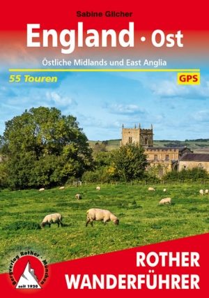
Wandelgids Ostliche Midlands & East Anglia - Rother • 9783763345298
Wandelgids England- Ostliche Midlands & East Anglia - Rother Productomschrijving: Een wandelgids vol tips en 55 wandlroutes in- en rond de mooie regio van oost-Midland's en East Anglia in het oosten van Engeland. Deze regio is gelegen rechts op het continent van Engeland boven de hoofdstad London. Deze gids biedt u 55 routes en een variatie aan bezienswaardigheden langs de routes. Een goei…

Reisgids GEOguide Normandie - Gallimard • 9782742463107
Reisgids Normandie - Gallimard Productomschrijving: De normandische kust is onder meer wereldwijd gekend voor zijn Mont-St-Michèl, en de D-day stranden, Alencon, Arromanches, Bagnoles-de-l'orne, Bayeux, Cabourg, Caen, Cherbourg-en-Cotentin, Deauville, Etretat, Dieppe, Falise, Fecamp, Giverni, Ggranville-en-chausey, Le Havre, Honfleur, île-Tatihou-en-Saint-Vaast-la-Hougue, Lisieux, Nez-de-J…

Landkaart Wegenkaart 504 S.E. Engeland & East Anglia - Michelin • 9782067183322
Regionale Wegenkaart South East Engeland & East Anglia Productomschrijving: De volledig bijgewerkte MICHELIN-kaart van Engeland Zuid-Oost, Midlands, Oost-England geeft u alle WEG- EN TOERISME-informatie die u nodig hebt om uw reizen in deze regio te optimaliseren: een INDEX VAN LOCATIES, een TABEL VAN AFSTANDEN en REISTIJDEN. Dankzij de schaal van 1:400.000 (1 cm = 4 km) kun je zowel de h…