

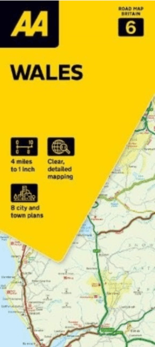
Landkaart Wegenkaart 6 Wales - AA
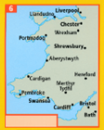
Liverpool- Chester- Shewsbury- Pembroke- Swansea- Cardiff
Korte omschrijving
Wegenkaart Wales - AA Productomschrijving: AA Road Map Wales is a practical and slimline, foldable map from the experts at the AA. Encased in a durable, weatherproof cover, the mapping is p...

Specificaties
- Uitgever: AA Road maps
- ISBN-13: 9780749584115
- HOOFDCATEGORIEËN: Wegenkaart - Landkaart
- Activiteiten: Street/Road maps & city plans
- Regio: Wales
- Land: Wales
- Schaal: 1:250000
- Taal: Engels
- Reeks/Serie:: AA Road maps Britain
Volledige omschrijving
Wegenkaart Wales - AA
Productomschrijving: AA Road Map Wales is a practical and slimline, foldable map from the experts at the AA. Encased in a durable, weatherproof cover, the mapping is produced at a scale of 3 miles to 1 inch (1:200,000 / 2km to 1cm) combining clear design, an easy-to-read scale and more road detail to ensure that you never lose your way.
Omvat: Liverpool, Chester, Shewsbury, Pembroke, Swansea, Cardiff, Bristol & Bath.
Also included are toll points, service areas, road numbers, motorways, dual carriageways and wide narrow local roads, National Parks:
• Fully updated speed camera locations, plus speed cameras with speed limits shown
• Clear place name index
• 10 city and town plans
• Caravan & camping sites are pinpointed on the mapping
• National Parks and places of interest are also highlighted
• National Trust, English Heritage, Scottish and Welsh Heritage sites shown
Overzichtskaarten

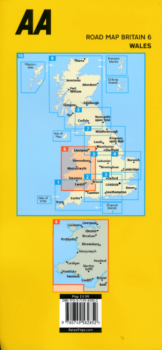
Wegenkaarten Landkaarten Road Maps Britain 1 > 10
Wegenkaarten Landkaarten Road Maps Britain 1 > 10
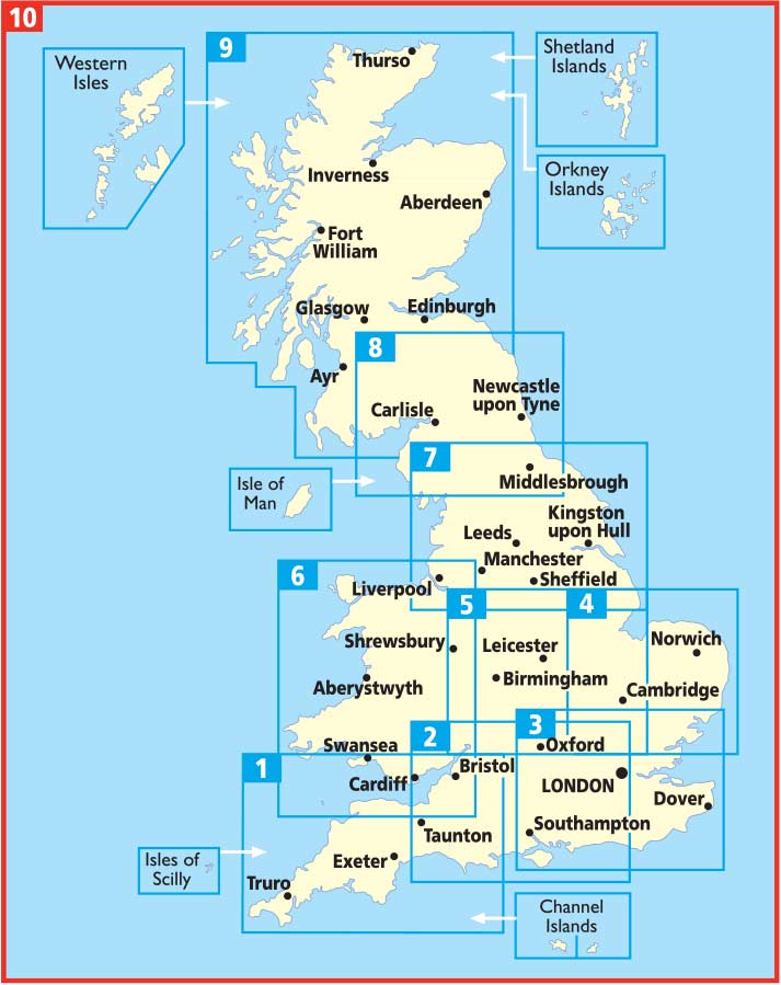
Producten op de overzichtskaart
Klik op een product om naar de detailpagina te gaan.
- Landkaart Wegenkaart 1 West Country & Wales Zuid - AA
- Landkaart Wegenkaart 2 Engeland Centr. Zuid - AA
- Landkaart Wegenkaart 3 Zuid Oost Engeland - AA
- Landkaart Wegenkaart 4 East Anglia - AA
- Landkaart Wegenkaart 5 Midlands & Central Engeland - AA
- Landkaart Wegenkaart 6 Wales - AA
- Landkaart Wegenkaart 7 Noord Engeland - AA
- Landkaart Wegenkaart 8 Noord Engeland & Scottish Borders - AA
- Landkaart Wegenkaart 9 Schotland - AA
- Landkaart Wegenkaart 10 Groot Brittannië - AA Publishing
Artikelen uit dezelfde regio
Wandelkaart 114 Anglesey- North West Wales - OSI • 9780319474372
Wandelkaart Anglesey - North West Wales - OSI Productbeschrijving: Kaart nummer 114 in de reeks van de OS Landranger kaarten bestrijkt het platteland Welsh eiland Anglesey. Het is omringd door zandstranden en rotsachtige grotten, met het binnenland dat deel is van het eiland wordt meestal landbouw geteelt. Anglesey is briljant geschikt voor toeristen met een ruime keuze aan accommodatie en…
Landkaart Wegenkaart 503 Wales, Midlands & Engeland ZW - Michelin • 9782067183285
Regionale Wegenkaart Wales, Midlands & Engeland ZW - Michelin Productomschrijving: De volledig bijgewerkte MICHELIN kaart van Engeland Zuidwest Wales biedt u alle weg- en toeristische informatie die u nodig heeft om het meeste uit uw reis te halen: een INDEX VAN LOCATIES en een TABEL VAN AFSTANDEN en REISTIJDEN. De schaal van 1:400.000, d.w.z. 1 cm = 4 km, maakt het gemakkelijk om zowel d…
Reisgids Wales - Rough Guides • 9780241306376
Reisgids Wales - Rough Guides Productomschrijving: Discover this beautiful country with the most incisive and entertaining guidebook on the market. Whether you plan to hike through the wilds of Snowdonia, follow in Wordsworth’s footsteps at Tintern Abbey or explore Welsh music and theatre in Swansea, The Rough Guide to Wales will show you the ideal places to sleep, eat, drink and shop alon…
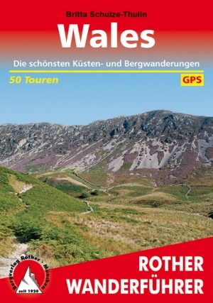
Wandelgids Wales - Rother • 9783763344291
Wandelgids Wales - Rother Productomschrijving: Wandelen in de mooiste en meest spectaculaire gebieden van Wales. In het kleine land tussen Ierland en Engeland, ongeveer de helft van de grootte van Zwitserland, is er een indrukwekkende verscheidenheid aan landschappen, die het best kan worden verkend te voet.. In Wales vind u een prachtig berglandschap. Naar het noorden in Snowdonia, de…

Wandelgids Walk Britain - Vertebrate Publishing • 9781839811449
Wandelgids Walk Britain - Vertebrate Productomschrijving: 90 inspirational car-free walks in England, Scotland and Wales Walk Britain by Elise Downing is an inspirational collection of 90 walking routes accessible by public transport which can enable you to see the best of Great Britain in an environmentally friendly way. The book is organised into easily accessible base locations thr…