

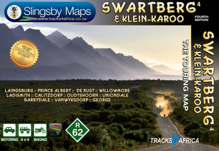
Landkaart Wegenkaart 4 Zuid-Afrika Swartberg & Klein-Karoo
The mightiest mountain range in the Western Cape
Korte omschrijving
Wegenkaart Zuid-Afrika Swartberg & Klein-Karoo - Tracks4Afrika Productomschrijving: Swartberg & Klein-Karoo The Swartberg is the mightiest mountain range in the Western Cape, with peaks...

Specificaties
- Uitgever: Tracks4Africa
- ISBN-13: 9781776322787
- HOOFDCATEGORIEËN: Wegenkaart - Landkaart
- Activiteiten: Street/Road maps & city plans
- Regio: West-Kaap, Afrika
- Land: Zuid-Afrika
- Schaal: 1:160000
- Editie: 4
- Taal: Engels
Volledige omschrijving
Wegenkaart Zuid-Afrika Swartberg & Klein-Karoo - Tracks4Afrika
Productomschrijving: Swartberg & Klein-Karoo
The Swartberg is the mightiest mountain range in the Western Cape, with peaks up to 2400 metres, fantastic ravines, gorges and poorts, amazing mountain passes, lost corners and a history as rich as its flora and fauna. The mountains frame the northern edge of the Klein-Karoo, their mighty peaks and slopes dark and swart against the northering sun.
The mountains and the Klein-Karoo provide a playground for tourists — there are ostrich farms, wildlife parks, the Cango caves, endless fascination for explorers, and a richness of facilities and activities that’s as good as you could find anywhere.
This is the first detailed map ever produced for the area; may it guide you on many an exciting journey of discovery.
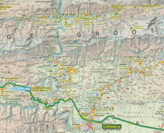
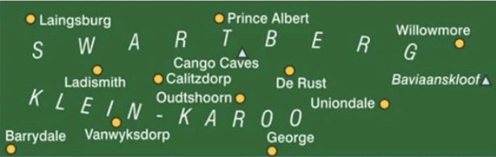
This double-sided, full-relief map covers, at a scale of 1:160 000, the entire Swartberg mountain range from west to east. North of the mountains the towns of Laingsburg, Prince Albert and Willowmore are included; through the Klein-Karoo the major towns are Ladismith, Calitzdorp, Oudtshoorn and De Rust. The southern boundary of the map is defined by the northern slopes of the Langeberg-Outeniqua range, with towns Barrydale, Vanwyksdorp, George and Uniondale.
All roads from National Highways to minor gravel roads are shown; the many classifications that indi- cate the quality of each road help you plan your route. No less than 28 mountain passes are shown — all are public roads!
- Distances are clearly shown; comprehensive 4 x 4 information
- GPS coordinates in DD MM SS format are provided for every road-junction
- All tourism facilities and accommodation establishments are shown in the out-of-town areas; there are insets of the major towns
- The map links to our maps of the Baviaanskloof, the Garden Route, Overberg and the Tankwa-Karoo
Additional info:
Swartberg and Klein-Karoo region on a contoured and GPS compatible, double-sided, waterproof and tear-resistant map at 1:160,000 from Slingsby Maps, with excellent topographic detail and plenty of tourist information, including street plans of ten main towns.
The map provides a very detailed picture of this mountainous terrain, with altitude colouring, shading, con- tours at 20m intervals and numerous spot heights. For GPS navigation important road junctions and various other features are annotated with waypoints and the map has latitude and longitude lines at 5’ intervals.
Road information is very finely graded, indicating road surface, private roads with public access, 4WD only tracks, cattle grids and game gates, locations of fuel supplies, etc. Also marked are routes found by publish- ers as enjoyable, or conversely as dull. Railway lines are shown with stations. For hikers the map indicates waymarked paths and shows other trails. A very wide range of symbols highlight various places of interest and tourist facilities: different types of accommodation from hotels to campsites, picnic places, farm stalls, wineries, restaurants, sport and recreational sites, animal viewing sites, etc.
The map also includes street plans of ten of the region’s main towns: Laingsburg, Ladismith, Van Wyksdorp, Calitzdrop, De Rust, Oudtshoorn, Schoemanshoek, Prince Albert, Uniondale and Willowmore, all annotated with accommodation and other tourist facilities of places of interest.
Artikelen uit dezelfde regio

Landkaart Wegenkaart SC7 & SC8 Baviaanskloof > Addo Tracks4Afrika • 9781776322770
Wegenkaart SC7 & SC8 Baviaanskloof > Addo Elephant Park Productomschrijving: SC7 & SC8 : Baviaanskloof / Addo Elephant National Park Includes: Cape St. Francis, Humansdorp, Patensie, Jansenville, Jeffrey’s Bay, Kariega (Uitenhage), Kirkwood, Paterson, Colchester, Alexandria and Gqeberha (Port Elizabeth). The Cape to Addo map series covers the southern parts of the Western Cape of …

Landkaart Wegenkaart SC3 & SC4 Swellendam > Mossel Bay • 9781776322756
Wegenkaart SC3 & SC4 Swellendam > Mossel Bay Productomschrijving: SC3 & SC4 : Overberg, Klein Karoo along the R62, part of the Garden Route The Cape to Addo map series covers the southern parts of the Western Cape of South Africa in a series of eight highly detailed maps, printed on four sheets of A1 durable paper. We start in Cape Town in the west and move along the southern coast th…

Reisgids Cape Town secret - Jonglez Publishing • 9782361951405
Cape Town secret - Jonglez Publishing Productinformation: A captain who continued to live on the wreck of the Kakapo for three years, Table Mountain s most exclusive hiking, a restaurant in a maximum security prison, the arboreal evidence of apartheid s earliest manifestation, a woman disguised as a man for 56 years in order to be a doctor, a beach on top of Table Mountain, a fascinating s…

Landkaart Wegenkaart Overberg Whale Coast - Slingsby Maps • 9781920377533
Wegenkaart Overberg Whale Coast - Slingsby Maps Productomschrijving: Overberg Whale Coast, West-kaap Zuid Afrika The Overberg is one of the premier tourist regions of South Africa. Here the Cape Fold Mountains march eastward from Sir Lowry’s Pass, a rugged backdrop to this old Cape landscape of farmsteads, gravel passes and unspoiled views. Delightful towns await you – historic Swelle…