
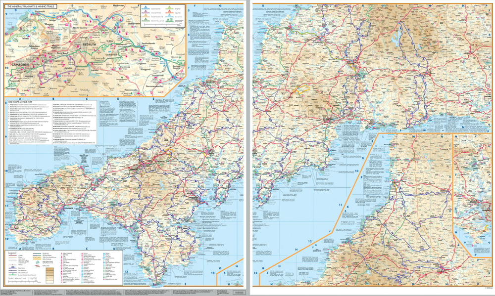
Fietskaart 01 Cornwall cycling map - Goldeneye
Mineral Tramways Trails- Traffic-Free Family Routes- Clay Trails

Korte omschrijving
Fietskaarten Cornwall, England van Goldeneye. Ideaal voor tochten in England.
Fietskaart Cornwall cycling map - Goldeneye Productomschrijving: Eén van Engeland's meest afgelegen gebieden, meest bezocht voor zijn vakantie eigenschappen. Met marktjes, pitoreske dorpen, ...

Specificaties
- Uitgever: Goldeneye
- ISBN-13: 9781859653029
- HOOFDCATEGORIEËN: Fietskaart
- Activiteiten: Fietsen / VTT / MTB
- Regio: Cornwall, England
- Land: England
- Schaal: 1:126720
- Editie: 4
- Taal: Engels
- Fietsen: Fietsen in het Buitenland
- De Engelse Graafschappen: Cornwall
Volledige omschrijving
Fietskaart Cornwall cycling map - Goldeneye
Productomschrijving: Eén van Engeland's meest afgelegen gebieden, meest bezocht voor zijn vakantie eigenschappen. Met marktjes, pitoreske dorpen, interessante resto's en pub's. Prachtig gelegen terrasjes, havenbootjes, en noem maar op. Een prachtig zeker geen klein gebied om in te vertoeven.
Engelse omschrijving: Cornwall is one of England’s most rural counties and these twenty-one circular routes have been chosen to explore the best of the quiet lanes linking its many interesting & picturesque villages, harbours & market towns. Although short sections of busier roads have sometimes had to be used to complete a circuit even the quietest lanes can be busy for short periods, as local people travel to & from work & school. To avoid sending cars along the very roads you are going to cycle, these routes have been designed, in the main, to begin at towns or villages, close to major roads, or from railway stations.
Most inland routes tend to be reasonably easy going, but be prepared for short, steep climbs, in and out of coastal valleys & bays. This is often via narrow sunken lanes & these take a little getting used to, so always be ready for the possibility of meeting vehicles on descents. This is particularly true during the 6 summer weeks when sections of the narrowest coastal lanes can become completely snarled up by a few cars. For maximum enjoyment at this time of year, coastal sections are best ridden in the early morning, or in some cases, avoided by using inland variants.
The Mineral Tramways Trails:
These trails celebrate Cornwall’s industrial past. There are 60km/37 miles of trails suitable for cycling, walking, jogging & horse riding. The majority of these are on tarmac or gravel paths, & are off-road. Most of these trails follow the old tramway & railway routes that were used to transport the ore & supplies to & from the copper & tin mines, to the ports at Portreath & Devoran. The off-road sections are illustrated on the map below.
1. Coast to Coast Trail; 17km/11miles.
Park at the Bike Chain Bissoe Bike Hire. The first tram road or plate way in Cornwall to serve the Gwennap Mines with the historic harbours, Portreath & Devoran. Passes by wildlife & ancient woodland. (F10)
2. Great Flat Lode Trail; 12km/7miles.
Park at King Edward Mine (Museum). A circular route with some steep sections explores the landscape of tin & copper mines from the 1860s. Panoramic views of South Crofty Mine when you climb Carn Brea. (E10)
3. Tehidy Trail; 4km/2.5miles.
Park in Portreath. Linear route using the tracks & trails through Tehidy Country Park former home of Sir Francis Basset, Lord de Dunstanville. (E9)
4. Portreath Branchline Trail; 9km/5miles.
Built in 1836 as the Hayle Railway to connect the engineering works of Hayle & Copperhouse with the Camborne/Redruth mines. The trail leads to the Great Flat Lode Trail by using quiet roads. (E9)
5. Redruth & Chasewater Railway Trail; 12km/7miles. Park at Twelveheads. Based on the old railway lines that carried wagons from mines around Gwennap & Redruth to the port of Devoran. The trail is mostly off-road with some major roads to cross. (F10)
6.Tresavean Trail;1.8km/1.1mies.
Short off-road route linked to the above. Park in Lanner or at Buller Hill P. (E10)
7.TolgusTrail;1.2km/0.8miles.
It connects Cornwall Gold & Tolgus Mill with the Coast to Coast Trail. Set west of Cambose & follows the Portreath Valley. Here tin was excavated from 1602. An 1818 map details water-powered stream works along this valley. (E9)
Traffic-Free Family Routes/Trails & Mountain Bike Adventures:
1. Bodmin Beast Cycle Trails (Cardinham Woods). A 12km/7.4 mile single track trail that sets the pace in Cornwall. The experienced & intermediate mountain biker will encounter technical climbs & descents. Exposure to steep unfenced side slopes. Graded Blue. Two sections are Graded Red. 4-Waymarked walks of 3-7.5km. Wood Cafe. Parking.
2. Camel Trail. 27km/17 miles. Cornwall’s leading trail that attracts in excess of 500,000 annual visitors. Bodmin to Padstow with a deviation north to Poley’s Bridge. Suitable for jogging, walking & bird watching, too. Cycle hire in Padstow & Wadebridge. Cafes: Wood & Green Cafe, Wadebridge (J6), the Camel Trail Tea Garden, near Dunmere (J7) & Snail’sPace Cafe/bike hire, Wenfordbridge (K6).
3. Lanhydrock Trails. A selection of trails to suit all standards; Green (Easy), Blue (Moderate) & Red (Difficult) from 1.5km/1 mile to 2.5km/1.5 miles in length. Woodland terrain with flat & hilly trails. Bike hire. Cafe. Parking charge. (K7)
4. Pentewan Trail. 6km/4 miles. An easy off-road route from London Apprentice to Pentewan with an off-shoot to Heligan Gardens that uses 1/2 mile of road. Bike hire. (J9)
5. Seaton Valley Country Park. An easy 2-mile route that tours the Country Park beside the river & back to the parking area. (N8)
6. Siblyback Lake. 5km/3.5 miles. An easy (Green) trail perfect for young families circles the lake. Follow an anti-clockwise direction. Feed the ducks. Olive & Co Cafe for refreshments. (M6)
7. Tamar Lakes. The off-road trail connects the Upper & Lower Lakes where you can spot kingfishers, herons, butterflies & dragonflies. Froghopper Cafe for refreshments. Angling centre. (M1)
8. Tamar Trails Centre. A multi-sport centre dedicated to family fun. Biking, canoeing, walking, tree surfing, running & socialising in their cafe. 01822833409 tamartrails.co.uk ( P6)
9. Wheel Peevor Mine Site. Linked to the Coast to Coast Trail. Rough tracks explore this site of industrial archaeology with three Engine Houses & 12 mine shafts. Accessible. (E9)
The Clay Trails:
1. Bugle to the Eden Project. 6km/4 miles. Crosses there heathlands of Treskilling Downs passing woodland & lakes. (J8)
2. Goss Moor Cycle Trail. 12km/7 mile circular trail through nature reserve. Mainly flat & off-road.(H8)
3. Par Beach to the Eden Project. 5km/3 mile route of the former china clay wagons.(K8)
5. 4. Wheal Martyn to Sky Spur. 3km/2 mile route through a challenging landscape of gravel & mud amidst white capped hills - the Cornish Alps. Great viewpoint from Sky Spur. (J8)
.png)
Artikelen uit dezelfde regio

Wandelkaart 107 St-Austell & Liskeard & Fowey- Cornwall - OSI • 9780319469880
Wandelkaart St Austell- Liskeard & Fowey - Cornwall - OSI Productbeschrijving: Kaart nummer 107 is de perfecte kaart voor iedereen die de omgeving van St Austell en Liskeard wil gaan verkennen. Hoogtepunten van het gebied: St Austell Bay, Looe Harbour Quay, Carnglaze grotten en Bodmin Moor. De OS Explorer kaart voor St Austell & Liskeard is beschikbaar in zowel de standaard papieren versie…

Wandelkaart 105 Falmouth & Mevagissey - Cornawall - OSI • 9780319469866
Wandelkaart Falmouth & Mevagissey - Cornwall - OSI Productbeschrijving: Kaart nummer 105 in de OS Explorer kaart reeks is de ideale kaart voor wandelingen, hikes en ritten rond Falmouth, Mevagissey, Truro and St Mawes. De South West Coast Path is een ideale manier om de kustlijn in dit deel van Cornwall te verkennen. Hoogtepunten van het gebied zijn onder andere: Pendennis Point, Lost Gard…
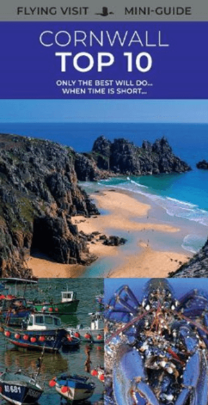
Reisgids Cornwall's Top 10 - William Fricker - Goldeneye • 9781859653098
Reisgids Cornwall's - Goldeneye Productomschrijving: Only the best will do when time is short... Ervaren reisschrijver en inwoner van Cornwall, William Fricker, en zijn team bij Goldeneye geven hun mening over de beste stranden om te bezoeken, de beste havens om te bezoeken en de mooiste stukken van het kustpad. Een heel scala aan activiteiten om aan deel te nemen; van het kopen van kunst …

Reisgids Cornwall & Devon - Marco Polo • 9783829734783
Reisgids Cornwall & Devon - Marco Polo Productomschrijving: Marco Polo reisgids voor Cornwall & Devon! Handig pocket formaat, boordevol informatie, met uitneembare kaart. Met ‘insider tips’ om deze regio's écht te ontdekken, de TOP 15 van bezienswaardigheden in één oogopslag, up-to-date informatie in overzichtelijke hoofdstukken: sightseeing, eten & drinken, winkelen, uitgaan, verblijf, r…

Wandelgids Land's End Circuit Cornwall England - Rucksack Readers • 9781898481928
Wandelgids Land's End Circuit Cornwall England Productomschrijving: Het South West Coast Path is beroemd mooi, maar de langste National Trail van Groot-Brittannië is niet voor angsthazen. Velen worden afgeschrikt door de uitdaging van 630 mijl en 35.000 meter stijgen en dalen. Dus auteur Max Landsberg heeft een 5-daagse proeverij gemaakt, beginnend bij St-Ives om Penzance te bereiken via e…