

Wandelkaart 101 Isles of Scilly- SW England - OSI
Isles of Scilly South West England
Korte omschrijving
Wandelkaarten Cornwall, England van Ordnance Survey. Ideaal voor tochten in England.
Wandelkaart Isles of Scilly - SW England - Ordnance Servey. Productomschrijving: Isles of Scilly, South West England - Kaart nummer 101 is een all purpose kaart vol gepakt met informatie om ...

Specificaties
- Uitgever: Ordnance Survey
- ISBN-13: 9780319243039
- HOOFDCATEGORIEËN: Wandelkaart
- Activiteiten: Wandelen, Hiking & Trekking
- Regio: Cornwall, England
- Land: England
- TOPO's & Stafkaarten: Topografisch wandelen
- AONB - Area of Outstanding Beauty/National Landscape: Isles of Scilly AONB
- Schaal: 1:25000
- Taal: Engels
- Reeks/Serie: Explorer Series OS
- De beroemdste Eilandengroepen: Isles of Scilly, England
Volledige omschrijving
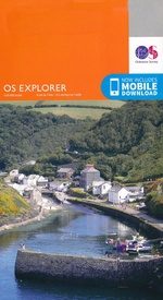
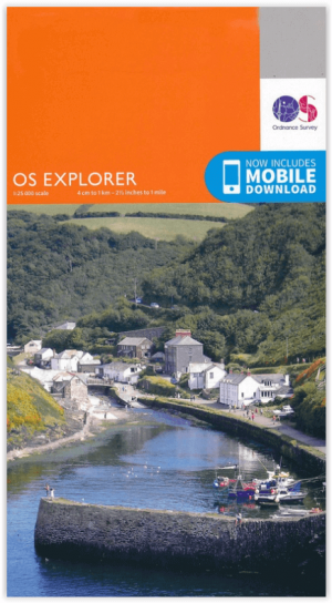
Wandelkaart Isles of Scilly - SW England - Ordnance Servey.
Productomschrijving: Isles of Scilly, South West England - Kaart nummer 101 is een all purpose kaart vol gepakt met informatie om u het gebied te helpen leren kennen. De 204 Landranger-kaarten bestrijken het land. Elke kaart heeft een oppervlakte van 40 km door 40 km (25 mijl door 25 mijl) en zoals andere kaarten van Ordnance Survey, National Grid-vierkanten worden verstrekt zodat elke functie een unieke referentienummer kan worden gegeven.
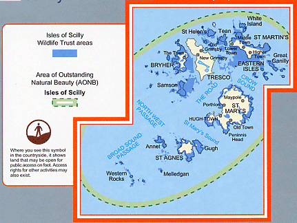
With hte Isle od Scilly Wildlife Trust Areas
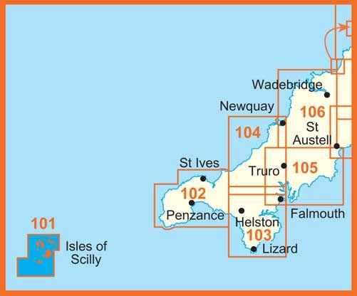
101 / Isles of Scilly, South West England - These highly detailed maps show all the administrative boundaries, settlements as small as isolated farms, the road network down to unfenced roads and country tracks, and field boundaries (hedges and drystone walls) which make navigation across the countryside much easier. Steep gradients on roads are indicated. Various landmarks, e.g. powerlines, archaeological sites, windmills, churches and lighthouses are shown and additional graphics indicate natural terrain features such as cliffs, scree, mud and vegetation variations.
The contour interval is 5 metres in the lower parts of the country and 10 metres in the uplands, and spot heights are marked. Each map covers an area of 30 x 20km (i.e. approx. 19 x 12 miles), with some double-sided maps covering more, as indicated in the individual descriptions. The maps are fully GPS compatible, with the National Grid shown at 1km intervals and latitude and longitude indicated by margin ticks at 1'.

Locatie op kaart
Artikelen uit dezelfde regio

Wandelgids Land's End Circuit Cornwall England - Rucksack Readers • 9781898481928
Wandelgids Land's End Circuit Cornwall England Productomschrijving: Het South West Coast Path is beroemd mooi, maar de langste National Trail van Groot-Brittannië is niet voor angsthazen. Velen worden afgeschrikt door de uitdaging van 630 mijl en 35.000 meter stijgen en dalen. Dus auteur Max Landsberg heeft een 5-daagse proeverij gemaakt, beginnend bij St-Ives om Penzance te bereiken via e…
Wandelkaart 102 Land's End - OSI • 9780319263648
Wandelkaart 102 Explorer Land's End - OSI Productomschrijving: Kaart nummer 102 in de OS Explorer kaartenserie is de perfecte kaart voor het ontdekken van het beroemde gebied rond Land's End, Penzance en St Ives. Het gebied staat bekend als het meest extreem zuidwestelijke punt van Groot-Brittannië. Hoogtepunten zijn: Penzance, Land's End, Mousehole, en Cape Cornwall. Inclusief mobiele…
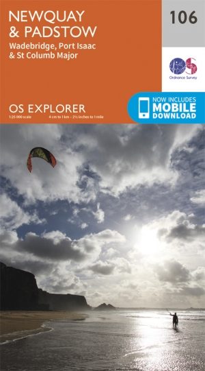
Wandelkaart 106 Newquay & Padstow - Cornwall - OSI • 9780319243084
Wandelkaart Newquay & Padstow - Cornwall - OSI Omvat ook: Wadebridge, Port Isaac & St Columb Major Productbeschrijving: Kaart nummer 106 in de OS Explorer kaarten reeks is de ideale kaart voor iedereen die de Cornish kuststeden van Newquay en Padstow wil bezoeken. Het gebied is beroemd onder vakantiegangers en word bezocht door wandelaars, surfers en mensen die willen proeven van de ge…
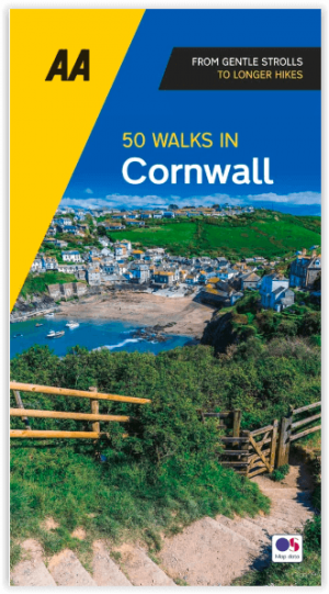
Wandelgids 50 walks in Cornwall - AA Publishing • 9780749583217
50 walks in Cornwall - AA Publishing. Productomschrijving: Wandelen is één van de favoriete vrijetijdsbestedingen van Groot-Brittannië en AA 50 Walks in Cornwall bevat een verscheidenheid aan uitgestippelde wandelingen van 2 tot 10 mijl, geschikt voor alle niveaus. Het boek bevat alle praktische details die u nodig heeft, vergezeld van fascinerende achtergrondinformatie over de geschiedeni…

Wandelgids Cornwall- Newquay & The North Coast - Cicerone • 9781786312471
Wandelgids Cornwall- Newquay & The North Coast Productomschrijving: Would you like to explore the best of Newquay and the North Coast? This guidebook covers 15 of the best short walks in the area (between 3 and 9.6km, all under three hours), including Polly Joke, Watergate Bay, Trevose Head, Padstow, Port Isaac, Camelford and Boscastle. Why choose this guidebook? - Easy to moderat…