

Fietsgids Gravel Bikepacking in South East England - Cicerone
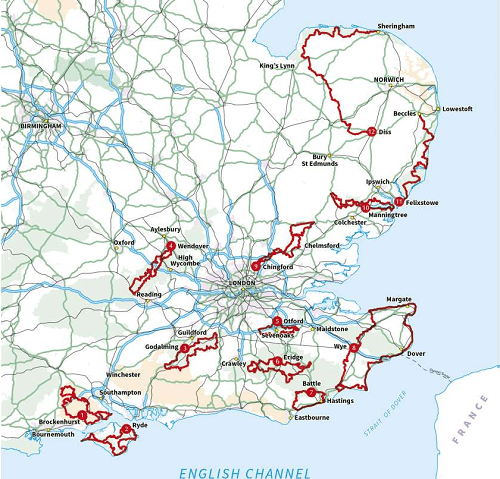
12 of the best gravel bikepacking routes in the South and East


Korte omschrijving
Fietsgidsen South & South East England van CICERONE Press. Ideaal voor tochten in England.
Gravel Bikepacking in South East England - Cicerone Productomschrijving: A guidebook to 12 of the best gravel bikepacking routes in the South and East, including the Cantii Way, exploring f...

Specificaties
- Uitgever: CICERONE Press
- ISBN-13: 9781786312372
- HOOFDCATEGORIEËN: Fietsgids
- Activiteiten: Fietsen / VTT / MTB
- Regio: South & South East England
- Land: England
- Schaal: 1:25000
- Editie: 1
- Taal: Engels
- Fietsen: Fietsen in het Buitenland
- De Engelse Graafschappen: Kent
- VTT / MTB: Mountainbike
Volledige omschrijving
Gravel Bikepacking in South East England - Cicerone
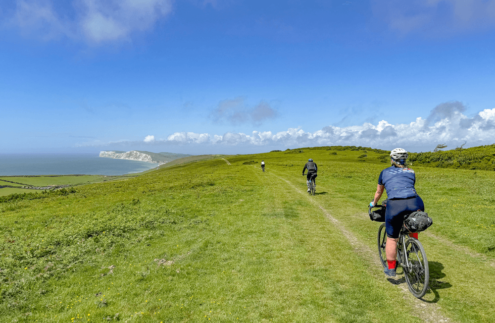
Productomschrijving: A guidebook to 12 of the best gravel bikepacking routes in the South and East, including the Cantii Way, exploring forest tracks, bridleways and quiet lanes over 1 to 5 days. Escape the urban sprawl and explore the region’s wildest off-road routes.
The cycle routes are suitable for beginner and experienced MTB and gravel-bike riders and range between 69 and 249km (40–155 miles) in length. All routes are easily accessed by public transport and close to London.
- Graded routes for all abilities
- GPX files available to download
- 1:150,000 maps and profiles included for each stage
- Handy route summary tables and accommodation listings help you plan your itinerary
- All routes easily accessible by train from London.

Artikelen uit dezelfde regio

Fietsgids Cycling London to Paris - Cicerone • 9781852849146
Cycling London to Paris - Cicerone Press Productomschrijving: Gloednieuwe fietsgids over de London to Paris Bike Ride, inclusief de 500 km traditionele route, die gebruik maakt van fietspaden en rustige wegen plus een ferry overtocht vanuit Dover, en de 400 km Avenue Verte, een bewegwijzerde route via Newhaven/Dieppe die meer gebruik maakt van speciale fietspaden. Elke route duurt 5-7 dage…

North Downs mountainbiking - cicerone • 9781852847029
Mountainbikegids - North Downs mountainbiking - cicerone Productomschrijving: Mountainbiken op de North Downs beslaat 21 routes over de North Downs, een gebied met een aantal van de mooiste routes ten zuidoosten van Engeland. Inbegrepen is een 59km lange MTB-route op de Downs, die de North Downs aan de South Downs aaneensluit in Shoreham-by-Sea. Ritten tellen voor moeilijkheid, en geïllust…

Landkaart Wegenkaart 504 S.E. Engeland & East Anglia - Michelin • 9782067183322
Regionale Wegenkaart South East Engeland & East Anglia Productomschrijving: De volledig bijgewerkte MICHELIN-kaart van Engeland Zuid-Oost, Midlands, Oost-England geeft u alle WEG- EN TOERISME-informatie die u nodig hebt om uw reizen in deze regio te optimaliseren: een INDEX VAN LOCATIES, een TABEL VAN AFSTANDEN en REISTIJDEN. Dankzij de schaal van 1:400.000 (1 cm = 4 km) kun je zowel de h…

Fietsgids Cycling Days Out - South East England - Vertebrate Publ • 9781906148249
Cycling Days Out - South East England - Vertebrate Productomschrijving: Traffic-free family and leisure cycling in Kent, Sussex, Surrey & Hampshire. Cycling Days Out – South East England is a guide to traffic-free family and leisure cycling in Kent, Sussex, Surrey and Hampshire. Written by local author Deirdre Huston, it explores tourist trails, country parks, forest riding and more. …

Wandelgids - Chilterns walking guide - Cicerone • 9781786310187
Wandelgids - Chilterns walking guide - Cicerone Productomschrijving: Deze plaats werd geklasseerd als gebied van uitmuntende schoonheid, of in Engelse termen beter gezegd, een "Area of Oustanding Natural Beauty". Gelegen ten westen van de hoofdstad lonon is dit een soort getaway voor de londonaars die de stad even moe zijn, en de natuur willen opsnuiven. Steve Davison, is de auteur die dez…