

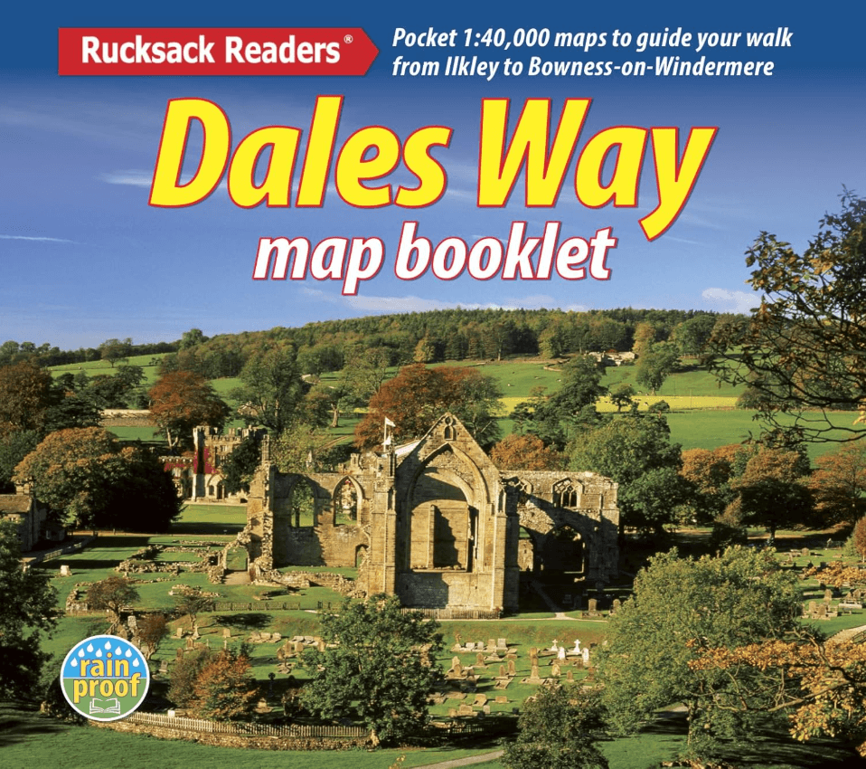
Dales Way map booklet - Rucksack Readers
From Ilkley, Yorkshire Dales to Bowness in the Lake District
Korte omschrijving
Wandelgidsen Noord Engeland en Yorkshire Dales van RUCKSACK READERS. Ideaal voor tochten in England.
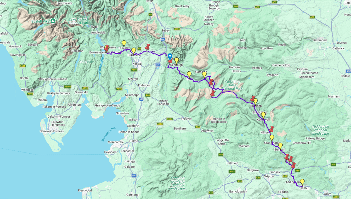
Map Booklet The Dales Way - Rucksack Readers Productomschrijving: This charming walk runs for 79 miles (127 km) from Ilkley in the Yorkshire Dales to Bowness in the Lake District. The route...

Specificaties
- Uitgever: RUCKSACK READERS
- ISBN-13: 9781913817367
- HOOFDCATEGORIEËN: Wandelgids
- Activiteiten: Wandelen, Hiking & Trekking
- Auteur: Jacquetta Megarry
- Regio: Noord Engeland, Yorkshire Dales
- Land: England
- Lange afstand wandelroutes: The Dales Way (130 km)
- Nationale parken: Yorkshire Dales NP, England
- Schaal: 1:112000
- Taal: Engels
- De Nationale Parken: Yorkshire Dales National Park, England
- De Engelse Graafschappen: Yorkshire
Volledige omschrijving
Map Booklet The Dales Way - Rucksack Readers
Productomschrijving: This charming walk runs for 79 miles (127 km) from Ilkley in the Yorkshire Dales to Bowness in the Lake District. The route heads north through Wharfedale, crisscrossing the river, and rises over high moorland to pick up River Dee through Dentdale. It joins River Lune briefly before heading west to Bowness on Lake Windermere. The LDWA has documented Link Routes for walkers beginning in Leeds, Harrogate and Bradford.
Along the Way, you'll see impressive railway viaducts and fine stone bridges; Bolton Priory and many small churches; limestone scenery with stone walls, hay meadows and lime kilns; and heritage centres you can visit. Above all, the route is blessed with many small villages with B&Bs and welcoming pubs at strategic intervals. Gradients are modest and most people will complete it comfortably in 6 or 7 days.
This guidebook has all that a walker needs:
• detailed directions for the main Way walked south to north
• detailed directions for the Bradford Link, sketches of Leeds and Harrogate Links
• background on geology, railway heritage, farming and wildlife
• side-trips to heritage centres and a feature on Bolton Priory
• contact details for accommodation and transport
• dropdown route map (1:112,000)
• over 70 glorious colour photos
• rainproof, rucksack-friendly format.
Gekoppelde artikelen
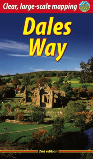
Wandelgids The Dales Way, 2e Editie - Rucksack Readers • 9781913817336
standaard versieThe Dales Way - Rucksack Readers Productomschrijving: This charming walk runs for 79 miles (127 km) from Ilkley in the Yorkshire Dales to Bowness in the Lake District. The route heads north through Wharfedale, crisscrossing the river, and rises over high moorland to pick up River Dee through Dentdale. It joins River Lune briefly before heading west to Bowness on Lake Windermere. The LDWA …
Artikelen uit dezelfde regio

Reisgids Noord-Engeland - Lannoo • 9789020955644
Reisgids Noord-Engeland - Lannoo Productomschrijving: Maak kennis met Yorkshire, het grootste graafschap van Groot-Brittannië, niet voor niets God's own Country genoemd. En met het Lake District, het spectaculaire land van meren (de diepste van Engeland) en bergen (de hoogste van Engeland). Reis naar het land van veearts James Herriot, naar de decors die je kent van tv-series en fi…
Wandelgids Dales Country Yorkshire England - Cicerone • 9781852843236
Wandelgids - Dales Country Yorkshire England - Cicerone Productomschrijving: Een gids over 30 familiewandelingen in de Yorkshire Dales, Engeland. De 30 circulaire wandelingen nemen de bekende Dales plekken in zoals Malham en Ingleborough. Routes nemen tussen een halve tot een volledige dag in beslag. Ook minder bezochte, bijna geheime routes, ingedeeld van gemakkelijk tot inspannend. P…
Wandelkaart OL19 Howgill Fells & Upper Eden Valley - OS • 9780319263341
Wandelkaart Howgill Fells & Upper Eden Valley - OS Productomschrijving: Topografische wandelkaart van The Howgill Fells & The Upper Eden Valley, dat deels in het Lake Distrisct National Park ligt. Omvat: Howgill Fells & Upper Eden Valley, parts of the Yorkshire Dales National Park en The Lake Distrisct National Park, The Pennine Journey, Dales High Way, Dales Way, E2 European Long D…
Wandelgids The Coast to Coast Map Booklet - Cicerone • 9781852849269
Wandelgids - The Coast to Coast Map Booklet - Cicerone Productomschrijving: Deze wandelgids toont u de 300km lange Coast to Coast Walk, een populaire interlokale trail in Noord-Engeland, die vertrekt uit St Bees Head in Cumbria naar Robin Hood's Bay aan de kust van Yorkshire. Product description: This map booklet shows the 190 mile (300km) Coast to Coast Walk, a popular long distance …
Wandelgids Patterdale- Lake District Fells - Cicerone • 9781786310347
Wandelgids Patterdale- Lake District Fells - Cicerone Productomschrijving: Deze gids maakt deel uit van de serie "Walking the Lake District Fells" en behandelt een breed scala aan routes naar 35 Lakeland-toppen die kunnen worden beklommen vanuit Ambleside, Grasmere en Patterdale en de valleien van Thirlmere en Ullswater, met hoogtepunten als Helvellyn en Fairfield. Suggesties voor langere …