

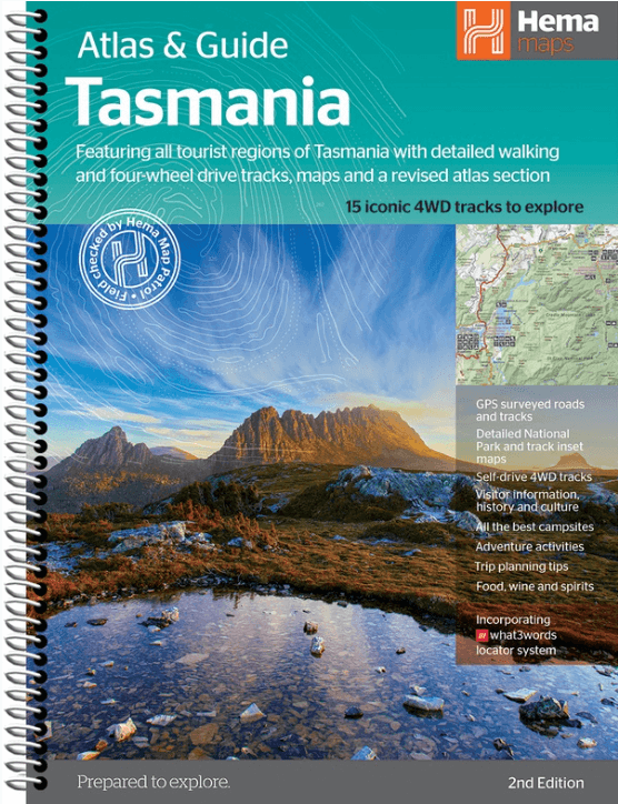
Wegenatlas Tasmanië atlas & gids Tasmanië - Hema Maps
With 5 of the best walking tracks
Korte omschrijving
Wegenatlas Tasmanië atlas & gids - Hema Productomschrijving: The definitive guidebook for discovering Tasmania, featuring the Top 15 4WD Trips of the State and 5 of the best walking tracks. ...

Specificaties
- Uitgever: Hema Maps
- ISBN-13: 9321438001973
- HOOFDCATEGORIEËN: Reisgids, Wegenatlas
- Activiteiten: Street/Road maps & city plans, Toerisme, WegenAtlas
- Regio: Tasmania
- Land: Australië
- Editie: 2
- Taal: Engels
- Reeks/Serie: Wegenatlassen
- De Australische Regio's: Tasmania
Volledige omschrijving
Wegenatlas Tasmanië atlas & gids - Hema
Productomschrijving: The definitive guidebook for discovering Tasmania, featuring the Top 15 4WD Trips of the State and 5 of the best walking tracks. - This first edition Tasmania Atlas & Guide contains 40 atlas pages at a large scale of 1:150 000 in a stunning cartographic style.
The guide features the Top 15 4WD Trips for Tassie, which has been field checked by Hema's Map Patrol. Also included is an introduction to the region, as well as information sections on planning the trip and what to see and do. There are detailed touring sections on the distinct regions of Tasmania. The Top 15 4WD Trips are broken into their respective localities, with each trip containing comprehensive trip information including gradings, distances, relevant travel information and drive coverage from start to finish.
Key Features:
- 40 atlas pages at a scale of 1:150 000
- Top 15 4WD Trips
- Top 5 Walking tracks
- Best campsites
- Adventure activities
- Trip planning tips
Artikelen uit dezelfde regio
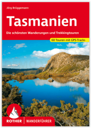
Wandelgids Tasmanien - Tasmanië - Rother Bergverlag • 9783763346585
Tasmanien - Tasmanië - Rother Bergverlag Productomschrijving: Tasmanië, de kleinste staat van Australië, verwent met ongerepte natuur, exotische planten en onbekende dieren - een waar paradijs voor liefhebbers van outdoor en trektochten. De Rother wandelgids "Tasmanië" presenteert de 60 mooiste wandelingen en trektochten op het groene eiland. Het aanbod varieert van korte ontdekkingswandel…

Landkaart Wegenkaart Tasmanië state map - Hema Maps • 9321438002208
Wegenkaart Tasmanië state map - Hema Productomschrijving: A fully indexed state map of Tasmania (TAS) at a scale of 1:480,000. Marked on the mapping are national parks, 24-hour fuel as well as camping and rest areas. On the reverse are regional maps of Launceston and Hobart, as well as CBD maps of Hobart, Launceston, Devonport and Burnie.
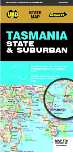
Landkaart Wegenkaart 770 Tasmania State & Suburban - Gregory's • 9780731933204
Wegenkaart Tasmania State & Suburban - Gregory's Productomschrijving: The latest edition of the Tasmania state and suburban map has been fully revised and updated and includes: State map & index to towns and localities Suburban map coverage of Hobart north to Mangalore and Runnymede south to Oyster Cove and South Arm, east to Sorell and west to Molesworth and an index to the Subur…
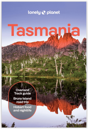
Reisgids Tasmania - Lonely Planet • 9781838699642
Reisgids Tasmania - Engelstalig Productomschrijving : Some say islands are metaphors for the heart. Isolation mightn’t be too good for romance, but Tasmania has turned remoteness into an asset, with unique wilderness and hip arts and food scenes. Lonely Planet will get you to the heart of Tasmania, with amazing travel experiences and the best planning advice: - Inspirational images…

Wegenkaart Planning map Tasmania Australia - Lonely Planet • 9781788688871
Planning map Tasmania Australia - Lonely Planet Productomschrijving: Durable and waterproof, with a handy slipcase and an easy-fold format, Lonely Planet's Tasmania Planning Map is your essential navigation tool. This full-colour map features accompanying images and information about top attractions, itinerary suggestions, a transport guide, themed lists and practical travel tips. - E…