

Wandelkaart South West Coast Path 2 - Harvey maps
St-Ives naar Plymouth

Korte omschrijving
Wandelkaarten South West England van HARVEY MAPS. Ideaal voor tochten in England.
South West Coast Path 2 - Harvey maps Productomschrijving: Het South West Coast path is een 1014 km lang langeafstandspad en het langste nationale pad in Engeland. Het pad strekt zich uit va...

Specificaties
- Uitgever: HARVEY MAPS
- ISBN-13: 9781851376827
- HOOFDCATEGORIEËN: Wandelkaart
- Activiteiten: Wandelen, Hiking & Trekking
- Regio: South West England
- Land: England
- Lange afstand wandelroutes: South West Coast Path - SWCP (1014 km)
- Schaal: 1:40000
- Taal: Engels
- Reeks/Serie: Superwalker XT40, Harvey Maps
- Iconische Wandelroutes: South West coast Path, Cornwall UK
- National Trails UK, England & Wales: South West Coast Path, England
Volledige omschrijving
South West Coast Path 2 - Harvey maps
Productomschrijving: Het South West Coast path is een 1014 km lang langeafstandspad en het langste nationale pad in Engeland. Het pad strekt zich uit van Minehead in Somerset tot Poole in Dorset, inclusief Land's End en de prachtige zuidkust van Cornwall. Dit deel van de route brengt u van St-Ives naar Plymouth.
Engelse omschrijving: The South West Coast path is a 1014km (630mile) long distance path and the longest National Trail in England. The path stretches from Minehead in Somerset to Poole in Dorset, including Land's End and Cornwall's stunning south coast.
- This updated Trail Map covers the second section of the South West Coast Path from St-Ives to Plymouth which is 282 km (181.5 miles).
- The entire route on 3 sheets. This is map 2 of 3.
- A good two weeks walking on one map.
- The XT40 is based on original HARVEY mapping with all the detail a walker would expect on a map at 1:40,000 scale.
- Clear and easy to read mapping which is uncluttered by information irrelevant to the walker.
- Printed on tough, light and 100% waterproof paper, less than half the weight of a laminated map.
- Shows facilities and services along the route.

Artikelen uit dezelfde regio

Reisgids Go Slow Dorset - Bradt guides • 9781804691687
Reisgids Dorset - Bradt Productomschrijving: This new, thoroughly updated fourth edition of Dorset (Slow Travel), Bradt’s popular and distinctive guide, offers in-depth exploration of one of England’s most popular counties. Author Alexandra Richards, Dorset born and bred, shares local insights to offer a wider, more personal selection of places to explore than any other guide, including at…
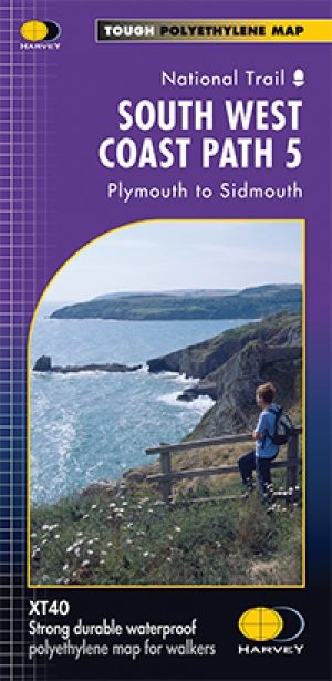
Wandelkaart - South West Coast Path 5 - Harvey maps • 9781851374427
Wandelkaart - South West Coast Path 5 - Harvey maps Productomschrijving: Waterdichte XT40 kaart van Harvey. Een ideale kaart voor wandelaars op de langste en op één van haar meest populairste nationale routes. Het loopt langs de kust van Somerset, Cornwall en Devon, Dorset van Minehead round via Land's end naar Poole. Het omvat alle 95 mijls van het World Heritage site bekend als de Jurass…

Wandelgids Part 3 SWCP Map Booklet PLymouth to pool - Cicerone • 9781786312006
Map booklet South West Coast Path - Cicerone Productomschrijving: Kaart van een deel van het zuidelijke deel van het 630 mijl (1014 km) lange South West Coast Path National Trail. Omvat het pad van Plymouth naar Poole langs de kustlijn van Devon en Dorset. Dit handige en compacte boekje met Ordnance Survey 1:25.000 kaarten toont de route en biedt alle kaarten die je nodig hebt om het pad i…

Wandelkaart - South West Coast Path 3 - Harvey maps • 9781851374328
Wandelkaart - South West Coast Path 3 - Harvey maps Productomschrijving: Waterdichte XT40 kaart van Harvey. Een ideale kaart voor wandelaars op de langste en op één van haar meest populairste nationale routes. Het loopt langs de kust van Somerset, Cornwall en Devon, Dorset van Minehead round via Land's end naar Poole. Het omvat alle 95 mijls van het World Heritage site bekend als de Jurass…

Wandelkaart 195 Bournemouth & Purbeck- SW England - OSI • 9780319262931
Wandelkaart Bournemouth & Purbeck - SW England Productbeschrijving: Kaart nummer 195 in de OS Landranger kaart reeks heeft betrekking op de kust van Dorset, Bournemouth, Poole Bay, Poole Harbour, Isle van Purbeck, de Purbeck Hills, Swanage, Christchurch Bay, Ringwood, Wimborne Minster, New Milton, Milford on Sea, Wareham en Corfe Castle. Ook inbegrepen is meest oostelijke gelegen gedeelte …