

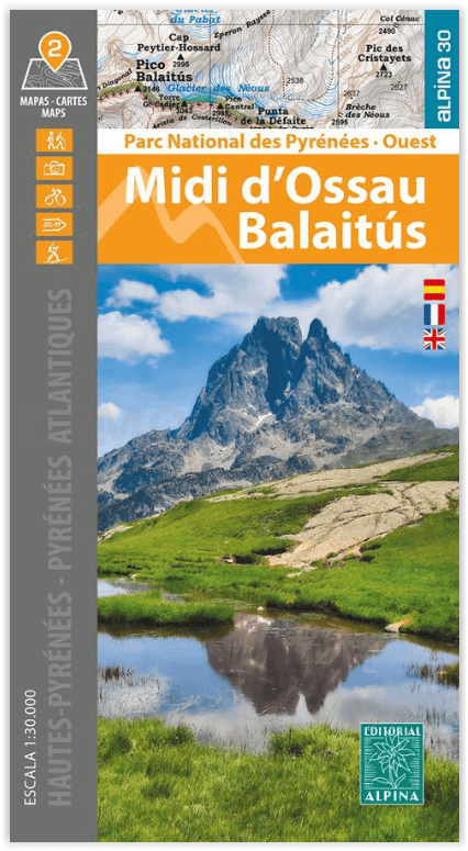
Wandelkaart Midi d'Ossau - Balaitus - PN Pyrénées Ouest - Alpina
Vignemale, Balaitus en de piek van de Midi d'Ossau
Korte omschrijving
Wandelkaarten Nouvelle-Aquitaine, Frankrijk en Occitanië, Frankrijk van Editorial Alpina S.L.. Ideaal voor tochten in Frankrijk en Spanje.
Wandelkaart Midi d'Ossau & Balaitus - IGN Productomschrijving: Het Nationaal park van de Pyreneeën strekt zich uit voor 100 km, 6 valleien, 2 departementen & 2 regio's. Deze kaart bestaat ui...

Specificaties
- Uitgever: Editorial Alpina S.L.
- ISBN-13: 9788470110948
- HOOFDCATEGORIEËN: Wandelkaart
- Activiteiten: Wandelen, Hiking & Trekking
- Regio: Nouvelle-Aquitaine, Frankrijk, Occitanië, Frankrijk
- Land: Frankrijk, Spanje
- Departement: Hautes-Pyrénées (65), Pyrénées-Atlantiques (64)
- Nationale parken: Pyrénées NP, Frankrijk
- TOPO's & Stafkaarten: Topografisch wandelen
- Schaal: 1:30000
- Taal: Engels
- Reeks/Serie: Alpina 30
Volledige omschrijving
Wandelkaart Midi d'Ossau & Balaitus - IGN
Productomschrijving: Het Nationaal park van de Pyreneeën strekt zich uit voor 100 km, 6 valleien, 2 departementen & 2 regio's. Deze kaart bestaat uit 2 kaarten, en omvatten de westelijke zijde van het nationaal park. Omvat de massieven van de Vignemale, Balaitus en de piek van de Midi d'Ossau.
Omvat: Het Nationaal Park Pyreneeën. Pyrénées-Atlantiques en Hautes-Pyrénées. Midisector van Ossau, Balaitous en Vignemale.
2 hiking maps in one folder
• Scale 1:25.000
• Equidistance contours: 10 m distance
• Master contours: at 50 m
• Shady relief
• Compatible with GPS
• Land use symbolized at three levels
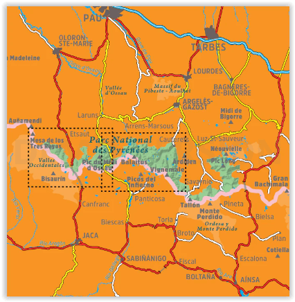
The Parc National des Pyrénées stretches over one hundred kilometers, across six valleys, two departments (Pyrénées-Atlantiques and Hautes-Pyrénées), and two regions (Nouvelle-Aquitaine and Occitanie), along the border with Spain. These two maps cover the western sector of the park, with the massifs of Vignemale and Balaitús, and the peak of Midi d’Ossau.
Covered area: Parc National des Pyrénées. Pyrénées-Atlantiques and Hautes-Pyrénées. Midi d’Ossau, Balaitús, and Vignemale sector.
Map features: Two topographic maps, scale 1:30.000, with hiking and tourist information: Mountain huts, signposted footpaths (GR’s, PR’s, local), routes to the summits, access to the starting points of the hikes, etcThe folding flap includes:
• 20 Hikes
• Geographic information
• The top 10 touristic highlights
Artikelen uit dezelfde regio

Fietsgids Le Gard - VTOPO • 9782375710241
Fietsgids Gard Occitanië Frankrijk - VTOPO Productomschrijving: In deze VTOPO ontdekt u 62 mountainbikeroutes, van familietochten tot routes voor experts, om het enorme potentieel van het departement Gard te ontdekken. Nieuwe editie en nieuwe routes! Met duidelijke en gedetailleerde gegevens, nauwkeurige kaarten, nuttige informatie en kwaliteitsfoto's is VTOPO het onmisbare naslagwerk gewo…
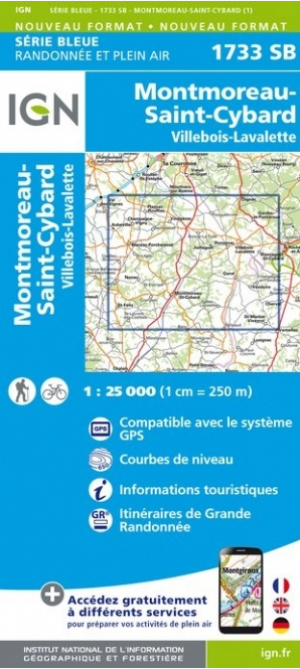
Wandelkaart 1733 SB Montmoreau-St-Cybard - IGN • 9782758542681
Wandelkaart 1733 SB - Montmoreau-St-Cybard Productomschrijving: Montmoreau-St-Cybard & Villebois-Lavalette zijn voormalige gemeentes in het Franse departement Charente in de regio Nouvelle-Aquitaine. omvat ondermeer ook: Aignes-et-Puypéroux, Saint-Amant-de-Montmoreau, Saint-Eutrope en Saint-Laurent-de-Belzagot tot de commune nouvelle Montmoreau, waarvan Montmoreau-Saint-Cybard de hoofdplaa…

Klimgids Mountaineering in the Pyrenees - Vertebrate Publ. • 9781910240564
Mountaineering in the Pyrenees - Vertebrate Productomschrijving: 25 classic mountain routes. Mountaineering in the Pyrenees by François Laurens features 25 classic mountain routes and link-ups – many of them accessible from spring to autumn – along the entire Pyrenean chain. Featured peaks include Pic des Posets, Monte Perdido and the Vignemale. Each route features technical notes, a topo …
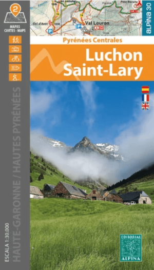
Wandelkaart 096 Bagnères-de-Luchon & Saint-Lary-Soulan - Alpina • 9788470112072
Wandelkaart Bagnères-de-Luchon & Saint-Lary-Soulan - Alpina Productomschrijving: Bagnères-de-Luchon is gelegen in de Haute-Garonne, en Saint-Lary-Soulan is een gemeente in het Franse departement Hautes-Pyrénées. Beide locaties liggen in de centrale Pyreneeën, en maakt deel uit van het arrondissement Saint-Gaudens. Bagnères-de-Luchon noemt zich de 'koningin der Pyreneeën.
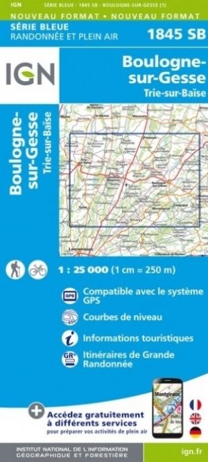
Wandelkaart 1845 SB Boulogne-sur-Gesse & Trie-sur-Baïse • 9782758541431
Wandelkaart 1845 SB - Boulogne-sur-Gesse & Trie-sur-Baïse Productomschrijving: Boulogne-sur-Gesse is een gemeente in het Franse departement Haute-Garonne in de regio Occitanie. De plaats maakt deel uit van het arrondissement Saint-Gaudens. Boulogne-sur-Gesse is, zoals de naam al zegt, gelegen aan de rivier de Gesse. Ook stroomt de Gimone, die even ten noorden van het dorp over gaat in het …