

Klimgids Mountaineering in the Pyrenees - Vertebrate Publ.
25 classic mountain routes


Korte omschrijving
Mountaineering in the Pyrenees - Vertebrate Productomschrijving: 25 classic mountain routes. Mountaineering in the Pyrenees by François Laurens features 25 classic mountain routes and link-u...

Specificaties
- Uitgever: Vertebrate Publishing
- ISBN-13: 9781910240564
- Activiteiten: Klimmen & Alpinisme, Rotsklimmen
- Auteur: François Laurens
- Regio: Catalaanse Pyreneeën, Spanje, Franse Pyreneeën, Frankrijk, Navarra, Spanje, Nouvelle-Aquitaine, Frankrijk, Occitanië, Frankrijk, Spaanse Pyreneeën, Spanje
- Land: Frankrijk, Spanje
- Nationale parken: Pyrénées NP, Frankrijk
- Taal: Engels
- Klimmen: Alpinisme, Rotsklimmen
- De Franse Regio's: Nouvelle Aquitaine, Occitanië
- Iconische Bergketens van Europa: De Pyreneeën
Volledige omschrijving
Mountaineering in the Pyrenees - Vertebrate
Productomschrijving: 25 classic mountain routes. Mountaineering in the Pyrenees by François Laurens features 25 classic mountain routes and link-ups – many of them accessible from spring to autumn – along the entire Pyrenean chain. Featured peaks include Pic des Posets, Monte Perdido and the Vignemale. Each route features technical notes, a topo and route description, and stunning photography.
Mountaineering in the Pyrenees features twenty-five classic mountain routes and link-ups that will delight any mountaineer who enjoys getting off the beaten track. Author and mountain guide François Laurens has drawn upon his encyclopaedic knowledge of the Pyrenees, and recommendations from other mountaineers, to put together a diverse selection of climbs – many of them accessible from spring to autumn – along the entire Pyrenean chain, from the Mediterranean to the Basque country.
The most characteristic feature of the Pyrenees is its hodgepodge of topographies, climates and lives, all jumbled together. Sometimes, moving just a short way across this patchwork landscape, perhaps from one side of a cliff to another, is enough to take you into a completely different environment. This diversity is reflected in the routes featured in this book.
Ridge traverses and rock climbs dominate the selection, which includes only a few ephemeral snow climbs, but every route has its own unique character and provides a wonderful day out in the mountains.
Featured routes include the Salenques-Tempestades Ridge on Pico de Aneto, the Espadas Ridge on Pic des Posets, and a selection of climbs on the renowned peaks of Monte Perdido, the Maladeta, the Balaitous, the Vignemale, and the Grand Astazous and Petit Astazous.
Each route features technical notes, a topo and route description, and photos illustrating the character of the climbing.
Artikelen uit dezelfde regio

Wandelgids Pyrénéens Randonnées vers cols d'Antan - Rando Ed. • 9782344040669
100 passages Pyrénéens vers cols d'Antan Productomschrijving: Bruno Mateo en Bruno Valcke wandelen graag in de Pyreneeën en geven betekenis aan hun wandelingen. Zij nodigen u uit hen te volgen op deze routes, die sinds mensenheugenis zijn gebruikt door de plaatselijke bevolking, legers, kooplieden, pelgrims, vluchtelingen en deserteurs, maar ook door Pyreneeërs. Zo reist u mee met de smokk…

Wandelgids D086 La Vienne à pied - FFR • 9782751411946
La Vienne à pied - FFR Productomschrijving: De Vienne met 40 rondwandelingen die de wandelaar in staat stellen het uitzonderlijke erfgoed van de Prehistorie tot de Middeleeuwen en het hedendaagse tijdperk te ontdekken. De Vienne heeft een uitzonderlijk erfgoed dat vertelt over de menselijke bewoning van haar grondgebied sinds de prehistorie. In deze sterk geromaniseerde regio vond het …

Wandelkaart 2228 SB Aigurande & Châtelus-Malvaleix - IGN • 9782758548485
Wandelkaart 2228 SB - Aigurande & Châtelus-Malvaleix Productomschrijving: Aigurande is een gemeente in het Franse departement Indre in de regio Centre-Val de Loire. De plaats maakt deel uit van het arrondissement La Châtre. Tussen 2014 en 2018 vernieuwt IGN haar volledige collectie serie blauw. Een nieuwe toewijzing voor optimale leesbaarheid, met een grotere mate van geometrische nau…
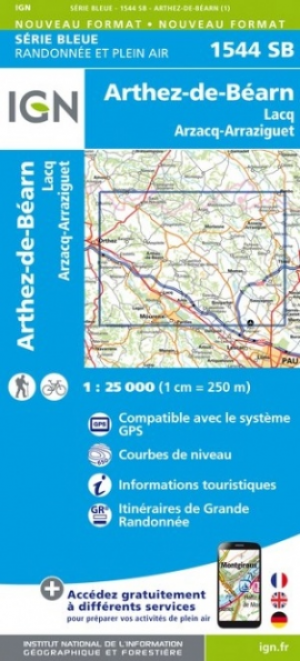
Wandelkaart 1544 SB Arthez-de-Béarn Lacq - IGN • 9782758541295
Wandelkaart 1544 SB - Arthez-de-Béarn Lacq - Nieuwe versie Productomschrijving: Arthez-de-Béarn Lacq is een gemeente in het Franse departement Pyrénées-Atlantiques in de regio Nouvelle-Aquitaine. De plaats maakt deel uit van het arrondissement Pau. Een gloed nieuwe reeks IGN kaarten: de oude versies met de Est en Ouest (E en O aanduiding achter het nummer van de kaart) verdwijnen en w…

Wandelkaart 2042 SB Grenade & Verdun-sur-Garonne - IGN • 9782758546092
Wandelkaart 2042 SB - Grenade & Verdun-sur-Garonne Productomschrijving: Grenade & Verdun-sur-Garonne zijn gemeentes in het Franse departement Haute-Garonne in de regio Occitanie. De plaats maakt deel uit van het arrondissement Toulouse. Productomschrijving: Tussen 2014 en 2018 vernieuwt IGN haar volledige collectie serie blauw. Een nieuwe toewijzing voor optimale leesbaarheid, met een …