

Wandelkaart FietskaartTOP100 D12 Aveyron Occitanië - IGN
Parc Naturèl Régionales des Grand Causses - Rodez - Millau
Korte omschrijving
Wandelkaarten Occitanië, Frankrijk van Institut Géographique National. Ideaal voor tochten in Frankrijk.
Wandelkaart Landkaart Fietskaart Aveyron - IGN Productomschrijving: Cette nouvelle édition possède un nouveau découpage départemental. Elle intègre les parcours vélo en partenariat avec l'a...

Specificaties
- Uitgever: Institut Géographique National
- ISBN-13: 9782758556329
- HOOFDCATEGORIEËN: Fietskaart, Wandelkaart
- Activiteiten: Fietsen / VTT / MTB, Wandelen, Hiking & Trekking
- Regio: Occitanië, Frankrijk
- Land: Frankrijk
- Departement: Aveyron (12)
- Regionale parken: Parc naturel régional des Grands Causses
- TOPO's & Stafkaarten: Topografisch - fietsen, Topografisch wandelen
- Schaal: 1:100000
- Editie: 1
- Taal: Frans
- Reeks/Serie: IGN France - TOP Cartes en Reliëf
- Fietsen: Fietsen in het Buitenland
- De Franse Regio's: Occitanië
Volledige omschrijving
Wandelkaart Landkaart Fietskaart Aveyron - IGN
Productomschrijving: Cette nouvelle édition possède un nouveau découpage départemental. Elle intègre les parcours vélo en partenariat avec l'association AF3V – VéloRoutes et Voies Vertes. La nouvelle TOP 100 grâce à son échelle au 1:100 000ème (1 cm = 1 km) est la carte idéale pour découvrir une région et faire du tourisme à pied, à vélo ou en voiture.
Un grand nombre d’informations touristiques sont représentées de façon très précises dans la cartographie : parcs et réserves naturelles, monuments, châteaux, musées, grottes, point de vues, refuges, site d’escalade et de sport en eau vive, plages surveillées…
Un re´seau de routes secondaires enrichi, pour permettre des balades a` ve´lo en toute se´curite´ :
• Pour la découverte à pied, l’intégralité des GR® et GR de Pays®
• Pour la découverte à vélo, l’ensemble du réseau routier local et l’intégralités des Vélo-routes et Voies Vertes avec la classification AF3V
• Pour la découverte en voiture, l’intégralité du réseau routier : national, régional, départemental et secondaire.
Pour compléter la cartographie :
• le relief est représenté par les courbes de niveau et les points cotés
• un index des communes permet de se repérer facilement
Des codes produits adaptés: D + N° du département.
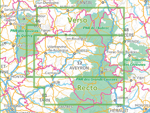
Overzichtskaarten

IGN France > TOP100 D-reeks - Departementale 1:100.000
IGN France > TOP100 D-reeks - Departementale 1:100.000
Producten op de overzichtskaart
Klik op een product om naar de detailpagina te gaan.
- Wandelkaart Fietskaart TOP100 D01 Ain - IGN
- Wandelkaart Fietskaart TOP100 D02 Aisne - IGN
- Wandelkaart Fietskaart TOP100 D03 Allier - IGN
- Wandelkaart Fietskaart TOP100 D04 Alpes-de-Haute-Provence- IGN
- Wandelkaart Fietskaart TOP100 D05 Hautes-Alpes - IGN
- Wandelkaart Fietskaart TOP100 D06 Alpes-Maritimes - IGN
- Wandelkaart Fietskaart TOP100 D07 Ardèche - IGN
- Wandelkaart Fietskaart TOP100 08 Ardennes - IGN
- Wandelkaart Fietskaart TOP100 D09 Ariège - IGN
- Wandelkaart Fietskaart TOP100 D10 Aube & PNR de la Forêt d'Orient - IGN
- Wandelkaart Fietskaart TOP100 D11 Aude - IGN
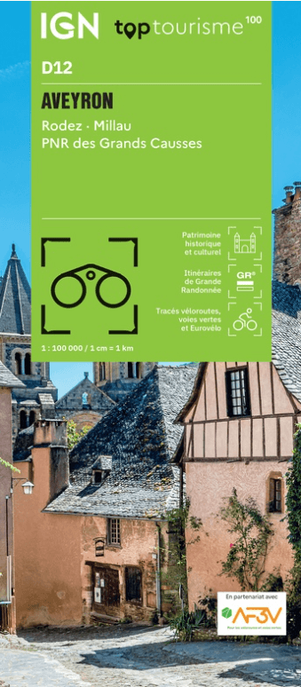
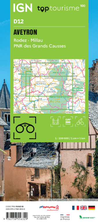
- Wandelkaart FietskaartTOP100 D12 Aveyron Occitanië - IGN
- Wandelkaart Fietskaart TOP100 D13 Bouches-du-Rhône - IGN
- Wandelkaart Fietskaart TOP100 D14 Calvados, Caen, Honfleur - IGN
- Wandelkaart Fietskaart TOP100 D15 Cantal, Aurillac, St Flour - IGN
- Wandelkaart Fietskaart TOP100 D16 Charente, Angoulême, Cognac - IGN
- Wandelkaart Fietskaart TOP100 D17 Charente-Maritime - IGN
- Wandelkaart Fietskaart TOP100 D18 Cher - IGN
- Wandelkaart Fietskaart TOP100 D19 Corrèze - IGN
- Wandelkaart Fietskaart TOP100 D21 Côte d'Or - IGN
- Wandelkaart Fietskaart TOP100 D22 Côtes-d'Armor Bretagne - IGN
- Wandelkaart Fietskaart TOP100 D23 Creuse Nouvelle-Aquitaine - IGN
- Wandelkaart Fietskaart TOP100 D24 Dordogne - IGN
- Wandelkaart Fietskaart TOP100 D25 Doubs - IGN
- Wandelkaart Fietskaart TOP100 D26 Drôme Auvergne-Rhône-Alpes - IGN
- Wandelkaart Fietskaart TOP100 D27 Eure - IGN
- Wandelkaart Fietskaart TOP100 D2A Corse-du-Sud - IGN
- Wandelkaart Fietskaart TOP100 D2B Haute-Corse - IGN
- Wandelkaart Fietskaart TOP100 D28 Eure-et-Loir - IGN
- Wandelkaart Fietskaart TOP100 D29 Finistère Bretagne - IGN
- Wandelkaart Fietskaart TOP100 D30 Gard - IGN
- Wandelkaart Fietskaart TOP100 D31 Haute-Garonne - IGN
- Wandelkaart Fietskaart TOP100 D32 Gers - IGN
- Wandelkaart Fietskaart TOP100 D33 Gironde Nouvelle-Aquitaine - FFR
- Wandelkaart Fietskaart TOP100 D34 Hérault - IGN
- Wandelkaart Fietskaart TOP100 D35 Ille-et-Vilaine Bretgane - IGN
- Wandelkaart Fietskaart TOP100 D36 Indre - IGN
- Wandelkaart Fietskaart TOP100 D37 Indre-et-Loire - IGN
- Wandelkaart Fietskaart TOP100 D38 Isère Auvergne-Rhône-Alpes - IGN
- Wandelkaart Fietskaart TOP100 D39 Jura - IGN
- Wandelkaart Fietskaart TOP100 D40 Landes Nouvelle-Aquitaine - FFR
- Wandelkaart Fietskaart TOP100 D41 Loir-et-Cher -IGN
- Wandelkaart Fietskaart TOP100 D42 Loire - IGN
- Wandelkaart Fietskaart TOP100 D43 Haute-Loire - IGN
- Wandelkaart Fietskaart TOP100 D44 Loire-Atlantique Pays-de-Loire - IGN
- Wandelkaart Fietskaart TOP100 D45 Loiret - IGN
- Wandelkaart Fietskaart TOP100 D46 Lot Occitanië - FFR
- Wandelkaart Fietskaart TOP100 D47 Lot-et-Garonne - FFR
- Wandelkaart Fietskaart TOP100 D48 Lozère - IGN
- Wandelkaart Fietskaart TOP100 D49 Maine-et-Loire Pays-de-la-Loire - IGN
- Wandelkaart Fietskaart TOP100 D50 Manche Normandië - FFR
- Wandelkaart Fietskaart TOP100 D51 Marne - IGN
- Wandelkaart Fietskaart TOP100 D52 Haute-Marne Grand-Est - FFR
- Wandelkaart Fietskaart TOP100 D53 Mayenne Pays-de-le-Loire - IGN
- Wandelkaart Fietskaart TOP100 D54 Meurthe-et-Moselle - IGN
- Wandelkaart Fietskaart TOP100 D55 Meuse Grand-Est - FFR
- Wandelkaart Fietskaart TOP100 D56 Morbihan Bretagne - IGN
- Wandelkaart Fietskaart TOP100 D57 Moselle - IGN
- Wandelkaart Fietskaart TOP100 D58 Nièvre - FFR
- Wandelkaart Fietskaart TOP100 D59 Le Nord - IGN
- Wandelkaart Fietskaart TOP100 D60 Le Oise - IGN
- Wandelkaart Fietskaart TOP100 D61 Le Orne - IGN
- Wandelkaart Fietskaart TOP100 D62 Pas-de-Calais - IGN
- Wandelkaart Fietskaart TOP100 D63 Puy-de-Dôme - IGN
- Wandelkaart Fietskaart TOP100 D64 Pyrénées-Atlantiques - IGN
- Wandelkaart Fietskaart TOP100 D65 Hautes-Pyrénées - IGN
- Wandelkaart Fietskaart TOP100 D66 Pyrénées-Orientales - IGN
- Wandelkaart Fietskaart TOP100 D67 Bas-Rhin - IGN
- Wandelkaart Fietskaart TOP100 D68 Haut-Rhin- Territoire de Belfort - IGN
- Wandelkaart Fietskaart TOP100 D69 Rhône - IGN
- Wandelkaart Fietskaart TOP100 D70 Haute-Saône - IGN
- Wandelkaart Fietskaart TOP100 D71 Saône-et-Loire - IGN
- Wandelkaart Fietskaart TOP100 D72 Sarthe Pays-de-la-Loire - IGN
- Wandelkaart Fietskaart TOP100 D73 Savoie Auvergne-Rhône-Alpes - IGN
- Wandelkaart Fietskaart TOP100 D74 Haute-Savoie Auvergne-Rhône-Alpes- IGN
- Wandelkaart Fietskaart TOP100 D75E Ile-de-France - IGN
- Wandelkaart Fietskaart TOP100 D75O Ile-de-France - IGN
- Wandelkaart Fietskaart TOP100 D76 Seine-Maritime - IGN
- Wandelkaart Fietskaart TOP100 D79 Deux-Sèvres - FFR
- Wandelkaart Fietskaart TOP100 D80 Somme - IGN
- Wandelkaart Fietskaart TOP100 D81 Tarn - IGN
- Wandelkaart Fietskaart TOP100 D82 Tarn-et-Garonne - IGN
- Wandelkaart Fietskaart TOP100 D83 Var - IGN
- Wandelkaart Fietskaart TOP100 D84 Vaucluse - IGN
- Wandelkaart Fietskaart TOP100 D85 Vendée - FFR
- Wandelkaart Fietskaart TOP100 D86 Le Vienne - IGN
- Wandelkaart Fietskaart TOP100 D87 Haute-Vienne - FFR
- Wandelkaart Fietskaart TOP100 D88 Vosges - IGN
- Wandelkaart Fietskaart TOP100 D89 Yonne - FFR
Artikelen uit dezelfde regio

Fietsgids Sud Occitanie Vol.1 Voyages à vélo - Ed. Glénat • 9782344051870
Sud Occitanie TOME 1 - Voyages à vélo - Glénat Productomschrijving: Tochten per fiets of met de elektrische fiets om het rijke erfgoed, de natuur en het landschap van Zuidoostelijk Occitanië te ontdekken: Gard, Hérault, Aude, Ariège, Haute-Garonne en Tarn. Een streek per fiets ontdekken is meer dan ooit ecologisch verantwoord en bij de tijd. En vandaag, met elektrische ondersteuning, is re…


Fietsgids Cycling the Canal de Garonne - Cicerone • 9781852847838
Fietsgids - Cycling the Canal de Garonne - Cicerone Productomschrijving: Canal du midi affietsen moet toch een dik plezier zijn tijdens de seizoensmaanden?, deze gids biedt u een dikke 240 km lange tocht langs de befaamde Canal du midi, op zich is deze UNESCO werelderfgoed, en dat is er dik aan te zien. Een indrukwekkende fauna & flora langs de weg, en een gids gevuld met weetjes die overa…
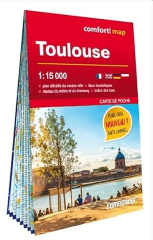
Stadskaart Plattegrond Toulouse MINI (Franstalig) - ExpressMap • 9788383554198
Stadskaart Toulouse MINI (Franstalig) - ExpressMap Productomschrijving: ExpressMap MINI, staat voor gebruiksgemak met de comfort! maps: geplastificeerde kaarten die makkelijk vouwen, zelfs met één hand. Dit innovatieve kaartconcept is waterbestendig, scheurvast en bijzonder duurzaam. Ideaal om een stadsuitstap te plannen en erg handig tijdens je bezoek. Een aantal belangrijke kenmerken…

Wandelkaart Fietskaart TOP100 D48 Lozère - IGN • 9782758555568
Wandelkaart Lozère - IGN Productomschrijving: Een nieuwe reeks met een nieuwe departementale indeling. De reeks bevat fietsroutes in samenwerking met de vereniging AF3V - VéloRoutes et Voies Vertes. Dankzij de schaal van 1:100.000 (1 cm = 1 km) is de nieuwe TOP 100 de ideale kaart om een regio te voet, op de fiets of met de auto te ontdekken. De kaart bevat een breed scala aan toeristische…
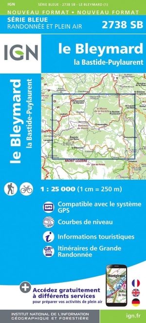
Wandelkaart 2738 SB Le Bleymard & Bastide-Puylaurent - IGN • 9782758546283
Wandelkaart - Le Bleymard & Bastide-Puylaurent Productomschrijving: Le Bleymard & Bastide-Puylaurent zijn gemeentes in het Franse departement Lozère in de regio Occitanie. De plaats maakt deel uit van het arrondissement Mende. Productomschrijving: Tussen 2014 en 2018 vernieuwt IGN haar volledige collectie serie blauw. Een nieuwe toewijzing voor optimale leesbaarheid, met een grotere m…