

Wandelkaart Edinburgh pocket map - Harper Collins
From Leith in the north to The Meadows in the south

Korte omschrijving
Wandelkaarten Edinburgh West Schotland van HarperCollins Publishers. Ideaal voor tochten in Schotland.
Pocket map Edinburgh - Harper Collins Engelse omschrijving: Handy little full colour map of central Edinburgh with a high level of detail. Clear mapping from Leith in the north to The Meadow...

Specificaties
- Uitgever: HarperCollins Publishers
- ISBN-13: 9780008663469
- HOOFDCATEGORIEËN: Wandelkaart
- Activiteiten: Toerisme, Wandelen, Hiking & Trekking
- Regio: Edinburgh West Schotland
- Land: Schotland
- Schaal: 1:11000
- Taal: Engels
- Reeks/Serie: Pocket Maps
Volledige omschrijving
Pocket map Edinburgh - Harper Collins
Engelse omschrijving: Handy little full colour map of central Edinburgh with a high level of detail. Clear mapping from Leith in the north to The Meadows in the south, and Edinburgh Zoo in the west to Holyrood Park in the east. Map at a scale of 1:11,000 (6 inches to 1 mile). Clear, detailed, full colour mapping is presented in a handy format ideal for the pocket or handbag. It is excellent value and covers the most visited area of central Edinburgh. It is an essential buy for tourists and residents alike.
This map includes:
• Detailed central area map
• Around Edinburgh map extending to airport, Pentland Hills and Forth Road Bridge
• Tourist locations
• Tram, train and bus stations
• Listing of major places to visit, with additional details for Edinburgh Castle and Holyroodhouse
• Detailed street index
Locatie op kaart
Artikelen uit dezelfde regio

Wandelkaart 351 Dunbar & North Berwick - Edinburgh - OSI • 9780319246023
Wandelkaart Dunbar & North Berwick - Edenburgh Schotland Productbeschrijving: Musselburgh & Haddington. 351 / Dunbar & North Berwick, Edenburgh, Schotland - Kaart nummer 351 omvat Dunbar en North Berwick. Hoogtepunten zijn onder meer de rivier de Tyne, John Muir trail en Torness point. Omvat ook Musselburgh en Haddington. De OS Explorer kaart voor Dunbar & North Berwick is beschikbaar…
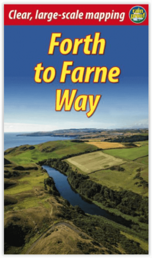
Wandelgids Forth to Farne Way - Schotland - Rucksack Readers • 9781898481966
Wandelgids Forth to Farne Way - Schotland Productomschrijving: Deze inspirerende pelgrimsroute van 110 mijl begint vanuit North Berwick aan de Firth of Forth bij Edinburgh en gaat verder via de 12e-eeuwse kerk van Whitekirk naar Dunbar. Het volgt de Noordzeekust naar het adembenemende landschap van St-Abb's Head en bezoekt Coldingham Priory, misschien wel het belangrijkste benedictijnenklo…

Stadskaart Edinburgh City map - Lonely Planet • 9781787018266
Edinburgh City map - Lonely Planet Productomschrijving: Durable and waterproof, with a handy slipcase and an easy-fold format, Lonely Planet Edinburgh City Map is your conveniently-sized passport to traveling with ease. Get more from your map and your trip with images and information about top city attractions, walking tour routes, transport maps, itinerary suggestions, extensive street an…

Wandelkaart 349 Falkirk- Cumbernauld & Livingston - OSI • 9780319246009
Wandelkaart Falkirk- Cumbernauld & Livingston - Schotland Productbeschrijving: Linlithgow, Bathgate & Kilsyth. 349 / Falkirk, Cumbernauld & Livingston, Edinburgh, Schotland - OS Explorer kaart 349 dekt Kilsyth Linlithgow en de Firth of Forth in Midden-Schotland. Het omvat de rivier de Avon en een deel van het Fife kustpad. De OS Explorer kaart voor Falkirk, Cumbernauld & Livingston is …

Wandelgids Wandelen in Edinburgh - Odyssee Reisgidsen • 9789461231505
Wandelen in Edinburgh - Odyssee Productomschrijving: Edinburgh is doordrenkt met geschiedenis. In Old Town leiden kronkelige straatjes je langs imposante architectuur en monumenten. De Royal Mile, van kasteel naar paleis, is wereldberoemd. Het 18de-eeuwse New Town met statige huizen vormt daarmee een fraai contrast. Edinburgh ligt aan zee, heeft talloze parken en is omgeven door heuvel…