

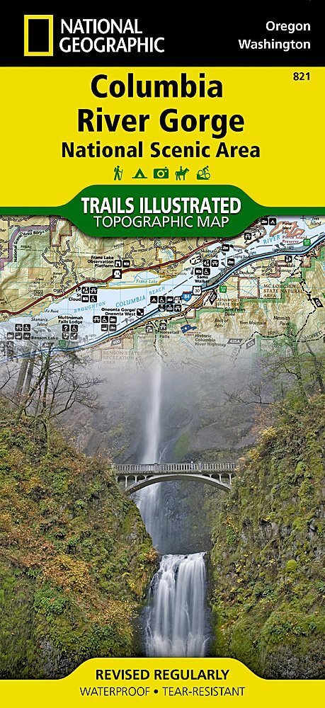
Wandelkaart 821 Columbia River Gorge - Nat Geo
130 km wandelplezier langs de mooiste zijde van deze Rivier
Korte omschrijving
Wandelkaarten Oregon, USA van National Geographic. Ideaal voor tochten in Verenigde Staten van Amerika (USA).
TOPO Wandelkaart 821 - Columbia River Gorge - Natgeo Productomschrijving: The Columbia River Gorge is een vallei van de Columbia River in het Pacific Northwest van de United States. Met een...

Specificaties
- Uitgever: National Geographic
- ISBN-13: 9781566954730
- HOOFDCATEGORIEËN: Wandelkaart
- Auteur: National Geographic
- Regio: Oregon, USA
- Land: Verenigde Staten van Amerika (USA)
- TOPO's & Stafkaarten: Topografisch wandelen
- Schaal: 1:75000
- Taal: Engels
Volledige omschrijving
TOPO Wandelkaart 821 - Columbia River Gorge - Natgeo
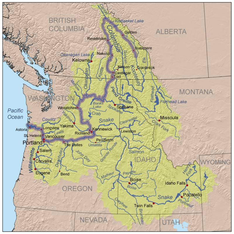
Productomschrijving: The Columbia River Gorge is een vallei van de Columbia River in het Pacific Northwest van de United States. Met een diepte van 1,200 meter, loopt de vallei voor een dikke 130 km, terwijl hij wevend door de Cascade Range loopt, die bij gevolg de grens maakt tussen de staat van Washinton in het Noorden, en de staat van Oregon in het Zuiden.
Engelse omschrijving: The magnificent Multnomah Falls is just one of many natural, cultural, and recreational attractions in the Columbia River Gorge Scenic Area. The 80-mile-long gorge contains diverse ecosystems ranging from the lush Oneonta Gorge Rain Forest to the arid Celilo Grasslands. Expertly researched and created in partnership with local land management agencies, National Geographic's Trails Illustrated map of Columbia River Gorge provides an unparalleled tool for exploring this breathtaking region. Some of the key areas of interest featured on the map include the White Salmon, Klickitat, Sandy, and Lower Deschutes rivers; Yacolt Burn State Forest; Maryhill, Columbia Hills, and Rooster Rock state parks; Mark O. Hatfield Wilderness; and portions of Mount Hood and Gifford-Pinchot national forests.
With miles of clearly marked trails including the Pacific Crest National Trail and the Oregon National Historic Trail, and such scenic roadways as the Historic Columbia River Highway and Yakima Scenic Byway, this map will prove invaluable whether you're taking in the scenery on foot or by car. A helpful list of waterfalls makes it easy to take in these natural wonders in your travels. Many recreation features are noted as well, including campgrounds, trailheads, interpretive trails, boat launches, and areas for fishing, windsurfing, and swimming. The map base includes contour lines and elevations for summits. Every Trails Illustrated map is printed on "Backcountry Tough" waterproof, tear-resistant paper. A full UTM grid is printed on the map to aid with GPS navigation.
Other features found on this map include: Bonneville Dam, Bull Run Reservoir Number One, Camas, Columbia Hills, Deschutes River, Gifford Pinchot National Forest, Gresham, Hood River, Klickitat River, Lake Celilo, Mark O. Hatfield Wilderness, Mount Defiance, Mt. Hood National Forest, Multnomah Falls, Shellrock Mountain, The Dalles, Troutdale, Washougal, White Salmon River.
Locatie op kaart
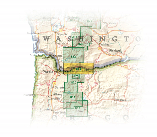
Overzichtskaarten

NAT GEO Washington trail maps
NAT GEO Washington trail maps

Producten op de overzichtskaart
Klik op een product om naar de detailpagina te gaan.
- Wandelkaart 216 Olympic NP- Washington - Nat Geo
- Wandelkaart 217 Mount Rainier NP- Washington - Nat Geo
- Wandelkaart 821 Columbia River Gorge - Nat Geo
- Wandelkaart 822 Mount St. Helens- Washington - Nat Geo
- Wandelkaart 223 North Cascades NP- Washington - Nat Geo
- Wandelkaart 825 Alpine Lakes Wilderness Washington - Nat Geo
- Wandelkaart 826 Mount Baker & Boulder River Wilderness

NAT GEO Oregon trails map
NAT GEO Oregon trails map

Producten op de overzichtskaart
Klik op een product om naar de detailpagina te gaan.
Artikelen uit dezelfde regio

Landkaart Wegenkaart Oregon State guide map - Nat Geo • 9781566957755
Wegenkaart Oregon State guide map - Nat Geo Productomschrijving: Expertly researched and full of high functional travel information, National Geographic's Oregon Guide Map combines a comprehensive road map and a travel guide in one easy to use resource. Roads are clearly designated as toll roads, highways, major and secondary routes, and scenic byways. The road network in annotated with mi…

Wandelkaart 244 Crater Lake National Park Oregon - Nat Geo • 9781566953023
Crater Lake National Park Oregon - Nat Geo Productomschrijving: Het overblijfsel van een vulkaan en bekend om zijn opmerkelijk blauwe water, Crater Lake is het diepste meer in de Verenigde Staten. National Geographic's Trails Illustrated kaart van Crater Lake National Park is ontworpen om te voldoen aan de behoeften van outdoor enthousiastelingen door het combineren van waardevolle informa…

Reisgids Washington, Oregon & Pacific Northwest - Lonely Planet • 9781838699796
Washington, Oregon & Pacific Northwest - Lonely Planet Productomschrijving: Lush forests, a pristine coastline, awesome food, frothy microbrews, and music and art galore – Pacific Northwesterners have it good and they don’t mind sharing. Lonely Planet will get you to the heart of Washington, Oregon & the Pacific Northwest, with amazing travel experiences and the best planning advice. L…

Wandelgids Rocky Mountains & Pacific Northwest NP - Lonely Planet • 9781838696085
Rocky Mountains & Pacific Northwest NP - Lonely Planet Productomschrijving: Lonely Planet's Rocky Mountains and the Pacific Northwest's National Parks is uw paspoort voor het meest actuele advies over wat je moet zien en overslaan. Beklim Grand Teton, bespioneer wilde dieren en kampeer bij Crater Lake, allemaal met je vertrouwde reisgenoot. Duik in het hart van de Rocky Mountains en de nat…

Wandelkaart 321 Mount Hood National Forest & Wilderness - Nat Geo • 9781566956673
Wandelkaart Mount Hood National Forest & Wilderness - Nat Geo Productomschrijving: 2 prachtige gebieden vol bos, rivieren, bergen en gletjers. Omvat: Barlow Pass, Hunchback Mountain, Mount Hood, Mount Hood Wilderness, Mt. Hood National Forest, Salmon-Huckleberry Wilderness, Zigzag Mountain. Engelse omschrijving: With its snow-covered peak, Mount Hood is an American icon and a premi…