

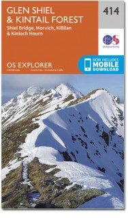
Wandelkaart 414 Glen Shiel & Kintail Forest- Highlands- OSI
Een samenstelling van zoveel mogelijk Munro's

Korte omschrijving
Wandelkaarten Highlands, Schotland van Ordnance Survey. Ideaal voor tochten in Schotland.
Wandelkaart Glen Shiel & Kintail Forest - Highlands Schotland Omvat ook: Shiel Bridge, Morvich, Killilan & Kinloch Hourn. 414 / Glen Shiel & Kintail Forest, Highlands, Schotland - Als u ...

Specificaties
- Uitgever: Ordnance Survey
- ISBN-13: 9780319246498
- HOOFDCATEGORIEËN: Wandelkaart
- Activiteiten: Wandelen, Hiking & Trekking
- Regio: Highlands, Schotland
- Land: Schotland
- Regionale parken: Kintail Forest, Highland's Schotland
- TOPO's & Stafkaarten: Topografisch wandelen
- Schaal: 1:25000
- Taal: Engels
- Reeks/Serie: Explorer Series OS
- Iconische Bergketens van Europa: De Schotse Highlands
Volledige omschrijving
Wandelkaart Glen Shiel & Kintail Forest - Highlands Schotland
Omvat ook: Shiel Bridge, Morvich, Killilan & Kinloch Hourn.
414 / Glen Shiel & Kintail Forest, Highlands, Schotland - Als u van plan bent om zoveel Munros op zak te steken, gaat u deze OS Explorer kaart 414 nodig hebben. Met 32 Munros op een dubbelzijdige kaart heeft dit gebied ook drie nationale natuurgebieden, Loch Cluanie en Loch Quoich. De OS Explorer kaart voor Glen Shiel & Kintail Forest is beschikbaar in zowel de standaard papieren versie als de weerbestendige 'Actief' versie.
414 / Glen Shiel & Kintail Forest, Highlands, Schotland - If you are planning on 'bagging' as many Munros as possible, you are going to need OS Explorer Map 414. With 32 Munros on a double sided map, this area also has Loch Cluanie, Loch Quoich, and three National Scenic Areas. The OS Explorer map for Glen Shiel & Kintail Forest is available in both the standard paper version and weatherproof 'Active' version.
Locatie op kaart
Gekoppelde artikelen

Wandelkaart 414 Glen Shiel & Kintail Forest- Highlands- OSI • 9780319246498
standaard versieWandelkaart Glen Shiel & Kintail Forest - Highlands Schotland Omvat ook: Shiel Bridge, Morvich, Killilan & Kinloch Hourn. 414 / Glen Shiel & Kintail Forest, Highlands, Schotland - Als u van plan bent om zoveel Munros op zak te steken, gaat u deze OS Explorer kaart 414 nodig hebben. Met 32 Munros op een dubbelzijdige kaart heeft dit gebied ook drie nationale natuurgebieden, Loch Cluanie…

Wandelkaart 414 Glen Shiel & Kintail Forest Schotland OSI • 9780319472699
weatherproof versieWandelkaart Glen Shiel & Kintail Forest - Highland's Schotland Omvat ook: Shiel Bridge, Morvich, Killilan & Kinloch Hourn. Productbeschrijving: Als u van plan bent om zoveel Munros mogelijk af te lopen, gaat u deze OS Explorer kaart 414 nodig hebben. Met 32 Munros op één dubbelzijdige kaart heeft dit gebied ook drie nationale natuurgebieden, Loch Cluanie en Loch Quoich. De OS Explorer …
Overzichtskaarten

OSI Explorer & Explorer Active - Ben Nevis - Glen Coe
OSI Explorer & Explorer Active - Ben Nevis - Glen Coe
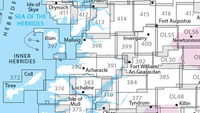
Producten op de overzichtskaart
Klik op een product om naar de detailpagina te gaan.
- Wandelkaart 372 Coll & Tiree- Ayrshire & Lanark - OSI
- Wandelkaart 374 Isle of Mull North & Tobermroy - OSI
- Wandelkaart 376 Oban & North Lorn- Argyl & Bute - OSI
- Wandelkaart 377 Loch Etive & Glen Orchy- Schotland- OSI
- Wandelkaart 383 Morvern & Lochaline- Highland's - OSI
- Wandelkaart 384 Glen Coe & Glen Etive- Highlands - OSI
- Wandelkaart 385 Rannoch Moor & Ben Alder- Highland's - OSI
- Wandelkaart 390 Ardnamurchan- Highlands Schotland - OSI
- Wandelkaart 391 Ardgour & Strontian- Highlands - OSI
- Wandelkaart 392 Ben Nevis & Fort William- Highlands - OSI
- Wandelkaart 397 Rum- Eigg- Muck- Canna & Sanday - OSI
- Wandelkaart 398 Loch Morar & Mallaig- Highland's - OSI
- Wandelkaart 399 Loch Akraig- Lochaber Schotland - OSI
- Wandelkaart 400 Loch Lochy & Glen Roy- Highlands - OSI
- Wandelkaart 413 Knoydart- Loch Hourn & Loch Duich - OSI
- Wandelkaart 414 Glen Shiel & Kintail Forest- Highlands- OSI
- Wandelkaart 415 Glen Affric & Glen Moriston - OSI
- Wandelkaart 416 Inverness & Loch Ness - OSI
- Wandelkaart OL50 Ben Alder, Loch Ericht & Laggan - OS
- Wandelkaart OL55 Loch Laggan, Creag Meagaidh & Corrieyairack - OS
- Wandelkaart OL56 Badenoch, Upper Strathspey & Kingussie - OS
Artikelen uit dezelfde regio
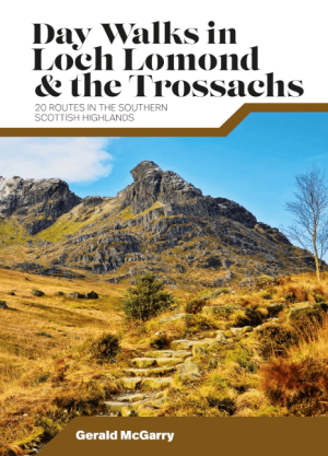
Wandelgids Day Walks in Loch Lomond & the Trossachs NP • 9781839810718
Day Walks in Loch Lomond & the Trossachs - Vertebrate Productomschrijving: 20 routes in the southern Scottish Highlands Day Walks in Loch Lomond & the Trossachs National Park features 20 day-length routes suitable for hillwalkers of all abilities. Researched and written by experienced local walker Gerald McGarry, the walks explore the highlights of the Loch Lomond & The Trossachs N…

Wandelkaart 446 Durness & Cape Wrath Schotland - OSI • 9780319246894
Wandelkaart Durness & Cape Wrath - Highlands Schotland Productbeschrijving: Kinlochbervie & Rhiconich. 446 / Durness & Cape Wrath, Highlands, Schotland - Kaart nummer 446 omvat Durness en Cape Wrath. Hoogtepunten zijn North-West Sutherland, Loch Eriboll, Kinlochbervie, Kyle van Durness en Sandwood Loch. Omvat ook Rhiconich, Loch nb Gainmhich en Loch Meidaidh. De OS Explorer kaart voor…

Wandelkaart 16 Lairg & Loch Shin Highland's Schotland - OSI • 9780319261149
Wandelkaart Lairg & Loch Shin - Highland's Schotland Productbeschrijving: OS Landranger kaart 16 toont het gebied rondom Loch Shin en Loch Naver, met inbegrip van Lairg en Oykel Bridge. Er valt ook een fietsroute langs de schilderachtige A836 te vinden, of u kunt een bezoek brengen aan de watervallen van Shin. De OS Landranger kaarten reeks heeft betrekking op Groot-Brittannië met 204…

Wandelkaart 428 Kyle of Lochalsh Schotland - OSI • 9780319472804
Wandelkaart Kyle of Lochalsh - Highland's Schotland Productbeschrijving: OS Explorer kaart 428 omvat de westelijke kant van de Wester Ross nationale Scenic Area. U kunt er ook de ruige kustlijn en kleine dorpjes gaan verkennen. De OS Explorer kaart voor Kyle van Lochalsh, Plockton & Applecross is beschikbaar in zowel de standaard papieren versie als de weerbestendige 'Actief' versie. P…
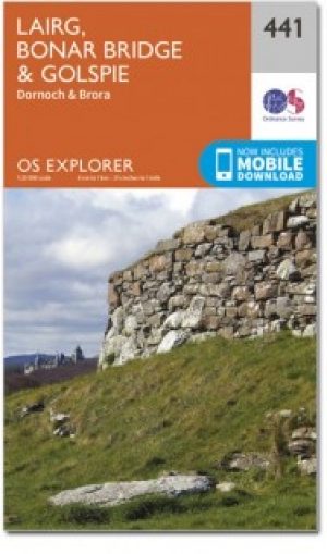
Wandelkaart 441 Lairg Bonar Bridge & Golspie - OSI • 9780319472934
Wandelkaart Lairg- Bonar Bridge & Golspie - Highland's Schotland Omvat ook: Dornoch & Brora. Productbeschrijving: Aan de Moray Firth toont OS Explorer kaart 441 de regio Brora naar Dornoch en het binnenland van Lairg bij Bonar Bridge. Verken rond Loch Fleet en Loch Brora of volg de rivier van Loch Shin naar Kyle of Sutherland. De OS Explorer kaart voor Lairg, Bonar Bridge & Golspie is …