

Wandelkaart 250 Cape Cod Massachusetts - Nat Geo
Including the Cape Cod Rail Trail

Korte omschrijving
Wandelkaarten Massachusetts, USA van National Geographic. Ideaal voor tochten in Verenigde Staten van Amerika (USA).
Wandelkaart Cape Cod Massachusetts - Nat Geo Productomschrijving: Laat de Cape Cod Coastal Recreation-kaart van National Geographic u zowel over land als over water leiden, langs enkele van ...

Specificaties
- Uitgever: National Geographic
- ISBN-13: 9781566953559
- HOOFDCATEGORIEËN: Wandelkaart
- Activiteiten: Wandelen, Hiking & Trekking
- Auteur: National Geographic
- Regio: Massachusetts, USA
- Land: Verenigde Staten van Amerika (USA)
- TOPO's & Stafkaarten: Topografisch wandelen
- Schaal: 1:63360
- Taal: Engels
Volledige omschrijving
Wandelkaart Cape Cod Massachusetts - Nat Geo
Productomschrijving: Laat de Cape Cod Coastal Recreation-kaart van National Geographic u zowel over land als over water leiden, langs enkele van de meest schilderachtige kustlijnen van Amerika. De kaart is gemaakt in samenwerking met de National Park Service en anderen en biedt ongeëvenaarde details van het gebied.
Omvat: Upper Cape, from Sandwich & Mashpee, door het Mid-Cape, incl. Nantucket Sound, en dan de Lower & Outer Cape, incl de Cape Cod National Seashore, Monomoy National Wildlife Refuge, Wellfleet and Provincetown Harbors, Nauset Beach and Nickerson State Park.
Engelse omschrijving: Let National Geographic's Cape Cod Coastal Recreation map lead you both on land and on water, along some of America's most picturesque shorelines. Created in partnership with the National Park Service and others, the map provides unparalleled detail of the area.
The beach guide lists the location and facilities available at more than 100 private and public beaches, sorted by town. Likewise, the marina guide lists the services, supplies and facilities at the marinas, along with maximum vessel size and water depth. In addition to beaches and marinas, other recreation features displayed on the map include: visitor centers, campgrounds, boat launches, interpretive trails, lighthouses, wildlife viewing areas, diving areas and golf courses. Hikers and bikers will find trails clearly marked, color-coded according their designated use, including the Cape Cod Rail Trail. A trail guide describes some of the more popular trails along with their distances and designated use.
Every Trails Illustrated map is printed on "Backcountry Tough" waterproof, tear-resistant paper. A full UTM grid is printed on the map to aid with GPS navigation. Other features found on this map include: Cape Cod, Dennis, Harwich, Mashpee, Nauset Beach, Race Point, Sandwich, Sandy Neck, Wellfleet Harbor, Yarmouth.
Locatie op kaart
Artikelen uit dezelfde regio
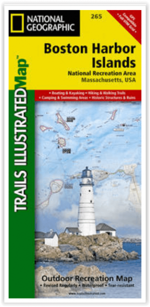
Wandelkaart Boston Harbor Islands - Nat Geo • 9781566955751
Wandelkaart Boston Harbor Islands - National Geographic Productomschrijving: Gelegen net buiten het centrum van Boston, bieden de Boston Harbor Islands een overvloed aan recreatieve mogelijkheden voor alle outdoor liefhebbers. Deskundig onderzoek en gemaakt in samenwerking met de National Park Service, Boston Harbor Islands Alliance en vele anderen, National Geographic's Trails Illustrated…

Reisgids (Autogids) Best Road Trips New England - Lonely Planet • 9781837584819
Best Road Trips New England - Lonely Planet Productomschrijving: Discover the freedom of open roads with Lonely Planet New England’s Best Trips, your passport to uniquely encountering New England by car. Featuring 32 amazing road trips, plus up-to-date advice on the destinations you’ll visit along the way, you can enjoy the soaking peaks and lush valleys of the White Mountains or explore m…

Stadskaart plattegrond Boston Massachusetts USA - Borch • 9783866093652
Wandelkaart Boston Massachusetts USA - Borch Productomschrijving: Our soft-laminated folded map of Boston in the 19th edition shows: Boston Downtown 1:11 000, Eastern Massachusetts 1:600 000, Boston and Region 1:200 000, Logan International Airport 1:33 000, Public Transport Boston, Top 30 Sights and USA administrative and time zones. Borch maps are easy to fold, durable and water-repellen…

Reisgids Boston - DK Eyewitness • 9780241275382
Reisgids Boston - DK Eyewitness Productomschrijving: Explore historic North End - Boston's oldest neighbourhood - admire the city's skyline from Back Bay Fens parkland, stroll around the university campuses of Harvard and MIT or people-watch at Faneuil Hall and Quincy Market, everything you need to know is clearly laid out within colour-coded chapters. Discover the best of Boston with this…

Reisgids New England USA - Insight guides ENG • 9781839053238
New England USA - Insight guides Productomschrijving: Van beslissen wanneer u gaat tot kiezen wat u gaat zien wanneer u aankomt, dit is alles wat u nodig hebt om uw reis te plannen en het beste van New England te ervaren, met diepgaande insiderinformatie over must-see topattracties zoals Cape Cod National Seashore en de Freedom Trail, maar ook verborgen culturele juweeltjes. Engelse om…