

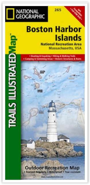
Wandelkaart Boston Harbor Islands - Nat Geo
All 34 harbor islands- shorelines & downtown Boston
Korte omschrijving
Wandelkaarten Massachusetts, USA van National Geographic. Ideaal voor tochten in Verenigde Staten van Amerika (USA).
Wandelkaart Boston Harbor Islands - National Geographic Productomschrijving: Gelegen net buiten het centrum van Boston, bieden de Boston Harbor Islands een overvloed aan recreatieve mogelijk...

Specificaties
- Uitgever: National Geographic
- ISBN-13: 9781566955751
- HOOFDCATEGORIEËN: Wandelkaart
- Activiteiten: Wandelen, Hiking & Trekking
- Auteur: National Geographic
- Regio: Massachusetts, USA
- Land: Verenigde Staten van Amerika (USA)
- Waterafstotende kaart: Nat Geo waterproof series
- Nationale parken: Boston Harbor Islands NP, Boston Massachusetts
- Schaal: 1:25000
- Taal: Engels
Volledige omschrijving
Wandelkaart Boston Harbor Islands - National Geographic
Productomschrijving: Gelegen net buiten het centrum van Boston, bieden de Boston Harbor Islands een overvloed aan recreatieve mogelijkheden voor alle outdoor liefhebbers. Deskundig onderzoek en gemaakt in samenwerking met de National Park Service, Boston Harbor Islands Alliance en vele anderen, National Geographic's Trails Illustrated kaart van Boston Harbor Islands National Recreation Area is een essentiële reisgenoot voor alle bezoekers van het gebied.
De voorzijde van de kaart bevat zowel topografie en bathymetrie, terwijl de achterzijde het gebied toont in hoge resolutie satellietbeelden. Samen bieden ze ongeëvenaarde details van alle 34 haveneilanden, kustlijnen, het centrum van Boston en naburige gemeenschappen, Boston Inner Harbor en de andere waterwegen die de eilanden omringen.
Omvat: Boston, Charles River, Hingham, Hull, Milton, Quincy, Winthrop.
Engelse omschrijving: Located just outside of downtown Boston, the Boston Harbor Islands provide an abundance of recreational opportunities for all outdoor enthusiasts. Expertly researched and created in cooperation with the National Park Service, Boston Harbor Islands Alliance and many others, National Geographic's Trails Illustrated map of Boston Harbor Islands National Recreation Area is an essential travel companion for all visitors to the area. The front side of the map contains both topography and bathymetry, while the reverse side shows the area in high-resolution satellite imagery. Together they provide unparalleled detail of all 34 harbor islands, shorelines, downtown Boston and neighboring communities, Boston Inner Harbor and the other waterways that surround the islands.
Mainland piers with park operated ferries to the islands are clearly marked along with their facilities as well as water taxi stations. Boaters will find boat ramps, docks, moorings, buoys, beacons and soundings. Background information of many of the islands is provided along with hiking and biking trails, available facilities and pinpointed structures, buildings and other points of interest. Other recreational features noted include areas for fishing, swimming, diving, canoeing, kayaking, cross-country skiing, wildlife viewing, camping and picnicking. The map also provides a complete road network of the area along with subway, commuter rail stations.
Every Trails Illustrated map is printed on "Backcountry Tough" waterproof, tear-resistant paper. A full UTM grid is printed on the map to aid with GPS navigation.
Other features found on this map include: Boston, Charles River, Hingham, Hull, Milton, Quincy, Winthrop.
Locatie op kaart
Artikelen uit dezelfde regio

Stadskaart plattegrond Boston Massachusetts USA - Borch • 9783866093652
Wandelkaart Boston Massachusetts USA - Borch Productomschrijving: Our soft-laminated folded map of Boston in the 19th edition shows: Boston Downtown 1:11 000, Eastern Massachusetts 1:600 000, Boston and Region 1:200 000, Logan International Airport 1:33 000, Public Transport Boston, Top 30 Sights and USA administrative and time zones. Borch maps are easy to fold, durable and water-repellen…

Reisgids Boston USA - Lonely Planet • 9781837584895
Reisgids Boston - Lonely Planet Productomschrijving: Boston’s history recalls revolution and transformation, and it is still among the USA’s most forward-thinking, barrier-breaking cities. Coverage includes: Plan Your Trip, Charlestown, West End, North End, Beacon Hill, Boston Common, Downtown, Waterfront, South End, Chinatown, Back Bay, Kenmore Square, Fenway, Seaport District, South …

Reisgids (Autogids) Best Road Trips New England - Lonely Planet • 9781837584819
Best Road Trips New England - Lonely Planet Productomschrijving: Discover the freedom of open roads with Lonely Planet New England’s Best Trips, your passport to uniquely encountering New England by car. Featuring 32 amazing road trips, plus up-to-date advice on the destinations you’ll visit along the way, you can enjoy the soaking peaks and lush valleys of the White Mountains or explore m…

Reisgids Boston - DK Eyewitness • 9780241275382
Reisgids Boston - DK Eyewitness Productomschrijving: Explore historic North End - Boston's oldest neighbourhood - admire the city's skyline from Back Bay Fens parkland, stroll around the university campuses of Harvard and MIT or people-watch at Faneuil Hall and Quincy Market, everything you need to know is clearly laid out within colour-coded chapters. Discover the best of Boston with this…

Reisgids New England USA - Insight guides ENG • 9781839053238
New England USA - Insight guides Productomschrijving: Van beslissen wanneer u gaat tot kiezen wat u gaat zien wanneer u aankomt, dit is alles wat u nodig hebt om uw reis te plannen en het beste van New England te ervaren, met diepgaande insiderinformatie over must-see topattracties zoals Cape Cod National Seashore en de Freedom Trail, maar ook verborgen culturele juweeltjes. Engelse om…