

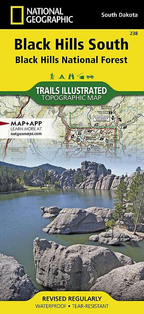
Wandelkaart 238 Black Hills National Forest SD-South - Nat Geo
Gelegen op de grens van Noord-Dakota en Wyoming
Korte omschrijving
Wandelkaarten Wyoming, USA en South Dakota van National Geographic. Ideaal voor tochten in Verenigde Staten van Amerika (USA).
Wandelkaart - Black Hills National Forest SD-South - Nat Geo Productomschrijving: Een regionaal park gelegen op de grens van Noord-Dakota en Wyoming. Wat wij regionaal noemen is in Amerikaan...

Specificaties
- Uitgever: National Geographic
- ISBN-13: 9781566953474
- HOOFDCATEGORIEËN: Wandelkaart
- Activiteiten: Wandelen, Hiking & Trekking
- Auteur: National Geographic
- Regio: South Dakota, Wyoming, USA
- Land: Verenigde Staten van Amerika (USA)
- TOPO's & Stafkaarten: Topografisch wandelen
- Schaal: 1:70000
- Taal: Engels
Volledige omschrijving
Wandelkaart - Black Hills National Forest SD-South - Nat Geo
Productomschrijving: Een regionaal park gelegen op de grens van Noord-Dakota en Wyoming. Wat wij regionaal noemen is in Amerikaanse normen slechts een paar bomen, wij noemen parken van dergelijke grote nationale parken.
Engelse omschrijving: National Geographic's Trails Illustrated map of Kenai Fjords National Park is an essential travel companion for outdoor enthusiasts looking to explore the pristine scenery in this area of southern Alaska. Expertly researched and created in partnership with the National Park Service, U.S. Forest Service and others, the map covers popular recreation and adventure points of interest, such as Harding Icefield, Exit Glacier, Resurrection River and Bay, as well as the adjacent Kenai National Wildlife Refuge, Kachemak Bay State Park and Wilderness Park, Chugach National Forest and Skilak Wildlife Recreation Area. Inset maps of Exit Glacier and Seward provide extra detail of these areas.
The map will guide your exploration, whether on land or on water. Hikers, bikers and ATVers will find clearly marked trails with mileage markers, in addition to contour lines, elevations, labeled peaks, glaciers and crevasses. The Iditarod National Historic Trail and Seward Highway Scenic Byway are both marked. Boaters and kayakers will benefit from the sounding information, tidal flats, boating hazard areas, island locations and pinpointed seabed formation warnings, beacons, anchorage spots and boat ramps. Other recreation points of interest include trailheads, campgrounds, public cabins, food storage lockers, ski trails, waterfalls and scenic viewpoints. The map also includes background information, QR codes for real-time weather and essential contact information.
Every Trails Illustrated map is printed on "Backcountry Tough" waterproof, tear-resistant paper. A full UTM grid is printed on the map to aid with GPS navigation. Other features found on this map include: Aialik Bay, Bear Glacier, Chernof Glacier, Chiswell Islands, Chugach National Forest, Harris Bay, Kenai Fjords National Park, Kenai Lake, Kenai Mountains, Kenai Peninsula, McCarty Glacier, Nuka Bay, Nuka Island, Pye Islands, Resurrection Bay, Skilak Glacier, Skilak Lake, Tustumena Glacier.
.png)
Locatie op kaart
Gekoppelde artikelen

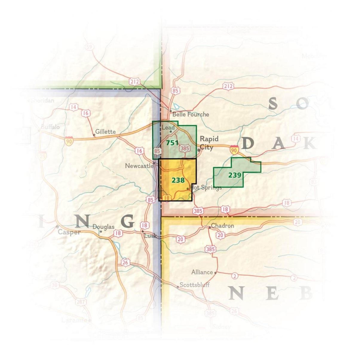
Wandelkaart Black Hills National Forest - SD+WY - Nat Geo • 9781566953795
standaard versieWandelkaart - Black Hills National Forest - SD+WY - Nat Geo Productomschrijving: Een regionaal park gelegen op de grens van Noord Dekota en Wyoming. Wat wij regionaal noemen is in Amerikaanse normen slechts een paar bomen, wij noemen parken van dergelijke grote nationale parken. Engelse omschrijving: Expertly researched and created in cooperation with the U.S. Forest Service and other…
Artikelen uit dezelfde regio


Wandelkaart 305 Yellowstone Lake - Yellowstone NP - Nat Geo • 9781566954365
Yellowstone Lake - Yellowstone NP - Nat Geo Omvat: Big Game Ridge, Colter Peak, Eagle Peak, Heart Lake, Lewis Lake, Mount Hancock, Mount Sheridan, North Absaroka Wilderness, Red Mountains, Shoshone National Forest, Teton National Forest, Teton Wilderness, Thorofare Plateau, Washakie Wilderness, Yellowstone Lake, Yellowstone National Park. Engelse omschrijving: National Geographic's Tra…

Wandelkaart 202 Grand Teton NP- Wyoming - Nat Geo • 9781566954372
TOPO Wandelkaart 202 - Grand Teton NP- Wyoming - National Geographic Productomschrijving: Grand Teton National Park is een nationaal park in Wyoming in de Verenigde Staten, ten zuiden van Yellowstone. Het park is genoemd naar de Grand Teton, een van de bergen van het Tetongebergte met 4197 meter hoog en de hoogste berg van het park. Het park omvat een groot deel van de onderliggende valle…
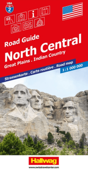
Landkaart Wegenkaart Road Map 2 USA Noord Centraal - Hallwag • 9783828310902
Wegenkaart USA Noord Centraal - Hallwag Productomschrijving: Op zoek naar betrouwbare Hallwag wegenkaarten van het Noord Amerikaanse Continent? Deze klassieke road maps staan bekend om hun duidelijke cartografie, praktische indeling en heldere weergave van wegen en verbindingen. Voor autoritten, vakanties, camperreizen en lange roadtrips bieden Hallwag wegenkaarten het overzicht dat je ond…

Wandelkaart 303 Mammoth Hot Springs- Yellowstone - Nat Geo • 9781566954341
TOPO Wandelkaart 303 - Mammoth Hot Springs - Yellowstone Productomschrijving: Mammoth Hot Springs is een groot hot springs complex op een travertijn heuvel in Yellowstone National Park behorend tot Fort Yellowstone en de Mammoth Hot Springs Historic District. Engelse omschrijving: National Geographic's Trails Illustrated map of the Mammoth Hot Springs area of Yellowstone National Park …

Wandelgids Rocky Mountains & Pacific Northwest NP - Lonely Planet • 9781838696085
Rocky Mountains & Pacific Northwest NP - Lonely Planet Productomschrijving: Lonely Planet's Rocky Mountains and the Pacific Northwest's National Parks is uw paspoort voor het meest actuele advies over wat je moet zien en overslaan. Beklim Grand Teton, bespioneer wilde dieren en kampeer bij Crater Lake, allemaal met je vertrouwde reisgenoot. Duik in het hart van de Rocky Mountains en de nat…