

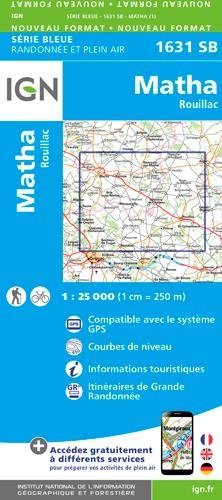
Wandelkaart 1631 SB Matha - IGN
Matha is gelegen in de Charente-Maritime
Korte omschrijving
Wandelkaarten Nouvelle-Aquitaine, Frankrijk van Institut Géographique National. Ideaal voor tochten in Frankrijk.
Wandelkaart 1631 SB - Matha - Nieuwe versie Productomschrijving: Matha is een gemeente in het Franse departement Charente-Maritime in de regio Nouvelle-Aquitaine. De plaats maakt deel uit va...

Specificaties
- Uitgever: Institut Géographique National
- ISBN-13: 9782758539186
- HOOFDCATEGORIEËN: Wandelkaart
- Activiteiten: Wandelen, Hiking & Trekking
- Regio: Nouvelle-Aquitaine, Frankrijk
- Land: Frankrijk
- Departement: Charente-Maritime (17)
- Schaal: 1:25000
- Editie: 1
- Taal: Frans
- Reeks/Serie: IGN France > TOP25 Randoo / Série Bleue
Volledige omschrijving
Wandelkaart 1631 SB - Matha - Nieuwe versie
Productomschrijving: Matha is een gemeente in het Franse departement Charente-Maritime in de regio Nouvelle-Aquitaine. De plaats maakt deel uit van het arrondissement Saint-Jean-d'Angély.
Desciptive produits: Une nouvelle cartographie pour une lisibilité optimale, avec une meilleure précision géométrique et des informations touristiques enrichies. Un nouveau format deux fois plus grand : le format des nouvelles SERIE BLEUE est équivalent à celui des TOP 25 et le nombre de références sera ainsi divisé par 2. Pour la plupart des cartes, la zone couverte correspond à l’assemblage des anciennes SERIE BLEUE Est et Ouest.
Locatie op kaart
Overzichtskaarten
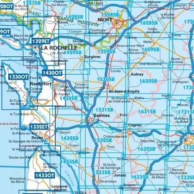
IGN TOP25 Wandelkaarten - Atlantische kust Poitou-Charentes NOORD
IGN TOP25 Wandelkaarten - Atlantische kust Poitou-Charentes NOORD
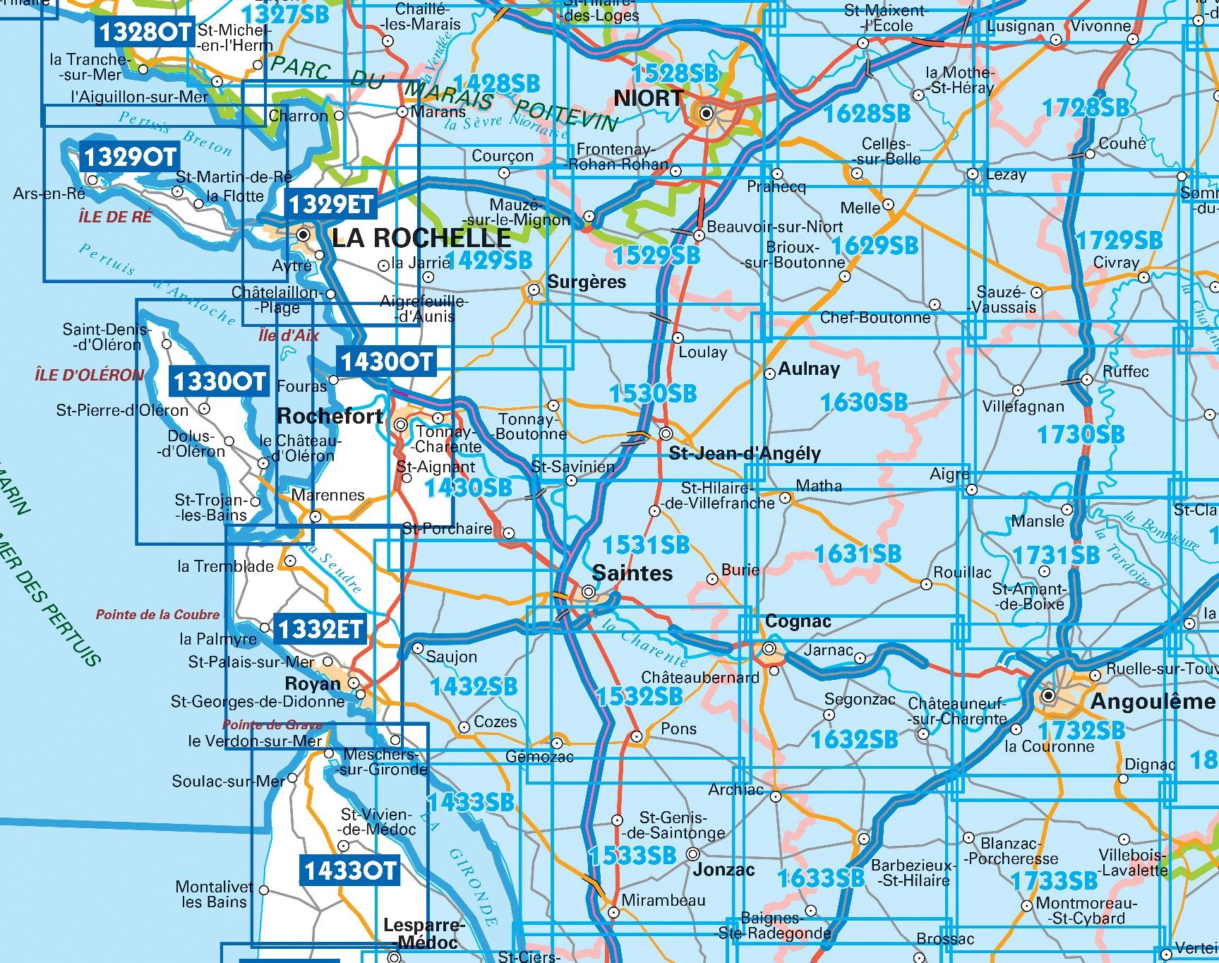
Producten op de overzichtskaart
Klik op een product om naar de detailpagina te gaan.
- Wandelkaart 1329 ET La Rochelle & Anse de l'Aiguillon - IGN
- Wandelkaart 1330 OT Ile d'Oléron & Ile d'Aix - IGN
- Wandelkaart 1332 ET Royan & Forêt de la Coubre - IGN
- Wandelkaart 1429 SB Surgères & Aigrefeuille-d'Aunis - IGN
- Wandelkaart 1433 OT Soulac-sur-Mer & Vendays-Montalivet
- Wandelkaart 1433 SB Lesparre-Medoc & Mortagne-sur-Gironde
- Wandelkaart 1528 SB Niort- Benet & Coulon - IGN
- Wandelkaart 1529 SB Frontenay-Rohan & Mauzé - IGN
- Wandelkaart 1530 SB St-Jean-d'Angély & Tonnay-Boutonne - IGN
- Wandelkaart 1531 SB Saintes & Burie - IGN
- Wandelkaart 1532 SB Pons & Pérignac - IGN
- Wandelkaart 1533 SB Jonzac & Mirambeau - IGN
- Wandelkaart 1629 SB Melle France - IGN
- Wandelkaart 1630 SB Aulnay - IGN
- Wandelkaart 1631 SB Matha - IGN
- Wandelkaart 1632 SB Cognac & Jarnac - IGN
- Wandelkaart 1633 SB Barbezieux-St-Hilaire - IGN
- Wandelkaart 1730 SB Ruffec & Villefagnan - IGN
- Wandelkaart 1731 SB Mansle & Aigre - IGN
- Wandelkaart 1732 SB Angoulême & Ruelle-sur-Touvre - IGN
Artikelen uit dezelfde regio

Wandelkaart 1436 SB St-Medard-en-Jalles - IGN • 9782758539131
Wandelkaart 1436 SB - St-Medard-en-Jalles Productomschrijving: Saint-Médard-en-Jalles is een gemeente in het Franse departement Gironde in de regio Nouvelle-Aquitaine. De plaats maakt deel uit van het samenwerkingsverband Bordeaux Métropole en het arrondissement Bordeaux. Desciptive produits: Une nouvelle cartographie pour une lisibilité optimale, avec une meilleure précision géométriq…
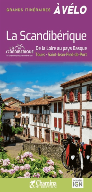
Fietsgids Scandibérique - Ed. Chamina • 9782844667137
Fietsgids Scandibérique - Chamina Productomschrijving: Au départ de Tours, au fil de l’Eurovélo 3, destination plein sud, principalement sur Véloroutes ou Voies Vertes. Un itinéraire exceptionnel qui rejoint Saint-Jean-Pied-de-Port dans les Pyrénées-Atlantiques, après avoir traversé les départements d’Indre-et-Loire, Vienne, Charente, Charente-Maritime, Gironde, Landes et Pyrénées-Atlanti…

Landkaart Wegenkaart 329 Dordogne & Corrèze - Michelin • 9782067202313
Departementale Wegenkaart Dordogne & Corrèze Productomschrijving: MICHELIN wegenkaarten en toeristische kaarten: vind meer dan alleen uw route! De 1:150.000 schaal (1cm = 1,5km) Corrèze, Dordogne departementale kaart is gedetailleerd en gemakkelijk te lezen. De kaart wordt jaarlijks bijgewerkt, met een index van steden en kaarten van Périgueux, Tulle en Brive-la-Gaillarde om je te helpen b…

Wandelgids Haute-Vienne - 30 balades à pied - Ed. Chamina • 9782844662651
Wandelgids - Haute-Vienne - 30 balades à pied - Ed. Chamina Productomschrijving: U bezoekt er vier belangrijke geografische en menselijke entiteiten van de Haute-Vienne: • La Basse-Marche • Les plateaux et monts du Limousin • La vallée de la Vienne • Le plateau de Millevaches Franse omschrijving: Vous visiterez les quatre grandes entités géographiques et humaines de la Haute-…

Wandelkaart 1539 SB St-Symphorien & Sore - IGN • 9782758541240
Wandelkaart 1539 SB - St-Symphorien & Sore - Nieuwe versie Productomschrijving: St-Symphorien & Sore zijn gemeentes in het Franse departement Landes in de regio Nouvelle-Aquitaine. De plaats maakt deel uit van het arrondissement Mont-de-Marsan. De locaties liggen pal in het midden van het befaamde Parc naturel régional de Landes de Gascognes. De perfecte uitvalsbasis voor wandelaars en fie…